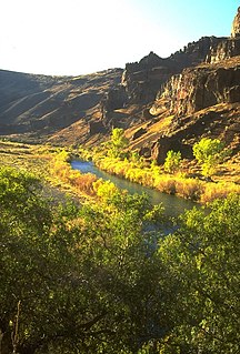
The Trask River is in northwestern Oregon in the United States. It drains a mountainous timber-producing area of the Northern Oregon Coast Range west of Portland into Tillamook Bay and the Pacific Ocean. It is one of five rivers—the Tillamook, the Trask, the Wilson, the Kilchis, and the Miami—that flow into the bay.

The Wilson River, about 33 miles (53 km) long, flows from the Northern Oregon Coast Range to Tillamook Bay in the U.S. state of Oregon. Formed by the confluence of its Devil's Lake Fork and its South Fork, it runs generally west through the Tillamook State Forest to its mouth near the city of Tillamook. It is one of five rivers—the Tillamook, the Trask, the Wilson, the Kilchis, and the Miami—that flow into the bay.

Succor Creek is a 69.4-mile-long (111.7 km) tributary of the Snake River in the U.S. states of Idaho and Oregon. The creek begins in the Owyhee Mountains in Owyhee County, Idaho. After flowing for about 23 miles (37 km) in Idaho, Succor Creek enters Malheur County, Oregon, where it flows for 39 miles (63 km) before re-entering Idaho for its final 5 miles (8.0 km). It joins the Snake near Homedale, about 413 river miles (665 km) from the larger river's confluence with the Columbia River.

Quartzville Creek is a 28-mile (45 km) tributary of the Middle Santiam River in Linn County in the U.S. state of Oregon. It is paralleled by the Quartzville Back Country Byway and used for recreation, including camping, fishing, hunting, kayaking, and gold panning. The lower 12 miles (19 km) of the creek, from the Willamette National Forest boundary to Green Peter Reservoir, was designated Wild and Scenic in 1988.

The Wenaha River is a tributary of the Grande Ronde River, about 22 miles (35 km) long, in the U.S. state of Oregon. The river begins at the confluence of its north and south forks in the Blue Mountains and flows east through the Wenaha–Tucannon Wilderness to meet the larger river at the small settlement of Troy. A designated Wild and Scenic River for its entire length, the stream flows wholly within Wallowa County.

The Dry River is an intermittent tributary, 88 miles (142 km) long, of the Crooked River in the U.S. state of Oregon. The stream arises near Hampton Buttes north of Hampton and U.S. Route 20 between Brothers and Riley in the Oregon High Desert. Beginning in eastern Deschutes County near its border with Crook County, it flows generally northwest along the Deschutes–Crook county line, crossing briefly into Crook County before turning slightly south and returning to Deschutes County. Along these upper reaches, it flows roughly parallel to the highway, under which it passes several times before turning sharply north near the Horse Ridge Research Natural Area, 19 miles (31 km) southeast of Bend. Continuing north and re-entering Crook County, it passes under Powell Butte Highway, Oregon Route 126, and Oregon Route 370 before entering the Crooked River 34 miles (55 km) from the larger stream's confluence with the Deschutes River.

Trout Creek is a 51-mile (82 km) long tributary of the Deschutes River in the U.S. state of Oregon. It drains approximately 692 square miles (1,792 km2) of Crook, Jefferson, and Wasco counties. Arising in the Ochoco Mountains, it flows north and then west to its confluence with the Deschutes River.

Fifteenmile Creek is a 54-mile (87 km) long tributary of the Columbia River in the U.S. state of Oregon. It drains 373 square miles (966 km2) of Hood River and Wasco counties. Arising in the Cascade Range near Mount Hood, it flows northeast then west to its confluence with the Columbia near The Dalles.

Bully Creek is a 62-mile (100 km) long tributary of the Malheur River, located in the U.S. state of Oregon. It drains 601 square miles (1,557 km2) of Malheur County. Arising in the Blue Mountains, it flows generally southeast to its confluence with the Malheur River near Vale.

The South Fork Crooked River is a tributary, 76 miles (122 km) long, of the Crooked River in the U.S. state of Oregon. Starting southeast of Hampton in Deschutes County, the South Fork flows east from near Ram Lake (dry). It passes under U.S. Route 20 at Hampton, then continues east and north for about 6 miles (10 km) before entering Crook County. Shortly thereafter, east of Hampton Buttes, it receives Buck Creek from the right and then passes through Logan Reservoir. Flowing north, it receives Sand Hollow Creek from the left, then Twelvemile Creek from the right before crossing under Oregon Route 380. Just north of the highway, the river joins Beaver Creek to form the Crooked River 125 miles (201 km) from its confluence with the Deschutes River.
Butter Creek is a 57-mile (92 km) long creek in the U.S. state of Oregon. The source of the creek is at an elevation of 5,034 feet (1,534 m) in Umatilla National Forest, while the mouth is at an elevation of 535 feet (163 m) upstream of Hermiston, Oregon. Butter Creek has a 465-square-mile (1,200 km2) watershed, and is a tributary of the Umatilla River.
Rock Creek is an 82-mile (132 km) tributary of the John Day River in the U.S. state of Oregon. The source of the creek is at an elevation of 4,351 feet (1,326 m) in the Umatilla National Forest, while the mouth is at an elevation of 404 feet (123 m) east of Wasco. Rock Creek has a 507-square-mile (1,310 km2) watershed.
West Little Owyhee River is a 63.1-mile-long (101.5 km) tributary of the Owyhee River in the U.S. state of Oregon. The source of the river is at an elevation of 6,508 feet (1,984 m) near McDermitt, while the mouth is at an elevation of 4,373 feet (1,333 m) in the Owyhee Desert. West Little Owyhee River has a 310-square-mile (800 km2) watershed.
Rattlesnake Creek is a tributary, 57 miles (92 km) long, of Crooked Creek in the U.S. state of Oregon. The creek, which is intermittent, begins in the desert north of McDermitt in Malheur County. It joins Crooked Creek southeast of the intersection of U.S. Route 95 and Oregon Route 78 at Burns Junction, about 15 miles (24 km) from the larger stream's confluence with the Owyhee River.
Rock Creek is a 56-mile (90 km) intermittent stream flowing in Lake and Harney counties in the U.S. state of Oregon. The source of Rock Creek is at an elevation of 6,914 feet (2,107 m) on Hart Mountain, while the mouth is at an elevation of 4,557 feet (1,389 m) in the Catlow Valley. Rock Creek has a 269-square-mile (700 km2) watershed.
Dry Creek is a tributary, 54 miles (87 km) long, of Crooked Creek in the U.S. state of Oregon. The creek, which is intermittent, begins in the desert near Five Points in Malheur County. It joins Crooked Creek east of Burns Junction and about 7 miles (11 km) south of the larger stream's confluence with the Owyhee River. Dry Creek drains a basin of about 299 square miles (770 km2).
Cow Creek is a 51-mile (82 km) tributary of Jordan Creek in the U.S. state of Oregon. The source of Cow Creek is at an elevation of 7,048 feet (2,148 m) near De Lamar, Idaho, while the mouth is at an elevation of 4,216 feet (1,285 m) at Danner. Cow Creek has a 330-square-mile (850 km2) watershed.
The South Fork Breitenbush River is a 10-mile (16 km) tributary of the Breitenbush River in the U.S. state of Oregon. The river flows generally northwest from Russell Lake in the Mount Jefferson Wilderness of the Cascade Range to near Breitenbush Hot Springs, where it merges with the North Fork Breitenbush River to form the main stem.

Whychus Creek is a tributary of the Deschutes River in Deschutes and Jefferson counties in the U.S. state of Oregon. Formerly named Squaw Creek, considered derogatory in the 21st century, it was renamed in 2006. Explorer John C. Frémont camped along the stream in 1843 but did not identify it by name. Robert S. Williamson, a surveyor who camped there in 1855, said its Indian name was Why-chus.