
Malheur County is one of the 36 counties in the U.S. state of Oregon. As of the 2020 census, the population was 31,571. Its county seat is Vale, and its largest city is Ontario. The county was named after the Malheur River, which runs through the county. The word "malheur" is French for misfortune or tragedy. Malheur County is included in the Ontario, Oregon Micropolitan Statistical Area, which is also included in the Boise Combined Statistical Area. It is included in the eight-county definition of Eastern Oregon.

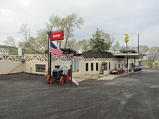
McDermitt is an unincorporated community straddling the Nevada–Oregon border, in Humboldt County, Nevada, and Malheur County, Oregon, United States. McDermitt's economy has historically been based on mining, ranching, and farming. The last mining operation closed in 1990, resulting in a steady decline in population.

Burns is a city in and the county seat of Harney County, in the U.S. state of Oregon. According to the 2020 census, the population was 2,730. Burns and the nearby city of Hines are home to about 60 percent of the people in the sparsely populated county, by area the largest in Oregon and the ninth largest in the United States.
Riley is an unincorporated community in Harney County, Oregon, United States, located at the crossroads of U.S. Highway 395 and U.S. Highway 20, milepost 104, about 28 miles (45 km) west of Burns, the seat of Harney County. The elevation of Riley is 4,226 feet (1,288 m). The town presently consists entirely of two service establishments with attached apartments: a post office, and a general store with gas pump and garage service. It exists to serve the rural farming and ranching community that surrounds it, and highway travelers.
Drewsey is an unincorporated community in Harney County, in the U.S. state of Oregon. Drewsey is along the main stem of the Malheur River, about 45 miles (72 km) east of Burns, off U.S. Route 20. It has the ZIP Code of 97904.
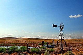
Denio is a census-designated place (CDP) in Humboldt County, Nevada, along the Oregon state line in the United States. The Denio post office was originally north of the state line in Harney County, Oregon, but the residents moved the building into Nevada in the mid-20th century. The population of the CDP, which is entirely in Nevada, was 47 at the 2010 census; additional development considered to be Denio extends into Oregon. The CDP includes a post office, a community center, a library, and the Diamond Inn Bar, the center of the town's social life. Recreational activities in the Denio area include bird watching, photography, off road vehicle use, fishing, recreational black opal mining, rockhounding, hunting, visiting the hot springs, and camping on the Sheldon National Wildlife Refuge.
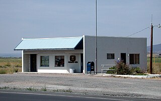
Arock is an unincorporated rural hamlet in Malheur County, Oregon, United States. It is part of the Ontario, OR–ID Micropolitan Statistical Area. There is a post office and K-8 school in Arock, and Jordan Creek flows near Arock and joins the Owyhee River just west of Arock.

Crane is a census-designated place and unincorporated community in Harney County, Oregon, United States, northeast of Malheur Lake on Oregon Route 78. Its population was 116 at the 2020 census.

Wagontire is an unincorporated community in Harney County, Oregon, United States, along U.S. Route 395.
Riverside is an unincorporated community in Malheur County, Oregon, United States. It lies at an elevation of 3,343 feet (1,019 m) and is part of the Ontario, Oregon–Idaho Micropolitan Statistical Area. It is northeast of Crane and south of Juntura along Juntura–Riverside Road and the South Fork Malheur River near its confluence with the main stem.
Juntura is an unincorporated community in Malheur County, Oregon, United States on U.S. Route 20. The word juntura is Spanish for "juncture", and the community was named for its proximity to the confluence of the Malheur River with the North Fork Malheur River. The name was probably selected by local settler B. L. Milligan, who arrived in the area in the 1880s and who later served as county school superintendent. Juntura post office was established in 1890 and is still operating. The community's development slowed after World War II, and on November 2, 1976, the town voted to disincorporate. Juntura is part of the Ontario micropolitan area.

Diamond is an unincorporated community in Harney County, Oregon, United States. Diamond is west of Oregon Route 205 and south of Malheur Lake, 52 miles (84 km) south-southeast of Burns by highway. Its post office is assigned ZIP code 97722.

Lawen is an unincorporated community in Harney County, Oregon, United States. It has a post office with a ZIP code 97720. Lawen lies along Oregon Route 78 just south of its interchanges with Oregon Route 205, U.S. Route 20, and U.S. Route 395 in Burns, the county seat. Lawen is just north of the East Fork Silvies River and Malheur Lake.

New Princeton is an unincorporated community in Harney County, in the U.S. state of Oregon. It is along Oregon Route 78 between Burns and Burns Junction at an elevation of 4,111 feet (1,253 m) above sea level. The South Fork Malheur River begins near Round Mountain, southeast of New Princeton.

The Double-O Ranch Historic District is located west of Harney Lake in Harney County in southeastern Oregon, United States. At one time, the Double-O Ranch covered over 17,000 acres (69 km2). The ranch was owned by Bill Hanley, a well-known cattle baron and Bull Moose progressive. In 1941, the United States Government purchased most of the Double O Ranch property and added it to the Malheur National Wildlife Refuge. The two remaining Double-O Ranch buildings are now listed on the National Register of Historic Places.
Buchanan is an unincorporated community in Harney County, Oregon, United States. It is about 20 miles (32 km) east of Burns on U.S. Route 20.
Venator is an unincorporated community in Harney County, Oregon, United States. It is on Crane–Venator Road about 17 miles (27 km) southeast of Crane, near the South Fork Malheur River.
Voltage is an unincorporated community in Harney County, Oregon, United States. It is about 34 miles (55 km) south of Burns, on the south shore of Malheur Lake near the Donner und Blitzen River.
Van is an unincorporated community in Harney County, Oregon, United States. It is along Van–Drewsey Road about 50 miles (80 km) northeast of Burns, in the Wolf Creek Valley.
Annex is an unincorporated community and census-designated place in Malheur County, Oregon, United States. Its population was 235 as of the 2010 census. The community is located on the south bank of the Snake River across from Weiser, Idaho; a bridge carrying U.S. Route 95 Spur connects the two.


