Ontario is approximately halfway between Portland and Salt Lake City. It is the closest city to the Idaho border along Interstate 84. The city's slogan is "Where Oregon Begins".
Ontario was founded on June11, 1883, by developers William Morfitt, Mary Richardson, Daniel Smith, and James Virtue. In March1884, Richard Welch started a post office for the quarter of Ontario, so named by James Virtue after Ontario, Canada. Two months later Joseph Morton applied for a Morton post office at an island about one mile south of town, with Oscar Scott as postmaster. Unfortunately for Morton and Scott, merchants Morfitt and Richardson of Malheur City, gold miner Virtue, and lumberman Smith of Baker City acquired more land and were better financed. More importantly, Morfitt had negotiated a train depot for Ontario. All the settlers and speculators knew the railroad was coming and how important that would be to Ontario's future so Scott closed his Morton post office and built a hotel at present-day Ontario. By December 1884, Scott was Ontario's postmaster.
The town continued to grow with the arrival of the Oregon Short Line Railroad in later 1884, and freight and passenger service were added to the town's offerings. Soon after, stock began arriving from Eastern Oregon's cattle ranches to Ontario's stockyard for transshipment to markets throughout the Pacific Northwest. Ontario became one of the largest stockyards in the West. In addition, the construction of the Nevada Ditch and other canals aided the burgeoning agricultural industry, adding those products to Ontario's exports.
A city by the time of World War II, Ontario Mayor Elmo Smith allowed Japanese Americans to settle at a time when much of the West Coast supported their exclusion. Smith told the Associated Press "If the Japs, both alien and nationals, are a menace to the Pacific Coast safety unless they are moved inland, it appears downright cowardly to take any other stand than to put out the call, 'Send them along; we'll cooperate to the fullest possible extent in taking care of them.'" A population of about 134 in the city and surrounding county before the war ballooned to 1,000 as the county recruited farm workers during the war.[8]
Geography
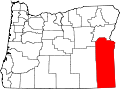
Ontario is in northeastern Malheur County, bordered to the east by the Snake River, which forms the state line with Idaho. The city is located at an elevation of 2,150 feet (660m) above sea level. Via Interstate 84 it is 30 miles (48km) northwest of Caldwell, Idaho, and 56 miles (90km) northwest of Boise, as well as 73 miles (117km) southeast of Baker City, Oregon.
According to the U.S. Census Bureau, the city of Ontario has a total area of 5.99 square miles (15.51km2), of which 0.001 square miles (0.003km2), or 0.02%, are water.[2]
Climate
Ontario has a cold desertdry-summer continental climate, abbreviated "BSk" on climate maps.[9] As is common with the high deserts of Oregon, winters are cold and snowy, while summers are hot, dry and sunny. The record high temperature of 113°F (45.0°C) was observed on August 4, 1961, and July 12, 1967, while the record low of −25°F (−31.7°C) was observed on January 27, 1957, and January 22, 1962.[10] On average, Ontario experiences 60.8 days with high temperatures of at least 90°F (32.2°C), 10.5 days with high temperatures of at least 100°F (37.8°C), 128.4 days with low temperatures at or below 32°F (0.0°C), and 2.1 days with low temperatures at or below 0°F (−17.8°C).[11]
Climate data for Ontario Municipal Airport, Ontario, Oregon (1991–2020 normals, extremes 1945–present)
Note: the US Census treats Hispanic/Latino as an ethnic category, meaning Hispanics/Latinos can be of any race.
As of the 2020 census, there were 11,645 people, 4,404 households, and 2,491 families residing in the city.[16]
The median age was 34.8 years. 27.2% of residents were under the age of 18 and 17.9% of residents were 65 years of age or older. For every 100 females there were 94.3 males, and for every 100 females age 18 and over there were 90.6 males age 18 and over.[16]
Of the 4,404 households, 32.9% had children under the age of 18 living in them. Of all households, 37.5% were married-couple households, 20.3% were households with a male householder and no spouse or partner present, and 32.9% were households with a female householder and no spouse or partner present. About 31.1% of all households were made up of individuals and 15.3% had someone living alone who was 65 years of age or older.[16]
There were 4,682 housing units, of which 5.9% were vacant. Among occupied housing units, 51.7% were owner-occupied and 48.3% were renter-occupied. The homeowner vacancy rate was 1.3% and the rental vacancy rate was 5.1%.[16]
99.9% of residents lived in urban areas, while 0.1% lived in rural areas.[17]
As of the census[19] of 2010, there were 11,366people, 4,275households, and 2,678families living in the city. The population density was 2,198.5 inhabitants per square mile (848.8/km2). There were 4,620housing units at an average density of 893.6 per square mile (345.0/km2). The racial makeup of the city was 69.5% White, 0.7% African American, 1.3% Native American, 2.2% Asian, 0.1% Pacific Islander, 22.6% from other races, and 3.5% from two or more races. Hispanic or Latino of any race were 41.3% of the population.
There were 4,275households, of which 35.4% had children under age18 living with them, 41.3% were married couples living together, 16.0% had a female householder with no husband present, 5.3% had a male householder with no wife present, and 37.4% were non-families. 30.9% of all households were made up of individuals, and 15.3% had someone living alone who was 65years of age or older. The average household size was 2.60 and the average family size was 3.28.
The median age in the city was 32.1years. 28.9% of residents were under age18; 12.3% were between the ages of 18 and 24; 23% were from 25 to 44; 21% were from 45 to 64; and 14.9% were 65years of age or older. The gender makeup of the city was 47.3% male and 52.7% female.
2000 census
Downtown Ontario
As of the census[4] of 2000, there were 10,985people, 4,084households, and 2,634families living in the city. The population density was 2,459.3people per square mile (948.8/km2). There were 4,436 housing units at an average density of 993.1per square mile (383.2/km2). The racial makeup of the city was 69.27% White, 0.55% African American, 2.69% Asian, 0.88% Native American, 0.15% Pacific Islander, 23.09% from other races, and 3.39% from two or more races. Hispanic or Latino of any race were 32.05% of the population.
There were 4,084households, out of which 35.6% had children under the age of 18 living with them, 47.4% were married couples living together, 13.1% had a female householder with no husband present, and 35.5% were non-families. 30.4% of all households were made up of individuals, and 15.4% had someone living alone who was 65years of age or older. The average household size was 2.63 and the average family size was 3.30.
In the city, the population was spread out, with 30.5% under age18, 11.5% from 18 to 24, 24.0% from 25 to 44, 18.6% from 45 to 64, and 15.4% who were 65 years of age or older. The median age was 31years. For every 100females, there were 89.7males. For every 100females age18 and over, there were 85.2males.
The median income for a household in the city was $29,173, and the median income for a family was $35,625. Males had a median income of $29,775 versus $21,967 for females. The per capita income for the city was $14,683. About 16.4% of families and 20.8% of the population were below the poverty line, including 29.0% of those under age18 and 14.3% of those age65 or over.
Economy
Southwest 4th Avenue overlooking Holy Rosary Medical Center
The Heinz Frozen Food Company (formerly Ore-Ida), a subsidiary of H. J. Heinz Company, processes locally grown potatoes, and annually produces over 600,000,000 pounds (270,000,000kg) of 75different potato products, while employing approximately 1,000.[20]Tater tots were first created and manufactured here in 1953 (commercial distribution began in 1956).[21]
St. Alphonsus Medical Center is a 49-bed, acute-care hospital, serving Ontario and the surrounding communities in Eastern Oregon and southwestern Idaho; it is part of the hospital system of Saint Alphonsus Regional Medical Center in Boise, Idaho.[22]
About five miles (8km) northwest of central Ontario is the Snake River Correctional Institution, a 3,000-bed medium security facility. Opened in 1991 and expanded in 1998, the prison has approximately 900 employees.
Cannabis legalization
Since 2019, cannabis dispensaries have been an important part of Ontario's economy and a notable example of the border effect.[23]
In November2018, voters overturned a ban on recreational marijuana dispensaries in the town, several years after Oregon legalized recreational marijuana use. As Ontario borders Idaho (where marijuana remains illegal for all purposes), local news outlets reported that by November2019 the city's dispensaries were generating a significant amount of revenue from Idaho residents driving across the state line.[24] Total cannabis sales from Ontario dispensaries topped $100million in December2020.[25]
↑Leeds, W.H., ed. (1899). "Special Laws". The State of Oregon General and Special Laws and Joint Resolutions and Memorials Enacted and Adopted by the Twentieth Regular Session of the Legislative Assembly (Report). Salem, Oregon: State Printer. p.683.
↑Kinoshita, Robert; Tanaka, Benjamin; Tanaka, Augustus "Gus" (2004). "Resettlement and return to the West Coast". In Hirahara, Naomi; Jensen, Gwenn (eds.). Silent Scars of Healing Hands. Center for Oral and Public History. Fullerton, CA: California State University. p.143.
↑Lange, Tony (February 9, 2021). "The border-town effect: Dispensaries boom on state line". Cannabis Business Times. Archived from the original on February 19, 2021. Retrieved May 28, 2021. A city of 11,000, Ontario grosses $91.7million in 2020 to take over 'Highest County' title in Oregon after local voters overturn ban on cannabis sales.
This list is incomplete. Snake River Correctional Institution is not in the Ontario city limits. Annex Charter School has an Ontario address but is away from Ontario, in the community of Annex
This page is based on this Wikipedia article Text is available under the CC BY-SA 4.0 license; additional terms may apply. Images, videos and audio are available under their respective licenses.