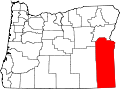
Brogan, Oregon

Last updated

Brogan, Oregon
Brogan, Oregon, Frontier store.jpg
The Frontier store in Brogan
USA Oregon location map.svg
Red pog.svg
Brogan
Location within Oregon and the United States
Usa edcp location map.svg
Red pog.svg
Brogan
Brogan (the United States)
Coordinates: 44°14′46″N117°31′01″W / 44.24611°N 117.51694°W / 44.24611; -117.51694
Country United States
State Oregon
County Malheur
Area
[1]
  Total2.86 sq mi (7.41 km2)
  Land2.86 sq mi (7.41 km2)
  Water0.00 sq mi (0.00 km2)
Elevation
2,615 ft (797 m)
Population
 (2020) [2]
  Total97
  Density33.92/sq mi (13.10/km2)
Time zone UTC-7 (Mountain (MST))
  Summer (DST) UTC-6 (Mountain)
ZIP codes
97903
FIPS code 41-08600

Brogan is an unincorporated community and Census-designated place (CDP) in Malheur County, Oregon, United States, on U.S. Route 26. Brogan was founded by D. M. Brogan in 1909, and when a post office was established in the locality on April 23 that year, it was named for him. [3] Brogan is located on the north end of the now-abandoned Union Pacific Railroad branch line from Vale. [3]

Contents

Demographics

Historical population
CensusPop.Note
2020 97
U.S. Decennial Census [4] [2]

Brogan is part of the Ontario, OR ID Micropolitan Statistical Area. At the 2010 census, the population was 90 (47 female and 43 male). The median age was 50.5 years. There were 41 households, five of which included children under age 18. [5]

As of the 2020 census, there were 97 people, 58 housing units, and 16 families in the CDP. There were 88 White people, 6 people from some other race, and 3 people from two or more races. 9 people were Hispanic or Latino. [6]

The ancestry in Brogan was 61% Irish, and 39% Italian. [6]

The median age was 51.9 years old. 48.8% of the population were older than 65, with 24.4% between the ages of 65 to 74, 9.8% between the ages of 75 to 84, and 14.6% older than 85 years old. [6]

0.0% of the population was in poverty, and the median income was not recorded. [6]

Education

Brogan is within the Vale School District 84. [7] This district has grades K-12 and operates Vale High School. [8]

Related Research Articles

<span class="mw-page-title-main">Malheur County, Oregon</span> County in Oregon, United States

Malheur County is one of the 36 counties in the U.S. state of Oregon. As of the 2020 census, the population was 31,571. Its county seat is Vale, and its largest city is Ontario. The county was named after the Malheur River, which runs through the county. The word "malheur" is French for misfortune or tragedy. Malheur County is included in the Ontario, Oregon Micropolitan Statistical Area, which is also included in the Boise Combined Statistical Area. It is included in the eight-county definition of Eastern Oregon.

<span class="mw-page-title-main">McDermitt, Nevada and Oregon</span> Unincorporated community in the state of Nevada, United States

McDermitt is an unincorporated community straddling the Nevada–Oregon border, in Humboldt County, Nevada, and Malheur County, Oregon, United States. McDermitt's economy has historically been based on mining, ranching, and farming. The last mining operation closed in 1990, resulting in a steady decline in population.

<span class="mw-page-title-main">Oak Grove, Oregon</span> Unincorporated community in the state of Oregon, United States

Oak Grove is an unincorporated community in Clackamas County, Oregon, United States, in the Portland metropolitan area. For statistical purposes, the United States Census Bureau has defined Oak Grove as a census-designated place (CDP). The census definition of the area may not precisely correspond to local understanding of the area with the same name. The population was 16,629 at the 2010 census.

<span class="mw-page-title-main">Oatfield, Oregon</span> Unincorporated community in the state of Oregon, United States

Oatfield is an unincorporated community and census-designated place in Clackamas County, Oregon, United States. It is in the Portland metropolitan area. As of the 2010 census, the population of the CDP was 13,415.

<span class="mw-page-title-main">Tri-City, Oregon</span> Unincorporated community in the state of Oregon, United States

Tri-City is a census-designated place (CDP) and unincorporated community in Douglas County, Oregon, United States. The population was 3,931 at the 2010 census. The community in Missouri Bottom near the Umpqua River is named for the three cities among which it is centered: Myrtle Creek, Canyonville and Riddle. The Tri City School District probably originated the name, which was later adopted by the local sewer district and the former Tri City State Airport.

<span class="mw-page-title-main">Rose Lodge, Oregon</span> Unincorporated community in the state of Oregon, United States

Rose Lodge is a census-designated place (CDP) and unincorporated community in Lincoln County, Oregon, United States, along the 45th parallel. The population was 1,894 at the 2010 census.

<span class="mw-page-title-main">Adrian, Oregon</span> City in Oregon, United States

Adrian is a city in Malheur County, Oregon, United States, near the confluence of the Snake River and the Owyhee River. The population was 177 at the 2010 census. It is part of the Ontario, OR–ID Micropolitan Statistical Area.

<span class="mw-page-title-main">Vale, Oregon</span> City in Oregon, United States

Vale is a city in and the county seat of Malheur County, Oregon, United States, about 12 miles (19 km) west of the Idaho border. It is at the intersection of U.S. Routes 20 and 26, on the Malheur River at its confluence with Bully Creek.

<span class="mw-page-title-main">Rickreall, Oregon</span> Unincorporated community in the state of Oregon, United States

Rickreall is an unincorporated community in Polk County, Oregon, United States. For statistical purposes, the United States Census Bureau has defined Rickreall as a census-designated place (CDP). The census definition of the area may not precisely correspond to local understanding of the area with the same name. The population of the CDP was 76 at the 2020 census. Rickreall is part of the Salem Metropolitan Statistical Area. Rickreall Creek runs along the community's southern edge.

<span class="mw-page-title-main">Beaver, Oregon</span> Unincorporated community in the state of Oregon, United States

Beaver is an unincorporated community in Tillamook County, Oregon, United States, along U.S. Route 101 and the Nestucca River, about 12 miles (19 km) south of Tillamook. For statistical purposes, the United States Census Bureau has defined Beaver as a census-designated place (CDP). The census definition of the area may not precisely correspond to local understanding of the area with the same name. The population of the CDP was 122 at the 2010 census.

<span class="mw-page-title-main">Cloverdale, Oregon</span> Census-designated place in Oregon, United States

Cloverdale is an unincorporated community in Tillamook County, Oregon, United States. For statistical purposes, the United States Census Bureau has defined Cloverdale as a census-designated place (CDP). The census definition of the area may not precisely correspond to local understanding of the area with the same name. The population was 242 at the 2000 census.

<span class="mw-page-title-main">Cayuse, Oregon</span> Unincorporated community in the state of Oregon, United States

Cayuse is a census-designated place (CDP) and unincorporated community in Umatilla County, Oregon, United States, located 11 miles (18 km) east of Pendleton on the Umatilla Indian Reservation. The population was 59 at the 2000 census. It is part of the Pendleton–Hermiston Micropolitan Statistical Area.

<span class="mw-page-title-main">Garden Home–Whitford, Oregon</span> CDP in Oregon, United States

Garden Home-Whitford is a census-designated place (CDP) consisting of the neighborhoods of Garden Home and the smaller Whitford area in Washington County, Oregon, United States. They are located in the southwest hills of Portland, near Beaverton. As of the 2020 census, the CDP population was 7,081.

<span class="mw-page-title-main">Metzger, Oregon</span> Unincorporated community in the state of Oregon, United States

Metzger is a census-designated place and unincorporated community, in Washington County, Oregon, United States. As of the 2010 census, the CDP population was 3,765. It is named for Herman Metzger, who platted the community. It is a suburb located within Portland, Oregon.

<span class="mw-page-title-main">West Haven-Sylvan, Oregon</span> CDP in Oregon, United States

West Haven-Sylvan is a census-designated place (CDP) in Washington and Multnomah counties, Oregon, United States, north of U.S. Route 26. As of the 2020 census, the CDP population was 9,299.

<span class="mw-page-title-main">Crane, Oregon</span> Unincorporated community in the state of Oregon, United States

Crane is a census-designated place and unincorporated community in Harney County, Oregon, United States, northeast of Malheur Lake on Oregon Route 78. Its population was 116 at the 2020 census.

<span class="mw-page-title-main">Juntura, Oregon</span> Unincorporated community in the state of Oregon, United States

Juntura is an unincorporated community in Malheur County, Oregon, United States on U.S. Route 20. The word juntura is Spanish for "juncture", and the community was named for its proximity to the confluence of the Malheur River with the North Fork Malheur River. The name was probably selected by local settler B. L. Milligan, who arrived in the area in the 1880s and who later served as county school superintendent. Juntura post office was established in 1890 and is still operating. The community's development slowed after World War II, and on November 2, 1976, the town voted to disincorporate. Juntura is part of the Ontario micropolitan area.

<span class="mw-page-title-main">Warren, Oregon</span> Unincorporated community in the state of Oregon, United States

Warren is an unincorporated community and census-designated place in Columbia County, Oregon, United States, located on U.S. Route 30 north of Scappoose and south of St. Helens on Scappoose Bay of the Multnomah Channel. As of the 2010 census it had a population of 1,787.

<span class="mw-page-title-main">Harper, Oregon</span> Unincorporated community in the state of Oregon, United States

Harper is an unincorporated community in Malheur County, Oregon, United States. Although it is unincorporated, it has a post office with a ZIP code 97906. Harper lies off U.S. Route 20 southwest of Vale.

Glasgow is an unincorporated community in Coos County, Oregon, United States. For statistical purposes, the United States Census Bureau has defined Glasgow as a census-designated place (CDP). The census definition of the area may not precisely correspond to local understanding of the area with the same name. As of the 2010 census the Glasgow CDP had a population of 763. The place name for Glasgow in the Coos language is Kdet.

References

  1. "ArcGIS REST Services Directory". United States Census Bureau. Retrieved October 12, 2022.
  2. 1 2 "Census Population API". United States Census Bureau. Retrieved October 12, 2022.
  3. 1 2 McArthur, Lewis A.; McArthur, Lewis L. (2003) [1928]. Oregon Geographic Names (7th ed.). Portland, Oregon: Oregon Historical Society Press. p. 114. ISBN   978-0875952772.
  4. "Census of Population and Housing". Census.gov. Retrieved June 4, 2016.
  5. "2010 Demographic Profile Data: Brogan CDP, Oregon". American FactFinder. U.S. Census Bureau. Archived from the original on February 12, 2020. Retrieved July 26, 2014.
  6. 1 2 3 4 "Explore Census Data". data.census.gov. Retrieved May 23, 2023.
  7. "2020 CENSUS - SCHOOL DISTRICT REFERENCE MAP: Malheur County, OR" (PDF). U.S. Census Bureau . Retrieved July 15, 2022.
  8. "Home". Vale School District 84 . Retrieved July 15, 2022.