Harper, Oregon | |
|---|---|
 | |
 Harper  Harper | |
| Coordinates: 43°51′56″N117°37′20″W / 43.86556°N 117.62222°W | |
| Country | United States |
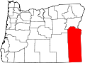
| State | Oregon |
| County | Malheur |
| Post office established | 1913 |
| Area | |
• Total | 7.00 sq mi (18.14 km2) |
| • Land | 7.00 sq mi (18.14 km2) |
| • Water | 0 sq mi (0.00 km2) |
| Elevation | 2,566 ft (782 m) |
| Population | |
• Total | 113 |
| • Density | 16.1/sq mi (6.23/km2) |
| Time zone | UTC-7 (Mountain (MST)) |
| • Summer (DST) | UTC-6 (Mountain) |
| ZIP Code | 97906 |
| FIPS code | 41-32400 |
| GNIS feature ID | 2611734 [2] |
Harper is an unincorporated community and census-designated place (CDP) in Malheur County, Oregon, United States. It has a post office with ZIP code 97906. [4] As of the 2020 census, it had a population of 113. [3]