The word juntura is Spanish for "juncture", and the community was named for its proximity to the confluence of the Malheur River with its North Fork.[5] The name was probably selected by local settler B. L. Milligan, who arrived in the area in the 1880s and who later served as county school superintendent.[5] Juntura post office was established in 1890 and is still operating.[5] The community's development slowed after World War II, and on November 2, 1976, the town voted to disincorporate.[5]
Geography
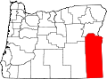
Juntura is in western Malheur County along U.S. Route 20, which leads east 55 miles (89km) to Vale and west 58 miles (93km) to Burns. The Malheur River forms the southeast edge of the community, and the North Fork forms the northeast edge; the rivers join at the eastern edge of the community. The Malheur is an east-flowing tributary of the Snake River, which it joins at the city of Ontario.
According to the U.S. Census Bureau, the Juntura CDP has an area of 2.29 square miles (5.93km2), all of it recorded as land.[1]
As of the 2020 census, there were 39 people, 35 housing units, and 20 families in the CDP. There were 34 White people, 1 Native American, 1 person from some other race, and 3 people from two or more races. 5 people were Hispanic or Latino.[7]
The median age was 64.5 years old. A total of 44.4% of the population were older than 65, with 22.2% between the ages of 65 and 74, 18.5% between the ages of 75 and 84, and 3.7% over 85.[7]
The median household income was $56,250. A total of 25.9% of the population was in poverty, with 46.2% of people between the ages of 18 and 64, and 8.3% of people over 65 were in poverty.[7]
Transportation
In the 21st century, Juntura is a stop on the Eastern POINT intercity bus line between Bend and Ontario. It makes one stop per day in each direction.[8]
Education
It is in the Juntura School District 12, an elementary school district.[9] It operates Juntura Grade School.[10] In 1975 the school began paying students to do janitorial work after the teacher, who previously worked at Fields. The janitorial duties each student has were rotated weekly. The students used the money to fund field trips. In 1979 the school had 26 students, with 11 in grades 5-7 and none in the 8th grade.[11] In the 2016-2017 school year, enrollment was initially five and went down to two because the remaining three students moved elsewhere. Kathleen Schram, the principal, stated that she expected that there would be more students later due to demographic patterns.[12] In 2023, all of the board members of the Juntura district left their posts at the same time as they disliked a new ethics rule from the State of Oregon.[13]
This page is based on this Wikipedia article Text is available under the CC BY-SA 4.0 license; additional terms may apply. Images, videos and audio are available under their respective licenses.