Columbia County was created in 1854 from the northern half of Washington County. Milton served as the county seat until 1857 when it was moved to St. Helens.
Columbia County has been afflicted by numerous flooding disasters, the most recent in December 2007. Heavy rains caused the Nehalem River to escape its banks and flood the city of Vernonia and rural areas nearby. Columbia County received a presidential disaster declaration for this event.
In the 1910s the Socialist Party of Oregon won a handful of votes. This party was distinct from the better-known SPO which operated throughout the twentieth century.
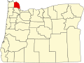
Map of Columbia County
Geography
According to the United States Census Bureau, the county has an area of 688 square miles (1,780km2), of which 657 square miles (1,700km2) is land and 31 square miles (80km2) (4.5%) is water.[2] It is Oregon's third-smallest county by land area and fourth-smallest by total area.
U.S. Decennial Census[4] 1790–1960[5] 1900–1990[6] 1990–2000[7] 2010–2020[1]
2020 census
Columbia County, Oregon – Racial and ethnic composition Note: the US Census treats Hispanic/Latino as an ethnic category. This table excludes Latinos from the racial categories and assigns them to a separate category. Hispanics/Latinos may be of any race.
As of the 2020 census, the county had a population of 52,589. Of the residents, 20.7% were under the age of 18 and 20.0% were 65 years of age or older; the median age was 43.4 years. For every 100 females there were 100.4 males, and for every 100 females age 18 and over there were 99.9 males. 58.8% of residents lived in urban areas and 41.2% lived in rural areas.[17][18][19]
There were 20,457 households in the county, of which 28.5% had children under the age of 18 living with them and 21.7% had a female householder with no spouse or partner present. About 24.0% of all households were made up of individuals and 11.9% had someone living alone who was 65 years of age or older.[18]
There were 21,697 housing units, of which 5.7% were vacant. Among occupied housing units, 75.5% were owner-occupied and 24.5% were renter-occupied. The homeowner vacancy rate was 1.3% and the rental vacancy rate was 4.6%.[18]
2010 census
As of the 2010 census, there were 49,351 people, 19,183 households, and 13,516 families living in the county.[20] The population density was 75.1 inhabitants per square mile (29.0/km2). There were 20,698 housing units at an average density of 31.5 units per square mile (12.2 units/km2).[21] The racial makeup of the county was 92.5% white, 1.3% American Indian, 0.9% Asian, 0.4% black or African American, 0.2% Pacific islander, 1.2% from other races, and 3.4% from two or more races. Those of Hispanic or Latino origin made up 4.0% of the population.[20] In terms of ancestry, 26.1% were German, 14.5% were English, 14.4% were Irish, 5.9% were Norwegian, and 4.8% were American.[22]
Of the 19,183 households, 32.0% had children under the age of 18 living with them, 55.5% were married couples living together, 9.8% had a female householder with no husband present, 29.5% were non-families, and 23.3% of all households were made up of individuals. The average household size was 2.55 and the average family size was 2.98. The median age was 41.3 years.[20]
The median income for a household in the county was $55,199 and the median income for a family was $62,728. Males had a median income of $52,989 versus $35,558 for females. The per capita income for the county was $24,613. About 6.5% of families and 10.3% of the population were below the poverty line, including 12.7% of those under age 18 and 6.6% of those age 65 or over.[23]
2000 census
As of the 2000 census, there were 43,560 people, 16,375 households, and 12,035 families living in the county. The population density was 66 inhabitants per square mile (25/km2). There were 17,572 housing units at an average density of 27 units per square mile (10 units/km2). The racial makeup of the county was 94.42% White, 0.24% Black or African American, 1.33% Native American, 0.59% Asian, 0.10% Pacific Islander, 0.79% from other races, and 2.53% from two or more races. 2.51% of the population were Hispanic or Latino of any race. 21.2% were of German, 10.8% English, 9.4% American, 9.3% Irish and 5.4% Norwegian ancestry.
There were 16,375 households, out of which 34.40% had children under the age of 18 living with them, 60.50% were married couples living together, 8.70% had a female householder with no husband present, and 26.50% were non-families. 21.10% of all households were made up of individuals, and 8.10% had someone living alone who was 65 years of age or older. The average household size was 2.65 and the average family size was 3.06.
In the county, the population was spread out, with 27.30% under the age of 18, 7.00% from 18 to 24, 28.10% from 25 to 44, 26.00% from 45 to 64, and 11.60% who were 65 years of age or older. The median age was 38 years. For every 100 females, there were 100.00 males. For every 100 females age 18 and over, there were 98.10 males.
The median income for a household in the county was $45,797, and the median income for a family was $51,381. Males had a median income of $42,227 versus $27,216 for females. The per capita income for the county was $20,078. About 6.70% of families and 9.10% of the population were below the poverty line, including 11.60% of those under age 18 and 7.00% of those age 65 or over.
Columbia County had newspapers as early as 1891, with the launch of the Clatskanie Chief. The Rainier Review was launched in 1895.[24] The St. Helens Chronicle, which grew out of a series of mergers of the Chronicle, the Sentinel, and the Mist founded in 1881.[25] The Chief and Chronicle merged in December 2023 to form The Columbia County Chronicle & Chief, which served as a newspaper of record for the county.[26] The paper published its final edition on September 25, 2024.[27][28] The South County Spotlight, launched in 1961, serves the region alone,[29] with a circulation of 3,600.[30] Columbia County has one AM radio station, KOHI AM 1600, which has broadcast continually since 1959. The station is locally owned, with an FCC-estimated weekly listenership of 10,000.[citation needed]
Emergency Services
Columbia River Fire & Rescue provides is one of the providers of emergency services in St.Helens.[31][32] It's ambulance turned right in front of a bicyclist and ran him over in 2022. CRF&R's ambulance took the victim to the hospital, but billed him $1,862 for the injury they caused.[33][34] The man filed a lawsuit against the company for nearly a million dollars.[35]
Between 1932 and 2012, the county was among the most consistently Democratic in the United States in terms of presidential elections. The last Republican to win a majority in Columbia County had been Herbert Hoover in the 1928 presidential election, although before 1932 no Democrat had won a majority in the county[36] since Samuel J. Tilden in 1876. In the 1952 presidential election, Columbia was the only county in Oregon to not back Dwight Eisenhower. However, Columbia County has begun to shift to more conservative politics in recent elections. In 2016, Donald Trump won the county with just under fifty percent of the vote, a break with the tradition of choosing Democrats for president.[37] Trump would repeat his win in the county 4 years later with an absolute majority of the vote.[38]
While Columbia had an 80-year streak of voting for the Democratic nominee, the margin had been as narrow as three percent in 2004[39] and in 1984.
The primary industries are wood products and paper manufacturing, trade, construction and horticulture.[41][42] The extensive stands of old-growth timber, which had attracted many of the early settlers to the area, were completely logged over by the 1950s.[43] Second-growth timber provides the raw material for local lumber and paper mills. About half the county's workforce commutes out of the county to work, most to the nearby Portland, Oregon, metro area.[44] Columbia County's average non-farm employment was 10,740 in 2007.[45] The five largest private employers in Columbia County are Fred Meyer, Cascade Tissue Group, Wal-Mart, OMIC, USIA,[46] and USG.[47]
Transportation
The CC Rider transit service links the county to Portland and points in Washington County, including connecting with TriMet buses and the MAX light rail system in eastern Hillsboro.
Public transit
Columbia County Rider (CC Rider), a service of the Columbia County Transit Division, provides six intercity bus lines and one "flex route" serving various points of downtown St. Helens and downtown Scappoose.[48] From 2016 to 2022, CC Rider buses were operated by contract drivers supplied by MTR Western, a charter motor coach operator,[49] but since July 2022 the county has operated the service directly.[50]
The transit service is largely funded by grants from the Oregon Department of Transportation and the federal government. Attempts at making CC Rider a separate transit district and to introduce new taxes to fund it have repeatedly failed since 2015. Columbia County and nearby Clatsop County are currently studying options on consolidating the two county's transit services.[51][52]
Single-ride fares range from $2 to $6 per ride, depending on number of zones traveled. A ride to Astoria costs up to $10 per ride each way.[53][54]
Most of Columbia County is in the boundary of Portland Community College, while a portion to the north is not in the boundary of any community college district.[56]
↑Analysis, US Department of Commerce, BEA, Bureau of Economic. "Bureau of Economic Analysis". www.bea.gov. Retrieved April 11, 2018.{{cite web}}: CS1 maint: multiple names: authors list (link)
This page is based on this Wikipedia article Text is available under the CC BY-SA 4.0 license; additional terms may apply. Images, videos and audio are available under their respective licenses.