Quincy, Oregon

Last updated
Old Quincy School, built in 1925 Old Quincy School (Columbia County, Oregon scenic images) (colDA0057a).jpg
Old Quincy School, built in 1925

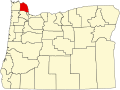
Quincy is an unincorporated community in Columbia County, Oregon, United States. [1] It is located about 4.5 miles northeast of Clatskanie and 3.5 miles southwest of Mayger in a drained and diked area of the Columbia River lowlands. [2] [3]

The Quincy area was first settled about 1882 and named by J. W. Barnes for his hometown of Quincy, Illinois. [4] Quincy post office ran from 1892 until 1933. [4]

In 1915, Quincy had a population of 40 and two churches and two schools. [5] In 1940, Quincy had a population of 303. [3] Quincy Store is still in operation. [5] [6]

Related Research Articles

The Wallooskee River is a tributary of the Youngs River, about 10 miles (16 km) long, in northwest Oregon in the United States. It drains a small area of the foothills of the Coast Range near the mouth of the Columbia River. The Youngs River is a tributary of the Columbia River.

The Clatskanie River is a tributary of the Columbia River, approximately 25 miles (40 km) long, in northwestern Oregon in the United States. It drains a timber-producing area in the foothills of the Northern Oregon Coast Range north-northwest of Portland.

Ortley, Oregon

Ortley is a former town in Wasco County, Oregon, in the United States. It was about 1 mile (2 km) south of Rowena and about 7 miles (11 km) southeast of Mosier; the site is now on private land and no evidence of the townsite exists today. It is still classed as a populated place by the USGS.

Cushman, Oregon Unincorporated community in the State of Oregon, United States

Cushman is an unincorporated community in Lane County, Oregon, United States. It is located on the north bank of the Siuslaw River on Oregon Route 126, between Tiernan and Florence.

Dolph, Oregon Unincorporated community in the State of Oregon, United States

Dolph is an unincorporated community in Tillamook County, Oregon, United States, near the Yamhill County line. It lies at the junction of Oregon Route 22 and Oregon Route 130 between Grande Ronde and Hebo, on the Little Nestucca River. It is within the Siuslaw National Forest in the Northern Oregon Coast Range.

Birkenfeld, Oregon Unincorporated community in the State of Oregon, United States

Birkenfeld is an unincorporated community in Columbia County, Oregon, United States, in the Nehalem Valley on Oregon Route 202 between Jewell and Mist.

Olney, Oregon Unincorporated community in the State of Oregon, United States

Olney is an unincorporated community and former company town in Clatsop County, Oregon, United States, on Oregon Route 202 approximately eight miles south of Astoria. Olney is located at 46.100109°N 123.757637°W. Its post office is assigned ZIP code 97325.

Wonder is an unincorporated community in Josephine County, Oregon, United States, on U.S. Route 199 about 13 miles west of Grants Pass and 8 miles east of Selma. It is within the Rogue River – Siskiyou National Forest.

Wyeth is an unincorporated locale in Hood River County, Oregon, United States. It is the site of a campground area in the Columbia River Gorge National Scenic Area off Interstate 84 (I-84).

Woodson is an unincorporated community in Columbia County, Oregon, United States. It is located on U.S. Route 30 seven miles west of Clatskanie and three miles east of Westport, on Westport Slough, a tributary of the Columbia River. In December 2007, the debris overflow from the flooding of Eilersten Creek caused evacuations and mud cover on Woodson Road north of the highway.

Harlan is an unincorporated community in Lincoln County, Oregon, United States, about 30 miles west of Corvallis. It is located in a valley of the Central Oregon Coast Range in the Siuslaw National Forest. The community's economy was once based on logging and sawmills. Cattle ranching is another mainstay of the local economy.

Walker is an unincorporated community in Lane County, Oregon, United States. It is located about 4 miles (6 km) north of Cottage Grove on Oregon Route 99, near the Coast Fork Willamette River.

Burnt Woods is an unincorporated community in Lincoln County, Oregon, United States. It is located about 16 miles (26 km) west of Philomath on U.S. Route 20 in the Central Oregon Coast Range near the Tumtum River.

Hamlet is an unincorporated community in Clatsop County, Oregon, United States. It is located approximately six miles southeast of Necanicum, in the Northern Oregon Coast Range near the confluence of the North Fork Nehalem River and the Little North Fork Nehalem River. It is surrounded by units of the Clatsop State Forest.

Holland is an unincorporated community in Josephine County, Oregon, United States. It is about eight miles southeast of Cave Junction, in the Illinois Valley south of Oregon Route 46.

Clifton is an unincorporated community in Clatsop County, Oregon, United States. It is located north of U.S. Route 30, about nine miles northwest of Westport on the south bank of the Columbia River. It is on Clifton Channel across from Tenasillahe Island.

Fort Hill is an unincorporated community in Polk and Yamhill counties in Oregon, United States. It is located about a mile east of Spirit Mountain Casino on Oregon Route 22 near the South Yamhill River. For statistical purposes, the United States Census Bureau has defined Fort Hill as a census-designated place (CDP). The census definition of the area may not precisely correspond to local understanding of the area with the same name. The hill of the same name, located just east of Valley Junction, was the site of a blockhouse built by settlers in 1855–1856. The blockhouse became part of Fort Yamhill, and was later moved to Grand Ronde Agency and is now located in Dayton.

Suver is an unincorporated community in Polk County, Oregon, United States. It is located about 10 miles north of Corvallis and about 8 miles south of Monmouth, 1 mile east of Oregon Route 99W.

Blalock was an unincorporated community located in the Columbia River Gorge in Gilliam County, Oregon, United States. The town displaced a Native American settlement originally named Táwash. Blalock was located about 7 miles (11 km) west of Arlington on Interstate 84/U.S. Route 30 at the mouth of Blalock Canyon. Blalock is still the name of a station on the Union Pacific Railroad.

The Little Clatskanie River is a short tributary of the Clatskanie River in Columbia County in the U.S. state of Oregon. It begins near Sarafin Point in the Northern Oregon Coast Range northwest of St. Helens and flows generally north to meet the larger stream near the unincorporated community of Apiary. The mouth of the Little Clatskanie is about 16 miles (26 km) from the main stem Clatskanie's confluence with the Columbia River. The Little Clatskanie has no named tributaries.

References

  1. "Quincy". Geographic Names Information System . United States Geological Survey. November 28, 1980. Retrieved November 17, 2014.
  2. Oregon Atlas & Gazetteer (7th ed.). Yarmouth, Maine: DeLorme. 2008. ISBN   0-89933-347-8.
  3. 1 2 Writers' Program of the Work Projects Administration in the State of Oregon (1940). Oregon: End of the Trail. American Guide Series. Portland, Oregon: Binfords & Mort. p.  279. OCLC   4874569.
  4. 1 2 McArthur, Lewis A.; McArthur, Lewis L. (2003) [1928]. Oregon Geographic Names (7th ed.). Portland, Oregon: Oregon Historical Society Press. p. 793. ISBN   978-0875952772.
  5. 1 2 Friedman, Ralph (1990). In Search of Western Oregon. Caldwell, Idaho: The Caxton Printers, Ltd. p. 129. ISBN   0-87004-332-3.
  6. "Suspect in shooting of Rainier officer found dead near Clatskanie". The Daily News . June 23, 2014. Retrieved November 17, 2014.

Coordinates: 46°08′37″N123°09′36″W / 46.1437218°N 123.1601189°W / 46.1437218; -123.1601189