Mist, Oregon

Last updated
Mist, Oregon
USA Oregon location map.svg
Red pog.svg
Mist
Location within the state of Oregon
Usa edcp location map.svg
Red pog.svg
Mist
Mist (the United States)
Coordinates: 45°59′47″N123°15′19″W / 45.99639°N 123.25528°W / 45.99639; -123.25528 Coordinates: 45°59′47″N123°15′19″W / 45.99639°N 123.25528°W / 45.99639; -123.25528
Country United States
State Oregon
County Columbia
Time zone UTC-8 (Pacific (PST))
  Summer (DST) UTC-7 (PDT)
ZIP code
97016
Area code(s) 503 and 971

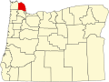
Mist is an unincorporated community in Columbia County, Oregon, United States. Formerly called Riverside, the place was renamed in 1888 for the atmospheric conditions of the Nehalem Valley. [1] The first land claims in the area had been made circa 1870. [2] The original Riverside post office was closed in 1975. [1]

Contents

Background

On July 6, 2001, the Mist store, which was built in 1874, caught fire and was destroyed. Until then, it was the oldest continuously operating business in Oregon, [3] offering food and hardware and displaying historic newspaper clippings and antique logging equipment on the walls.[ citation needed ]

Mist is a crossroads community where Oregon Route 47 turns north to Clatskanie, and a pioneer trail (Burn Road) crossed the Nehalem River and went south to Vernonia. It is the eastern terminus of Oregon Route 202. The Nehalem River valley widens between Mist and Jewell and was favored by the Native American tribes of the area for hunting; it was later favored by early European American settlers for agriculture.[ citation needed ] Although the area is now sparsely settled, it is notable for having the largest operating sawmill in Columbia County and also geological conditions lending themselves to natural gas storage.[ citation needed ] Mist contains one of the very few, and therefore very valuable, natural gas storage areas in the Pacific Northwest. It operates unobtrusively[ citation needed ] on a hill near Mist. It is controlled by NW Natural (formerly Northwest Natural Gas) and is connected by several pipelines, including a 16-inch (410 mm) and a 24-inch (610 mm) pipeline along the Nehalem Highway. [4]

Earlier in the 20th century, Mist had a logging camp next to a railroad used by the Kerry Timber and Logging Company. The remains of the camp were discovered in 2008 and 2009. [2] Though still important in terms of logging, the population today is sparse, and there is no longer a railroad.[ citation needed ]

Related Research Articles

Scouting in Washington (state)

Scouting in Washington has a long history, from the 1910s to the present day, serving thousands of youth in programs that suit the environment in which they live.

Molalla, Oregon City in Oregon, United States

Molalla is a city in Clackamas County, Oregon. The population was 8,108 at the time of the 2010 census.

Nehalem, Oregon City in Oregon, United States

Nehalem is a city in Tillamook County, Oregon, United States. Incorporated in 1889, the city lies along the Nehalem River and Nehalem Bay near the Pacific Ocean. It is bisected by U.S. Route 101. The population was 355 at the 2020 census.

Cedar River (Washington) River in the United States of America

The Cedar River is a river in the U.S. state of Washington. About 45 miles (72 km) long, it originates in the Cascade Range and flows generally west and northwest, emptying into the southern end of Lake Washington. Its upper watershed is a protected area called the Cedar River Watershed, which provides drinking water for the greater Seattle area.

Coos Bay

Coos Bay is an S-shaped inlet where the Coos River enters the Pacific Ocean, approximately 10 miles (16 km) long and two miles wide, on the Pacific Ocean coast of southwestern Oregon in the United States. The city of Coos Bay, once named Marshfield, was renamed for the bay and is located on its inner side. The Port of Coos Bay is the largest and deepest port between San Francisco, California and the Columbia River.

Salmonberry River River in Oregon, United States

The Salmonberry River is a tributary of the Nehalem River, about 20 miles (32 km) long, in northwest Oregon in the United States. It drains a remote unpopulated area of the Northern Oregon Coast Range in the Tillamook State Forest about 65 miles (105 km) west-northwest of Portland. The river runs through part of the region devastated between 1933 and 1951 by a series of wildfires known as the Tillamook Burn.

Clatsop

The Clatsop is a small tribe of Chinookan-speaking Native Americans in the Pacific Northwest of the United States. In the early 19th century they inhabited an area of the northwestern coast of present-day Oregon from the mouth of the Columbia River south to Tillamook Head, Oregon.

Oregon Route 47 Oregon state highway

Oregon Route 47 is an Oregon state highway that runs between the Willamette Valley, near McMinnville, and the city of Clatskanie, along the Columbia River in the northwest part of the state. OR 47 traverses several highways of the Oregon state highway system: part of the Tualatin Valley Highway No. 29, part of the Nehalem Highway No. 102, part of the Sunset Highway No. 47, and the Mist–Clatskanie Highway No. 110.

Kitimat District municipality in British Columbia, Canada

Kitimat is a district municipality in the North Coast region of British Columbia, Canada. It is a member municipality of the Regional District of Kitimat–Stikine regional government. The Kitimat Valley is part of the most populous urban district in northwest British Columbia, which includes Terrace to the north along the Skeena River Valley. The city was planned and built by the Aluminum Company of Canada (Alcan) during the 1950s. Its post office was approved on June 6, 1952.

Moyers is an unincorporated community located in Pushmataha County, Oklahoma, United States.

FortisBC is an electricity and natural gas distribution utility in the Canadian province of British Columbia, a subsidiary of Newfoundland-based Fortis Inc., Canada’s largest private utility company. In March 2011, Terasen Gas, British Columbia's largest natural gas distributor, was renamed FortisBC Energy Inc., as both companies are owned by Fortis Inc.

NW Natural, formerly Northwest Natural Gas Company, is an American publicly traded utility headquartered in Portland, Oregon, United States. Primarily a natural gas distributor, the company services residential, commercial, and industrial customers in Western Oregon and Southwest Washington in the Pacific Northwest. Founded in 1859, the company has approximately 680,000 customers and revenues of nearly one billion in US dollars annually.

Collier Memorial State Park

Collier Memorial State Park is a state park in southern Oregon. The park is operated and maintained by the Oregon Parks and Recreation Department. It is located on U.S. Highway 97, approximately 30 miles (48 km) north of Klamath Falls and 105 miles (169 km) south of Bend. The park covers 146 acres (59 ha) along the Williamson River.

Glenwood, Washington County, Oregon Unincorporated community in the State of Oregon, United States

Glenwood is an unincorporated community in Washington County, Oregon, United States, northwest of Forest Grove on Oregon Route 6.

Olney, Oregon Unincorporated community in the State of Oregon, United States

Olney is an unincorporated community and former company town in Clatsop County, Oregon, United States, on Oregon Route 202 approximately eight miles south of Astoria. Olney is located at 46.100109°N 123.757637°W. Its post office is assigned ZIP code 97325.

Christmas flood of 1964 Major flood in the United States

The Christmas flood of 1964 was a major flood in the United States' Pacific Northwest and some of Northern California between December 18, 1964, and January 7, 1965, spanning the Christmas holiday. Considered a 100-year flood, it was the worst flood in recorded history on nearly every major stream and river in coastal Northern California and one of the worst to affect the Willamette River in Oregon. It also affected parts of southwest Washington, Idaho, and Nevada. In Oregon, 17 or 18 people died as a result of the disaster, and it caused hundreds of millions of dollars in damage. The flooding on the Willamette covered 152,789 acres (61,831.5 ha). The National Weather Service rated the flood as the fifth most destructive weather event in Oregon in the 20th century. California Governor Pat Brown was quoted as saying that a flood of similar proportions could "happen only once in 1,000 years," and it was often referred to later as the Thousand Year Flood. The flood killed 19 people, heavily damaged or completely devastated at least 10 towns, destroyed all or portions of more than 20 major highway and county bridges, carried away millions of board feet of lumber and logs from mill sites, devastated thousands of acres of agricultural land, killed 4,000 head of livestock, and caused $100 million in damage in Humboldt County, California, alone.

Foss, Oregon Unincorporated community in the State of Oregon, United States

Foss is an unincorporated community in Tillamook County, Oregon, United States. It is about 4 miles (6 km) east of Mohler and Oregon Route 53, near the Nehalem River. Foss is the site of an important river flood gauge.

Columbia and Nehalem Valley Railroad

The Columbia and Nehalem Valley Railroad was a standard gauge logging railroad near Columbia City, Oregon, which was owned by the Portland-based Peninsular Lumber Company.

Outline of Washington infrastructure Overview of and topical guide to infrastructure of the U.S. state of Washington

The following outline is provided as an overview of and topical guide to infrastructure of the U.S. state of Washington.

References

  1. 1 2 McArthur, Lewis A.; McArthur, Lewis L. (2003) [1928]. Oregon Geographic Names (7th ed.). Portland, Oregon: Oregon Historical Society Press. p. 652. ISBN   978-0875952772.
  2. 1 2 Connolly, Thomas J.; Bland, Richard L.; Tonsfeldt, Ward (Fall 2011). "Tracking the Kerry Line: Evidence From a Logging Railroad Camp in the Nehalem Valley, Oregon" (PDF). Journal of Northwest Anthropology. Richland, Washington: Northwest Anthropology. 45 (22): 199–208. ISSN   1538-2834 . Retrieved February 26, 2014.
  3. The Nehalem River Highway, Jeffrey Butts
  4. Northwest Natural 2006 Annual report