Birkenfeld, Oregon

Last updated

Birkenfeld, Oregon
Birkenfeld Store.JPG
The Birkenfeld Country Store
USA Oregon location map.svg
Red pog.svg
Birkenfeld
Location within the state of Oregon
Usa edcp location map.svg
Red pog.svg
Birkenfeld
Birkenfeld (the United States)
Coordinates: 45°59′26″N123°20′15″W / 45.99056°N 123.33750°W / 45.99056; -123.33750
Country United States
State Oregon
County Columbia
Elevation
515 ft (157 m)
Population
 (2000)
  Total840
Time zone UTC-8 (Pacific (PST))
  Summer (DST) UTC-7 (PDT)
Area codes 503 and 971

Birkenfeld is an unincorporated community in Columbia County, Oregon, United States, in the Nehalem Valley on Oregon Route 202 between Jewell and Mist. [1]

Contents

History

German immigrant Anton Birkenfeld settled in the Nehalem Valley in 1886 and founded Birkenfeld in about 1910. [2] Birkenfeld's post office was founded in 1916, [2] bringing much-needed mail service on a more local basis. As of 2010, the Birkenfeld post office has been closed permanently. [3] Although mail can still be addressed directly to the defunct post office, the community has a Clatskanie ZIP code, 97016 and all mail directed toward Birkenfeld is automatically redirected there. [3]

As of the 1990s the community had a store, a café, a tavern, a garage, and a church. [4] [5]

Geography

Located on the northwest of Oregon it has a latitude of 515 feet (157 meters) above sea level.

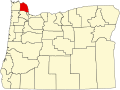
Degrees Minutes Seconds: Latitude: 45-59'26" N Longitude: 123-20'15" W Decimal Degrees: Latitude: 45.9906668 Longitude: -123.3376214 [6]

Climate

Birkenfeld has a warm-summer Mediterranean climate (Köppen Csb) with cool and cloudy winters, and warm, dry summers. [7] This climate is characterized by having overcast, wet, and changing weather conditions in fall, winter, and spring, as Birkenfeld lies in the direct path of the stormy westerly flow, and mild and dry summers when the Pacific High reaches in northernmost point in mid summer. [8]

According to the Köppen climate classification, Birkenfeld falls within the dry-summer temperate zone (Csb). [8] [9] with a USDA Plant Hardiness Zones between 8b and 9a. [10] Other climate systems, such as the Trewartha climate classification, places it within the oceanic zone (Do), like much of the Pacific Northwest and Western Europe. [11]

Winters are cool, cloudy, and rainy. The coldest month is December with an average daily high of 44.0 °F (6.7 °C), although overnight lows usually remain above freezing by a few degrees. Evening temperatures fall to or below freezing 33 nights per year on average, but very rarely to or below 18 °F (−8 °C).

Annual snowfall in Birkenfeld falls during the December-to-March time frame.

Summers in Birkenfeld are warm, occasionally hot, dry, and sunny, though the sunny warm weather is short lived from mid June through early September. The months of June, July, August and September account for a combined 5.4 inches (137 mm) of total rainfall  of the 54.7 in (1,389 mm) of the precipitation that falls throughout the year. The warmest months are July and August, with an average high temperature of 78.0 °F (25.6 °C). Because of its location 46 miles (74 km) to the coast, as well as the protective nature of the Oregon Coast Range to its west, Birkenfeld summers are less susceptible to the moderating influence of the nearby Pacific Ocean. Spring and fall can bring variable weather including warm fronts that send temperatures surging above 80 °F (27 °C) and cold snaps that plunge daytime temperatures into the 40s °F (4–9 °C). However, lengthy stretches of overcast days beginning in mid fall and continuing into mid spring are most common. Rain often falls as a light drizzle for several consecutive days at a time, contributing to 152 days on average with measurable (≥0.01 in or 0.25 mm) precipitation annually.

Climate data for Birkenfeld, Oregon
MonthJanFebMarAprMayJunJulAugSepOctNovDecYear
Average high °F (°C)46.0
(7.8)
48.0
(8.9)
52.0
(11.1)
58.0
(14.4)
65.0
(18.3)
69.0
(20.6)
78.0
(25.6)
78.0
(25.6)
72.0
(22.2)
60.0
(15.6)
50.0
(10.0)
44.0
(6.7)
60.0
(15.6)
Average low °F (°C)37.0
(2.8)
37.0
(2.8)
38.0
(3.3)
40.0
(4.4)
46.0
(7.8)
50.0
(10.0)
54.0
(12.2)
55.0
(12.8)
52.0
(11.1)
46.0
(7.8)
41.0
(5.0)
36.0
(2.2)
44.3
(6.8)
Average precipitation inches (mm)8.2
(210)
6.0
(150)
6.2
(160)
4.1
(100)
2.6
(66)
1.7
(43)
0.6
(15)
0.9
(23)
2.2
(56)
4.3
(110)
8.6
(220)
9.3
(240)
54.7
(1,393)
Average snowfall inches (cm)1.8
(4.6)
1.1
(2.8)
0.3
(0.76)
0
(0)
0
(0)
0
(0)
0
(0)
0
(0)
0
(0)
0
(0)
0.3
(0.76)
1.3
(3.3)
4.8
(12.22)
Average precipitation days17141714107236111718136
Average snowy days1000000000001
Source: NOAA [12]

Demographics

Birkenfeld, Oregon has a population of 840.

The median household income in Birkenfeld, Oregon is $41,938. The median household income for the surrounding county is $47,577 compared to the national median of $50,013. The median age of people living in Birkenfeld is 43.2 years. [13]

Related Research Articles

<span class="mw-page-title-main">Temperate climate</span> Main climate class

In geography, the temperate climates of Earth occur in the middle latitudes, which span between the tropics and the polar regions of Earth. These zones generally have wider temperature ranges throughout the year and more distinct seasonal changes compared to tropical climates, where such variations are often small and usually only have precipitation changes.

<span class="mw-page-title-main">Harbor, Oregon</span> Unincorporated community in the state of Oregon, United States

Harbor is an unincorporated community in Curry County, Oregon, United States. It is located across the Chetco River from the city of Brookings. For statistical purposes, the United States Census Bureau has defined Harbor as a census-designated place (CDP). The census definition of the area may not precisely correspond to local understanding of the area with the same name. The population of the CDP was 2,391 at the 2010 census.

<span class="mw-page-title-main">Waldport, Oregon</span> City in Oregon, United States

Waldport is a city in Lincoln County, Oregon, United States. The population was 2,033 at the 2010 census. The city is located on the Alsea River and Alsea Bay, 15 miles (24 km) south of Newport and 8 miles (13 km) north of Yachats.

<span class="mw-page-title-main">Newberg, Oregon</span> City in Oregon, United States

Newberg is a city in Yamhill County, Oregon, United States. Located in the Portland metropolitan area, the city is home to George Fox University. As of the 2020 census, the city population was 25,138 making it the second most populous city in the county.

<span class="mw-page-title-main">Mediterranean climate</span> Type of climate

A Mediterranean climate, also called a dry summer climate, described by Köppen as Cs, is a temperate climate type that occurs in the lower mid-latitudes. Such climates typically have dry summers and wet winters, with summer conditions ranging from warm to hot and winter conditions typically being mild. These weather conditions are typically experienced in the majority of Mediterranean-climate regions and countries, but remain highly dependent on proximity to the ocean, altitude and geographical location.

<span class="mw-page-title-main">Brightwood, Oregon</span> Unincorporated community in the state of Oregon, United States

Brightwood is an unincorporated community within the Mount Hood Corridor in Clackamas County, Oregon, United States. It is located between Wemme and Sandy just off U.S. Route 26 at an elevation of 1165 feet. It is one of the communities that make up the Villages at Mount Hood.

<span class="mw-page-title-main">Köppen climate classification</span> Climate classification system

The Köppen climate classification is one of the most widely used climate classification systems. It was first published by German-Russian climatologist Wladimir Köppen (1846–1940) in 1884, with several later modifications by Köppen, notably in 1918 and 1936. Later, German climatologist Rudolf Geiger (1894–1981) introduced some changes to the classification system, which is thus sometimes called the Köppen–Geiger climate classification.

<span class="mw-page-title-main">Oceanic climate</span> Climate classification

An oceanic climate, also known as a marine climate, is the temperate climate sub-type in Köppen classification represented as Cfb, typical of west coasts in higher middle latitudes of continents, generally featuring cool summers and mild winters, with a relatively narrow annual temperature range and few extremes of temperature. Oceanic climates can be found in both hemispheres generally between 45 and 63 latitude, most notably in northwestern Europe, northwestern America, as well as New Zealand. Other varieties of climates usually classified together with these include subtropical highland climates, represented as Cwb or Cfb, and subpolar oceanic climates, represented as Cfc or Cwc. Subtropical highland climates occur in some mountainous parts of the subtropics or tropics, some of which have monsoon influence, while subpolar oceanic climates occur near polar regions.

Midland is an unincorporated community in Klamath County, Oregon, United States, about 8 miles (13 km) south of Klamath Falls on U.S. Route 97. The site was platted in 1908 and named Midland, with a post office established in 1909. At the time it was said the name was chosen because the town was halfway between Portland and San Francisco on the proposed Cascade Line of the Southern Pacific Railroad. It is not halfway, however, and it is now thought that the name refers to the town's site on land partly surrounded by marshes.

<span class="mw-page-title-main">Alvadore, Oregon</span> Unincorporated community in the state of Oregon, United States

Alvadore is an unincorporated community in Lane County, Oregon, United States, located nine miles northwest of downtown Eugene and one mile northeast of Fern Ridge Reservoir.

<span class="mw-page-title-main">Climate classification</span> Systems that categorize the worlds climates

Climate classifications are systems that categorize the world's climates. A climate classification may correlate closely with a biome classification, as climate is a major influence on life in a region. One of the most used is the Köppen climate classification scheme first developed in 1884.

<span class="mw-page-title-main">Climate of Oregon</span> Current climate details for Oregon

According to the Köppen climate classification, most of Western Oregon has a warm-summer Mediterranean climate, which features warm, dry summers, and wet winters with frequent overcast and cloudy skies. Eastern Oregon falls into the cold semi-arid climate, which features drier weather.

Denmark is an unincorporated community in Curry County, Oregon, United States, between Bandon and Port Orford where U.S. Route 101 crosses Willow Creek.

Pinehurst is an unincorporated community in Jackson County, Oregon, United States, on Oregon Route 66 about 25 miles (40 km) southeast of Ashland. It is along Jenny Creek near Round Prairie between the Siskiyou Mountains and the foothills of the Cascade Range.

New Era is an unincorporated community in Clackamas County, Oregon, United States. Its post office opened in 1876 and closed in 1940.

Walker is an unincorporated community in Lane County, Oregon, United States. It is located about 4 miles (6 km) north of Cottage Grove on Oregon Route 99, near the Coast Fork Willamette River.

<span class="mw-page-title-main">Climate of Spain</span> Overview of the climate of Spain

The climate in Spain varies across continental Spain. Spain is the most climatically diverse country in Europe with 17 different Köppen climates, excluding the Canary Islands, and is within the 10 most climatically diverse countries in the world. The country is dominated by five major climate regions, with the other regions including smaller portions of the country. The Mediterranean environment and location in Europe mean that it will experience greater heatwaves and dry weather due to climate change.

Cascade Summit is an unincorporated community in Klamath County, Oregon, United States. It is located on the west shore of Odell Lake near Shelter Cove; about 30 miles southeast of Oakridge.

Porto and its metropolitan area feature a Mediterranean climate with mild wet winters and warm dry summers. According to the Troll-Paffen climate classification, Porto has a warm-temperate subtropical climate, and a subtropical climate according to Siegmund/Frankenberg. Porto is the wettest major city with a Mediterranean climate.

<span class="mw-page-title-main">Climate of Seattle</span> Overview of climatic conditions in Seattle

The climate of Seattle is temperate, classified in the Warm-Summer (in contrast to Hot-Summer) subtype of the Mediterranean zone by the most common climate classification although some sources put the city in the oceanic zone. It has cool, wet winters and mild, relatively dry summers, covering characteristics of both. The climate is sometimes characterized as a "modified Mediterranean" climate because it is cooler and wetter than a "true" Mediterranean climate, but shares the characteristic dry summer and the associated reliance upon cooler-season precipitation. The city and environs are part of USDA hardiness zone 8b, with isolated coastal pockets falling under 9a.

References

  1. "Birkenfeld". Geographic Names Information System . United States Geological Survey, United States Department of the Interior. November 28, 1980. Retrieved January 10, 2010.
  2. 1 2 McArthur, Lewis A.; McArthur, Lewis L. (2003) [1928]. Oregon Geographic Names (7th ed.). Portland, Oregon: Oregon Historical Society Press. p. 84. ISBN   978-0875952772.
  3. 1 2 "USPS ZIP Code Lookup". Archived from the original on September 3, 2007.
  4. Friedman, Ralph (1990). In Search of Western Oregon. Caldwell, Idaho: The Caxton Printers, Ltd. p. 144. ISBN   0-87004-332-3.
  5. Friedman, Ralph (1993) [1972]. Oregon for the Curious (3rd ed.). Portland, Oregon: Pars Publishing Company. p. 36. ISBN   0-87004-222-X.
  6. "Birkenfeld, Oregon". www.lat-long.com. Retrieved October 31, 2021.
  7. Anderson, Heather Arndt (2014). Portland: A Food Biography. Rowman & Littlefield Publishers. p. 138. ISBN   978-1-44222-738-5.
  8. 1 2 "Global Ecological Zoning for the Global Forest Resources Assessment 2000". Forestry Department of the Food and Agriculture Organization. 2001. Retrieved September 12, 2012.
  9. Kottek, M.; J. Grieser; C. Beck; B. Rudolf; F. Rubel (2006). "World Map of the Köppen-Geiger climate classification updated". Meteorol. Z. 15 (3): 259–263. Bibcode:2006MetZe..15..259K. doi:10.1127/0941-2948/2006/0130 . Retrieved February 15, 2007.
  10. "USDA Plant Hardiness Zone Map". United States Department of Agriculture. Archived from the original on February 27, 2014. Retrieved June 1, 2014.
  11. "Global ecological zoning for the global forest resources assessment 2000". Food And Agriculture Organisation of the United Nations. Retrieved January 30, 2016.
  12. "Monthly Averages for Birkenfeld, OR". 2020. Retrieved July 30, 2020.
  13. "Birkenfeld, Oregon Real Estate Overview". Real Living Real Estate. Retrieved October 31, 2021.