Mayger, Oregon | |
|---|---|
 Mayger  Mayger | |
| Coordinates: 46°09′47″N123°06′29″W / 46.163°N 123.108°W | |
| Country | United States |
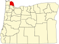
| State | Oregon |
| County | Columbia |
| Elevation | 141 ft (43 m) |
| Time zone | UTC-8 (Pacific (PST)) |
| • Summer (DST) | UTC-7 (PDT) |
| ZIP code | 97016 |
| Area codes | 503 and 971 |
Mayger is an unincorporated community in Columbia County, Oregon, United States. [1] Fishing is important to Mayger. [2] It was originally the site of Frenchman Charles Mayger's Mayger Logging Company, which he sold in 1886 to William F. Slaughter. [3] [4] Mayger's post office was established three years later and its first postmaster was Charles Mayger. It closed in 1961. [4] [5] Mayger is served by the Clatskanie, Oregon post office.