Newberg, Oregon

Last updated

Newberg, Oregon
Newberg Oregon city hall.JPG
City Hall
Flag of Newberg, Oregon.gif
Motto: 
A Great Place to Grow!
Yamhill County Oregon Incorporated and Unincorporated areas Newberg Highlighted.svg
Location in Oregon
Coordinates: 45°18′26″N122°57′37″W / 45.30722°N 122.96028°W / 45.30722; -122.96028
CountryUnited States
State Oregon
County Yamhill
Incorporated 1889
Government
   Mayor Bill Rosacker[ citation needed ]
Area
[1]
  Total5.98 sq mi (15.49 km2)
  Land5.98 sq mi (15.49 km2)
  Water0.00 sq mi (0.00 km2)
Elevation
[2]
213 ft (65 m)
Population
 (2020) [3]
  Total25,138
  Density4,204.38/sq mi (1,623.34/km2)
Time zone UTC-8 (Pacific)
  Summer (DST) UTC-7 (Pacific)
ZIP code
97132
Area code 503
FIPS code 41-52100 [4]
GNIS feature ID2411240 [2]
Website City of Newberg

Newberg is a city in Yamhill County, Oregon, United States. Located in the Portland metropolitan area, the city is home to George Fox University. As of the 2020 census, the city population was 25,138 making it the second most populous city in the county.

Contents

History

Hoover-Minthorn House Hoover Minthorn house sign.JPG
Hoover-Minthorn House

Ewing Young, after leading pioneering fur brigades in California, came to Portland in 1834 and settled on the west bank of the Willamette River near the mouth of Chehalem Creek, opposite of Champoeg. [5] Young's home is believed to be the first house built by European-Americans on that side of the river. [5] Later, Joseph Rogers settled near the Willamette River at what is now Newberg in 1848. [6] [7] The community was known early on as Chehalem, and later as Roger's Landing for Rogers who founded the settlement, and who died in 1855. [6] In 1883, the community was platted. [6] Incorporated in 1889, a community tradition states that this town was named by its first postmaster, Sebastian Brutscher, for his former hometown of Neuberg in Germany One of the current streets, Brutscher Street, is named after Brutscher.

Newberg was one of the first communities in Oregon to hold Quaker services. It was incorporated as a city in 1889. The city's oldest surviving newspaper, The Newberg Graphic, was established Dec. 1, 1888. Friends Pacific Academy, renamed Pacific College in 1891 and then George Fox University in 1949, was founded by the Quakers in 1885. George Fox University is classified by U.S. News & World Report as a first-tier regional university and "Best Value" school. [8] The campus resides in the center of the city, surrounded by university-owned housing.

Herbert Hoover moved to the city in 1885, [9] [10] to live with his uncle and aunt after the death of his parents and was one of the first students to attend his uncle's Pacific Academy. [11] The home has been turned into the Hoover-Minthorn House museum.

The town was "dry", meaning no alcohol could be sold within the city limits, for a good part of its early history.

The first domesticated Llama was brought to Newberg in 1972, and the town quickly became the leader in llama breeding in the Pacific Northwest by 1982.[ citation needed ]

Geography

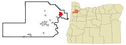
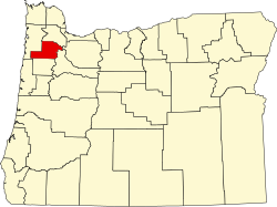
Newberg is located on Oregon Route 99W, approximately 25 miles (40 km) southwest of Portland. Springbrook, once a separate community, is now considered part of Newberg.

According to the United States Census Bureau, the city has a total area of 5.81 square miles (15.05 km2), all land. [12] It averages 176 feet (54 m) in elevation.

Climate

Newberg, like Portland, has a warm-summer Mediterranean climate (Köppen Csb) with cool and cloudy winters, and warm and dry summers. [13] This climate is characterized by having overcast, wet, and changing weather conditions in fall, winter, and spring, as Newberg lies in the direct path of the stormy westerly flow, and mild and dry summers when the Pacific High reaches its northernmost point in mid summer. [14] According to the Köppen climate classification, Newberg falls within the dry-summer temperate zone (Csb). [14] [15] with a USDA Plant Hardiness Zones between 8b and 9a. [16] Other climate systems, such as the Trewartha climate classification, place it within the oceanic zone (Do), like much of the Pacific Northwest and Western Europe. [17]

Winters are cool, cloudy, and rainy. The coldest months are December and January, with an average daily high of 46.0 °F (7.8 °C), although overnight lows usually remain above freezing by a few degrees. Evening temperatures fall to or below freezing 33 nights per year on average, but very rarely to or below 18 °F (−8 °C). There are only 2.1 days per year where the daytime high temperature fails to rise above freezing. The lowest overnight temperature ever recorded was −3 °F (−19 °C).

Annual snowfall in Newberg falls during the December-to-March time frame. Newport, for example, has more frequent snow than Portland, due in part to higher elevations near the West Hills and Mount Tabor, so can experience a dusting of snow while downtown Portland receives no accumulation at all.

Summers in Newberg are warm, occasionally hot, dry, and sunny, though the sunny warm weather is short-lived, from mid June through early September. The months of June, July, August and September account for a combined 4.78 inches (121 mm) of total rainfall  of the 39.95 in (1,015 mm) of the precipitation that falls throughout the year. The warmest month is July, with an average high temperature of 80.0 °F (26.7 °C). Because of its inland location 70 miles (110 km) from the coast, as well as the protective nature of the Oregon Coast Range to its west, Newberg summers are less susceptible to the moderating influence of the nearby Pacific Ocean. Consequently, Portland experiences heat waves on rare occasion, with temperatures rising into the 90 °F (32 °C) for a few days. However, on average, temperatures reach or exceed 80 °F (27 °C) on only 56 days per year, of which about 12 days will reach 90 °F (32 °C) and only 1–2 days will reach 100 °F (38 °C).

Spring and fall can bring variable weather, including warm fronts that send temperatures surging above 80 °F (27 °C) and cold snaps that plunge daytime temperatures into the 40s °F (4–9 °C). However, lengthy stretches of overcast days beginning in mid fall and continuing into mid spring are most common. Rain often falls as a light drizzle for several consecutive days at a time, contributing to 152 days on average with measurable (≥0.01 in or 0.25 mm) precipitation annually.

Climate data for Newberg, Oregon
MonthJanFebMarAprMayJunJulAugSepOctNovDecYear
Record high °F (°C)65.0
(18.3)
71.0
(21.7)
83.0
(28.3)
93.0
(33.9)
100.0
(37.8)
102.0
(38.9)
107.0
(41.7)
107.0
(41.7)
105.0
(40.6)
92.0
(33.3)
73.0
(22.8)
64.0
(17.8)
107.0
(41.7)
Mean daily maximum °F (°C)46.0
(7.8)
50.0
(10.0)
56.0
(13.3)
61.0
(16.1)
68.0
(20.0)
73.0
(22.8)
80.0
(26.7)
79.0
(26.1)
74.0
(23.3)
64.0
(17.8)
53.0
(11.7)
46.0
(7.8)
62.5
(17.0)
Daily mean °F (°C)39.0
(3.9)
43.0
(6.1)
48.0
(8.9)
52.0
(11.1)
58.0
(14.4)
63.0
(17.2)
68.0
(20.0)
68.0
(20.0)
63.0
(17.2)
55.0
(12.8)
46.0
(7.8)
41.0
(5.0)
53.7
(12.0)
Mean daily minimum °F (°C)34.0
(1.1)
36.0
(2.2)
39.0
(3.9)
42.0
(5.6)
48.0
(8.9)
53.0
(11.7)
57.0
(13.9)
57.0
(13.9)
52.0
(11.1)
46.0
(7.8)
40.0
(4.4)
36.0
(2.2)
45.0
(7.2)
Record low °F (°C)−2.0
(−18.9)
−3.0
(−19.4)
19.0
(−7.2)
29.0
(−1.7)
29.0
(−1.7)
39.0
(3.9)
43.0
(6.1)
44.0
(6.7)
34.0
(1.1)
26.0
(−3.3)
13.0
(−10.6)
6.0
(−14.4)
−3.0
(−19.4)
Average precipitation inches (mm)5.83
(148)
4.84
(123)
4.06
(103)
2.79
(71)
2.25
(57)
1.62
(41)
0.68
(17)
0.84
(21)
1.64
(42)
2.92
(74)
6.07
(154)
6.41
(163)
39.95
(1,015)
Average precipitation days18161714129458121819152
Average snowy days2100000000014
Source 1: precipitation per inch on The Weather Channel [18]
Source 2: http://www.myforecast.co/bin/climate.m?city=27576 [19]

Demographics

Newberg Public Library Newberg Public Library.jpg
Newberg Public Library
Historical population
CensusPop.Note
1890 514
1900 94583.9%
1910 2,260139.2%
1920 2,56613.5%
1930 2,95115.0%
1940 2,9600.3%
1950 3,94633.3%
1960 4,2046.5%
1970 6,50754.8%
1980 10,39459.7%
1990 13,08625.9%
2000 18,06438.0%
2010 22,06822.2%
2020 25,13813.9%
Sources: [4] [20] [21] [22] [23] [3]

2010 census

As of the census [24] of 2010, there were 22,068 people, 7,736 households, and 5,398 families living in the city. The population density was 3,798.3 inhabitants per square mile (1,466.5/km2). There were 8,265 housing units at an average density of 1,422.5 per square mile (549.2/km2). The racial makeup of the city was 85.9% White, 0.8% African American, 0.8% Native American, 2.2% Asian, 0.2% Pacific Islander, 7.0% from other races, and 3.1% from two or more races. Hispanic or Latino of any race were 13.5% of the population.

There were 7,736 households, of which 37.4% had children under the age of 18 living with them, 53.1% were married couples living together, 12.0% had a female householder with no husband present, 4.7% had a male householder with no wife present, and 30.2% were non-families. 23.2% of all households were made up of individuals, and 9.8% had someone living alone who was 65 years of age or older. The average household size was 2.66 and the average family size was 3.12.

The median age in the city was 32.8 years. 25.2% of residents were under the age of 18; 13.8% were between the ages of 18 and 24; 27.1% were from 25 to 44; 21.9% were from 45 to 64; and 12% were 65 years of age or older. The gender makeup of the city was 48.6% male and 51.4% female.

2000 census

As of the census [4] of 2000, there were 18,064 people, 6,099 households, and 4,348 families living in the city. The population density was 3,599.4 inhabitants per square mile (1,389.7/km2). There were 6,435 housing units at an average density of 1,282.2 per square mile (495.1/km2). The racial makeup of the city was 90.49% White, 0.35% African American, 0.64% Native American, 1.04% Asian, 0.17% Pacific Islander, 5.06% from other races, and 2.24% from two or more races. Hispanic or Latino of any race were 10.52% of the population.

There were 6,099 households, out of which 40.2% had children under the age of 18 living with them, 54.5% were married couples living together, 11.9% had a female householder with no husband present, and 28.7% were non-families. 21.7% of all households were made up of individuals, and 8.8% had someone living alone who was 65 years of age or older. The average household size was 2.76 and the average family size was 3.20.

In the city, the population was spread out, with 27.7% under the age of 18, 15.0% from 18 to 24, 29.8% from 25 to 44, 16.9% from 45 to 64, and 10.6% who were 65 years of age or older. The median age was 30 years. For every 100 females, there were 93.7 males. For every 100 females age 18 and over, there were 89.8 males.

The median income for a household in the city was $44,206.00, and the median income for a family was $51,084. Males had a median income of $34,099 versus $23,571 for females. The per capita income for the city was $16,873. About 4.3% of families and 6.6% of the population were below the poverty line, including 7.0% of those under age 18 and 6.1% of those age 65 or over.

Economy

George Fox University campus George Fox University entrance sign.JPG
George Fox University campus

As of 2002, dental equipment manufacturer A-dec was the city's largest employer with 832 employees, and George Fox University was second with 400. [25] The next largest employers were SP Newsprint Co., Suntron Corp., and Providence Newberg Medical Center. [25] Upon opening in September 2009, [26] the Allison Inn and Spa, a 77-room destination hotel, spa, and restaurant employs approximately 200 full-time workers. A Hazelden Betty Ford Foundation inpatient addiction treatment center is located in the city. [27]

Museums and other points of interest

Education

Newberg is served by the Newberg School District, which has six elementary schools, two middle schools, and two high schools, Newberg High School and Catalyst Alternative High School. The town also has two private Christian schools (Veritas School and C. S. Lewis Academy). The city also is home to George Fox University, and a new campus of Portland Community College opened in fall 2011.

In September 2021, the Newberg School District received news coverage over several incidents involving racism and identity, starting when the school board voted to ban Pride and Black Lives Matter symbols in district schools. [28] Later on in the month, Newberg High School students participated in a "virtual slave trade" which targeted black students at the school. [29] On September 20, a Newberg Public Schools employee was placed on administrative leave after reporting for work while wearing blackface. [30]

Media

Transportation

Road

OR 18.svg
OR 18 is an east-west route connecting with US 101 in Otis Junction to the west, and OR 219 near Newberg. The highway was expanded and named as the Newberg-Dundee Bypass.
OR 99W.svg
OR 99W (formerly US 99W) is a major north-south route which follows an east-west alignment through Newberg. It connects with Portland to the northeast, Dundee and McMinnville to the southwest, and the western Willamette Valley to the south. In combination with OR 18, this is the main route for traffic between Portland and the central Oregon Coast.
OR 219.svg
OR 219 is a north-south route connecting with St. Paul and Woodburn to the south, and Scholls and Hillsboro to the north.
OR 240.svg
OR 240 is an east-west route connecting with OR 47 in the town of Yamhill.

Air

Rail

Converted Russell traction engine of the Pacific Brick Face Co. in 1907 Pacific Brick Face Co. at Newberg, Oregon in 1907.jpg
Converted Russell traction engine of the Pacific Brick Face Co. in 1907

Newberg is served by the Portland & Western Railroad which offers freight service as needed. The railroad was originally part of the Southern Pacific Railroad and was built in the 1870s. Newberg has not had regular passenger railroad service since the 1930s; however there have been several studies to consider bringing commuter rail service to the Portland metropolitan area.

Notable people

Sister cities

Related Research Articles

<span class="mw-page-title-main">Washington County, Oregon</span> County in Oregon, United States

Washington County is one of 36 counties in the U.S. state of Oregon and part of the Portland metropolitan area. The 2020 census recorded the population as 600,372, making it the second most populous county in the state and most populous "Washington County" in the United States. Hillsboro is the county seat and largest city, while other major cities include Beaverton, Tigard, Cornelius, Banks, Gaston, Sherwood, North Plains, and Forest Grove, the county's oldest city. Originally named Twality when created in 1843, the Oregon Territorial Legislature renamed it for the nation's first president in 1849 and included the entire northwest corner of Oregon before new counties were created in 1854. The Tualatin River and its drainage basin lie almost entirely within the county, which shares its boundaries with the Tualatin Valley. It is bordered on the west and north by the Northern Oregon Coast Range, on the south by the Chehalem Mountains, and on the north and east by the Tualatin Mountains, or West Hills.

<span class="mw-page-title-main">Yamhill County, Oregon</span> County in Oregon, United States

Yamhill County is one of the 36 counties in the U.S. state of Oregon. As of the 2020 census, the population was 107,722. The county seat is McMinnville. Yamhill County was named after the Yamhelas, members of the Kalapuya Tribe.

<span class="mw-page-title-main">Happy Valley, Oregon</span> City in Oregon, United States

Happy Valley is a suburban city in the Portland, Oregon metropolitan area. Happy Valley is near the northwest edge of Clackamas County, Oregon, United States approximately 10 miles to the southeast of downtown Portland, Oregon. The population was 23,733 at the 2020 census.

<span class="mw-page-title-main">Molalla, Oregon</span> City in Oregon, United States

Molalla is a city in Clackamas County, Oregon. The population was 10,228 at the time of the 2020 census.

<span class="mw-page-title-main">Powers, Oregon</span> City in Oregon, United States

Powers is a city in Coos County, Oregon, United States. The population was 689 at the 2010 census.

<span class="mw-page-title-main">Gold Beach, Oregon</span> City in Oregon, United States

Gold Beach is a city in and the county seat of Curry County, Oregon, United States, on the Oregon Coast. The population was 2,241 at the 2020 census.

<span class="mw-page-title-main">Redmond, Oregon</span> City in Oregon, United States

Redmond is a city in Deschutes County, Oregon, United States. Incorporated on July 6, 1910, the city is on the eastern side of Oregon's Cascade Range, in the High Desert in Central Oregon. From Redmond there is access to recreational opportunities. Redmond is a full-service municipality and one of the fastest-growing industrial and residential communities in Oregon. Redmond had a population of 32,421 in 2019, and the population continues to grow at a rate of about 6.7 percent each year.

<span class="mw-page-title-main">Drain, Oregon</span> City in Oregon, United States

Drain is a city in Douglas County, Oregon, United States. The population was 1,151 at the 2010 census. Drain is named after town founder and politician Charles J. Drain, who donated 60 acres (24 ha) of nearby land to the Oregon and California Railroad in 1871.

<span class="mw-page-title-main">Reedsport, Oregon</span> City in Oregon, United States

Reedsport is a city in northwest Douglas County, Oregon, United States. As of the 2020 census, the population was 4,310.

<span class="mw-page-title-main">Central Point, Oregon</span> City in Oregon, United States

Central Point is a city in Jackson County, Oregon, United States. The population was 17,169 as of 2010. The city shares its southern border with Medford and is a part of the Medford metropolitan area. Central Point is home of the Jackson County Fair that occurs in July.

<span class="mw-page-title-main">Coburg, Oregon</span> City in Oregon, United States

Coburg is a city in Lane County, Oregon, United States, 8 miles (13 km) north of Eugene. The city's population as of the 2020 census was 1,306. Founded in 1847, Coburg has retained the characteristics of traditional small town with walkable and close ties to the surrounding farming communities that stretch in all directions. Maintaining these characteristics is the central part of the city's community vision process completed in 2017.

<span class="mw-page-title-main">Newport, Oregon</span> City in Lincoln County, Oregon

Newport is a city in Lincoln County, Oregon, United States. It was incorporated in 1882, though the name dates back to the establishment of a post office in 1868. Newport was named for Newport, Rhode Island. As of the 2010 census, the city had a total population of 9,989, an increase of nearly 5% over its 2000 population; as of 2019, it had an estimated population of 10,853.

<span class="mw-page-title-main">Waldport, Oregon</span> City in Oregon, United States

Waldport is a city in Lincoln County, Oregon, United States. The population was 2,033 at the 2010 census. The city is located on the Alsea River and Alsea Bay, 15 miles (24 km) south of Newport and 8 miles (13 km) north of Yachats.

<span class="mw-page-title-main">Ontario, Oregon</span> City in Oregon, United States

Ontario is the largest city in Malheur County, Oregon, United States. It lies along the Snake River at the Idaho border. The population was 11,645 at the 2020 census. The city is the largest community in the region of far eastern Oregon, also known as the Western Treasure Valley.

<span class="mw-page-title-main">Troutdale, Oregon</span> City in Oregon, United States

Troutdale is a city in Multnomah County, Oregon, United States, immediately north of Gresham and east of Wood Village. As of the 2020 census, the city population was 16,300. The city serves as the western gateway to the Historic Columbia River Highway, the Mount Hood Scenic Byway, and the Columbia River Gorge. It is approximately 12 miles (19 km) east of Portland.

<span class="mw-page-title-main">Maupin, Oregon</span> City in Oregon, United States

Maupin is a city in Wasco County, Oregon, United States. Located on the Deschutes River, much of the city's economy is related to the river through outdoor activities, such as fishing and rafting. The population was 418 at the 2010 census.

<span class="mw-page-title-main">Forest Grove, Oregon</span> City in Oregon, United States

Forest Grove is a city in Washington County, Oregon, United States, 25 miles (40 km) west of Portland. Originally a small farm town, it is now primarily a commuter town in the Portland metro area. Settled in the 1840s, the town was platted in 1850, then incorporated in 1872, making it the first city in Washington County. The population was 21,083 at the 2010 census, an increase of 19.1% over the 2000 figure (17,708).

<span class="mw-page-title-main">North Plains, Oregon</span> City in Oregon, United States

North Plains is a city in Washington County, Oregon, United States, off U.S. 26 on the northwest outskirts of the Portland metropolitan area. The population was 3,441 at the 2020 census.

<span class="mw-page-title-main">Fossil, Oregon</span> City in Oregon, United States

Fossil is a city in and the county seat of Wheeler County, Oregon, United States. The name was chosen by the first postmaster, Thomas B. Hoover, who had found some fossil remains on his ranch. The population was 473 at the 2010 census.

<span class="mw-page-title-main">Dundee, Oregon</span> City in Oregon, United States

Dundee is a city in Yamhill County, Oregon, United States. The population was 3,238 at the 2020 census.

References

  1. "ArcGIS REST Services Directory". United States Census Bureau. Retrieved October 12, 2022.
  2. 1 2 U.S. Geological Survey Geographic Names Information System: Newberg, Oregon
  3. 1 2 "Census Population API". United States Census Bureau. Retrieved October 12, 2022.
  4. 1 2 3 "U.S. Census website". United States Census Bureau . Retrieved January 31, 2008.
  5. 1 2 Hussey, John A. (1967). Champoeg: Place of Transition, A Disputed History. Oregon Historical Society.
  6. 1 2 3 Klooster, Karl (February 14, 2009). "Back in time: Yamhill Valley – 1859". News-Register. Archived from the original on July 14, 2011. Retrieved February 2, 2010.
  7. Lewis A. McArthur (1991). Oregon Place Names, 6th edition. Portland, Oregon: Oregon Historical Society. ISBN   978-0-87595-237-6.
  8. "'About George Fox University: Quick Facts'". georgefox.edu. Retrieved August 14, 2012.
  9. "Newberg History | Newberg Oregon". www.newbergoregon.gov. Retrieved March 8, 2021.
  10. Walch, Timothy. "Hoover, Herbert Clark." The World Book Encyclopedia, 2015th ed., vol. 9, World Book, Inc., a Scott Fetzer Company, 2015, p. 326.
  11. "Herbert Hoover and Friends Pacific Academy | George Fox". www.georgefox.edu. Retrieved March 8, 2021.
  12. "US Gazetteer files 2010". United States Census Bureau. Archived from the original on January 25, 2012. Retrieved December 21, 2012.
  13. Anderson 2014, p. 138.
  14. 1 2 "Global Ecological Zoning for the Global Forest Resources Assessment 2000". Forestry Department of the Food and Agriculture Organization. 2001. Retrieved September 12, 2012.
  15. Kottek, M.; J. Grieser; C. Beck; B. Rudolf; F. Rubel (2006). "World Map of the Köppen-Geiger climate classification updated". Meteorol. Z. 15 (3): 259–263. Bibcode:2006MetZe..15..259K. doi:10.1127/0941-2948/2006/0130 . Retrieved February 15, 2007.
  16. "USDA Plant Hardiness Zone Map". United States Department of Agriculture. Archived from the original on February 27, 2014. Retrieved June 1, 2014.
  17. "Global ecological zoning for the global forest resources assessment 2000". Food And Agriculture Organisation of the United Nations. Retrieved January 30, 2016.
  18. "Monthly Averages for Newberg, OR". Weather.com. Retrieved March 24, 2018.
  19. "Monthly Averages and Extremes, for Newberg, OR". myforecast.co. Retrieved July 22, 2020.
  20. "Population Estimates". United States Census Bureau . Retrieved October 3, 2014.
  21. "Population-Oregon" (PDF). 15th Census of the United States. U.S. Census Bureau. Retrieved November 27, 2013.
  22. "Number of Inhabitants: Oregon" (PDF). 18th Census of the United States. U.S. Census Bureau. Retrieved November 22, 2013.
  23. "Pennsylvania: Population and Housing Unit Counts" (PDF). U.S. Census Bureau. Retrieved November 22, 2013.
  24. "U.S. Census website". United States Census Bureau . Retrieved December 21, 2012.
  25. 1 2 "Newberg Community Profile". Oregon Economic & Community Development Department. Archived from the original on August 17, 2007. Retrieved May 8, 2009.
  26. "Trendsetting Travel: Best Travel Values Around the Americas". Food & Wine. Retrieved March 8, 2021.
  27. "Springbrook Campus". Hazelden. Retrieved January 16, 2015.
  28. Campuzano, Eder (September 3, 2021). "'Deal with it:' Newberg school board's conservative majority defends banning Pride, Black Lives Matter symbols". The Oregonian . Retrieved September 20, 2021.
  29. Koch, Ashley (September 14, 2021). "Newberg High School students participated in virtual 'slave trade'". KGW . Retrieved September 20, 2021.
  30. "Newberg Public Schools employee on leave after reporting to work in 'Blackface'". KPTV. September 20, 2021. Retrieved September 20, 2021.

Commons-logo.svg Media related to Newberg, Oregon at Wikimedia Commons