Related Research Articles
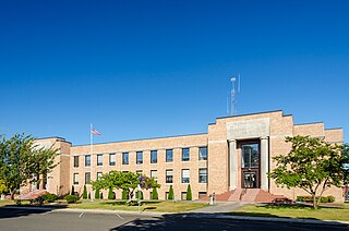
Tillamook County is one of the 36 counties in the U.S. state of Oregon. As of the 2020 census, the population was 27,390. The county seat is Tillamook. The county is named for the Tillamook or Killamook people, a Native American tribe who were living in the area in the early 19th century at the time of European American settlement. The county is located within Northwest Oregon.
Polk County is one of the 36 counties in the U.S. state of Oregon. As of the 2020 census, the population was 87,433. The county seat is Dallas. The county is named for James Knox Polk, the 11th president of the United States.

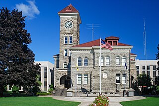
Lincoln County is one of the 36 counties in the U.S. state of Oregon. As of the 2020 census, its population was 50,395. The county seat is Newport. The county is named for Abraham Lincoln, 16th president of the United States.
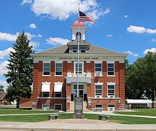
Washington County is a county located in the eastern side of the U.S. state of Colorado. As of the 2020 census, the population was 4,817. The county seat is Akron. The county was named in honor of the United States President George Washington.

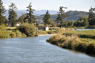
The North Yamhill River is a 31-mile (50 km) tributary of the Yamhill River in the U.S. state of Oregon. It drains an area of the Northern Oregon Coast Range, as well as part of the Willamette Valley west of the Willamette River.
The Little Nestucca River is a river, approximately 20 miles (32 km) long, on the Pacific coast of northwest Oregon in the United States. It drains an area of the Central Oregon Coast Range west of the Willamette Valley.

The Alsea River flows 48.5 miles (78.1 km) from Alsea, an unincorporated community in the coastal mountains of the U.S. state of Oregon, to the Pacific Ocean near the city of Waldport. It begins at the confluence of the North Fork Alsea River and the South Fork Alsea River and ends in Alsea Bay, a wide estuary at Waldport. The river flows generally west-northwest in a winding course through the mountains of southern Benton and Lincoln counties, passing near the unincorporated community of Tidewater and through the Siuslaw National Forest. Its drainage basin extends into Lane County, along the headwaters of the South Fork Alsea River.
The Trask River is in northwestern Oregon in the United States. It drains a mountainous timber-producing area of the Northern Oregon Coast Range west of Portland into Tillamook Bay and the Pacific Ocean. It is one of five rivers—the Tillamook, the Trask, the Wilson, the Kilchis, and the Miami—that flow into the bay.

The Nehalem River is a river on the Pacific coast of northwest Oregon in the United States, approximately 119 miles (192 km) long. It drains part of the Northern Oregon Coast Range northwest of Portland, originating on the east side of the mountains and flowing in a loop around the north end of the range near the mouth of the Columbia River. Its watershed of 855 square miles (2,210 km2) includes an important timber-producing region of Oregon that was the site of the Tillamook Burn. In its upper reaches it flows through a long narrow valley of small mountain communities but is unpopulated along most of its lower reaches inland from the coast.
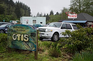
Otis is an unincorporated community in Lincoln County, Oregon, United States, a half mile north of Otis Junction on Oregon Route 18. It is near the Salmon River.

The North Coast of California is a region in Northern California that lies on the Pacific coast between San Francisco Bay and the Oregon border. It commonly includes Mendocino, Humboldt, and Del Norte counties and sometimes includes Lake and two counties from the San Francisco Bay area, Marin and Sonoma.
Pixieland was an amusement park near Otis Junction, Oregon, United States, located about three miles (5 km) north of Lincoln City. Opened in 1969, it operated for only four years.
Valley Junction is an unincorporated community in Polk County, Oregon, United States. It is located at the junction of Oregon Route 18 and Oregon Route 22, on the South Yamhill River east of Grand Ronde. A now-abandoned section of the Willamina and Grand Ronde Railway short line passed through Valley Junction. The Fort Yamhill State Heritage Area and Spirit Mountain Casino are nearby.
Dairy Creek is a 10.55-mile (16.98 km) tributary of the Tualatin River in the U.S. state of Oregon. It begins at the confluence of its east and west forks near the unincorporated community of Schefflin and meanders southeast across the Tualatin Valley to the Tualatin River near Hillsboro, in Washington County. East Fork Dairy Creek begins at 45.788446°N 123.041498°W in Columbia County, slightly north of its border with Washington County, and flows generally south for 22 miles (35 km). West Fork Dairy Creek, also about 22 miles (35 km) long, forms at 45.7553899°N 123.178168°W, near the unincorporated community of Tophill, and flows generally southeast. Before railroads displaced river boats on the Tualatin, some steamships also worked the lower section of Dairy Creek, with plans to go as far up stream as Centerville.

Dolph is an unincorporated community in Tillamook County, Oregon, United States, near the Yamhill County line. It lies at the junction of Oregon Route 22 and Oregon Route 130 between Grande Ronde and Hebo, on the Little Nestucca River. It is within the Siuslaw National Forest in the Northern Oregon Coast Range.
Necanicum is an unincorporated community in Clatsop County, Oregon, United States. It is located approximately 13 miles southeast of Seaside on U.S. Route 26 in the Northern Oregon Coast Range, next to the Necanicum River. Necanicum Junction is about a mile east of the site of the former post office, at the intersection of U.S. 26 and Oregon Route 53. It is served by the Seaside post office.
Saint Joseph is an unincorporated community in Yamhill County, Oregon, United States. It is located about two miles west of Lafayette near Oregon Route 99W. The area is sometimes known as "St. Joe".
Burnt Woods is an unincorporated community in Lincoln County, Oregon, United States. It is located about 16 miles (26 km) west of Philomath on U.S. Route 20 in the Central Oregon Coast Range near the Tumtum River.
Pleasant Valley is an unincorporated community in Tillamook County, Oregon, United States. It is located about seven miles south of Tillamook, on U.S. Route 101.
Jewell Junction is a highway junction and unincorporated community in Clatsop County, Oregon, United States. It is located at the intersection of U.S. Route 26 and Oregon Route 103, approximately nine miles southwest of Jewell.
References
- ↑ "Otis Junction". Geographic Names Information System . United States Geological Survey, United States Department of the Interior. November 28, 1980. Retrieved December 20, 2009.
- ↑ "A 1940 Oregon Coast Tour: Tillamook to Taft". Oregon State Archives . Retrieved December 20, 2009.
- ↑ Associated Press (January 29, 1960). "Forest Funds Allocated for Road Jobs". The Register-Guard . Retrieved December 20, 2009.
- 1 2 Shriver, Jerry (September 1, 2005). "Big taste resides in a little corner of Oregon". USA Today . Retrieved December 20, 2009.
- ↑ Miller, Bryan (May 19, 1989). "At the Nation's Table". The New York Times . Retrieved December 20, 2009.
- ↑ Oregonian/OregonLive, Christina Morales | The (July 5, 2019). "Otis Cafe fire damages landmark Lincoln County restaurant on July 4th". oregonlive. Retrieved September 28, 2023.
- ↑ "Pixieland". www.oregonencyclopedia.org. Retrieved September 28, 2023.
45°01′09″N123°56′54″W / 45.019275°N 123.948446°W
Municipalities and communities of Lincoln County, Oregon, United States | ||
|---|---|---|
| Cities |  | |
| CDPs | ||
| Other communities | ||
| Indian reservation | ||
| Footnotes | ‡This populated place also has portions in an adjacent county or counties | |
| | This Lincoln County, Oregon state location article is a stub. You can help Wikipedia by expanding it. |