History
The Corvallis and Yaquina Wagon Road Company established Elk City in 1866 by building a warehouse with a store and by laying out a town. A year later, Elk City had a second store, a hotel, and a structure doubling as a church and schoolhouse. Boats regularly ascended the river to Elk City, the last stop on the overland mail route of the time, and delivered mail downriver by water. [4]
In the late 19th century, Elk City was one of the stops on the Oregon Pacific Railroad, linking the former port city of Yaquina to Corvallis and Albany. [5] After the Oregon Pacific failed financially, fell into receivership, and went through 17 years of financial and legal complications, it became a branch line of the Southern Pacific in 1907. [6]
Efforts to restore a covered bridge over the Yaquina River at Elk City fell short in 1981. Fund-raising for repairs had produced $20,000, and restoration had begun when high winds caused another $90,000 damage to the structure. The county did not have enough money to pay for restoration or to pursue an insurance settlement through the courts. [7] The original bridge, built by the county in 1922, was a 100-foot (30 m) Howe truss span supported by wooden pilings that suffered from rot. [8]

The Rogue River in southwestern Oregon in the United States flows about 215 miles (346 km) in a generally westward direction from the Cascade Range to the Pacific Ocean. Known for its salmon runs, whitewater rafting, and rugged scenery, it was one of the original eight rivers named in the Wild and Scenic Rivers Act of 1968. Beginning near Crater Lake, which occupies the caldera left by the explosive volcanic eruption and collapse of Mount Mazama, the river flows through the geologically young High Cascades and the older Western Cascades, another volcanic province. Further west, the river passes through multiple exotic terranes of the more ancient Klamath Mountains. In the Kalmiopsis Wilderness section of the Rogue basin are some of the world's best examples of rocks that form the Earth's mantle. Near the mouth of the river, the only dinosaur fragments ever discovered in Oregon were found in the Otter Point Formation, along the coast of Curry County.

The Yaquina River is a stream, 59 miles (95 km) long, on the Pacific coast of the U.S. state of Oregon. It drains an area of the Central Oregon Coast Range west of the Willamette Valley near Newport.

The Smith River is a 90-mile (140 km) tributary of the Umpqua River in the U.S. state of Oregon. It drains 352 square miles (910 km2) of the Central Oregon Coast Range between the watershed of the Umpqua to the south and the Siuslaw River to the north.
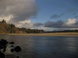
The Salmon River flows from the Central Oregon Coast Range to the Pacific Ocean coast of northwest Oregon in the United States. About 24 miles (39 km) long, it begins and ends in Lincoln County but also flows briefly through western Polk and southern Tillamook counties. Much of its course lies within the Siuslaw National Forest.
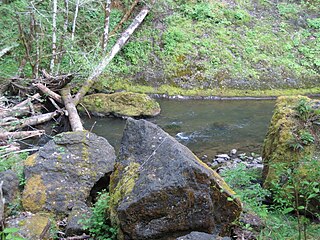
The Nestucca River flows for about 57 miles (92 km) through forests near the Pacific coast of northwest Oregon in the United States. It drains a timber-producing area of the Northern Oregon Coast Range west of Portland.

Seal Rock is an unincorporated coastal community in Lincoln County, Oregon, United States, between Newport and Waldport on U.S. Route 101.

Yaquina Bay, like Coos Bay, is a shallow coastal bay on the Oregon Coast in the Pacific Northwest of North America. The principal town on Yaquina Bay is Newport, Oregon. The Yaquina River flows into the bay. Until modern roads reached Newport in the late 1920s, the principal transportation method to and from Newport was by ship or boat.

Chitwood is an unincorporated community in Lincoln County, Oregon, United States. Chitwood lies on U.S. Route 20 between Toledo to the west and Eddyville to the east. The Yaquina River flows through Chitwood.
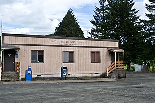
Eddyville is an unincorporated community in Lincoln County, in the U.S. state of Oregon. Eddyville's unofficial estimated population as of 2014 was about 400 to 500.
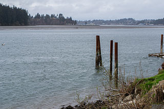
Yaquina, at one time a thriving port called Yaquina City, is an unincorporated community in Lincoln County, in the U.S. state of Oregon. It is near the mouth of the Yaquina River, on the east side of Yaquina Bay, and is a 3-to-4-mile drive from Newport. The Oregon Press Association, which became the Oregon Newspaper Publishers Association, was founded in Yaquina City in 1887.

T.M. Richardson was a steamboat built in 1888 at Oneatta, Oregon, which served on Yaquina Bay and on the Yaquina River from 1888 to 1908. This vessel was commonly known as the Richardson or the T.M.

Floras Lake is a natural 236-acre (96 ha) body of water on the southern Oregon Coast of the United States. Fed by four small tributaries from a basin of about 10 square miles (26 km2) in Curry County, it lies about 10 miles (16 km) north of Port Orford and 2 miles (3 km) west of U.S. Route 101. It was probably named for Fred Flora, a 19th-century settler and miner who lived nearby.
The Willamette Valley & Coast Railroad (WV&C) was a small 19th-century railway line in the American state of Oregon which sought to cross the Coast Mountain Range to connect the agriculturally oriented Willamette Valley with international shipping at Yaquina Bay. Following three false starts during the ten years after the American Civil War, the railway was launched in July 1874. Work was completed on the valley-to-coast road in 1884. The line is today operated by Portland and Western Railroad.

Newport was an American steamboat built in 1908 at Yaquina City, Oregon. Now a ghost town, Yaquina City was then the terminus of the Corvallis & Eastern Railroad. For many years Newport transported excursionists in the summer months across a short water route between Yaquina City and the town of Newport, Oregon.
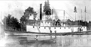
Three Sisters was a sternwheel-driven steamboat that operated on the Willamette River from 1886 to 1896. The steamer was built as an extreme shallow-draft vessel, to permit it to reach points on the upper Willamette river such as Corvallis, Harrisburg and Eugene, Oregon during summer months when water levels in the river were generally low. The vessel was also known for having been washed up on a county road in Oregon during a flood in 1890.

The Chitwood Bridge is a covered bridge in Lincoln County in the U.S. state of Oregon. The bridge carries Chitwood Road, off U.S. Route 20, over the Yaquina River at Chitwood. The structure was added to the National Register of Historic Places in 1979.

The Upper Willamette Transportation Line was a line of four inland steamboats that operated from the fall of 1859 to the summer of 1860 on the upper Willamette River in the state of Oregon, United States.

Fanny Patton was a stern-wheel driven steamboat that operated on the Willamette River, in Oregon, starting in August 1865. This steamer operated from 1865 to 1880 for various owners, and was a considered a profitable vessel. The steamer was named for the daughter of businessman Edwin N Cook, Frances Mary "Fannie" Cooke (1837–1886). Edwin N. Cook was one of the principals of the People's Transportation Company.
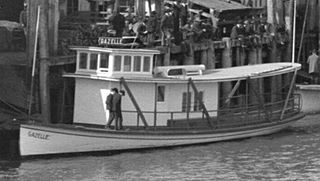
Gazelle was a gasoline powered launch that operated on the Willamette and Columbia river from 1905 to 1911. For short periods of time Gazelle was operated on the Oregon Coast, on Yaquina Bay and also as an off-shore fishing vessel, in the Coos Bay area.
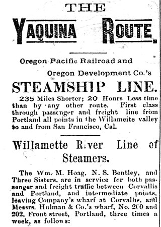
N.S. Bentley, commonly referred to as simply Bentley, was a stern-wheel driven steamboat that operated on the Willamette rivers. Launched in East Portland in December 1886, Bentley ran until 1896, when it was rebuilt and renamed Albany. Bentley was owned by the Oregon Pacific Railway, and was used as part of a rail and marine link from Portland to San Francisco, running down the Willamette, then to Yaquina Bay, and then by ocean steamer south to California. In 1896, Bentley was rebuilt and renamed Albany.


