Lincoln Beach, Oregon

Last updated
Lincoln Beach, Oregon
Lincoln County Oregon Incorporated and Unincorporated areas Lincoln Beach Highlighted.svg
Location of Lincoln Beach, Oregon
Coordinates: 44°52′20″N124°2′12″W / 44.87222°N 124.03667°W / 44.87222; -124.03667 Coordinates: 44°52′20″N124°2′12″W / 44.87222°N 124.03667°W / 44.87222; -124.03667
Country United States
State Oregon
County Lincoln
Area
[1]
  Total4.13 sq mi (10.68 km2)
  Land3.23 sq mi (8.37 km2)
  Water0.89 sq mi (2.31 km2)
Elevation
46 ft (14 m)
Population
 (2020) [2]
  Total2,343
  Density724.94/sq mi (279.93/km2)
Time zone UTC-8 (Pacific (PST))
  Summer (DST) UTC-7 (PDT)
ZIP code
97341
Area code(s) 458 and 541
FIPS code 41-42550 [3]
GNIS feature ID1136480 [4]
Lincoln Beach, Oregon - beach homes and beachcombers Lincoln beach OR beachcombing.JPG
Lincoln Beach, Oregon - beach homes and beachcombers
Fishing Rock with Rabbit Rock in background Fishing Rock OR.JPG
Fishing Rock with Rabbit Rock in background

Lincoln Beach is a census-designated place (CDP) in Lincoln County, Oregon, United States. [5] It includes the unincorporated communities of Lincoln Beach and Gleneden Beach. The total population was 2,045 at the 2010 census. [6]

Contents

Geography

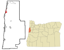
Lincoln Beach is located in northwestern Lincoln County at 44°52′20″N124°02′12″W / 44.872092°N 124.036591°W / 44.872092; -124.036591 , [7] between Lincoln City to the north and Depoe Bay to the south. It is bordered to the west by the Pacific Ocean. Lincoln Beach proper is in the southern part of the CDP at 46 feet (14 m) above sea level, [5] while Gleneden Beach is in the northern part of the CDP at an elevation of 40 feet (12 m). U.S. Route 101 runs through the CDP, leading north 8 miles (13 km) to the center of Lincoln City and south 17 miles (27 km) to Newport, the Lincoln county seat.

According to the United States Census Bureau, the CDP has a total area of 4.1 square miles (10.7 km2), of which 3.2 square miles (8.4 km2) are land and 0.89 square miles (2.3 km2), or 21.6%, are water. [8]

Demographics

Historical population
CensusPop.
2020 2,343
U.S. Decennial Census [9] [2]

As of the census [3] of 2000, there were 2,078 people, 1,073 households, and 657 families residing in the CDP. The population density was 632.5 people per square mile (243.9/km2). There were 2,198 housing units at an average density of 669.1 per square mile (257.9/km2). The racial makeup of the CDP was 95.52% White, 0.10% African American, 1.40% Native American, 0.77% Asian, 0.05% Pacific Islander, 0.82% from other races, and 1.35% from two or more races. Hispanic or Latino of any race were 2.02% of the population.

There were 1,073 households, out of which 10.9% had children under the age of 18 living with them, 53.0% were married couples living together, 6.1% had a female householder with no husband present, and 38.7% were non-families. 32.1% of all households were made up of individuals, and 16.0% had someone living alone who was 65 years of age or older. The average household size was 1.93 and the average family size was 2.35.

In the CDP, the population was spread out, with 10.9% under the age of 18, 3.3% from 18 to 24, 16.0% from 25 to 44, 33.8% from 45 to 64, and 36.1% who were 65 years of age or older. The median age was 58 years. For every 100 females, there were 85.2 males. For every 100 females age 18 and over, there were 82.5 males.

The median income for a household in the CDP was $33,425, and the median income for a family was $41,415. Males had a median income of $32,557 versus $18,519 for females. The per capita income for the CDP was $21,810. About 4.0% of families and 6.9% of the population were below the poverty line, including 3.0% of those under age 18 and 2.2% of those age 65 or over.

Related Research Articles

<span class="mw-page-title-main">Lincoln County, Oregon</span> County in Oregon, United States

Lincoln County is one of the 36 counties in the U.S. state of Oregon. As of the 2020 census, its population was 50,395. The county seat is Newport. The county is named for Abraham Lincoln, 16th president of the United States.

<span class="mw-page-title-main">Freedom, California</span> Census-designated place in California, United States

Freedom is a census-designated place (CDP) in Santa Cruz County, California, United States. The population was 3,070 at the 2010 census.

<span class="mw-page-title-main">Kekaha, Hawaii</span> Census-designated place in Hawaii, United States

Kekaha is a census-designated place (CDP) in Kauaʻi County, Hawaiʻi, United States. The population was 3,715 at the 2020 census, up from 3,175 at the 2000 census.

<span class="mw-page-title-main">Beckett, New Jersey</span> Census-designated place in New Jersey, United States

Beckett is an unincorporated community and census-designated place (CDP) within Logan Township, in Gloucester County, New Jersey, United States. As of the 2010 United States Census, the CDP's population was 4,847.

<span class="mw-page-title-main">Vernon Valley, New Jersey</span> Census-designated place in New Jersey, United States

Vernon Valley is an unincorporated community and census-designated place (CDP) located in Vernon Township, in Sussex County, New Jersey, United States. As of the 2010 United States Census, the CDP's population was 1,626.

<span class="mw-page-title-main">Terrebonne, Oregon</span> Unincorporated community in the state of Oregon, United States

Terrebonne is an unincorporated community and census-designated place (CDP) in Deschutes County, Oregon, United States. It is part of the Bend, Oregon Metropolitan Statistical Area. The population was 1,257 at the 2010 census.

<span class="mw-page-title-main">Green, Oregon</span> Unincorporated community in the state of Oregon, United States

Green is a census-designated place (CDP) and unincorporated community in Douglas County, Oregon, United States. The population was 7,614 at the 2020 census.

<span class="mw-page-title-main">Warm Springs, Oregon</span> Unincorporated community in the state of Oregon, United States

Warm Springs is a census-designated place (CDP) and an unincorporated community in Jefferson County, Oregon, United States. Located on the Warm Springs Indian Reservation, the community is also known as the "Warm Springs Agency". The population was 2,945 at the 2010 census, up from 2,431 at the 2000 census.

<span class="mw-page-title-main">Altamont, Oregon</span> Unincorporated community in the state of Oregon, United States

Altamont is a census-designated place (CDP) and unincorporated community in Klamath County, Oregon, United States, southeast of Klamath Falls. As of the 2010 Census, the population was 19,257. All mailing addresses in Altamont are Klamath Falls addresses, although Altamont is outside of the city limits of Klamath Falls.

<span class="mw-page-title-main">Rose Lodge, Oregon</span> Unincorporated community in the state of Oregon, United States

Rose Lodge is a census-designated place (CDP) and unincorporated community in Lincoln County, Oregon, United States, along the 45th parallel. The population was 1,894 at the 2010 census.

<span class="mw-page-title-main">Oceanside, Oregon</span> Unincorporated community in the state of Oregon, United States

Oceanside is a census-designated place (CDP) and unincorporated community in Tillamook County, Oregon, United States. The population was 361 at the 2010 census. Oregon Route 131's northern terminus is in the community, which is just north of Netarts. Symons State Park is in Oceanside, while Three Arch Rocks National Wildlife Refuge lies just offshore.

<span class="mw-page-title-main">Mission, Oregon</span> Unincorporated community in the state of Oregon, United States

Mission is an unincorporated community in Umatilla County, Oregon, United States. For statistical purposes, the United States Census Bureau has defined Mission as a census-designated place (CDP). The census definition of the area may not precisely correspond to local understanding of the area with the same name. The population was 1,019 at the 2000 census.

<span class="mw-page-title-main">Halchita, Utah</span> CDP in Utah, United States

Halchita is a census-designated place (CDP) in San Juan County, Utah, United States. The population was 270 at the 2000 census.

<span class="mw-page-title-main">Cohassett Beach, Washington</span> CDP in Washington, United States

Cohassett Beach is a census-designated place (CDP) in Grays Harbor County, Washington, United States. The population was 722 at the 2010 census.

<span class="mw-page-title-main">Copalis Beach, Washington</span> CDP in Washington, United States

Copalis Beach is a census-designated place (CDP) in Grays Harbor County, Washington, United States. The population was 415 at the 2010 census.

<span class="mw-page-title-main">Ocean City, Washington</span> Census-designated place in Washington, United States

Ocean City is a census-designated place (CDP) in Grays Harbor County, Washington, United States. The population was 200 at the 2010 census.

<span class="mw-page-title-main">Ocean Park, Washington</span> CDP in Washington, United States

Ocean Park is a census-designated place (CDP) in Pacific County, Washington, United States. The population was 1,573 at the 2010 census. It is on the Long Beach Peninsula, north of Long Beach, Washington.

<span class="mw-page-title-main">Etna, Wyoming</span> Census-designated place in Wyoming, United States

Etna is a census-designated place (CDP) in Lincoln County, Wyoming, United States. The population was 164 at the 2010 census.

<span class="mw-page-title-main">Barview, Oregon</span> Census-designated place in Oregon, United States

Barview is a census-designated place (CDP) in Coos County, Oregon, United States. The population was 1,844 at the 2010 census.

Lincoln is a census-designated place (CDP) consisting of the primary settlement in the town of Lincoln in Penobscot County, Maine, United States. The population was 2,884 at the 2010 census.

References

  1. "ArcGIS REST Services Directory". United States Census Bureau. Retrieved October 12, 2022.
  2. 1 2 "Census Population API". United States Census Bureau. Retrieved Oct 12, 2022.
  3. 1 2 "U.S. Census website". United States Census Bureau . Retrieved 2008-01-31.
  4. "US Board on Geographic Names". United States Geological Survey. 2007-10-25. Retrieved 2008-01-31.
  5. 1 2 "Lincoln Beach". Geographic Names Information System . United States Geological Survey, United States Department of the Interior. 1980-11-28. Retrieved 2010-01-09.
  6. "Total Population: 2010 Census DEC Summary File 1 (P1), Lincoln Beach CDP, Oregon". data.census.gov. U.S. Census Bureau. Retrieved August 21, 2020.
  7. "US Gazetteer files: 2010, 2000, and 1990". United States Census Bureau. 2011-02-12. Retrieved 2011-04-23.
  8. "2019 U.S. Gazetteer Files: Places: Oregon". United States Census Bureau. Retrieved August 21, 2020.
  9. "Census of Population and Housing". Census.gov. Retrieved June 4, 2016.