It has been suggested that Whiteson station be merged into this article. ( Discuss ) Proposed since September 2025. |
Whiteson | |
|---|---|
 Whiteson Road and field in Whiteson | |
 Whiteson Location within the state of Oregon  Whiteson Whiteson (the United States) | |
| Coordinates: 45°09′05″N123°11′48″W / 45.15139°N 123.19667°W | |
| Country | United States |
| State | Oregon |
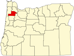
| County | Yamhill |
| Elevation | 164 ft (50 m) |
| Time zone | UTC-8 (Pacific (PST)) |
| • Summer (DST) | UTC-7 (PDT) |
| GNIS feature ID | 1166722 [1] |
Whiteson is an unincorporated community in Yamhill County, Oregon, United States. Oregon Geographic Names states that Whiteson is named for either for Henry White, who laid out the town site and gave the railroad right-of-way, or for William White. It is possible they are members of the same family. Whiteson post office was established in 1890. Whiteson is an agricultural community that relies on the neighboring communities of McMinnville and Amity for basic services such as fire, health, and education. [2] The Yamhill County Sheriff has primary police jurisdiction over Whiteson. [2]