Fort Hill | |
---|---|
Coordinates: 45°04′01″N123°33′38″W / 45.06694°N 123.56056°W | |
Elevation | 105 m (345 ft) |
Population | |
• Estimate (2020) | 154 |
Area code | 541 & 458 |
GNIS feature ID | 2629773 [1] |
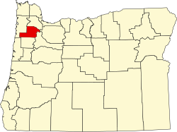
Fort Hill is an unincorporated community in Polk and Yamhill counties in Oregon, United States. [1] It is located about a mile east of Spirit Mountain Casino on Oregon Route 22 near the South Yamhill River. For statistical purposes, the United States Census Bureau has defined Fort Hill as a census-designated place (CDP). [2] The census definition of the area may not precisely correspond to local understanding of the area with the same name. The hill of the same name, [3] located just east of Valley Junction, was the site of a blockhouse built by settlers in 1855–1856. [4] The blockhouse became part of Fort Yamhill, and was later moved to Grand Ronde Agency and is now located in Dayton. [4]
As of the 2020 census there were 154 people, 79 housing units, and 98 families in the CDP. There were 116 White people, 0 African Americans, 16 Native Americans, 2 Asians, 2 from some other race, and 18 from two or more races. There were 14 people with Hispanic or Latino origin. [5]
The median age in Fort Hill was 57.9 years old. 43.4% of the population were between the ages of 75 to 84. 30.1% of the population were veterans. [5]
The median household income was $16,914, but 0.0% of the population were in poverty. [5]
Oak Grove is an unincorporated community in Clackamas County, Oregon, United States, in the Portland metropolitan area. For statistical purposes, the United States Census Bureau has defined Oak Grove as a census-designated place (CDP). The census definition of the area may not precisely correspond to local understanding of the area with the same name. The population was 16,629 at the 2010 census.
Oatfield is an unincorporated community and census-designated place in Clackamas County, Oregon, United States. It is in the Portland metropolitan area. As of the 2010 census, the population of the CDP was 13,415.
Tri-City is a census-designated place (CDP) and unincorporated community in Douglas County, Oregon, United States. The population was 3,931 at the 2010 census. The community in Missouri Bottom near the Umpqua River is named for the three cities among which it is centered: Myrtle Creek, Canyonville and Riddle. The Tri City School District probably originated the name, which was later adopted by the local sewer district and the former Tri City State Airport.
Altamont is a census-designated place (CDP) and unincorporated community in Klamath County, Oregon, United States, southeast of Klamath Falls. As of the 2010 Census, the population was 19,257. All mailing addresses in Altamont are Klamath Falls addresses, although Altamont is outside of the city limits of Klamath Falls.
Rose Lodge is a census-designated place (CDP) and unincorporated community in Lincoln County, Oregon, United States, along the 45th parallel. The population was 1,894 at the 2010 census.
Brooks is an unincorporated community in Marion County, Oregon, United States. For statistical purposes, the United States Census Bureau has defined Brooks as a census-designated place (CDP). The census definition of the area may not precisely correspond to local understanding of the area with the same name. As of the 2020 census the population was 472. Brooks is part of the Salem Metropolitan Statistical Area.
Grand Ronde is a census-designated place (CDP) and unincorporated community in Polk and Yamhill counties, Oregon, United States. Historically noted as a village in Polk County, the sphere of influence and community is in both Polk and Yamhill counties. The name of the community is a variation of the French Grande Ronde or "Grand Round" which could be about the large round-up of Native American peoples in the area who were settled on what was known as the Grand Ronde Indian Reservation, or possibly referencing the shape of the valley in which the community is located. As of the census of 2010, there were 1,661 people in 658 households residing in Grand Ronde. It is part of the Salem Metropolitan Statistical Area.
Biggs Junction is an unincorporated community in Sherman County, Oregon, United States. For statistical purposes, the United States Census Bureau has defined Biggs Junction as a census-designated place (CDP). The census definition of the area may not precisely correspond to local understanding of the area with the same name.
Cape Meares is a census-designated place (CDP) and unincorporated community in Tillamook County, Oregon, United States. The population was 110 at the 2000 census.
Cayuse is a census-designated place (CDP) and unincorporated community in Umatilla County, Oregon, United States, located 11 miles (18 km) east of Pendleton on the Umatilla Indian Reservation. The population was 59 at the 2000 census. It is part of the Pendleton–Hermiston Micropolitan Statistical Area.
Rowena is an unincorporated community in Wasco County, Oregon, United States. For statistical purposes, the United States Census Bureau has defined Rowena as a census-designated place (CDP). The census definition of the area may not precisely correspond to local understanding of the area with the same name. The population was 187 at the 2010 census.
Wamic is a census-designated place (CDP) and unincorporated community in Wasco County, Oregon, United States. Wamic was named for the Womack family, which settled the area. A post office was established at Wamic in 1884 and it closed in 1958. The population was 36 at the 2000 census.
Garden Home-Whitford is a census-designated place (CDP) consisting of the neighborhoods of Garden Home and the smaller Whitford area in Washington County, Oregon, United States. They are located in the southwest hills of Portland, near Beaverton. As of the 2020 census, the CDP population was 7,081.
Metzger is a census-designated place and unincorporated community, in Washington County, Oregon, United States. As of the 2010 census, the CDP population was 3,765. It is named for Herman Metzger, who platted the community. It is a suburb located within Portland, Oregon.
Raleigh Hills is a census-designated place and neighborhood in Washington County, Oregon within the metropolitan area of Portland, Oregon, United States. It is located in the southwest hills in Washington County, with Beaverton to the west, West Slope to the north, and Progress and Garden Home to the south. As of the 2000 census, the census-designated place had a total population of 5,865.
West Haven-Sylvan is a census-designated place (CDP) in Washington and Multnomah counties, Oregon, United States, north of U.S. Route 26. As of the 2020 census, the CDP population was 9,299.
Dayton is a city in Yamhill County, Oregon, United States. The population was 2,678 at the 2020 census.
Mount Hood is an unincorporated community and census-designated place (CDP) in Hood River County, Oregon, United States, about 3 miles (5 km) northeast of Parkdale on Oregon Route 35. As of the 2010 census it had a population of 286. Mount Hood is the terminus of Oregon Route 281, the Hood River Highway.
Warren is an unincorporated community and census-designated place in Columbia County, Oregon, United States, located on U.S. Route 30 north of Scappoose and south of St. Helens on Scappoose Bay of the Multnomah Channel. As of the 2010 census it had a population of 1,787.
Glasgow is an unincorporated community in Coos County, Oregon, United States. For statistical purposes, the United States Census Bureau has defined Glasgow as a census-designated place (CDP). The census definition of the area may not precisely correspond to local understanding of the area with the same name. As of the 2010 census the Glasgow CDP had a population of 763. The place name for Glasgow in the Coos language is Kdet.