Falls City, Oregon

Last updated

Falls City, Oregon
Fire department - Falls City Oregon.jpg
Fire department in Falls City
Polk County Oregon Incorporated and Unincorporated areas Falls City Highlighted.svg
Location in Oregon
Coordinates: 44°51′58″N123°26′19″W / 44.86611°N 123.43861°W / 44.86611; -123.43861
Country United States
State Oregon
County Polk
Incorporated 1893
Government
   Mayor TJ Bailey[ citation needed ]
Area
[1]
  Total1.20 sq mi (3.11 km2)
  Land1.20 sq mi (3.11 km2)
  Water0.00 sq mi (0.00 km2)
Elevation
[2]
381 ft (116 m)
Population
 (2020) [3]
  Total1,051
  Density874.38/sq mi (337.72/km2)
Time zone UTC-8 (Pacific)
  Summer (DST) UTC-7 (Pacific)
ZIP code
97344
Area code 503
FIPS code 41-24550 [4]
GNIS feature ID2410482 [2]
Website www.fallscityoregon.gov

Falls City is a city in Polk County, Oregon, United States. The population was 1,051 at the 2020 census. It is part of the Salem Metropolitan Statistical Area.

Contents

History

Post office Post office - Falls City Oregon.jpg
Post office

It is part of the Salem micropolitan statistical area. Falls City is named after a waterfall (Berry Creek Falls) in the Little Luckiamute River that passes through the center of town. In the past it was a lumbermill town and once had three mills in operation, a bank, hotel, soda shop, jail, and several grocery stores and bars. It formerly supported a large logging population and other population centers in the hills of the Coast Range, such as the smaller lumber-based community of Black Rock and the company-owned mill town Valsetz. [5] [6]

Geography

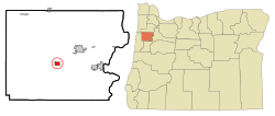
According to the United States Census Bureau, the city has a total area of 1.20 square miles (3.11 km2), all of it land. [7]

Climate

The city of Falls City experiences warm and dry summers, and cold and wet winters, with no average monthly temperatures above 71.6 °F or 22 °C. According to the Köppen Climate Classification, Falls City has a warm-summer Mediterranean climate, abbreviated Csb on climate maps. [8]

Climate data for Falls City
MonthJanFebMarAprMayJunJulAugSepOctNovDecYear
Record high °F (°C)68
(20)
67
(19)
82
(28)
88
(31)
94
(34)
102
(39)
106
(41)
102
(39)
100
(38)
90
(32)
74
(23)
63
(17)
106
(41)
Mean daily maximum °F (°C)44.6
(7.0)
49.2
(9.6)
53.9
(12.2)
60.4
(15.8)
66.6
(19.2)
71.7
(22.1)
80.4
(26.9)
80.4
(26.9)
74.3
(23.5)
63.3
(17.4)
52.2
(11.2)
46.2
(7.9)
61.9
(16.6)
Mean daily minimum °F (°C)31.5
(−0.3)
33.3
(0.7)
35.3
(1.8)
37.9
(3.3)
41.8
(5.4)
45.9
(7.7)
48.4
(9.1)
48.2
(9.0)
46.4
(8.0)
42
(6)
36.2
(2.3)
33.4
(0.8)
40
(4)
Record low °F (°C)−5
(−21)
1
(−17)
18
(−8)
23
(−5)
26
(−3)
26
(−3)
36
(2)
36
(2)
26
(−3)
23
(−5)
10
(−12)
−2
(−19)
−5
(−21)
Average precipitation inches (mm)12.49
(317)
10.19
(259)
9.16
(233)
4.36
(111)
2.65
(67)
1.5
(38)
0.3
(7.6)
0.56
(14)
1.9
(48)
5.22
(133)
11.81
(300)
13.61
(346)
73.75
(1,873)
Average snowfall inches (cm)7.8
(20)
2.8
(7.1)
2.3
(5.8)
0
(0)
0
(0)
0
(0)
0
(0)
0
(0)
0
(0)
0.1
(0.25)
0.5
(1.3)
2.4
(6.1)
16
(41)
Average precipitation days19161813117236121719143
Source: [9]

Demographics

Historical population
CensusPop.Note
1900 269
1910 969260.2%
1920 9942.6%
1930 494−50.3%
1940 71544.7%
1950 85319.3%
1960 653−23.4%
1970 74514.1%
1980 8047.9%
1990 8181.7%
2000 96618.1%
2010 947−2.0%
2020 1,05111.0%
U.S. Decennial Census [10] [3]
Falls City High School Falls City High School - Falls City Oregon.jpg
Falls City High School

2010 census

As of the census [11] of 2010, there were 947 people, 366 households, and 261 families residing in the city. The population density was 789.2 inhabitants per square mile (304.7/km2). There were 395 housing units at an average density of 329.2 per square mile (127.1/km2). The racial makeup of the city was 91.6% White, 0.1% African American, 2.3% Native American, 0.4% Asian, 0.1% Pacific Islander, 1.8% from other races, and 3.7% from two or more races. Hispanic or Latino of any race were 5.2% of the population.

There were 366 households, of which 30.3% had children under the age of 18 living with them, 54.4% were married couples living together, 10.4% had a female householder with no husband present, 6.6% had a male householder with no wife present, and 28.7% were non-families. 22.7% of all households were made up of individuals, and 7.6% had someone living alone who was 65 years of age or older. The average household size was 2.59 and the average family size was 2.98.

The median age in the city was 43.5 years. 22.9% of residents were under the age of 18; 8% were between the ages of 18 and 24; 21% were from 25 to 44; 31.9% were from 45 to 64; and 16.3% were 65 years of age or older. The gender makeup of the city was 51.5% male and 48.5% female.

2000 census

As of the census [4] of 2000, there were 966 people, 338 households, and 255 families residing in the city. The population density was 785.2 inhabitants per square mile (303.2/km2). There were 373 housing units at an average density of 303.2 per square mile (117.1/km2). The racial makeup of the city was 92.86% White, 0.93% African American, 1.66% Native American, 0.10% Asian, 0.21% Pacific Islander, 1.04% from other races, and 3.21% from two or more races. Hispanic or Latino of any race were 3.62% of the population.

There were 338 households, out of which 35.2% had children under the age of 18 living with them, 58.3% were married couples living together, 13.6% had a female householder with no husband present, and 24.3% were non-families. 19.2% of all households were made up of individuals, and 9.5% had someone living alone who was 65 years of age or older. The average household size was 2.86 and the average family size was 3.25.

In the city, the population was spread out, with 31.0% under the age of 18, 5.5% from 18 to 24, 26.7% from 25 to 44, 22.4% from 45 to 64, and 14.5% who were 65 years of age or older. The median age was 38 years. For every 100 females, there were 91.7 males. For every 100 females age 18 and over, there were 88.4 males.

The median income for a household in the city was $32,461, and the median income for a family was $36,528. Males had a median income of $31,827 versus $26,429 for females. The per capita income for the city was $13,858. About 11.6% of families and 15.8% of the population were below the poverty line, including 16.5% of those under age 18 and 9.0% of those age 65 or over.

Related Research Articles

<span class="mw-page-title-main">American Falls, Idaho</span> City in and county seat of Power County, Idaho, United States

American Falls is a city in and the county seat of Power County, Idaho, United States. The population was 4,457 at the time of the 2010 census.

<span class="mw-page-title-main">Buhl, Idaho</span> City in Twin Falls, Idaho, United States

Buhl is a city located on the old Oregon Trail in the western half of Twin Falls County, Idaho. The population was 4,122 at the time of the 2010 census, up from 3,985 in 2000. It is part of the Twin Falls, Idaho metropolitan area.

<span class="mw-page-title-main">Haines, Oregon</span> City in Oregon, United States

Haines is a city in Baker County, Oregon, United States. The population was 416 at the 2010 census.

<span class="mw-page-title-main">Richland, Oregon</span> City in Oregon, United States

Richland is a city in Baker County, Oregon, United States. The population was 156 at the 2010 census.

<span class="mw-page-title-main">Columbia City, Oregon</span> City in Oregon, United States

Columbia City is a city in Columbia County, Oregon, United States. It was named for its location on the Columbia River. The population was 1,946 at the 2010 census.

<span class="mw-page-title-main">Canyonville, Oregon</span> City in Oregon, United States

Canyonville is a city in Douglas County, Oregon, United States. The population was 1,884 at the 2010 census. The main regional tourist attraction, the Seven Feathers Casino Resort is in Canyonville. The Weaver-Worthington Farmstead, a National Historical Landmark, is located near Canyonville.

<span class="mw-page-title-main">Winston, Oregon</span> City in Oregon, United States

Winston is a city in Douglas County, Oregon, United States, located 7 miles southwest of Roseburg. The population was 5,379 according to the 2010 United States Census. Winston is probably best-known as the home of Wildlife Safari.

<span class="mw-page-title-main">Long Creek, Oregon</span> City in Oregon, United States

Long Creek is a city in Grant County, Oregon, United States. The population was 173 at the 2020 census. The city is named after John Long, a prominent miner who came to Grant County in 1862 during the Canyon City rush of that same year. Located in a high valley of the Blue Mountains, ranching has been the principal enterprise for the area. Log harvesting was slowly curtailed in the nearby Malheur National Forest until the local mill was closed in 1998.

<span class="mw-page-title-main">Butte Falls, Oregon</span> City in Oregon, United States

Butte Falls is a city in Jackson County, Oregon, United States. The population was 423 at the 2010 census. As of July 1, 2018, the city's population was estimated to be 450.

<span class="mw-page-title-main">Bonanza, Oregon</span> Town in Oregon, United States

Bonanza is a town in Klamath County, Oregon, United States, near Klamath Falls. The population was 415 at the 2010 census.

<span class="mw-page-title-main">Malin, Oregon</span> City in Oregon, United States

Malin is a city in Klamath County, Oregon, United States. The population was 805 at the 2010 census.

<span class="mw-page-title-main">Halsey, Oregon</span> City in Oregon, United States

Halsey is a city in Linn County, Oregon, United States. The population was 904 at the 2010 census.

<span class="mw-page-title-main">Harrisburg, Oregon</span> City in Oregon, United States

Harrisburg is a city in Linn County, Oregon, United States. The population was 3,567 at the 2010 census.

<span class="mw-page-title-main">Scio, Oregon</span> City in Oregon, United States

Scio is a city in Linn County, Oregon, United States. The population was 838 at the 2010 census.

<span class="mw-page-title-main">Scotts Mills, Oregon</span> City in Oregon, United States

Scotts Mills is a city in Marion County, Oregon, United States. The population was 419 at the 2020 census. It is 2 miles (3 km) south of Marquam and Oregon Route 213, between Silverton and Molalla.

<span class="mw-page-title-main">Rufus, Oregon</span> City in Oregon, United States

Rufus is a city in Sherman County, Oregon, United States. The population was 249 at the 2010 census. The city was named for an early settler, Rufus Carrol Wallis.

<span class="mw-page-title-main">Bay City, Oregon</span> City in Oregon, United States

Bay City is a city in Tillamook County, Oregon, United States. The population was 1,286 at the 2010 census.

<span class="mw-page-title-main">Adams, Oregon</span> City in Oregon, United States

Adams is a city in Umatilla County, Oregon, United States, located about 13 miles (21 km) northeast of Pendleton on Oregon Route 11. The population was 350 at the 2010 census. It is part of the Pendleton–Hermiston Micropolitan Statistical Area.

<span class="mw-page-title-main">North Powder, Oregon</span> City in Oregon, United States

North Powder is a city in Union County, Oregon, United States. The population was 439 at the 2010 census.

<span class="mw-page-title-main">Mosier, Oregon</span> City in Oregon, United States

Mosier is a city along the Columbia River in Wasco County, Oregon, United States. The population was 433 at the 2010 census.

References

  1. "ArcGIS REST Services Directory". United States Census Bureau. Retrieved October 12, 2022.
  2. 1 2 U.S. Geological Survey Geographic Names Information System: Falls City, Oregon
  3. 1 2 "Census Population API". United States Census Bureau. Retrieved October 12, 2022.
  4. 1 2 "U.S. Census website". United States Census Bureau . Retrieved January 31, 2008.
  5. "Welcome to Polk County, Oregon". June 25, 2007. Archived from the original on June 25, 2007.
  6. "fallscity.org". www.fallscity.org.
  7. "US Gazetteer files 2010". United States Census Bureau. Archived from the original on January 25, 2012. Retrieved December 21, 2012.
  8. "Falls City, Oregon Köppen Climate Classification (Weatherbase)". Weatherbase.
  9. "FALLS CITY 2 SSW, OR (352800)". Western Regional Climate Center. Retrieved November 23, 2015.
  10. "Census of Population and Housing". Census.gov. Retrieved June 4, 2015.
  11. "U.S. Census website". United States Census Bureau . Retrieved December 21, 2012.