External links
- Historic image of Crowley railroad depot from Salem Public Library
Municipalities and communities of Polk County, Oregon, United States | ||
|---|---|---|
| Cities | 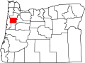 | |
| CDPs | ||
| Unincorporated communities | ||
| Indian reservation | ||
| Ghost towns | ||
| Footnotes | ‡This populated place also has portions in an adjacent county or counties | |
44°58′37″N123°12′29″W / 44.977°N 123.208°W
| | This Polk County, Oregon state location article is a stub. You can help Wikipedia by expanding it. |