Eola, Oregon

Last updated

Eola, Oregon
EolaSchool.JPG
Former 1937 school in Eola
Polk County Oregon Incorporated and Unincorporated areas Eola Highlighted.svg
Location of Eola, Oregon
Coordinates: 44°55′53″N123°07′17″W / 44.93139°N 123.12139°W / 44.93139; -123.12139
Country United States
State Oregon
County Polk
Area
[1]
  Total0.06 sq mi (0.16 km2)
  Land0.06 sq mi (0.16 km2)
  Water0.00 sq mi (0.00 km2)
Elevation
[2]
203 ft (62 m)
Population
 (2020) [3]
  Total60
  Density1,000.00/sq mi (383.96/km2)
Time zone UTC-8 (Pacific (PST))
  Summer (DST) UTC-7 (PDT)
FIPS code 41-23550 [4]
GNIS feature ID2408085 [2]

Eola is an unincorporated community in Polk County, Oregon, United States. It lies four miles west of Salem on Oregon Route 22 at the confluence of Rickreall Creek and the Willamette River.

Contents

For statistical purposes, the United States Census Bureau has defined Eola as a census-designated place (CDP). The census definition of the area may not precisely correspond to local understanding of the area with the same name. The population of the CDP was 60 at the 2020 census. [5] It is part of the Salem Metropolitan Statistical Area.

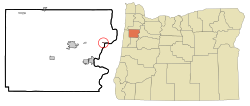
The Eola Hills rise north of the community and were named after it. [6]

History

Eola was originally named Cincinnati in 1844 by settlers Joshua "Sheep" Shaw and his son, A. C. R. Shaw, who thought the site resembled Cincinnati, Ohio, where Joshua once lived. [6] [7] Joshua Shaw earned his nickname by being the first person to bring sheep overland to the Oregon Country via the Oregon Trail, also in 1844. [8]

Cincinnati post office was established in 1851, the first stop on a 70-mile mail route that included Nathaniel Ford's home in Rickreall and Nesmith's Mills at Ellendale. [6] [8]

The Oregon Territorial Legislature incorporated the community with the name "Eola" in 1856. [6] The name comes from Aeolus , Greek god of the winds, though the reason for the name change is disputed. [6]

Cincinnati post office was also renamed. Eola post office ran until 1901 and was later reestablished from 1955 to 1965. [6]

The first school in Eola (then Cincinnati) was built in 1853. [9] Miss Abigail J. Scott, best known by her married name as the suffragist Abigail Scott Duniway, was the first teacher. [6] [9] The original school burned down and was replaced by a school at Second and Mill streets in 1858. [7] This school served the community until 1937, and at the time was the oldest schoolhouse still in use in the state. [7] In 1937, a new school was built using a Works Progress Administration grant. [7] This building served as a public school facility until 2003. [10] Today the building is used as a church.

Geography

According to the United States Census Bureau, the CDP has a total area of 0.1 square miles (0.26 km2), all of it land. [11]

Demographics

Historical population
CensusPop.Note
2020 60
U.S. Decennial Census [12] [3]

As of the census [4] of 2000, there were 49 people, 29 households, and 6 families residing in the CDP. The population density was 767.0 inhabitants per square mile (296.1/km2). There were 36 housing units at an average density of 563.5 per square mile (217.6/km2). The racial makeup of the CDP was 89.80% White, 8.16% from other races, and 2.04% from two or more races. Hispanic or Latino of any race were 8.16% of the population.

There were 29 households, out of which 3.4% had children under the age of 18 living with them, 20.7% were married couples living together, and 75.9% were non-families. 69.0% of all households were made up of individuals, and 13.8% had someone living alone who was 65 years of age or older. The average household size was 1.69 and the average family size was 3.14.

In the CDP, the population was spread out, with 10.2% under the age of 18, 4.1% from 18 to 24, 26.5% from 25 to 44, 49.0% from 45 to 64, and 10.2% who were 65 years of age or older. The median age was 50 years. For every 100 females, there were 122.7 males. For every 100 females age 18 and over, there were 131.6 males.

The median income for a household in the CDP was $12,361 and the per capita income was $9,489. There were no families and 29.8% of the population living below the poverty line, including no people under eighteen and none of those over 64.

Related Research Articles

<span class="mw-page-title-main">Salem, Oregon</span> Capital city of Oregon, United States

Salem is the capital city of the U.S. state of Oregon, and the county seat of Marion County. It is located in the center of the Willamette Valley alongside the Willamette River, which runs north through the city. The river forms the boundary between Marion and Polk counties, and the city neighborhood of West Salem is in Polk County. Salem was founded in 1842, became the capital of the Oregon Territory in 1851, and was incorporated in 1857.

<span class="mw-page-title-main">Yamhill County, Oregon</span> County in Oregon, United States

Yamhill County is one of the 36 counties in the U.S. state of Oregon. As of the 2020 census, the population was 107,722. The county seat is McMinnville. Yamhill County was named after the Yamhelas, members of the Kalapuya Tribe.

<span class="mw-page-title-main">Polk County, Oregon</span> County in Oregon, United States

Polk County is one of the 36 counties in the U.S. state of Oregon. As of the 2020 census, the population was 87,433. The county seat is Dallas. The county is named for James Knox Polk, the 11th president of the United States.

<span class="mw-page-title-main">Marion County, Oregon</span> County in Oregon, United States

Marion County is one of the 36 counties in the U.S. state of Oregon. The population was 345,920 at the 2020 census, making it the 5th most populous county in Oregon. The county seat is Salem, which is also the state capital of Oregon. The county was originally named the Champooick District, after Champoeg, a meeting place on the Willamette River. On September 3, 1849, the territorial legislature renamed it in honor of Francis Marion, a Continental Army general from South Carolina who served in the American Revolutionary War.

<span class="mw-page-title-main">Jennings Lodge, Oregon</span> Unincorporated community in the state of Oregon, United States

Jennings Lodge is a census-designated place and unincorporated community in Clackamas County, Oregon, United States, between Milwaukie and Gladstone. For statistical purposes, the United States Census Bureau has defined Jennings Lodge as a census-designated place (CDP). The census definition of the area may not precisely correspond to local understanding of the area with the same name. As of the United States Census, 2010, it had a total population of 7,315.

<span class="mw-page-title-main">Oak Grove, Oregon</span> Unincorporated community in the state of Oregon, United States

Oak Grove is an unincorporated community in Clackamas County, Oregon, United States, in the Portland metropolitan area. For statistical purposes, the United States Census Bureau has defined Oak Grove as a census-designated place (CDP). The census definition of the area may not precisely correspond to local understanding of the area with the same name. The population was 16,629 at the 2010 census.

<span class="mw-page-title-main">Brooks, Oregon</span> Unincorporated community in the state of Oregon, United States

Brooks is an unincorporated community in Marion County, Oregon, United States. For statistical purposes, the United States Census Bureau has defined Brooks as a census-designated place (CDP). The census definition of the area may not precisely correspond to local understanding of the area with the same name. As of the 2020 census the population was 472. Brooks is part of the Salem Metropolitan Statistical Area.

<span class="mw-page-title-main">Butteville, Oregon</span> Unincorporated community in the state of Oregon, United States

Butteville is a census-designated place and unincorporated community in Marion County, Oregon, United States. For statistical purposes, the United States Census Bureau has defined Butteville as a census-designated place (CDP). The census definition of the area may not precisely correspond to local understanding of the area with the same name. As of the 2020 census the population was 273. It is part of the Salem Metropolitan Statistical Area.

<span class="mw-page-title-main">Hayesville, Oregon</span> Unincorporated community in the state of Oregon, United States

Hayesville is a census-designated place and unincorporated community in Marion County, Oregon, United States, just outside the city limits of Salem but within the city's urban growth boundary. It is part of the Salem Metropolitan Statistical Area. For statistical purposes, the United States Census Bureau has defined Hayesville as a census-designated place (CDP). The census definition of the area may not precisely correspond to local understanding of the area with the same name. The population of the CDP was 21,891 at the 2020 census.

<span class="mw-page-title-main">Marion, Oregon</span> Unincorporated community in the state of Oregon, United States

Marion is an unincorporated community in Marion County, Oregon, United States. For statistical purposes, the United States Census Bureau has defined Marion as a census-designated place (CDP). The census definition of the area may not precisely correspond to local understanding of the area with the same name. The population was 307 at the 2020 census. Marion is part of the Salem Metropolitan Statistical Area.

<span class="mw-page-title-main">Mehama, Oregon</span> Unincorporated community in the state of Oregon, United States

Mehama is an unincorporated community in Marion County, Oregon, United States, located on Oregon Route 22 and the North Santiam River. For statistical purposes, the United States Census Bureau has defined Mehama as a census-designated place (CDP). The census definition of the area may not precisely correspond to local understanding of the area with the same name. The population was 317 at the 2020 census. It is part of the Salem Metropolitan Statistical Area.

<span class="mw-page-title-main">Dallas, Oregon</span> City in Oregon, United States

Dallas is a city and the county seat of Polk County, Oregon, United States. The population was 16,854 at the 2020 census.

<span class="mw-page-title-main">Grand Ronde, Oregon</span> Census-designated place in Oregon, United States

Grand Ronde is a census-designated place (CDP) and unincorporated community in Polk and Yamhill counties, Oregon, United States. Historically noted as a village in Polk County, the sphere of influence and community is in both Polk and Yamhill counties. The name of the community is a variation of the French Grande Ronde or "Grand Round" which could be about the large round-up of Native American peoples in the area who were settled on what was known as the Grand Ronde Indian Reservation, or possibly referencing the shape of the valley in which the community is located. As of the census of 2010, there were 1,661 people in 658 households residing in Grand Ronde. It is part of the Salem Metropolitan Statistical Area.

<span class="mw-page-title-main">Independence, Oregon</span> City in Oregon, United States

Independence is a city in Polk County, Oregon, United States, on the west bank of the Willamette River along Oregon Route 51, and east of nearby Monmouth. It is part of the Salem Metropolitan Statistical Area. Thirty square blocks of the oldest part of Independence form the National Register of Historic Places-listed Independence Historic District.

<span class="mw-page-title-main">Monmouth, Oregon</span> City in Oregon, United States

Monmouth is a city in Polk County in the U.S. state of Oregon. It was named for Monmouth, Illinois, the origin of its earliest settlers. The population is 11,110 at the 2020 Census and it is part of the Salem Metropolitan Statistical Area.

<span class="mw-page-title-main">Rickreall, Oregon</span> Unincorporated community in the state of Oregon, United States

Rickreall is an unincorporated community in Polk County, Oregon, United States. For statistical purposes, the United States Census Bureau has defined Rickreall as a census-designated place (CDP). The census definition of the area may not precisely correspond to local understanding of the area with the same name. The population of the CDP was 76 at the 2020 census. Rickreall is part of the Salem Metropolitan Statistical Area. Rickreall Creek runs along the community's southern edge.

<span class="mw-page-title-main">Garden Home–Whitford, Oregon</span> CDP in Oregon, United States

Garden Home-Whitford is a census-designated place (CDP) consisting of the neighborhoods of Garden Home and the smaller Whitford area in Washington County, Oregon, United States. They are located in the southwest hills of Portland, near Beaverton. As of the 2020 census, the CDP population was 7,081.

<span class="mw-page-title-main">Salem Metropolitan Statistical Area</span> Metropolitan statistical area in Oregon, United States

The Salem Metropolitan Statistical Area (MSA), as defined by the United States Census Bureau, is a Metropolitan Statistical Area consisting of two counties in western Oregon, Marion and Polk. The principal city is Salem, the state capital, which has a population of 175,535. The Salem MSA had a population of 433,353 at the 2020 census. In 2010, there were 390,738 people living in the Salem MSA. In 2000, the MSA had a population of 347,214, and had a population of 278,024 according to the 1990 census.

<span class="mw-page-title-main">Rickreall Creek</span> Stream in Polk County, Oregon, United States

Rickreall Creek is a stream in Polk County, Oregon, United States rising on Laurel Mountain in the Central Oregon Coast Range and draining into the Willamette River west of Salem at Eola. The creek passes through the city of Dallas and the unincorporated community of Rickreall. The origin of the name is under some dispute, but one theory says that "Rickreall" is a corruption of "La Creole", La Creole River being another name for the stream.

<span class="mw-page-title-main">Peoria, Oregon</span> Unincorporated community in the state of Oregon, United States

Peoria is an unincorporated community and census-designated place (CDP) in Linn County, Oregon, United States. It is on the right bank of the Willamette River at river mile 141 between Eugene and Corvallis. Lacking stores and services, it is a cluster of houses plus a county park along Peoria Road, about 8 miles (13 km) south of Oregon Route 34 and 12 miles (19 km) north of Harrisburg. As of the 2010 census, the population was 94.

References

  1. "ArcGIS REST Services Directory". United States Census Bureau. Retrieved October 12, 2022.
  2. 1 2 U.S. Geological Survey Geographic Names Information System: Eola, Oregon
  3. 1 2 "Census Population API". United States Census Bureau. Retrieved October 12, 2022.
  4. 1 2 "U.S. Census website". United States Census Bureau . Retrieved January 31, 2008.
  5. "Eola CDP, Oregon". United States Census Bureau . Retrieved January 13, 2022.
  6. 1 2 3 4 5 6 7 McArthur, Lewis A.; Lewis L. McArthur (2003) [1928]. Oregon Geographic Names (7th ed.). Portland, Oregon: Oregon Historical Society Press. p. 333. ISBN   0-87595-277-1.
  7. 1 2 3 4 Corning, Howard McKinley (1973) [1947]. "Eola, The Town That Was Cincinnati". Willamette Landings: Ghost Towns of the River (2nd ed.). Portland, Oregon: Oregon Historical Society. pp. 132–138. ISBN   0-87595-042-6.
  8. 1 2 Wirfs, Charlotte L. (1980). "Tour No. 1: Early Settlements of N.E. Polk County". Historically Speaking. Polk County Historical Society. IV: 4.
  9. 1 2 Our History of Education Archived 2007-05-08 at the Wayback Machine
  10. Itemizer Observer "Eola, Oak Grove schools face closure [ permanent dead link ]" April 29, 2003. Accessed March 15, 2009.
  11. "US Gazetteer files: 2010, 2000, and 1990". United States Census Bureau. February 12, 2011. Retrieved April 23, 2011.
  12. "Census of Population and Housing". Census.gov. Retrieved June 4, 2016.