Related Research Articles

Polk County is one of the 36 counties in the U.S. state of Oregon. As of the 2020 census, the population was 87,433. The county seat is Dallas. The county is named for James Knox Polk, the 11th president of the United States.

Lakeview is a town in Lake County, Oregon, United States. The population was 2,418 at the 2020 census. It is the county seat of Lake County. The city bills itself as the "Tallest Town in Oregon" because of its elevation, 4,757 feet (1,450 m) above sea level. Lakeview is situated in the Goose Lake Valley at the foot of the Warner Mountains and at the edge of Oregon's high desert country. Its economy is based on agriculture, lumber production, and government activities. In addition, tourism is an increasingly important part of the city's economy. Oregon's Outback Scenic Byway passes through Lakeview.

Dallas is a city and the county seat of Polk County, Oregon, United States. The population was 16,854 at the 2020 census.

Grand Ronde is a census-designated place (CDP) and unincorporated community in Polk and Yamhill counties, Oregon, United States. Historically noted as a village in Polk County, the sphere of influence and community is in both Polk and Yamhill counties. The name of the community is a variation of the French Grande Ronde or "Grand Round" which could be in reference to the large round up of Native Americans peoples in the area who were settled on what was known as the Grand Ronde Indian Reservation, or possibly referencing the shape of the valley in which the community is located. As of the census of 2010, there were 1,661 people in 658 households are residing in Grand Ronde. It is part of the Salem Metropolitan Statistical Area.

The OC&E Woods Line State Trail is a rail trail in Klamath and Lake counties in the U.S. state of Oregon. It is Oregon's longest state park. The trail follows the old OC&E and Weyerhaeuser railroads from Klamath Falls to Thompson Reservoir. Along its 105-mile (169 km) length it passes through the communities of Olene, Sprague River, Dairy, Beatty, and Bly.
The Portland and Western Railroad is a 516-mile (830 km) Class II railroad serving the U.S. state of Oregon, and is a wholly owned subsidiary of shortline and regional railroad holding company Genesee & Wyoming Inc. The PNWR includes a subsidiary, the Willamette and Pacific Railroad.

Central Oregon is a geographic region in the U.S. state of Oregon and is traditionally considered to be made up of Deschutes, Jefferson, and Crook counties. Other definitions include larger areas, often encompassing areas to the north towards the Columbia River, eastward towards Burns, or south towards Klamath Falls. These three counties have a combined population of 200,431 as of the 2010 census, with Deschutes the largest of the three counties, having approximately four times the population of the other two counties combined. As of 2015, the most populous city in the region is Bend, with an estimated 87,014 residents. As defined by the three county definition, Central Oregon covers 7,833 square miles (20,290 km2) of land. Central Oregon has had 3 record tourism years beginning in 2012. Over 2.2 million people visited Central Oregon in 2012 and again in 2013.

Larch Mountain is an extinct volcano near Portland, Oregon. The name is misleading, as no western larch can be found there. It received that name when early lumbermen sold the noble fir wood as larch. The peak can be reached between May and November on paved Larch Mountain Road, 16 mi (26 km) east of Corbett, Oregon, although the road is closed during the winter and spring months. The road leading to Larch Mountain from the Historic Columbia River Highway is 14 miles long, which closed at milepost 10 from Nov. through late May or early June due to snow.

Algoma is an unincorporated community on the east shore of Upper Klamath Lake, in Klamath County, Oregon, United States. It is about 8 miles (13 km) north of the city of Klamath Falls on U.S. Route 97. Algoma was named for the Algoma Lumber Company.
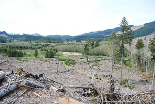
Valsetz was an unincorporated community and timber company town in Polk County, Oregon, United States, west of Falls City in the Central Oregon Coast Range. It no longer exists.

Bridal Veil is a virtual ghost town located in Multnomah County, Oregon, United States. It was established in the 1880s during a logging boom by a logging company as it harvested timber on nearby Larch Mountain to be a company mill town around a sawmill. It had a close relationship with the logging town of Palmer for the first 50 years of its history. As of November 2011, all that remains of the town is a post office and a cemetery. The site is located near the west end of the Columbia River Gorge.

Silver Falls State Park is a state park in the U.S. state of Oregon, located near Silverton, about 20 miles (32 km) east-southeast of Salem. It is the largest state park in Oregon with an area of more than 9,000 acres (36 km2), and it includes more than 24 miles (39 km) of walking trails, 14 miles (23 km) of horse trails, and a 4-mile (6.4 km) bike path. Its 8.7-mile (14.0 km) Canyon Trail/Trail of Ten Falls runs along the banks of Silver Creek and by ten waterfalls, from which the park received its name. Four of the ten falls have an amphitheater-like surrounding that allows the trail to pass behind the flow of the falls. The Silver Falls State Park Concession Building Area and the Silver Creek Youth Camp-Silver Falls State Park are separately listed on the U.S. National Register of Historic Places.

Ellendale is a ghost town in Polk County, Oregon, United States, about two and a half miles west of Dallas. It was the first settlement in present-day Polk County by non-Kalapuyans. The community's name changed over the years, with the first post office in Polk County being opened in this locality as "O'Neils Mills" in 1850. The post office was renamed "Nesmiths" in 1850 and discontinued in 1852. The community was eventually renamed Ellendale.
Louis Gerlinger Sr. was a businessperson in the railroad and timber industries in the U.S. state of Oregon in the early 20th century.
George T. Gerlinger was influential in the railroad and lumber products business in the U.S. state of Oregon in the early 20th century. The oldest son of Louis Gerlinger, Sr., in 1902 he organized a group of investors in Dallas, Oregon to build railroad lines in the area.
Carl Gerlinger, Sr. was an American businessperson in the U.S. state of Oregon in the early 20th century.

Santiam State Forest is one of six state forests managed by the Oregon Department of Forestry. The forest is located approximately 25 miles (40 km) southeast of Salem, Oregon, and includes 47,871 acres (193.73 km2) on the western slope of the Cascade Mountains in three Oregon counties: Clackamas, Linn, and Marion. It is bounded on the east by the Willamette National Forest and Mount Hood National Forest. Silver Falls State Park is located west of the forest. The rest of the land surrounding the forest belongs to the Bureau of Land Management or is privately owned. The forest is managed as part of the Department of Forestry's North Cascade District.
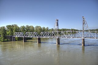
The Union Street Railroad Bridge is a vertical lift, Pratt through truss bridge that spans the Willamette River in Salem, Oregon, United States, built in 1912–13. It was last used by trains in the early 1990s and was sold for one dollar in 2003 to the City of Salem, which converted it to bicycle and pedestrian use in 2008–2009. It was added to the National Register of Historic Places in 2006.

The Valley and Siletz Railroad (VS) is a 40.6-mile (65.3 km) defunct railroad located in Polk and Benton counties in the U.S. state of Oregon.
The Salem, Falls City and Western Railway (SFC&W) was an American railroad based in Polk County, Oregon that ran between Salem and Black Rock via Dallas and Falls City.
References
- 1 2 "Black Rock". Geographic Names Information System . United States Geological Survey, United States Department of the Interior. November 28, 1980. Retrieved April 8, 2014.
- ↑ Oregon Atlas & Gazetteer (7th ed.). Yarmouth, Maine: DeLorme. 2008. p. 33. ISBN 0-89933-347-8.
- 1 2 3 4 5 6 7 8 9 10 11 12 13 McArthur, Scott (May 15, 2013). "Story of Black Rock Logging Camp". Statesman-Journal . Salem, Oregon.
- 1 2 3 4 5 6 McArthur, Lewis A.; McArthur, Lewis L. (2003) [1928]. Oregon Geographic Names (7th ed.). Portland, Oregon: Oregon Historical Society Press. p. 86. ISBN 978-0875952772.
- 1 2 3 4 5 6 "Black Rock" (PDF). Oregon Inventory of Historic Properties Historic Resource Survey Form Polk County. Oregon State Historic Preservation Office . Retrieved April 10, 2014.
- ↑ Alanen, Donald Mathew (2008). The Logger's Encyclopedia: A Road to the Past.
- ↑ "Pacific Coast Mills, Jay S. Hamilton ad". The Timberman. Portland, Oregon. 16 (7–12): 52, 76. May 1915.
- ↑ Johnston, James (February 24, 2012). "Mountain Bike Mecca". Eugene Weekly . Archived from the original on April 13, 2014. Retrieved April 8, 2014.
- ↑ "About BRMBA". Blackrock Mountain Bike Association. Archived from the original on April 7, 2014. Retrieved April 8, 2014.
- ↑ "Nearby Trails". Santiam Bicycle. Archived from the original on April 13, 2014. Retrieved April 8, 2014.
