Related Research Articles

Lake County is one of the 36 counties in the U.S. state of Oregon. As of the 2010 census, the population was 7,895. Its county seat is Lakeview. The county is named after the many lakes found within its boundaries, including Lake Abert, Summer Lake, Hart Lake, and Goose Lake.

Carter County is a county in the Ozarks of Missouri. At the 2020 census, it had a population of 5,202. The largest city and county seat is Van Buren. The county was officially organized on March 10, 1859, and is named after Zimri A. Carter, a pioneer settler who came to Missouri from South Carolina in 1812.

Oregon State University (OSU) is a public land-grant research university in Corvallis, Oregon. The university offers more than 200 undergraduate-degree programs along with a variety of graduate and doctoral degrees. On-campus enrollment averages near 32,000, making it the state's largest university. Since its founding over 272,000 students have graduated from OSU. It is classified among "R1: Doctoral Universities – Very high research activity" with an additional, optional designation as a "Community Engagement" university.
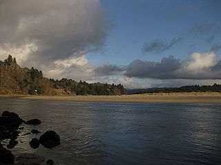
The Salmon River flows from the Central Oregon Coast Range to the Pacific Ocean coast of northwest Oregon in the United States. About 24 miles (39 km) long, it begins and ends in Lincoln County but also flows briefly through western Polk and southern Tillamook counties. Much of its course lies within the Siuslaw National Forest.
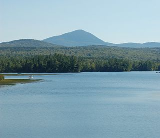
Mount Blue State Park is a public recreation area covering 7,489 acres (3,031 ha) in the town of Weld, Franklin County, Maine. The state park's bifurcated land includes acreage on the west shore of Webb Lake as well as Mount Blue and other peaks to the east of the lake. The park is connected by road with the 10,555-acre (4,271 ha) Tumbledown Public Lands, the site of Little Jackson Mountain, Tumbledown Mountain, and Tumbledown Pond, an alpine lake near the top of Tumbledown and Little Jackson mountains. The park and public lands are managed by the Maine Department of Agriculture, Conservation and Forestry.

Fort Rock is a tuff ring located on an ice age lake bed in north Lake County, Oregon, United States. The ring is about 4,460 feet (1,360 m) in diameter and stands about 200 feet (60 m) high above the surrounding plain. Its name is derived from the tall, straight sides that resemble the palisades of a fort. The region of Fort Rock-Christmas Lake Valley Basin contains about 40 such tuff rings and maars and is located in the Brothers Fault Zone of central Oregon's Great Basin. William Sullivan, an early settler in the area, named Fort Rock in 1873 while searching for lost cattle.
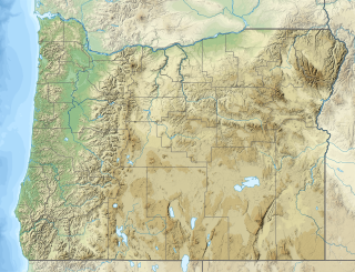
Rogers Peak is the highest mountain in Tillamook County, Oregon. Located in the Tillamook State Forest, the peak is also the highest peak in the Northern Oregon Coast Range, which is the northern section of the Oregon Coast Range.

Trask Mountain in the Northern Oregon Coast Range, is the tallest mountain in Yamhill County, Oregon. It is located in the northwest corner of the county. Evidently the mountain was named for Elbridge Trask who settled west of the peak in Tillamook County in 1852.
George T. Gerlinger was influential in the railroad and lumber products business in the U.S. state of Oregon in the early 20th century. The oldest son of Louis Gerlinger, Sr., in 1902 he organized a group of investors in Dallas, Oregon to build railroad lines in the area.
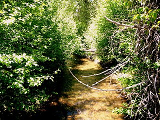
Sun Pass State Forest is one of six state forests managed by the Oregon Department of Forestry. The forest is located 40 miles (64 km) north of Klamath Falls, Oregon near the southeastern corner of Crater Lake National Park. It is the largest single block of Oregon state forestry land east of the Cascade Mountains. The forest is managed as part of the Klamath-Lake District, comprising 21,317 acres (86.27 km2) of the 33,739 state-owned acres within the district.

Santiam State Forest is one of six state forests managed by the Oregon Department of Forestry. The forest is located approximately 25 miles (40 km) southeast of Salem, Oregon, and includes 47,871 acres (193.73 km2) on the western slope of the Cascade Mountains in three Oregon counties: Clackamas, Linn, and Marion. It is bounded on the east by the Willamette National Forest and Mount Hood National Forest. Silver Falls State Park is located west of the forest. The rest of the land surrounding the forest belongs to the Bureau of Land Management or is privately owned. The forest is managed as part of the Department of Forestry's North Cascade District.

H. B. Van Duzer Forest State Scenic Corridor is a 12-mile (19 km) scenic driving route along Route 18 in Lincoln, Tillamook, and Polk counties in the U.S. state of Oregon that passes through a forested corridor. The Van Duzer Corridor stretches from northwestern Polk County to Lincoln City, passing through the Northern Oregon Coast Range.
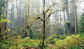
Elliott State Forest is a state forest in Coos and Douglas counties of the U.S. state of Oregon, between Coos Bay and Reedsport in the Oregon Coast Range. The first state forest established in Oregon, it is named after the state's first state forester Francis Elliott. Trees commonly found in this forest are the Douglas-fir, western hemlock, western redcedar, bigleaf maple, and red alder.

Clatsop State Forest is a state forest in Clatsop and Columbia counties in the U.S. state of Oregon. It is managed by the Astoria District of the Oregon Department of Forestry.

The Little Luckiamute River is a stream in Polk County in the U.S. state of Oregon. It rises in the Central Oregon Coast Range near Fanno Peak and joins the Luckiamute River about 4 miles (6 km) upstream of the Sarah Helmick State Recreation Site southwest of Monmouth.
Black Rock is an unincorporated community and former logging camp in Polk County, Oregon, United States. It is located about three miles west of Falls City, in the Central Oregon Coast Range on the Little Luckiamute River.

The Treat River is a short tributary of the Salmon River in Lincoln County, in the U.S. state of Oregon. It begins in the Siuslaw National Forest in the Central Oregon Coast Range and flows generally northwest. It enters the larger stream between the H. B. Van Duzer Forest State Scenic Corridor along Oregon Route 18 and the unincorporated community of Rose Lodge. It has no named tributaries.

Crump Lake is a shallow lake in the Warner Valley of eastern Lake County, Oregon, United States. The lake covers 7,680 acres (31.1 km2). It is the largest of the Warner Lakes system. The lake is named for pioneer rancher Thomas Crump. Crump Lake is owned by the Oregon Department of State Lands. Much of the land around the lake is administered by the Bureau of Land Management and the United States Fish and Wildlife Service. The lake and the surrounding wetlands support a wide variety of birds and other wildlife. Recreational opportunities on or near Crump Lake include fishing, bird watching, and camping.

The Cline Buttes are mountains with volcanic origins that form three dome-shaped peaks located in Deschutes County in central Oregon. They are some of the eastern foothills of the Cascade Range. Situated on land administered by the Bureau of Land Management, the buttes are flanked on the east and west sides by two separate sections of the Eagle Crest Resort. On the highest summit, there is a Federal Aviation Administration site with an aircraft navigation beacon. The mountains have several hiking trails as well as a number of popular mountain bike routes.
References
- ↑ "State of Oregon: Working Forests - State Forests". www.oregon.gov.
- ↑ "Department of State Lands : Elliott State Forest : Land : State of Oregon". www.oregon.gov.
- ↑ "Feature Detail Report". GNIS. USGS. Retrieved 2008-08-19.
- ↑ Paul M. Dunn Papers, 1916-1988 Archived 2010-06-03 at the Wayback Machine
- ↑ OSU College of Forestry: Significant Dates in School's History
- ↑ U.S. Geological Survey Geographic Names Information System: George T Gerlinger State Experimental Forest
- ↑ U.S. Geological Survey Geographic Names Information System: McDonald State Forest
- ↑ Patricia Jenkins Heppe (18 November 1982). "The Use of Suburban Habitats by Columbian Black-tailed Deer" (PDF). Masters Thesis. pp. 17 ("5"). Retrieved 2008-08-19.
- ↑ McDonald-Dunn Forest Archived 2008-12-02 at the Wayback Machine
- ↑ Jan Bannan (2002). Oregon State Parks, A Complete Recreation Guide. The Mountaineers. p. 90. ISBN 978-0-89886-794-7 . Retrieved 2008-08-19.