West Salem, Oregon | |
|---|---|
Neighborhood | |
 Old commercial district on Edgewater Street | |
 Interactive map of West Salem, Oregon | |
| Coordinates: 44°56′20″N123°03′39″W / 44.93889°N 123.06083°W | |
| Country | United States |
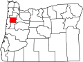
| State | Oregon |
| County | Polk County |
| City | Salem |
| Elevation | 144 ft (44 m) |
| Population (2020) | |
• Total | 34,148 |
| Time zone | Pacific |
| ZIP code | 97304 |
| Area codes | 503 and 971 |
| GNIS feature ID | 1163343 [1] |
West Salem is a neighborhood in Salem, Oregon, United States, located in the far northwest part of the city. West Salem is the only part of the city that is located in Polk County. The neighborhood is separated from the rest of Salem by the Willamette River, which serves as West Salem's southeast border. The business districts of West Salem are located on Edgewater Street and Wallace Road. As of 2020 [update] , the portion of Salem within Polk County had a population of 34,148.