Grand Ronde, Oregon

Last updated

Grand Ronde, Oregon
Grand Ronde, Oregon.jpg
The Grand Ronde Public Library
Polk County Oregon Incorporated and Unincorporated areas Grand Ronde Highlighted.svg
Location of Grand Ronde within Polk County, Oregon
Coordinates: 45°04′25″N123°37′16″W / 45.07361°N 123.62111°W / 45.07361; -123.62111
Country United States
State Oregon
County Polk & Yamhill
Area
[1]
  Total19.20 sq mi (49.72 km2)
  Land19.20 sq mi (49.72 km2)
  Water0.00 sq mi (0.00 km2)
Elevation
[2]
338 ft (103 m)
Population
 (2020) [3]
  Total2,010
  Density104.70/sq mi (40.43/km2)
Time zone UTC-8 (Pacific (PST))
  Summer (DST) UTC-7 (PDT)
ZIP code
97347
Area code 503
FIPS code 41-30300 [4]
GNIS feature ID2408316 [2]

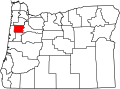
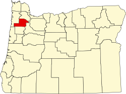
Grand Ronde is a census-designated place (CDP) and unincorporated community in Polk and Yamhill counties, Oregon, United States. [2] Historically noted as a village in Polk County, the sphere of influence and community is in both Polk and Yamhill counties. [5] The name of the community is a variation of the French Grande Ronde or "Grand Round" which could be about the large round-up of Native American peoples in the area who were settled on what was known as the Grand Ronde Indian Reservation, or possibly referencing the shape of the valley in which the community is located. [5] As of the census of 2010, there were 1,661 people in 658 households residing in Grand Ronde. [6] It is part of the Salem Metropolitan Statistical Area.

Contents

History

On January 4, 1855, a treaty between the various bands of Kalapuyans and Oregon Superintendent of Indian Affairs Joel Palmer was effected, calling for the various bands to remove to a reservation to be established by the government. For this purpose the Grand Ronde Indian Reservation was opened on June 30, 1857, covering 60,000 acres in northwest Polk and southwest Yamhill counties. A census conducted in 1870 reported only 47 Yamels and 36 Luckiamutes on the reservation; in 1910 the Yamels numbered five, the Luckiamutes, eight. By the end of the historic period, the Kalapuyan people no longer existed as a distinct cultural-racial entity. [7]

According to a Cultural Resources Report from the Oregon Department of Transportation, [ citation needed ] the town of Grand Ronde began as "New Grand Ronde" in about 1908 when the first large groups of Indians were leaving the Reservation and establishing their own farms and ranches under the Dawes Act. In 1921, International Harvester laid out a town site. In 1922 the company built nine miles of track from Willamina to Grand Ronde, calling it the Willamina and Grand Ronde Railroad. The short railroad connected the area with the Southern Pacific railroad at Willamina. The railroad helped the timber industry to flourish and made it possible for lumber mills to grow and dominate the economy of the area. Grand Ronde became the center of support services for mill workers and a train depot, store, hotel, movie theater, diner, gas station, bank, post office, church, and a small residential area were built.

The Spaulding-Miami Lumber Company created and owned the town proper in the early 1920s as part of its logging operations. [8] A rail line and several related buildings were built as well as a hotel. A spur of the railroad headed south out of the town across Rock Creek and into the coastal range. [9] Electricity was brought to the town in 1922 according to the Lumber World Review, Volume 42, published in January 1922. [8]

The Confederated Tribes of the Grand Ronde Community own and operate Spirit Mountain Casino, which is a major local employer. In 1997, the casino created the Spirit Mountain Community Fund, which supports several charities both within Polk County and throughout Oregon from the casino's gambling revenue. In January 2010, the CDP was expanded to include areas located inside Yamhill County. [10]

There was quite a bit of communication about the name of the town going back and forth between the Oregon Geographic Board and the United States Geographic Board starting in 1919. Initially, the State was calling for the town to be officially named "Grande Ronde" using the typical French spelling, (possibly due to the history of French Canadian fur trapping in the area via the Hudson Bay Company), though through research and correspondence lasting into the early 1940s, the name as spelled currently, "Grand Ronde", was made official. [5]

Geography

According to the United States Census Bureau, the CDP has a total area of 0.6 square miles (1.6 km2), all of it land. [11] The community is located 344 feet (105 m) above sea-level. [2]

This area is considered to be in Eco Sub-Region 3c by data [12] published by Oregon State University and is described as "The nearly level to undulating Prairie Terraces ecoregion includes all of the terraces of the Willamette River upstream of the Portland/Vancouver Basin (3a). Ecoregion 3c is drained by low-gradient, meandering streams and rivers. Its broad fluvial terraces once supported oak savanna and prairies that were maintained by burning; wetter areas supported Oregon ash and black cottonwood. Today, only relict native prairie remains. The poorly drained soils derived from glacio-lacustrine deposits are extensively farmed for grass seed and small grains. Grasses tolerate poor drainage and poor rooting conditions better than other crops. In addition to agriculture, the Prairie Terraces also experience the bulk of urban expansion"

Climate

The overall climate of Grand Ronde can be considered a temperate climate.[ citation needed ] This is characteristic of areas with wet, mild winters and warm, dry summers.

Grand Ronde is located in the Oregon Coast Range, which is one of the wettest places in the contiguous United States. Precipitation data has been gathered in Grand Ronde sporadically since 1910 and continuously since 1948. [13] That data shows the average annual precipitation from 1971 to 2000 to be 101.01 inches (2,566 mm).

In contrast, rainfall in Willamina, approximately 7 miles (11 km) away, is 50.90 inches (1,293 mm). [14] Additionally, precipitation at Laurel Mountain, located about 9 miles (14 km) to the southeast and further up in the Oregon Coast Range, comes down at an average rate of 121.48 inches (3,086 mm) per year. [15]

Demographics

Historical population
CensusPop.Note
2020 2,010
U.S. Decennial Census [16] [3]

As of the census of 2010, there were 1,661 people in 658 households residing in Grand Ronde [17]

As of the census [4] of 2000, there were 271 people, 113 households, and 61 families residing in the CDP. The population density was 413.8 people per square mile (159.8 people/km2). There were 140 housing units at an average density of 213.8 per square mile (82.5/km2). The racial makeup of the CDP was 67.16% White, 25.83% Native American, 2.95% Asian, 0.37% from other races, and 3.69% from two or more races. Hispanic or Latino of any race were 1.11% of the population.

There were 113 households, out of which 29.2% had children under the age of 18 living with them, 31.0% were married couples living together, 14.2% had a female householder with no husband present, and 46.0% were non-families. 36.3% of all households were made up of individuals, and 6.2% had someone living alone who was 65 years of age or older. The average household size was 2.40 and the average family size was 3.07.

In the CDP, the population was spread out, with 28.8% under the age of 18, 8.5% from 18 to 24, 29.9% from 25 to 44, 25.8% from 45 to 64, and 7.0% who were 65 years of age or older. The median age was 36 years. For every 100 females, there were 111.7 males. For every 100 females age 18 and over, there were 107.5 males.

The median income for a household in the CDP was $23,929, and the median income for a family was $20,139. Males had a median income of $19,722 versus $21,583 for females. The per capita income for the CDP was $13,538. None of the families and 19.1% of the population were living below the poverty line.

Related Research Articles

<span class="mw-page-title-main">Yamhill County, Oregon</span> County in Oregon, United States

Yamhill County is one of the 36 counties in the U.S. state of Oregon. As of the 2020 census, the population was 107,722. The county seat is McMinnville. Yamhill County was named after the Yamhelas, members of the Kalapuya Tribe.

<span class="mw-page-title-main">Polk County, Oregon</span> County in Oregon, United States

Polk County is one of the 36 counties in the U.S. state of Oregon. As of the 2020 census, the population was 87,433. The county seat is Dallas. The county is named for James Knox Polk, the 11th president of the United States.

<span class="mw-page-title-main">Highland City, Florida</span> Census-designated place in Florida, United States

Highland City is a census-designated place (CDP) in Polk County, Florida, United States. The population was 2,051 at the 2000 census. It is part of the Lakeland–Winter Haven Metropolitan Statistical Area.

<span class="mw-page-title-main">Falls City, Oregon</span> City in Oregon, United States

Falls City is a city in Polk County, Oregon, United States. The population was 1,051 at the 2020 census. It is part of the Salem Metropolitan Statistical Area.

<span class="mw-page-title-main">Rickreall, Oregon</span> Unincorporated community in the state of Oregon, United States

Rickreall is an unincorporated community in Polk County, Oregon, United States. For statistical purposes, the United States Census Bureau has defined Rickreall as a census-designated place (CDP). The census definition of the area may not precisely correspond to local understanding of the area with the same name. The population of the CDP was 76 at the 2020 census. Rickreall is part of the Salem Metropolitan Statistical Area. Rickreall Creek runs along the community's southern edge.

<span class="mw-page-title-main">Cayuse, Oregon</span> Unincorporated community in the state of Oregon, United States

Cayuse is a census-designated place (CDP) and unincorporated community in Umatilla County, Oregon, United States, located 11 miles (18 km) east of Pendleton on the Umatilla Indian Reservation. The population was 59 at the 2000 census. It is part of the Pendleton–Hermiston Micropolitan Statistical Area.

<span class="mw-page-title-main">Sheridan, Oregon</span> City in Oregon, United States

Sheridan is a city in Yamhill County, Oregon, United States. Platted in the 1860s when it received a post office, the city was incorporated in 1880. A major fire burned much of the city in 1913, and a flood covered much of the city in 1964. The population of the city as of the 2020 Census was 6,100, a decrease from 6,127 at the 2010 census.

<span class="mw-page-title-main">Willamina, Oregon</span> City in Oregon, United States

Willamina is a city in Polk and Yamhill Counties in the U.S. state of Oregon. The population was 2,239 at the 2020 census.

<span class="mw-page-title-main">South Yamhill River</span> River in Oregon, United States

The South Yamhill River is a tributary of the Yamhill River, approximately 60 miles (97 km) long, in northwest Oregon in the United States. It drains an area of the Northern Oregon Coast Range, as well as part of the Willamette Valley west of the Willamette River.

<span class="mw-page-title-main">Treaty with the Kalapuya, etc.</span> 1855 treaty between the United States and Native Americans

The Treaty with the Kalapuya, etc., also known as the Kalapuya Treaty or the Treaty of Dayton, was an 1855 treaty between the United States and the bands of the Kalapuya tribe, the Molala tribe, the Clackamas, and several others in the Oregon Territory. In it the tribes were forced to cede land in exchange for promised permanent reservation, annuities, supplies, educational, vocational, health services, and protection from ongoing violence from American settlers. The treaty effectively gave over the entirety of the Willamette Valley to the United States and removed indigenous groups who had resided in the area for over 10,000 years. The treaty was signed on January 22, 1855, in Dayton, Oregon, ratified on March 3, 1855, and proclaimed on April 10, 1855.

<span class="mw-page-title-main">Kalapuya</span> Native American tribe, native of the Willamette Valley, modern-day Oregon

The Kalapuya are a Native American people, which had eight independent groups speaking three mutually intelligible dialects. The Kalapuya tribes' traditional homelands were the Willamette Valley of present-day western Oregon in the United States, an area bounded by the Cascade Range to the east, the Oregon Coast Range at the west, the Columbia River at the north, to the Calapooya Mountains of the Umpqua River at the south.

<span class="mw-page-title-main">Atfalati</span> Tribe of Native Americans of the Tualatin Valley, Oregon

The AtfalatiIPA:[aˈtɸalati], also known as the Tualatin or Wapato Lake Indians are a tribe of the Kalapuya Native Americans who originally inhabited and continue to steward some 24 villages on the Tualatin Plains in the northwest part of the U.S. state of Oregon; the Atfalati also live in the hills around Forest Grove, along Wapato Lake and the north fork of the Yamhill River, and into areas of Southern Portland.

<span class="mw-page-title-main">Oregon Route 18</span> Highway in Oregon, United States

Oregon Route 18 is a state highway that runs between the Oregon Coast, near Lincoln City, and Newberg. OR 18 traverses the Salmon River Highway No. 39 of the Oregon state highway system, named after the river alongside its westernmost segments.

<span class="mw-page-title-main">Confederated Tribes of the Grand Ronde Community of Oregon</span> Indian tribes in Oregon, United States

The Confederated Tribes of the Grand Ronde Community of Oregon (CTGR) consists of twenty-seven Native American tribes with long historical ties to present-day western Oregon between the western boundary of the Oregon Coast and the eastern boundary of the Cascade Range, and the northern boundary of southwestern Washington and the southern boundary of northern California. The community has an 11,288-acre (45.7 km2) Indian reservation, the Grand Ronde Indian Reservation, which was established in 1856 in Yamhill and Polk counties.

<span class="mw-page-title-main">Grand Ronde Community</span> Indian reservation in Oregon, US

The Grand Ronde Community is an Indian reservation located on several non-contiguous sections of land in southwestern Yamhill County and northwestern Polk County, Oregon, United States, about 18 miles (29 km) east of Lincoln City, near the community of Grand Ronde. In the mid-19th century, the United States government forced various tribes and bands from all parts of Western Oregon to be removed from their homes and placed on this reservation. It is governed by the Confederated Tribes of the Grand Ronde Community of Oregon. The reservation has a land area of 16.384 square miles (42.43 km2). In the 2000 census recorded a population of 55 persons. Most members of the tribe live elsewhere in order to find work.

<span class="mw-page-title-main">Fort Yamhill</span>

Fort Yamhill was an American military fortification in the state of Oregon. Built in 1856 in the Oregon Territory, it remained an active post until 1866. The Army outpost was used to provide a presence next to the Grand Ronde Agency Coastal Reservation. Several officers stationed at the United States Army post prior to the American Civil War would later serve as generals in that war.

Valley Junction is an unincorporated community in Polk County, Oregon, United States. It is located at the junction of Oregon Route 18 and Oregon Route 22, on the South Yamhill River east of Grand Ronde. A now-abandoned section of the Willamina and Grand Ronde Railway short line passed through Valley Junction. The Fort Yamhill State Heritage Area and Spirit Mountain Casino are nearby.

<span class="mw-page-title-main">Salem Metropolitan Statistical Area</span> Metropolitan statistical area in Oregon, United States

The Salem Metropolitan Statistical Area (MSA), as defined by the United States Census Bureau, is a Metropolitan Statistical Area consisting of two counties in western Oregon, Marion and Polk. The principal city is Salem, the state capital, which has a population of 175,535. The Salem MSA had a population of 433,353 at the 2020 census. In 2010, there were 390,738 people living in the Salem MSA. In 2000, the MSA had a population of 347,214, and had a population of 278,024 according to the 1990 census.

<span class="mw-page-title-main">Chehalem Creek</span> River in Oregon, United States

Chehalem Creek is a tributary of the Willamette River in Yamhill County in the U.S. state of Oregon. It drains a watershed of 43,400 acres (176 km2), about 68 square miles. Its headwaters rise on the eastern slope of the Northern Oregon Coast Range above Larsen Reservoir 6 miles (10 km) southeast of Gaston and discharge into the Willamette near Newberg. The word "Chehalem" is a corruption of the Atfalati Indian word "'Chahelim'", a name given in 1877 to one of the bands of Atfalati.

Fort Hill is an unincorporated community in Polk and Yamhill counties in Oregon, United States. It is located about a mile east of Spirit Mountain Casino on Oregon Route 22 near the South Yamhill River. For statistical purposes, the United States Census Bureau has defined Fort Hill as a census-designated place (CDP). The census definition of the area may not precisely correspond to local understanding of the area with the same name. The hill of the same name, located just east of Valley Junction, was the site of a blockhouse built by settlers in 1855–1856. The blockhouse became part of Fort Yamhill, and was later moved to Grand Ronde Agency and is now located in Dayton.

References

  1. "ArcGIS REST Services Directory". United States Census Bureau. Retrieved October 12, 2022.
  2. 1 2 3 4 U.S. Geological Survey Geographic Names Information System: Grand Ronde, Oregon
  3. 1 2 "Census Population API". United States Census Bureau. Retrieved October 12, 2022.
  4. 1 2 "U.S. Census website". United States Census Bureau . Retrieved January 31, 2008.
  5. 1 2 3 "USGS Geographic Names Information System". USGS Geographic Names Information System. USGS.
  6. "2010 Census Interactive Population Search".
  7. "Polk County, Oregon - An Historic Context" (PDF).
  8. 1 2 "Lumber World Review Volume 42". 1922.
  9. "Willamina & Grand Ronde Railway".
  10. "Geographic Change Notes for Oregon". United States Census Bureau. Retrieved March 7, 2014.
  11. "US Gazetteer files: 2010, 2000, and 1990". United States Census Bureau. February 12, 2011. Retrieved April 23, 2011.
  12. "Ecoregions of Oregon" (PDF). Oregon State University. Retrieved August 31, 2016.
  13. Grand Ronde Period of Record.
  14. Willamina Precipitation
  15. Laurel Mountain Precipitation
  16. "Census of Population and Housing". Census.gov. Retrieved June 4, 2016.
  17. "2010 Census Interactive Population Search".