Cove Orchard | |
|---|---|
 Pentecostal Church in Cove Orchard | |
 Cove Orchard Location within the state of Oregon  Cove Orchard Cove Orchard (the United States) | |
| Coordinates: 45°22′30″N123°09′17″W / 45.37500°N 123.15472°W | |
| Country | United States |
| State | Oregon |
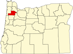
| County | Yamhill |
| Elevation | 259 ft (79 m) |
| Time zone | UTC-8 (Pacific (PST)) |
| • Summer (DST) | UTC-7 (PDT) |
| GNIS feature ID | 1162920 [1] |
Cove Orchard is an unincorporated community in Yamhill County, in the U.S. state of Oregon. It is along Oregon Route 47 between Yamhill and Gaston in the northern part of the county. [2]
According to Oregon Geographic Names, F. C. Graham of Portland platted the community and chose the name. Cove Orchard had a post office from 1912 to 1953. [3]