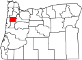
Ellendale, Oregon

Last updated
Field and barn Barn and field - Ellendale Oregon.jpg
Field and barn

Ellendale is a ghost town in Polk County, Oregon, United States, about two and a half miles west of Dallas. It was the first White settlement in present-day Polk County. [1] The community's name changed over the years, with the first post office in Polk County being opened in this locality as "O'Neils Mills" in 1850. [1] The post office was renamed "Nesmiths" (Or "Nesmiths Mills") in 1850 and discontinued in 1852. [2] The community was eventually renamed Ellendale.

Contents

History

James A. O'Neil built the county's first gristmill at the confluence of La Creole Creek (now Rickreall Creek) and O'Neils Creek over the winter of 1844–1845. [1] The site was chosen for its proximity to water power for the mill, timber and a rock quarry that could provide millstones. [1] The most important factor for siting the mill at this location, however, was its proximity to the Siskiyou Trail.[ citation needed ] A community formed around the mill as it was one of only two gristmills on the west side of the Willamette River at the time and it served settlers from as far away as northern Yamhill County and south as far as Linn and Benton counties. [1] O'Neil offered lodging and a store for people who had made the long trip to his mill. [1] Miners on their way to the California Gold Rush would also stop at the community for flour for the journey. [1]

In 1849, a flood destroyed the mill and O'Neil sold his interest to James W. Nesmith and Henry Owen, who rebuilt it as "Nesmith's Mill". [1] In 1856 the mill was sold again to Hudson & Company [2] but in November 1857 it was closed because more mills had been built in the area and it was no longer needed. [1] In 1863, the mill site, water power and land were sold to judge Reuben P. Boise, whose donation land claim adjoined the property. [1] La Creole Creek was renamed "Ellen's Dale" after Boise's wife, and soon both the creek and the community were renamed "Ellendale". [1]

In 1860, one of Oregon's earliest [1] woolen mills was started in Ellendale by Boise and several others, who had bought and converted a sawmill that had been built upstream from the gristmill in 1854. [3] The sawmill had the only planer in that part of Oregon, most boards still being hand-dressed at the time. [3] In 1870 Boise's mill burned down. [4] Nothing is left at the site today.[ citation needed ]

The Pumping Station Bridge in the Ellendale area was added to the National Register of Historic Places in 1979, [5] however, it collapsed in 1987 and was removed from the list. [6]

See also

Related Research Articles

Polk County, Oregon U.S. county in Oregon

Polk County is one of the 36 counties in the U.S. state of Oregon. As of the 2010 census, the population was 75,403, making it the least populous county in the Willamette Valley. The county seat is Dallas. The county is named for James Knox Polk, the 11th president of the United States.

Eola, Oregon Census-designated place in Oregon, United States

Eola is an unincorporated community in Polk County, Oregon, United States four miles west of Salem on Oregon Route 22 at the confluence of Rickreall Creek and the Willamette River.

Willamina, Oregon City in Oregon, United States

Willamina is a city in Polk and Yamhill Counties in the U.S. state of Oregon. The population was 2,025 at the 2010 census.

James Nesmith American judge

James Willis Nesmith was an American politician and lawyer from Oregon. Born in New Brunswick to American parents, he grew up in New Hampshire and Maine. A Democrat, he moved to Oregon Country in 1843 where he entered politics as a judge, a legislator in the Provisional Government of Oregon, a United States Marshal, and after statehood a United States Senator and Representative.

Valsetz, Oregon

Valsetz was an unincorporated community and timber company town in Polk County, Oregon, United States, west of Falls City in the Central Oregon Coast Range. It no longer exists.

Kernville, Oregon

Kernville is an unincorporated community in Lincoln County, Oregon, United States. It is located near the intersection of U.S. Route 101 and Oregon Route 229, where the Siletz River enters Siletz Bay. There are two communities, known as "old" and "new" Kernville, in close proximity. Old Kernville is considered a ghost town.

Reuben P. Boise American judge

Reuben Patrick Boise was an American attorney, judge and politician in the Oregon Territory and the early years of the state of Oregon. A native of Massachusetts, he immigrated to Oregon in 1850, where he would twice serve on the Oregon Supreme Court for a total of 16 years, with three stints as chief justice. Early in his legal career, he worked as a district attorney.

John Phillips House United States historic place

John Phillips House is a historic 1853 vernacular Greek Revival house in the Spring Valley area of Polk County, Oregon, United States. It was built for pioneer John Phillips, who came to Oregon via the Oregon Trail in 1845. He finished his journey to Oregon on the Meek Cutoff as part of Stephen Meek's "lost wagon train".

Zena, Oregon

Zena is a former community approximately 10 miles northwest of Salem, Oregon, United States, in Polk County. The community was established in 1858, originally called "Spring Valley". It was renamed "Zena" by Daniel Jackson Cooper and his brother Jacob Calvin Cooper, pioneers from Missouri. In 1866 they built a store and obtained the post office there, renaming the community in tribute to their wives, ArvazenaSpilman Cooper and MelzenaSpilman Cooper. Zena is home to the historic Spring Valley Presbyterian Church. The 1992 novel The Road to Zena by Joel Redon is set in Zena and nearby Lincoln.

Shelton Ditch (Oregon)

Shelton Ditch is an artificial canal in Marion County, Oregon, United States. Built in the mid-19th century, it originates from Mill Creek east of Airport Road in Salem, passes through a corner of the Salem main Post Office property, and along the southern edge of downtown Salem. Shelton Ditch passes by the north side of Pringle Park before emptying into Pringle Creek. After the Mill Race joins Pringle Creek near Salem's city hall, Pringle Creek passes under the Boise Cascade building and empties into the Willamette River next to Riverfront Park across from Minto-Brown Island Park.

John Daniel Boon was an American merchant and politician in what became the state of Oregon. A native of Ohio, he immigrated to the Oregon Country where he farmed and later operated a general store. A Democrat, he served as the Treasurer of the Oregon Territory and was the first Oregon State Treasurer. His former home and store are both listed on the National Register of Historic Places.

Rickreall Creek Stream in Polk County, Oregon, United States

Rickreall Creek is a stream in Polk County, Oregon, United States rising on Laurel Mountain in the Central Oregon Coast Range and draining into the Willamette River west of Salem at Eola. The creek passes through the city of Dallas and the unincorporated community of Rickreall. The origin of the name is under some dispute, but one theory says that "Rickreall" is a corruption of "La Creole", La Creole River being another name for the stream.

Salt Creek is an unincorporated historic community in Polk County, Oregon, United States on Oregon Route 22 about six miles northwest of Dallas. As an early European American settlement of the Oregon Country, the cemetery at Salt Creek has graves dating back to 1847. Salt Creek, a tributary of the South Yamhill River, was named by early settlers for the salt licks found on its banks. The Salt Creek post office, named after the creek, was established in 1852 and closed in 1903. James B. Riggs, who arrived in Oregon via the Oregon Trail and the Meek Cutoff in 1845, was the first postmaster. Riggs previously been the first postmaster of Yoncalla, followed by Jesse Applegate.

Dolph, Oregon Unincorporated community in Oregon, United States

Dolph is an unincorporated community in Tillamook County, Oregon, United States, near the Yamhill County line. It lies at the junction of Oregon Route 22 and Oregon Route 130 between Grande Ronde and Hebo, on the Little Nestucca River. It is within the Siuslaw National Forest in the Northern Oregon Coast Range.

Brunks Corner, Oregon

Brunks Corner is an unincorporated community in Polk County, Oregon, United States, at the junction of Oregon Route 22 and Oak Grove Road, near the terminus of Oregon Route 51.

Motor, Iowa United States historic place

Motor is an unincorporated community in Clayton County, Iowa, United States. The townsite is also a nationally recognized historic district listed as a historic site on the National Register of Historic Places in 1977.

Black Rock is an unincorporated community and former logging camp in Polk County, Oregon, United States. It is located about three miles west of Falls City, in the Central Oregon Coast Range on the Little Luckiamute River.

Suver is an unincorporated community in Polk County, Oregon, United States. It is located about 10 miles north of Corvallis and about 8 miles south of Monmouth, 1 mile east of Oregon Route 99W.

Derry is an unincorporated locale in Polk County, Oregon, United States. It is located about 10 miles west of Salem and one mile east of Rickreall.

Pumping Station Bridge

The Pumping Station Bridge was a covered bridge spanning Rickreall Creek, near Ellendale, Oregon, in the United States. Before collapsing, it was listed on the National Register of Historic Places (NRHP). The bridge was removed from the NRHP on May 18, 1987.

References

  1. 1 2 3 4 5 6 7 8 9 10 11 12 Mack, Lynn (October 15, 2006). "Mill was county's first community". Statesman Journal . pp. 5C.
  2. 1 2 McArthur, Lewis A.; Lewis L. McArthur (2003) [1928]. Oregon Geographic Names (Seventh ed.). Portland, Oregon: Oregon Historical Society Press. p. 327. ISBN   0-87595-277-1.
  3. 1 2 "Polk County Place Names". Archived from the original on 2007-09-27. Retrieved 2007-03-26.
  4. Oregon Department of Justice Archived 2008-12-06 at the Wayback Machine
  5. Oregon National Register List
  6. Salem Public Library Oregon Historic Photograph Collections

Coordinates: 44°55′48″N123°21′18″W / 44.93°N 123.355°W / 44.93; -123.355