List of ghost towns in Oregon

Last updated

According to several historians, the U.S. state of Oregon contains over 200 ghost towns. [1] [2] Professor and historian Stephen Arndt has counted a total of 256 ghost towns in the state, some well known, others "really obscure." [3] The high number of ghost towns and former communities in the state is largely due to its frontier history and the influx of pioneers who emerged in the area during the 19th century. [2] Many of the ghost towns in Oregon were once mining or lumber camps that were abandoned after their respective industries became unprosperous. [2]

Contents

This list includes towns and communities that have been described as ghost towns, and may be abandoned, unpopulated, or have populations that have declined to significantly small numbers; [lower-alpha 1] some may still be classified as unincorporated communities. As of 2019, some of the towns included may have small residual populations; others may retain few physical remnants of their existence, but are broadly considered ghost towns under prevailing definitions in the United States. [lower-alpha 2]

Classifications

Many historians and enthusiasts of ghost towns use a classification system to distinguish ghost towns by types. This classification, which breaks towns into numerous different types, was established by photographer Gary Speck, and has been adapted here. [6]

ClassDistinguishing features [6]
ANo apparent remains of former settlement exist. In some cases, site may be marked and/or contain a cemetery.
B Dilapidated buildings and/or remnants of buildings present, along with rubble and debris.
CNo population, but structures are still mostly intact; may be actively preserved.
DArea is sparsely populated and may boast period structures (of varied physical condition) and/or a cemetery, but no operative town proper.
EHas retained a small population and historic structures, though typically not as substantive as in its heyday.

Towns

Andrews, 2009 Andrews School (Harney County, Oregon scenic images) (harDA0166).jpg
Andrews, 2009
Antelope, 2009 Antelope Oregon post office.jpg
Antelope, 2009
Aurora, 2008 Aurora Museum (Marion County, Oregon scenic images) (marDA0083).jpg
Aurora, 2008
Bayocean, c. 1911 Bayohotelviewa.jpg
Bayocean, c. 1911
Bridal Veil, 1894 Bridal-Veil-School-1894.jpg
Bridal Veil, 1894
Cascadia, 1925 Hotel in Cascadia Oregon 1925.jpg
Cascadia, 1925
Cornucopia, 1913 Cornucopia, Oregon (1913).jpg
Cornucopia, 1913
Flora, 2009 Flora Church (Wallowa County, Oregon scenic images) (walDA0064).jpg
Flora, 2009
Golden, 2009 Golden church 3 - Golden Oregon.jpg
Golden, 2009
Kent, 2006 Old Grain Elevator (Sherman County, Oregon scenic images) (sheD0049).jpg
Kent, 2006
Latourell, 2016 The Old Latourell House (27787913785).jpg
Latourell, 2016
Lime building interior, 2012 Lime, Oregon (8112049437).jpg
Lime building interior, 2012
Millican, 2011 Millican, Oregon.jpg
Millican, 2011
Ordnance, 2011 Ordnance, Oregon.jpg
Ordnance, 2011
Richmond, 2011 Church building in Richmond, Oregon.jpg
Richmond, 2011
Waldo cemetery, 2013 Waldo Cemetery - Cave Junction Oregon.jpg
Waldo cemetery, 2013
Whitney, c. 1900 Post office in Whitney, Oregon.jpg
Whitney, c. 1900
Zena, 2007 ZenaChurch&Cem.JPG
Zena, 2007
Zumwalt, 2009 Zumwalt Prairie (Wallowa County, Oregon scenic images) (walDA0139).jpg
Zumwalt, 2009
TownEst.Dis. Est.CountyClassNotesRefs.
Airlie 18821927 Polk DThe railroad from Airlie north to Monmouth was abandoned in 1927, but the community survived, anchored by a general store and gas station.. [7] [8]
Ajax 1888Unknown Gilliam B [9]
Andrews 1880 Harney CWhen it burned down in 1996, the community became a ghost town. In 2011, artist John Simpkins moved into the abandoned school at Andrews. He set up residence in ... [10]
Anlauf 19011946 Douglas DThe home was sold in the 1960s and then torn down when the freeway was built. Clarence, who was also a logger, and Grace Anlauf, the parents of Clay and Pat ... [11]
Antelope 1871 Wasco DAs more Rajneeshees moved to Antelope, more of the town's original residents sold their lots and left. The old-timers panicked, and held a vote to disincorporate [12]
Apiary 1889 Columbia DTwo principal roads to Apiary are being completed within the next year, and a part of the old one abandoned. The Cloverdale road, known as the market road ... [13]
Ashwood 1870 (c.) Jefferson C [14] [15]
Auburn 18611940s Baker BSite of first gold rush in eastern Oregon. [16]
Aurora 1858January 22, 1883 Marion EFounded as Aurora Colony; has residual population. [17] [18]
Austin 1888 Grant B [19]
Ballston 1878 Polk DBallston was founded in 1878 by pioneer Isaac Ball on his donation land claim. Ball and his family immigrated from England, and arrived in Oregon via the Oregon Trail in 1848. Ball named the town "Ballsville", and it had a post office of the same name. The name of the post office was changed to Ballston in 1880. [20]
Bayocean 1906 Tillamook ADestroyed by coastal erosion; last residence collapsed into sea in 1960. [21]
Beaver Hill 1896 Coos A [22]
Bethel 1865 Polk D [23]
Blalock 1879 Gilliam AInundated by the John Day Dam in 1968. [24]
Blitzen 1915 (c.) Harney B [25]
Bohemia 1893 Lane B [26]
Boston 1858 Linn DPartly resected and subsumed by Shedd in 1899. [27]
Bourne 1895 Baker B [28]
Boyd 1861 Wasco CRepurposed as farmland. [29]
Bridal Veil 1886 Multnomah D [30]
Buena Vista 1850 Polk D [31]
Bull Run 1893 Clackamas DOriginally named Unavilla. Site of Bull Run Hydroelectric Powerhouse, abandoned in 2008. [32] [33]
Buncom 1851 Jackson C [34]
Burlington 1854 Linn AAbandoned after 1874. [35]
Butteville 1840 Marion D [36] [37]
Cabell City 1880s Grant BMining encampment; also contains cemetery. [38]
Cascadia 1898 (c.) Linn C [39]
Champoeg 1841 Marion D [40]
Cherryville 1884 Clackamas DRemaining cemetery designated local historic site in 2014. [41] [42]
Chitwood 1887 Lincoln D [43]
Clifton 1874 Clatsop D [44]
Copper 1924 Jackson ARemaining buildings demolished and/or flooded to make way for Applegate Lake. [45]
Copper 1904 Wallowa Un­known [46]
Copperfield 1898 Baker A [47]
Cornucopia 1884 Baker C [48]
Danner 1863 Malheur C [49]
Dee 1906 Hood River B [50]
DeMoss 1897 Sherman C [51]
Divide 1900 Lane A [52]
Dufur 1893 Wasco E [53]
Early 1902 Sherman A [51] [54]
Elk City 1868 Lincoln DOriginally named Newton. [55]
Ellendale 1850 Polk D [56]
Eola 1844 Polk D [57]
Erskine 1882 Sherman A [51]
Eureka 1892 Baker B [58]
Eureka Bar 1903 Wallowa BAs of 2015, only foundations of buildings remain. [59]
Fargher 1878 (c.) Wasco D [51] [60]
Flora 1897 Wallowa D [50]
Fort Clatsop 1804 Clatsop C [61]
Fort Stevens 1863 Clatsop C [62]
Frankport 1850s Curry A [63]
Friend 1903 Wasco C [64]
Galena 1865 Grant C [65]
Geneva 1910 Jefferson A [66]
Golden 1840 (c.) Josephine C [67]
Gordon 1896 Sherman A [51] [68]
Gorman 1892 Sherman A [51]
Granite 1867 Grant D [69] [70]
Greenback 1897 Josephine B [71]
Greenhorn 1897 Baker, Grant C [72]
Greenville 1871 Washington D [73]
Hardman 1881 Morrow D [74]
Horse Heaven 1933 Jefferson B [75]
Hoskins 1856 Benton AFounded at site of Fort Hoskins. [76]
Idiotville Un­known Tillamook Un­known
Izee 1889 Grant D [77] [78]
Jawbone Flats 1931 Marion C [79]
Jimtown 1904 Baker D [80]
Kent 1887 Sherman D [81]
Kerby 1884 (c.) Josephine E [82]
Kernville 1896 Lincoln D [83]
Kings Valley 1855 Benton D [84] [85]
Kinton 1894 Washington D [86]
Kinzua 1927 Wheeler A [87]
Klondike 1899 Sherman B [51]
Lamonta 1890 Jefferson AOriginally named Desert. [88]
Latourell 1876 Multnomah D [89]
Lime 1899 Baker BSite of former lime cement plant. [90]
Locust Grove 1895 Sherman B [91]
Lonerock 1881 Gilliam D [92]
Luper 1850 Lane C [93]
McCoy 1879 Polk B [3]
McDonald 1904 Sherman ASite of a former river crossing, only modern ranch buildings remain [51]
McEwen 1891 Baker D [94]
Mabel 1878 Lane C [95] [96]
Malheur City 1863 Malheur AAll wooden structures destroyed in 1957 brushfire, leaving only stone remnants. [97]
Marysville 1848 Benton Subsumed by Corvallis. [98]
Mayville 1884 Gilliam D [99] [100]
Medical Springs 1868 Union DAs of 2014, three buildings remained. [101]
Miller 1860 (c.) Sherman A [51] [102]
Millican 1913 Deschutes D [87]
Mitchell 1873 Wheeler E [103]
Monkland 1886 Sherman A [51]
Narrows 1889 Harney A [104]
Nelson 1880s Baker ALocation of lime cement plant between 1979–1980. [105]
New Era 1876 Clackamas DAlso location of the New Era Spiritual Camp. [106]
Nolin 1860s Umatilla DOriginally named Happy Canyon. [107]
Nonpareil 1882 Douglas D [108]
Orleans 1850 Linn ASignificantly damaged in the Great Flood of 1862. [109]
Ordnance 1943 Umatilla B [110]
Orodell 1867 Union A [111]
Ortley 1911 Wasco A [112]
Paisley 1873 Lake E [113]
Persist 1902 Jackson Un­known [114]
Pinehurst 1878 Jackson DPublic school still operating as of 2017. [115] [116]
Pittsburg 1879 Columbia D [117]
Placer 1885 Josephine D [118]
Pocahontas 1862 Baker A [119]
Pondosa 1927 Union D [120]
Richmond 1899 Wheeler B [121]
Robinette 1898 Baker AInundated by Brownlee Reservoir in 1958. [122]
Rock Point 1852 Jackson COriginal tavern (est. 1864) restored by Del Rio Vineyards in 2001. [123] [124]
Rosebush Sherman A [51]
Rutledge 1884 Sherman A [51]
Saint Joseph 1872 Yamhill D [125]
Sanger 1871 Baker DOriginally named Augusta; renamed Sanger in 1887. [126]
Scottsburg 1850 Douglas DPopulation significantly declined after Great Flood of 1862. [127]
Shaniko 1901 Wasco D [128]
Shelburn 1850 (c.) Linn D [129]
Sherar's Bridge 1860 Sherman A [130]
Southport 1875 (c.) Coos A [131]
Sparta 1872 Baker B [132]
Sterlingville 1854 Jackson A [133] [134]
Sumpter 1889 Baker E [135]
Susanville 1864 Grant B [136]
Thatcher 1895 Washington D [137]
Thornberry 1916 Sherman A [51] [138]
Tiller 1902 Douglas CSold in 2018 to be converted into a resort. [139]
Valsetz 1919 Polk A [140]
Waldo 1852 Josephine A [141]
Wendling 1899 Lane A [142] [143]
Westfall 1870 Malheur BOriginally named Bully. [144] [145]
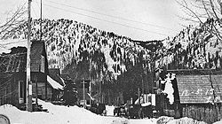
Whitney 1900 Baker C [146]
Yaquina 1887 Lincoln A [147] [148]
Zena 1858 Polk C [149]
Zumwalt 1903 Wallowa B [150]

See also

Notes and references

Notes

  1. According to T. Lindsay Baker, a "ghost town" can refer to either an unpopulated town or a town that, though still populated (albeit in small numbers), has seen a significant decline in population since its establishment. [4]
  2. American author Lambert Florin's preferred definition of a ghost town is simply "a shadowy semblance of a former self," [5] while historian T. Lindsey Baker defines a ghost town as simply "a town for which the reason for being no longer exists." Based on the definitions, Sherman County has the most ghost towns with 14 while Klamath County has the fewest with zero. [4]

Related Research Articles

<span class="mw-page-title-main">Whitney, Oregon</span> Unincorporated community in the state of Oregon, United States

Whitney is an unincorporated community, also considered a ghost town, in Baker County, Oregon, United States, on Oregon Route 7 southwest of Sumpter. It is on the North Fork Burnt River, near the Blue Mountains and Wallowa-Whitman National Forest.

Carpenterville is an unincorporated community in Curry County, Oregon, United States. It is located on the former alignment of U.S. Route 101 known as the Roosevelt Highway, about 16 miles north of Brookings. Carpenterville was the highest point on the former main coastal highway and the area is known for its views.

<span class="mw-page-title-main">Ashwood, Oregon</span> Unincorporated community in Oregon, United States

Ashwood is a ghost town in Jefferson County, Oregon, United States, 32 miles (51 km) northeast of Madras.

Austin is an unincorporated community, considered a ghost town, in Grant County, Oregon, United States. It is located north of Oregon Route 7, near the Middle Fork John Day River in the Malheur National Forest.

Auburn was an unincorporated community in rural Baker County, Oregon, United States, now considered a ghost town. Auburn lies off Oregon Route 7 southwest of Baker City and east of McEwen on the edge of the Blue Mountains.

<span class="mw-page-title-main">Susanville, Oregon</span>

Susanville is an unincorporated community in Grant County, Oregon, United States, in the Blue Mountains about two miles up Elk Creek from Galena. The place was started as a gold mining camp in 1862 or 1864 and is now considered a ghost town.

<span class="mw-page-title-main">Lancaster, Oregon</span> Unincorporated community in the state of Oregon, United States

Lancaster is an unincorporated community in Lane County, Oregon, United States. It is located about two miles south of Harrisburg and two miles north of Junction City, on Oregon Route 99E near the Willamette River.

Prosper is an unincorporated community in Coos County, Oregon, United States. It is about 3 miles (5 km) northwest of Bandon next to the Coquille River. There is no longer a town at the site.

Drew is an unincorporated community in Douglas County, Oregon, United States. It is located about six miles south of Tiller and 21 miles north of Trail on Oregon Route 227, surrounded by the Umpqua National Forest.

Cherryville is an unincorporated community and former town in Clackamas County, Oregon, United States, founded in 1884. It is located approximately 6 miles (9.7 km) east of Sandy on U.S. Route 26, near the route of the Barlow Road.

Hamlet is an unincorporated community in Clatsop County, Oregon, United States. It is located approximately six miles southeast of Necanicum, in the Northern Oregon Coast Range near the confluence of the North Fork Nehalem River and the Little North Fork Nehalem River. It is surrounded by units of the Clatsop State Forest.

Holland is an unincorporated community in Josephine County, Oregon, United States. It is about eight miles southeast of Cave Junction, in the Illinois Valley south of Oregon Route 46.

<span class="mw-page-title-main">Vaughn, Oregon</span> Human settlement in Oregon, United States

Vaughn is an unincorporated community in Lane County, Oregon, United States. It is located about 4 miles (6.4 km) south of Noti in the foothills of the Central Oregon Coast Range near Noti Creek. Author Ralph Friedman described Vaughn as "a mill in the meadows".

Clifton is an unincorporated community in Clatsop County, Oregon, United States. It is located north of U.S. Route 30, about nine miles northwest of Westport on the south bank of the Columbia River. It is on Clifton Channel across from Tenasillahe Island.

Randolph is an unincorporated community in Coos County, Oregon, United States, founded as a "black sand" gold mining boomtown in the 1850s. Although it is considered a ghost town because there are no significant structures left at the site, the USGS classifies Randolph as a populated place. It is on the north bank the Coquille River about 7 miles (11 km) north of Bandon and about 3 miles east of the Pacific Ocean.

Hobsonville is an unincorporated community in Tillamook County, Oregon, United States. Although it is considered a ghost town, it is still classified as a populated place by the United States Geological Survey (USGS). Hobsonville is on the east shore of Tillamook Bay, about 2 miles south of Garibaldi via U.S. Route 101 or about a mile from Garibaldi across Miami Cove.

Fargher is a former community in Sherman County, Oregon, United States. It was founded by Arthur W. Fargher, a native of the Isle of Man, who arrived in Oregon in 1878. The community's rail station was located near the Sherars Bridge. It is contemporarily considered a ghost town.

Gorman is a former community in Sherman County, Oregon, United States, established in 1892. Its post office opened August 25, 1892, and operated for eight years before closing in 1900. Gorman is contemporarily considered a ghost town.

Miller is a former community in Sherman County, Oregon, United States, established circa 1860. It was named for Thomas Jefferson Miller, a settler of the area, also for which Miller Island on the Columbia River takes its name. Miller is contemporarily considered a ghost town.

References

  1. Arndt, Steve (2015). Oregon Ghost Towns A to Z. Portland, Oregon: Stephen Arndt. ISBN   978-0-984-42949-3.
  2. 1 2 3 McBee, Ben (June 23, 2017). "The Vanished Cities". 1859 . Bend, Oregon. OCLC   489252235. Archived from the original on August 19, 2019. Retrieved August 19, 2019.
  3. 1 2 McOmie, Grant (September 5, 2015). "Grant's Getaways: Oregon's Ghost Towns". USA Today . ISSN   0734-7456. Archived from the original on August 19, 2019.
  4. 1 2 Baker 2003, p. 9.
  5. Hall 2010, p. 7.
  6. 1 2 Thomsen 2012, pp. 24–25.
  7. McArthur & McArthur 1974, p. 6.
  8. McArthur & McArthur 2003, p. 11.
  9. McArthur & McArthur 1974, pp. 6–7.
  10. McArthur & McArthur 2003, p. 24.
  11. McArthur & McArthur 1974, p. 18.
  12. Varney, Drew & Drew 2005, pp. 109–112.
  13. Miller 1977, p. 127.
  14. Weis 2006, pp. 16, 18.
  15. Florin 1971, pp. 688–690.
  16. Miller 1977, p. 69.
  17. Florin 1971, pp. 694–696.
  18. Florin 1992, p. 12.
  19. Miller 2017, p. 15.
  20. "Explore Polk County" (PDF). Polk County Itemizer-Observer . May 22, 2009. p. 77C. Archived from the original (PDF) on September 20, 2009.
  21. Wilson, Jason (April 28, 2015). "Bayocean: the American city that disappeared because man ignored nature". The Guardian . London. Archived from the original on April 28, 2015. Retrieved August 19, 2019.
  22. Miller 1977, p. 72.
  23. Florin 1992, p. 13.
  24. McArthur & McArthur 2003, pp. 88–89.
  25. Metzler 1986, p. 61.
  26. Romaine 2015, p. 150.
  27. McArthur & McArthur 2003, pp. 101, 865.
  28. Miller 1977, p. 73.
  29. Varney, Drew & Drew 2005, pp. 100–101.
  30. Boddie, Ken (September 10, 2018). "Where We Live: The ghost town that is Bridal Veil". KOIN . Portland, Oregon. Archived from the original on August 19, 2019. Retrieved August 19, 2019.
  31. Corning 1947, p. 55.
  32. Kullgren, Ian K. (December 4, 2014). "Historic facility that powered Portland's early streetcars to reopen to public". The Oregonian . Portland, Oregon. Archived from the original on August 19, 2019. Retrieved August 19, 2019.
  33. McArthur & McArthur 1974, p. 93.
  34. Friedman 1990, pp. 248–249.
  35. Corning 1947, p. 67.
  36. Florin 1971, pp. 701–703.
  37. Florin 1992, pp. 19–21.
  38. McArthur & McArthur 1991, p. 116.
  39. McArthur & McArthur 1974, p. 137.
  40. Florin 1992, pp. 28–29.
  41. Friedman 1990, p. 621.
  42. Wray, Kylie (June 11, 2014). "Historic Cherryville Cemetery receives a stone marker". Portland Tribune . Portland, Oregon. Archived from the original on December 12, 2018.
  43. Friedman 1990, p. 196.
  44. Friedman 1990, pp. 123–124.
  45. Miller, Bill (December 14, 2008). "The underwater ghost town". Mail Tribune . Medford, Oregon. Retrieved May 4, 2018.
  46. McArthur & McArthur 1974, p. 176.
  47. Perry, Douglas (October 31, 2016). "Rich, even murderous, history can still be found in Oregon's ghost towns: Halloween history photos". The Oregonian . Portland, Oregon. Archived from the original on August 19, 2019. Retrieved August 19, 2019.
  48. Florin 1992, p. 36.
  49. McArthur & McArthur 2003, p. 267.
  50. 1 2 Miller 1977, p. 116.
  51. 1 2 3 4 5 6 7 8 9 10 11 12 13 "Ghost Towns of the Old West". Sherman County, Oregon. Archived from the original on August 19, 2019.
  52. McArthur & McArthur 2003, pp. 291–292.
  53. Varney 2013, pp. 138–9.
  54. McArthur & McArthur 1974, p. 240.
  55. McArthur & McArthur 2003, p. 323.
  56. McArthur & McArthur 2003, p. 327.
  57. McArthur & McArthur 2003, p. 333.
  58. McArthur & McArthur 1974, p. 261.
  59. Rautenstrauch, Rick (January 28, 2015). "Eureka Bar's faded summer dream". Wallowa County Chieftain . Enterprise, Oregon. Archived from the original on August 20, 2019.
  60. McArthur & McArthur 1974, p. 267.
  61. Varney 2013, p. 116.
  62. Varney 2013, p. 120.
  63. Sullivan, William (June 30, 2009). "Secret sea cave". The Register-Guard . Eugene, Oregon. Archived from the original on August 20, 2019. Retrieved August 20, 2019.
  64. Varney 2013, pp. 138–42.
  65. Weis 2006, pp. 16–17.
  66. Hatton, Chitwood & Garrett 1996, p. 263.
  67. Varney, Drew & Drew 2005, pp. 149–150.
  68. McArthur & McArthur 1974, p. 318.
  69. Varney, Drew & Drew 2005, p. 132.
  70. Weis 2006, pp. 9–11.
  71. Weis 2006, pp. 63–64.
  72. Miller 1977, p. 91.
  73. Friedman 1990, pp. 154, 293.
  74. Varney 2013, p. 169.
  75. Weis 2006, pp. 39–40.
  76. Florin 1992, p. 45.
  77. Miller 2017, p. 8.
  78. "Izee". Grant County Chamber of Commerce. Archived from the original on August 20, 2019.
  79. "Jawbone Flats History". Opal Creek Ancient Forest Center. United States Forest Service. Archived from the original on August 18, 2019.
  80. McArthur & McArthur 2003, pp. 511–512.
  81. Varney 2013, pp. 152–5.
  82. Varney 2013, p. 206.
  83. McArthur & McArthur 1974, pp. 406–407.
  84. Florin 1971, pp. 736–738.
  85. "Geographic Identifiers: 2010 Demographic Profile Data (G001): Kings Valley CDP, Oregon". U.S. Census Bureau, American Factfinder. Archived from the original on February 12, 2020. Retrieved February 24, 2014.
  86. Friedman 1990, p. 386.
  87. 1 2 "Remnants of another time". The Bulletin . Bend, Oregon. June 9, 2013. Retrieved September 1, 2017.
  88. Austin, Lon (January 30, 2011). "Homesteading on the Grasslands". Central Oregonian . Prineville, Oregon. Archived from the original on August 18, 2019.
  89. "Latourell, Oregon". Columbia River Images. Archived from the original on March 14, 2020.
  90. McArthur & McArthur 1991, p. 508.
  91. Friedman 1990, pp. 608–609.
  92. Varney, Drew & Drew 2005, pp. 113–116.
  93. Harris, Sandy. "Take A Walk With Me Into The Past". Eugene Daily News. Eugene, Oregon. Archived from the original on August 19, 2019. Retrieved August 19, 2019.
  94. McArthur & McArthur 1974, p. 477.
  95. McArthur & McArthur 2003, p. 600.
  96. Florin 1971, pp. 742–743.
  97. Florin 1971, pp. 744–746.
  98. Corning 1947, p. 61.
  99. Varney 2013, pp. 162–4.
  100. Gardner, Rita (March 17, 2018). "Mayville". The Oregon Encyclopedia . Archived from the original on August 20, 2019. Retrieved August 20, 2019.
  101. Anderson, John Gottberg (April 14, 2014). "Traveling Union County's back roads". The Bulletin . Bend, Oregon. Archived from the original on March 16, 2015. Retrieved August 19, 2019.
  102. "Sherman County Milestones". Sherman County, Oregon. Archived from the original on August 19, 2019. Retrieved August 19, 2019.
  103. Florin 1971, pp. 748–750.
  104. Florin 1992, p. 63.
  105. McArthur & McArthur 2003, p. 578.
  106. Friedman 1990, p. 456.
  107. McArthur & McArthur 2003, p. 711.
  108. McArthur & McArthur 1974, p. 542.
  109. Corning 1947, pp. 61, 66.
  110. McArthur & McArthur 2003, p. 725.
  111. McArthur & McArthur 1991, p. 643.
  112. Florin 1992, p. 66.
  113. Florin 1971, pp. 760–762.
  114. McArthur & McArthur 1974, p. 580.
  115. Friedman 1990, p. 755.
  116. Nguyen, Tran (September 5, 2017). "The Pinehurst way". Mail Tribune . Medford, Oregon. Archived from the original on August 20, 2019. Retrieved August 20, 2019.
  117. Miller 1977, p. 53.
  118. Weis 2006, pp. 60–62.
  119. McArthur & McArthur 2003, pp. 771–772.
  120. Bebout, Bill (June 22, 1959). "Ghost Town Of Pondosa Left In Charred Ruins By Flames". The Observer . La Grande, Oregon. p. 1 via Newspapers.com.
  121. Weis 2006, pp. 23–24.
  122. "Robinette: The Eastern Oregon ghost town lying underwater". The Oregonian . Portland, Oregon. Associated Press. January 1, 2018. Archived from the original on August 19, 2019.
  123. McArthur & McArthur 2003, p. 818.
  124. Battistella, Maureen (December 1, 2016). "Wine with a View". Oregon Wine Press. Archived from the original on August 20, 2019. Retrieved August 20, 2019.
  125. McArthur & McArthur 2003, p. 838.
  126. Florin 1992, p. 75.
  127. Friedman 1990, pp. 220–221.
  128. Varney 2013, p. 156.
  129. Florin 1992, p. 79.
  130. Florin 1971, pp. 771–772.
  131. Case 1983, p. 59.
  132. Florin 1992, p. 83.
  133. Friedman 1990, pp. 249–250.
  134. Fattig, Paul (November 3, 2013). "The road to Sterlingville". Mail Tribune . Medford, Oregon. Archived from the original on August 20, 2019. Retrieved August 20, 2019.
  135. Varney, Drew & Drew 2005, pp. 124–129.
  136. Weis 2006, p. 19.
  137. Friedman 1990, p. 156.
  138. McArthur & McArthur 1974, p. 724.
  139. Eastman, Janet (September 12, 2018). "Sold! The entire town of Tiller to turn into a resort (photo, video)". The Oregonian . Portland, Oregon. Archived from the original on March 14, 2020.
  140. Friedman 1990, p. 181.
  141. Friedman 1990, pp. 236–237.
  142. Friedman 1990, p. 510.
  143. Adams, Tom (November 7, 2016). "'It was quite a town': The rise - and fall - of Wendling, Oregon". KVAL . Eugene, Oregon. Archived from the original on August 20, 2019. Retrieved August 20, 2019.
  144. Smith 1963, p. 18.
  145. Highberger, Mark (September 20, 2002). "Westfall". The Observer . La Grande, Oregon. Archived from the original on August 20, 2019. Retrieved August 20, 2019.
  146. Varney, Drew & Drew 2005, p. 124.
  147. Friedman 1990, pp. 57–60.
  148. Sandler, Rich (Winter 2008). "The Rise and Fall of Yaquina City" (PDF). Corvallis, Oregon: Oregon State University. pp. 1–15. Archived (PDF) from the original on August 20, 2019. Retrieved August 20, 2019.
  149. Friedman 1990, p. 400.
  150. McArthur & McArthur 1974, p. 817.

Sources