Related Research Articles

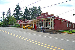
Scio is a city in Linn County, Oregon, United States. The population was 838 at the 2010 census.

Oregon Geographic Names is a compilation of the origin and meaning of place names in the U.S. state of Oregon, published by the Oregon Historical Society. The book was originally published in 1928. It was compiled and edited by Lewis A. McArthur. As of 2011, the book is in its seventh edition, which was compiled and edited by Lewis L. McArthur.

The South Santiam River is a tributary of the Santiam River, about 69 miles (111 km) long, in western Oregon in the United States. It drains an area of the Cascade Range into the Willamette Valley east of Corvallis.

Belknap Springs is an unincorporated community and private hot springs resort in Lane County, Oregon, United States, near the McKenzie River. The springs were located and initially developed by R. S. Belknap in 1869. A post office named "Salt Springs" was established in the location in 1874, and the name changed to "Belknap Springs" in 1875. The post office closed in 1877 and reopened in 1891, operating intermittently until 1953. Today the location uses a McKenzie Bridge mailing address.

Wren is an unincorporated community in Benton County, Oregon, United States. It is located at the junction of U.S. Route 20 and Oregon Route 223 on the Marys River.
Tiller is an unincorporated community in Douglas County, Oregon, United States. It is located on Oregon Route 227 and the South Umpqua River, in the Umpqua National Forest.

Shedd is an unincorporated community and census-designated place (CDP) in Linn County, Oregon, United States, on Oregon Route 99E. As of the 2010 census it had a population of 204.

Crabtree is an unincorporated community and census-designated place in Linn County, Oregon, United States. As of the 2010 census, it had a population of 391. It has a post office with a ZIP code of 97335. Crabtree lies off Oregon Route 226 about 10 miles (16 km) east of Albany.
Alder is an unincorporated community in Benton County, Oregon, United States. Alder lies near U.S. Route 20 southeast of Blodgett on the Marys River in the Central Oregon Coast Range. The post office serving Alder was named Hipp.

Saint Benedict is the name of the post office at Mount Angel Abbey in Marion County, Oregon, United States.
Shaw is an unincorporated community in Marion County, Oregon, United States, on Oregon Route 214.
Macleay is an unincorporated community in Marion County, Oregon, United States, about nine miles east of downtown Salem in the Waldo Hills near the Little Pudding River.
Tonquin is an unincorporated locale in Washington County, Oregon, United States.
Drew is an unincorporated community in Douglas County, Oregon, United States. It is located about six miles south of Tiller and 21 miles north of Trail on Oregon Route 227, surrounded by the Umpqua National Forest.
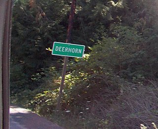
Deerhorn is an unincorporated community in Lane County, Oregon, United States. It is about 4 miles (6 km) west of Leaburg on Oregon Route 126 in the McKenzie River valley.
Dodson is an unincorporated community in Multnomah County, Oregon, United States. It is located about 4½ miles east of Multnomah Falls and one mile west of Warrendale, in the Columbia River Gorge on Interstate 84/U.S. Route 30. It is across the Columbia River from Skamania, Washington. Dodson is within the Cascade Locks ZIP code.
Hampton is an unincorporated locale in Lane County, Oregon, United States. It is located about 13 miles (21 km) southeast of Lowell. Hampton was established in 1952 as a station on the Southern Pacific Railroad Cascade Line on the shore of Lookout Point Lake, when the railroad was relocated because of the creation of the lake. It was named for Harry A. Hampton, the railroad division engineer from 1922 to 1943.
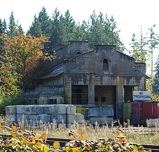
Burlington is an unincorporated historic community Linn County, in the U.S. state of Oregon. It was located about a mile downriver from Peoria.
Rowland is a ghost town in Linn County, in the U.S. state of Oregon.
Tallman is a ghost town in Linn County, in the U.S. state of Oregon. It is located northwest of Lebanon.
References
- ↑ U.S. Geological Survey Geographic Names Information System: Thomas (historical)
- ↑ "Linn County". Jim Forte Postal History. Retrieved 1 October 2014.
- ↑ "Historical scrapbook". The Times. Mar 10, 1966. p. 4. Retrieved 29 October 2015.
- ↑ McArthur, Lewis A.; McArthur, Lewis L. (2003) [1928]. Oregon Geographic Names (7th ed.). Portland, Oregon: Oregon Historical Society Press. p. 948. ISBN 978-0875952772.
Municipalities and communities of Linn County, Oregon, United States | ||
|---|---|---|
| Cities |  | |
| CDPs | ||
| Other unincorporated communities | ||
| Ghost towns | ||
| Indian reservation | ||
| Footnotes | ‡This populated place also has portions in an adjacent county or counties | |
Coordinates: 44°41′15″N122°56′02″W / 44.6876222°N 122.9339800°W
| This Linn County, Oregon state location article is a stub. You can help Wikipedia by expanding it. |