Tangent, Oregon

Last updated

Tangent, Oregon
Western Star Grange-309, Tangent Drive - DPLA - c9f74fcd133fdb8e57be2a9346f5344b.jpg
Western Star Grange #309 on Tangent Drive.
Nickname: 
Grass Seed Capital of the World
Linn County Oregon Incorporated and Unincorporated areas Tangent Highlighted.svg
Location in Oregon
Coordinates: 44°32′53″N123°06′40″W / 44.54806°N 123.11111°W / 44.54806; -123.11111
Country United States
State Oregon
County Linn
Incorporated 1893
Government
   Mayor Loel Trulove Jr. [1]
Area
[2]
  Total3.79 sq mi (9.82 km2)
  Land3.79 sq mi (9.82 km2)
  Water0.00 sq mi (0.00 km2)
Elevation
[3]
246 ft (75 m)
Population
 (2020) [4]
  Total1,231
  Density324.80/sq mi (125.41/km2)
Time zone UTC-8 (Pacific)
  Summer (DST) UTC-7 (Pacific)
ZIP code
97389
Area code 541
FIPS code 41-72600 [5]
GNIS feature ID2412033 [3]
Website www.cityoftangent.org

Tangent is a city in Linn County, Oregon, United States. The population was 1,231 at the 2020 census.

Contents

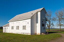
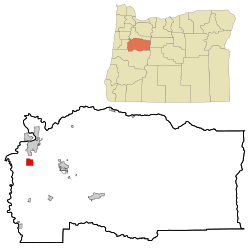
Tangent was the site of a railway station on the Southern Pacific line south of Albany. Its name referred to a straight stretch of the line with no curves for more than 20 miles (32 km). [6] The federal government established a post office in Tangent on September 17, 1872. [6]

Geography

According to the United States Census Bureau, the city has a total area of 3.78 square miles (9.79 km2), all land. [7]

Climate

This region experiences warm (but not hot) and dry summers, with no average monthly temperatures above 71.6 °F (22.0 °C). According to the Köppen Climate Classification system, Tangent has a warm-summer Mediterranean climate, abbreviated "Csb" on climate maps. [8]

Demographics

Historical population
CensusPop.Note
1880 38
1900 84
1980 478
1990 55616.3%
2000 93367.8%
2010 1,16424.8%
2020 1,2315.8%
U.S. Decennial Census [9] [4]

2020 census

As of the census of 2020, there were 1,231 people and 446 households in the city. There were 463 housing units, of which 96.3% were occupied and 74.7% were owner-occupied. The racial makeup of the city was 85.9% White, 0.4% African American, 1.1% Native American, 0.6% Asian, 0.0% Hawaiian or Pacific Islander, 2.7% from other races, and 9.3% from two or more races. Hispanic or Latino of any race were 11.5% of the population. [10]

There were 446 households, of which 30.5% had children under the age of 18 living with them. 52.7% were married couples living together, 8.1% were cohabitating couples, 17.5% were male householders with no spouse present, and 21.7% were female householders with no spouse present. [10]

The median age in the city was 38.3 for males, 42.7 for females, and 40.0 for both sexes. 23.3% of the population was under the age of 18, and 14.9% were over the age of 65. [10]

2010 census

As of the census of 2010, there were 1,164 people, 410 households, and 315 families living in the city. The population density was 307.9 inhabitants per square mile (118.9/km2). There were 433 housing units at an average density of 114.6 per square mile (44.2/km2). The racial makeup of the city was 89.4% White, 0.2% African American, 0.8% Native American, 0.3% Asian, 0.2% Pacific Islander, 4.6% from other races, and 4.5% from two or more races. Hispanic or Latino of any race were 8.4% of the population. [5]

There were 410 households, of which 39.0% had children under the age of 18 living with them, 58.3% were married couples living together, 13.4% had a female householder with no husband present, 5.1% had a male householder with no wife present, and 23.2% were non-families. 16.8% of all households were made up of individuals, and 5.2% had someone living alone who was 65 years of age or older. The average household size was 2.83 and the average family size was 3.17. [5]

The median age in the city was 36.7 years. 29.2% of residents were under the age of 18; 7.4% were between the ages of 18 and 24; 24.5% were from 25 to 44; 26% were from 45 to 64; and 12.8% were 65 years of age or older. The gender makeup of the city was 49.4% male and 50.6% female. [5]

2000 census

As of the census of 2000, there were 933 people, 339 households, and 262 families living in the city. The population density was 246.9 inhabitants per square mile (95.3/km2). There were 366 housing units at an average density of 96.9 per square mile (37.4/km2). The racial makeup of the city was 95.71% White, 1.07% Native American, 0.32% Pacific Islander, 1.29% from other races, and 1.61% from two or more races. Hispanic or Latino of any race were 2.79% of the population. [5]

There were 339 households, out of which 35.4% had children under the age of 18 living with them, 66.1% were married couples living together, 7.4% had a female householder with no husband present, and 22.7% were non-families. 17.1% of all households were made up of individuals, and 6.8% had someone living alone who was 65 years of age or older. The average household size was 2.75 and the average family size was 3.08. [5]

In the city, the population was spread out, with 27.9% under the age of 18, 5.9% from 18 to 24, 32.7% from 25 to 44, 22.8% from 45 to 64, and 10.7% who were 65 years of age or older. The median age was 37 years. For every 100 females, there were 97.3 males. For every 100 females age 18 and over, there were 96.8 males. [5]

The median income for a household in the city was $44,231, and the median income for a family was $50,450. Males had a median income of $36,458 versus $21,250 for females. The per capita income for the city was $17,012. About 5.2% of families and 6.4% of the population were below the poverty line, including 9.0% of those under age 18 and 2.0% of those age 65 or over. [5]

Related Research Articles

<span class="mw-page-title-main">Haines, Oregon</span> City in Oregon, United States

Haines is a city in Baker County, Oregon, United States. The population was 416 at the 2010 census.

<span class="mw-page-title-main">Glendale, Oregon</span> City in Oregon, United States

Glendale is a city in Douglas County, Oregon, United States. The population was 874 at the 2010 census.

<span class="mw-page-title-main">Butte Falls, Oregon</span> City in Oregon, United States

Butte Falls is a city in Jackson County, Oregon, United States. The population was 423 at the 2010 census. As of July 1, 2018, the city's population was estimated to be 450.

<span class="mw-page-title-main">Dunes City, Oregon</span> City in Oregon, United States

Dunes City is a city in Lane County, Oregon, United States. The population was 1,303 at the 2010 census.

<span class="mw-page-title-main">Siletz, Oregon</span> City in Oregon, United States

Siletz is a city in Lincoln County, Oregon, United States. The population was 1,212 at the 2010 census. The city is located next to the Siletz Reservation and is the site of the annual Nesika Illahee Pow Wow in August.

<span class="mw-page-title-main">Harrisburg, Oregon</span> City in Oregon, United States

Harrisburg is a city in Linn County, Oregon, United States. The population was 3,567 at the 2010 census.

<span class="mw-page-title-main">Sodaville, Oregon</span> City in Oregon, United States

Sodaville is a city in Linn County, Oregon, United States. The population was 308 at the 2010 census.

<span class="mw-page-title-main">Sublimity, Oregon</span> City in Oregon, United States

Sublimity is a city in Marion County, Oregon, United States. The population was 2,967 at the 2020 census. It is part of the Salem Metropolitan Statistical Area.

<span class="mw-page-title-main">Turner, Oregon</span> City in Oregon, United States

Turner is a city in Marion County, Oregon, United States. The population was 2,944 at the 2020 census. It is part of the Salem Metropolitan Statistical Area. The community was incorporated by the Oregon Legislative Assembly on February 10, 1905.

<span class="mw-page-title-main">Grass Valley, Oregon</span> City in Oregon, United States

Grass Valley is a city in Sherman County, Oregon, United States. The population was 164 at the 2010 census.

<span class="mw-page-title-main">Bay City, Oregon</span> City in Oregon, United States

Bay City is a city in Tillamook County, Oregon, United States. The population was 1,286 at the 2010 census.

<span class="mw-page-title-main">Wheeler, Tillamook County, Oregon</span> City in Oregon, United States

Wheeler is a city in Tillamook County, Oregon, United States. The population was 414 at the 2010 census. It is named after Coleman Wheeler, who opened a sawmill in the town and had a lumber business; Coleman is a great-grandfather of Ted Wheeler, who as of 2023 is mayor of Portland, Oregon.

<span class="mw-page-title-main">Adams, Oregon</span> City in Oregon, United States

Adams is a city in Umatilla County, Oregon, United States, located about 13 miles (21 km) northeast of Pendleton on Oregon Route 11. The population was 350 at the 2010 census. It is part of the Pendleton–Hermiston Micropolitan Statistical Area.

<span class="mw-page-title-main">Stanfield, Oregon</span> City in Oregon, United States

Stanfield is a city in Umatilla County, Oregon, United States. The population was 2,043 at the 2010 census. It is part of the Pendleton–Hermiston Micropolitan Statistical Area.

<span class="mw-page-title-main">Imbler, Oregon</span> City in Oregon, United States

Imbler is a city in Union County, Oregon, United States. The population was 306 at the 2010 census.

<span class="mw-page-title-main">Mosier, Oregon</span> City in Oregon, United States

Mosier is a city along the Columbia River in Wasco County, Oregon, United States. The population was 433 at the 2010 census.

<span class="mw-page-title-main">Banks, Oregon</span> City in Oregon, United States

Banks is a city in Washington County, Oregon, United States which is located in the Tualatin Valley. It is the southern anchor to the Banks–Vernonia State Trail, which is a 21-mile (34 km) long linear trail popular with bicyclists, hikers, and equestrians. The population was 1,777 at the 2010 census. The community was named for John and Nancy Banks, who owned a nearby dairy farm. Incorporated in 1921, it is located in the western part of the county where Oregon Route 6 intersects Oregon Route 47.

<span class="mw-page-title-main">Rivergrove, Oregon</span> City in Oregon, United States

Rivergrove is a city in Clackamas County, Oregon, United States. A small portion of the city extends into nearby Washington County. Its name is a portmanteau of the Tualatin River, which forms its southern border, and Lake Grove, a community that is now part of Lake Oswego. Interstate 5 forms the western border, with Childs Road serving as the northern border for much of the city. The population was 545 at the 2020 census.

<span class="mw-page-title-main">Idanha, Oregon</span> City in Oregon, United States

Idanha is a city on the Marion County/Linn County line in Oregon, United States, on Oregon Route 22 and the Santiam River. The population was 156 at the 2020 census.

<span class="mw-page-title-main">Sutherlin, Oregon</span> City in Oregon, United States

Sutherlin is a city in Douglas County, Oregon, United States. As of the 2010 Census, the population was 7,810, making it the second most populous city in Douglas County. Located off of I-5, nearby features include Cooper Creek Reservoir, Ford's pond, the Umpqua River, a golf course, and numerous vineyards.

References

  1. "City Government – City of Tangent". January 14, 2024. Archived from the original on January 14, 2024.
  2. "ArcGIS REST Services Directory". United States Census Bureau. Retrieved October 12, 2022.
  3. 1 2 U.S. Geological Survey Geographic Names Information System: Tangent, Oregon
  4. 1 2 "Census Population API". United States Census Bureau. Retrieved October 12, 2022.
  5. 1 2 3 4 5 6 7 8 "U.S. Census website". United States Census Bureau . Retrieved December 21, 2012.
  6. 1 2 McArthur, Lewis A.; Lewis L. McArthur (2003) [1928]. Oregon Geographic Names (Seventh ed.). Portland, Oregon: Oregon Historical Society Press. p. 936. ISBN   0-87595-277-1.
  7. "US Gazetteer files 2010". United States Census Bureau. Archived from the original on July 2, 2012. Retrieved December 21, 2012.
  8. "Tangent, Oregon". Weatherbase. CantyMedia. 2015. Retrieved March 22, 2015.
  9. "Census of Population and Housing". Census.gov. Retrieved June 4, 2015.
  10. 1 2 3 "Explore Census Data". data.census.gov. Retrieved July 22, 2023.