
Huntington is a city in Baker County, on the eastern border of Oregon, United States. It is located on the Snake River and along Interstate 84 and U.S. Route 30. The population was 440 at the 2010 census, down from 515 in 2000.

Hells Canyon is a ten-mile-wide (16 km) canyon in the Western United States, located along the border of eastern Oregon, western Idaho, and a small section of eastern Washington. It is part of the Hells Canyon National Recreation Area which is also located in part of the Wallowa-Whitman National Forest. It is North America's deepest river gorge at 7,993 feet (2,436 m), running deeper than the Grand Canyon in Arizona.

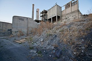
Oxbow is an unincorporated community in Baker County, Oregon, United States. Oxbow is along Oregon Route 86 next to the Snake River near the Oxbow Dam on the Oregon-Idaho border, about 17 miles (27 km) northeast of Halfway. Oxbow is just south of the site of the former mining town of Copperfield. Oxbow has a post office with a ZIP code 97840.

Whitney is an unincorporated community, also considered a ghost town, in Baker County, Oregon, United States, on Oregon Route 7 southwest of Sumpter. It is on the North Fork Burnt River, near the Blue Mountains and Wallowa-Whitman National Forest.

Oregon Route 86 is an Oregon state highway running from Interstate 84 at Baker City to the Idaho state line at Oxbow. OR 86 comprises most of the Baker-Copperfield Highway No. 12. It is 67.82 miles (109.15 km) long and runs east–west. OR 86 has an unsigned spur near Halfway, which runs for 1.15 miles (1.85 km). Most of OR 86 is part of the Hells Canyon Scenic Byway.

Oxbow Dam is a hydroelectric run-of-the-river rockfill dam in the western United States, on the Snake River in Hells Canyon along the Idaho-Oregon border.

Fern Hobbs was an American attorney in the U.S. state of Oregon, and Private Secretary to Oregon Governor Oswald West. She was noted for her ambition and several accomplishments as a young woman, and became the highest-paid woman in public service in America in her mid-twenties.

Homestead is an unincorporated community in Baker County, in the U.S. state of Oregon. Homestead lies on the Snake River south of Hells Canyon National Recreation Area and about 4 miles (6 km) north of Copperfield and Oxbow.
Lime is an unincorporated community and ghost town in the northwest United States, located in Baker County, Oregon. Five miles (8 km) north of Huntington on Interstate 84, it is near the confluence of Marble Creek and the Burnt River on the Union Pacific Railroad. The historic Oregon Trail passes through Lime.
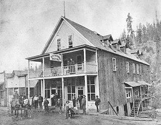
Bourne is a ghost town in Baker County, Oregon, United States about 7 miles (11 km) north of Sumpter in the Blue Mountains. It lies on Cracker Creek and is within the Wallowa–Whitman National Forest. Platted in 1902, the former gold mining boomtown is considered a ghost town today.
Nibley is an unincorporated historic community in Union County, Oregon, United States, about 11 miles east of La Grande on Oregon Route 237 in the Grande Ronde Valley.
Robinette is a former unincorporated community in Baker County, Oregon, United States.
Leland is an unincorporated community in Josephine County, Oregon, United States. It lies in the Klamath Mountains along Grave Creek, a tributary of the Rogue River.
Williamson Mountain, elevation 6,304 feet (1,921 m), is a peak in the Cascade Range in the U.S. state of Oregon. It is named after Lt. Robert S. Williamson, who with Lt. Philip Sheridan took part in the Pacific Railroad Surveys in central Oregon in 1855. The United States Board on Geographic Names approved the name in 1931. Before that, the peak was known by its Chinook Jargon name of Leloo Mountain, derived from the French le loup.
Flagg, Oregon, began as a railroad station on the Southern Pacific Line from Eugene to Coos Bay and later became an unincorporated community in Lane County, Oregon, United States, on Penn Road approximately 5 miles (8 km) west of Vaughn. Wildcat Creek, a tributary of the Siuslaw River, flows by Flagg.
The North Fork Owyhee River is a tributary, about 30 miles (48 km) long, of the Owyhee River in Malheur County, Oregon, and Owyhee County, Idaho, in the United States. It begins on the east flank of the Owyhee Mountains in Idaho and flows generally southwest to meet the main stem at Three Forks, Oregon, 161 miles (259 km) above the confluence of the larger river with the Snake River.
The Middle Fork Owyhee River is a tributary of the North Fork Owyhee River in Malheur County, Oregon, and Owyhee County, Idaho, in the United States. It forms along Juniper Mountain, south of the Owyhee Mountains in Idaho. From its headwaters, it flows southwest then curves northwest to and beyond the Idaho–Oregon border, then turns north to meet the North Fork at Three Forks, Oregon. The confluence is less than a mile upstream from the North Fork's confluence with the Owyhee River. Below Three Forks, the main stem Owyhee flows 161 miles (259 km) to empty into the Snake River.
Penn is an unincorporated community and former railway station in Lane County, in the U.S. state of Oregon. It was named for the Penn Timber Company, which operated in the vicinity.
Bitter Lick is an unincorporated community in Jackson County, Oregon, United States. It lies at the confluence of Bitter Lick Creek and Elk Creek, northwest of the ghost town of Persist. Bitter Lick is in the northern part of the county, north of Lost Creek Lake, a reservoir on the Rogue River.
Dardanelles is an unincorporated community in Jackson County, Oregon, United States. It lies opposite the city of Gold Hill on the south side of the Rogue River. Interstate 5 and Oregon Route 99 pass by Gold Hill and Dardanelles.


