Baker County is one of the 36 counties in the U.S. state of Oregon. As of the 2020 census, the population was 16,668. The county seat and largest city is Baker City. The county was organized on September 22, 1862, when a portion of Wasco County was partitioned off. The new county's area was reduced in 1864 when Union County was partitioned off, and again in 1887 when Malheur County was partitioned off. The county's lines were last adjusted in 1901 when a parcel was added to the county.

Sumpter is a city in Baker County, Oregon, United States. The population was 204 at the 2010 census. Sumpter is named after Fort Sumter by its founders. The name was inspired by a rock as smooth and round as a cannonball, which reminded a local resident of the American Civil War and Fort Sumter.

Granite is a city in Grant County, in the U.S. state of Oregon. The city had a population of 38 in 2010, up from 24 in 2000. In 2010, it was the fourth-smallest incorporated city by population in Oregon. The smaller cities were Shaniko, Lonerock (21), and nearby Greenhorn (0).

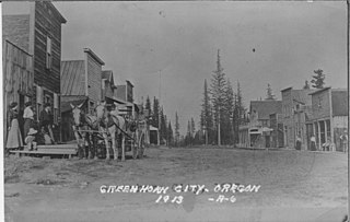
Greenhorn is a nearly non-populated city in Baker and Grant counties in the U.S. state of Oregon. It straddles the Blue Mountain ridge, so that it is located in both Grant County and Baker County. As most of the city is situated in Baker County, and the early residents considered Baker City to be more convenient, for administrative purposes it is considered to be in Baker County.

Whitney is an unincorporated community, also considered a ghost town, in Baker County, Oregon, United States, on Oregon Route 7 southwest of Sumpter. It is on the North Fork Burnt River, near the Blue Mountains and Wallowa-Whitman National Forest.

Ashwood is a ghost town in Jefferson County, Oregon, United States, 32 miles (51 km) northeast of Madras.
Austin is an unincorporated community, considered a ghost town, in Grant County, Oregon, United States. It is located north of Oregon Route 7, near the Middle Fork John Day River in the Malheur National Forest.

Lewis Ankeny McArthur, known as "Tam" McArthur, was an executive for Pacific Power and Light Company. He was also the secretary for the Oregon Geographic Board for many years and the author of Oregon Geographic Names. His book, now in its seventh edition, is a comprehensive source of information on the origins and history of Oregon place names. It is a standard reference book in libraries throughout Oregon and the Pacific Northwest. Tam McArthur Rim in the Cascade Mountains is named in his honor.
Pocahontas is a historic former community in Baker County, Oregon, United States. It lies northwest of Baker City along Pocahontas Road near the Elkhorn Mountains.
Copper is a former community in Jackson County, Oregon, United States. Copper was located about 1 mile (1.6 km) north of the Oregon–California border, near the mouth of Carberry Creek. Copper was named for the copper mining in the region, including at the Blue Ledge mine just over the state line in California. The town had a post office from 1924 until 1932. The elevation of Copper is 1,949 feet.
Orodell, also known as Oro Dell, is an unincorporated historic community in Union County, Oregon, United States, on the Grande Ronde River at the northwest edge of La Grande. It is considered a ghost town. Either Charles Fox or Stephen Coffin started the first sawmill in the Grande Ronde Valley there in the summer of 1862, after a joint-stock company between Coffin and other local settlers failed to materialize in 1861.
Sparta is an unincorporated community in Baker County, Oregon, United States. It was named for Sparta, Illinois, by William H. Packwood, a prominent Oregon pioneer who visited the gold diggings at the Powder River there in 1871.

Bourne is a ghost town in Baker County, Oregon, United States about 7 miles (11 km) north of Sumpter in the Blue Mountains. It lies on Cracker Creek and is within the Wallowa–Whitman National Forest. Platted in 1902, the former gold mining boomtown is considered a ghost town today.
Galena is an unincorporated community in Grant County, Oregon, United States, about 20 miles (32 km) from Austin Junction in the Blue Mountains. It is on the Middle Fork John Day River in the Malheur national forest. The former gold mining camp is considered a ghost town.

Susanville is an unincorporated community in Grant County, Oregon, United States, in the Blue Mountains about two miles up Elk Creek from Galena. The place was started as a gold mining camp in 1862 or 1864 and is now considered a ghost town.

Lancaster is an unincorporated community in Lane County, Oregon, United States. It is located about two miles south of Harrisburg and two miles north of Junction City, on Oregon Route 99E near the Willamette River.

John Miller Drake was a Union Army officer in the 1st Oregon Cavalry and the 1st Oregon Infantry regiments during the American Civil War. He eventually reached the rank of lieutenant colonel. He led one of the first campaigns to respond to the threat Chief Paulina posed to settlers and rival Indians in central Oregon. Later he was a purchasing agent for the Oregon Railway and Navigation Company.
Eureka is a ghost town in Baker County, Oregon, United States, located along Cracker Creek, approximately 5 miles (8.0 km) north of Sumpter, and .6 miles (0.97 km) from Bourne. It was originally founded as a mining camp c. 1892, though by 1945 operations had ceased.
Ogle Creek is a headwaters tributary, about 2 miles (3 km) long, of the Molalla River in the northwestern part of Oregon in the United States. From its source in the Cascade Range, it flows north from far-northern Marion County into Clackamas County near Ogle Mountain. From there it continues north into the river about 46 miles (74 km) above its confluence with the Willamette River.


