Related Research Articles

La Grande is a city in Union County, Oregon, United States. La Grande is Union County's largest city, with a population of 13,082 at the time of the 2010 U.S. Census. The La Grande metro population is 25,076. It is the 16th largest metropolitan area in Oregon.

Union is a city in Union County, Oregon, United States, originally platted in 1864, and located 15 miles (24 km) southeast of La Grande. It is the namesake of Union County, which references the Union states, or Northern States, of the American Civil War. The population was 2,152 at the 2020 census. The city is known for the numerous historic Victorian homes that line its Main Street, some of which are registered on the National Register of Historic Places. It is also home to Oregon State University's Eastern Oregon Agricultural Research Center, founded in 1888, which is contemporarily housed in the former Union train station.

The Blue Mountains are a mountain range in the northwestern United States, located largely in northeastern Oregon and stretching into extreme southeastern Washington. The range has an area of about 15,000 square miles (39,000 km2), stretching east and southeast of Pendleton, Oregon, to the Snake River along the Oregon–Idaho border.

The Grande Ronde River is a tributary of the Snake River, 182 miles (293 km) long, in northeastern Oregon and southeastern Washington in the United States. It drains an area southeast of the Blue Mountains and northwest of the Wallowa Mountains, on the Columbia Plateau. It flows through the agricultural Grande Ronde Valley in its middle course and through a series of scenic canyons in its lower course.

The Wallowa River is a tributary of the Grande Ronde River, approximately 55 miles (89 km) long, in northeastern Oregon in the United States. It drains a valley on the Columbia Plateau in the northeast corner of the state north of Wallowa Mountains.
Mount Emily is a mountain in the Blue Mountains of eastern Oregon in the United States. It is located in western Union County on the Wallowa-Whitman National Forest.
Mist is an unincorporated community in Columbia County, Oregon, United States. Formerly called Riverside, the place was renamed in 1888 for the atmospheric conditions of the Nehalem Valley. The first land claims in the area had been made circa 1870. The original Riverside post office was closed in 1975.
Alicel is an unincorporated community in the Sand Ridge area of the Grande Ronde Valley in Union County, Oregon, United States. It is northeast of La Grande on Oregon Route 82. It was a station on Union Pacific Railroad's Joseph branch, and in 1890 was named for Alice Ladd, wife of local resident Charles Ladd. Alicel was platted in 1890, and had a post office from 1890 until 1972.

French Prairie is located in Marion County, Oregon, United States, in the Willamette Valley between the Willamette River and the Pudding River, north of Salem. It was named for some of the earliest settlers of that part of the Oregon Country, French Canadian/Métis people who were mostly former employees of the Hudson's Bay Company. "French Prairie" naming was first captured in writing in the early 1850s by a French Consul to California visiting Oregon. Pierre Charles Fournier de Saint-Amant referred to the area as "les prairies françaises". French Prairie is also known as an early Métis settlement in the Pacific Northwest history.

McEwen is an unincorporated community in Baker County, Oregon, United States. McEwen lies on Oregon Route 7 east of its interchange with Oregon Route 410. McEwen is about 6 miles (10 km) southeast of Sumpter along the Powder River.
The Grande Ronde Valley is a valley in Union County in northeastern Oregon, United States. It is surrounded by the Blue Mountains, and is drained by the Grande Ronde River. La Grande is its largest community. The valley is 35 miles (56 km) long, north to south, from Pumpkin Ridge to Pyles Canyon, and 15 miles (24 km) wide, east to west, from Cove to the Grande Ronde River's canyon. Its name, fittingly, means, "great circle."

Catherine Creek is a 32.4-mile-long (52.1 km) creek in northeastern Oregon, United States. A tributary of the Grande Ronde River, it is the second-longest stream in the Grande Ronde Valley. Originating in the foothills of the Wallowa Mountains, it flows generally northwest through Catherine Creek State Park and the city of Union before joining the river.

Dolph is an unincorporated community in Tillamook County, Oregon, United States, near the Yamhill County line. It lies at the junction of Oregon Route 22 and Oregon Route 130 between Grande Ronde and Hebo, on the Little Nestucca River. It is within the Siuslaw National Forest in the Northern Oregon Coast Range.
Starkey is an unincorporated community in Union County, Oregon, United States, about 26 miles southwest of La Grande. It is about two miles south of Oregon Route 244 in the Blue Mountains.

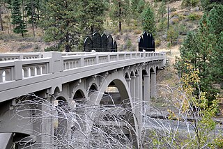
Hilgard is an unincorporated community in Union County, Oregon, United States, at the junction of Oregon Route 244 with Interstate 84/U.S. Route 30, near the Grande Ronde River. It is also the site of a junction (wye) of the Union Pacific Railroad. Hilgard Junction State Recreation Area is across the river from the community.
Nibley is an unincorporated historic community in Union County, Oregon, United States, about 11 miles east of La Grande on Oregon Route 237 in the Grande Ronde Valley.
The history of rail in Oregon predates the transcontinental railroad in 1869.
Perry is an unincorporated community in Union County, Oregon, United States. It is located five miles west of La Grande on the Grande Ronde River and Interstate 84. The town was originally named Stumptown, but was later renamed in honor of an early railroad dispatcher in La Grande.
Kamela is an unincorporated community in Union County, Oregon, United States. It is located west of Interstate 84 about 20 miles northwest of La Grande.
The following is a timeline of the history of Oregon in the United States of America.
References
- ↑ "Orodell". Geographic Names Information System . United States Geological Survey, United States Department of the Interior. May 22, 1986. Retrieved January 6, 2010.
- 1 2 3 4 5 McArthur, Lewis A.; McArthur, Lewis L. (2003) [1928]. Oregon Geographic Names (7th ed.). Portland, Oregon: Oregon Historical Society Press. p. 731. ISBN 978-0875952772.
- 1 2 Deumling, Dietrich (May 1972). The roles of the railroad in the development of the Grande Ronde Valley (masters thesis). Flagstaff, Arizona: Northern Arizona University. pp. 15–16. OCLC 4383986.
- ↑ An Illustrated history of Union and Wallowa counties. Western Historical Publishing Company. 1902. p. 138. OCLC 16675525.
- ↑ Evans, Elwood (1889). History of the Pacific Northwest: Oregon and Washington: Embracing an Account of the Original Discoveries on the Pacific Coast of North America, and a Description of the Conquest, Settlement and Subjugation of the Original Territory of Oregon; Also Interesting Biographies of the Earliest Settlers and More Prominent Men and Women of the Pacific Northwest, Including a Description of the Climate, Soil, Productions of Oregon and Washington. Vol. 2. North Pacific history Company. p. 227. Retrieved March 13, 2014.
- ↑ Bailey, Barbara Ruth (1982). Main Street: Northeastern Oregon. Oregon Historical Society. p. 25,46. ISBN 0-87595-073-6.
45°20′34″N118°06′49″W / 45.342910°N 118.113553°W
Municipalities and communities of Union County, Oregon, United States | ||
|---|---|---|
| Cities | 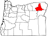 | |
| Unincorporated communities | ||
| Indian reservation | ||
| Ghost town | ||
| | This Union County, Oregon state location article is a stub. You can help Wikipedia by expanding it. |