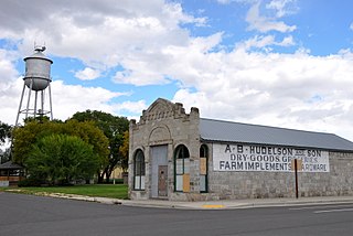
La Grande was named the county seat when Union County was created in 1865.[9] Due to the Thomas and Ruckle Road going through Union, it elected the county seat in 1872, but when the railroad was built it was put through La Grande instead of Union. La Grande became the bigger town within the county and regained the county seat in 1902.[9] J. W. Shelton, a local attorney, chartered the Union Electric Power and Light Company in March 1890 to bring the railroad from Union Junction (2.5 miles away) to Union itself.[9] The company was renamed the Union Railway Company in July 1890, and the rail spur was built into Union by August 1892.[9] Shelton planned to build more lines, had a fight with his company partners (the Hutchinsons), then two competing firms were formed: Shelton's The Union Railway in January 1893, and Hutchinsons' Union Street Railway and Suburban Railway.[9] Both companies competed to buy the Union Railway Company.[9] Shelton maintained control until August 1905, when The Union Railway was renamed to the Union, Cove and Valley Railway. This company was bought the following year by a timber company from the East Coast.[9]
During the 2006 November elections, Kyle Corbin, an 18-year-old college student, was elected mayor after a successful write-in campaign. He had promised to bring an end to the political chaos that had plagued the town for the last two years, which included three councilmen and mayor Deborah Clark being removed in recall elections. "I know the procedures and rules," he told an Oregonian reporter. "I've run a meeting with a bunch of high school kids."[10] Since then, one newspaper reports that "talk around town about whether the young mayor will succeed ranges from skepticism to sunny optimism."[11]
As of the census of 2000, there were 1,926 people, 766 households, and 550 families residing in the city. The population density was 773.0 inhabitants per square mile (298.5/km2). There were 821 housing units at an average density of 329.5 per square mile (127.2/km2). The racial makeup of the city was 96.21% White, 0.10% African American, 0.99% Native American, 0.36% Asian, 0.05% Pacific Islander, 0.73% from other races, and 1.56% from two or more races. Hispanic or Latino of any race were 1.30% of the population.[4]
There were 766 households, out of which 30.5% had children under the age of 18 living with them, 59.5% were married couples living together, 9.0% had a female householder with no husband present, and 28.1% were non-families. 24.0% of all households were made up of individuals, and 12.4% had someone living alone who was 65 years of age or older. The average household size was 2.51 and the average family size was 2.97.[4]
In the city, the population was spread out, with 26.0% under the age of 18, 6.0% from 18 to 24, 24.5% from 25 to 44, 25.4% from 45 to 64, and 18.2% who were 65 years of age or older. The median age was 41 years. For every 100 females, there were 92.0 males. For every 100 females age 18 and over, there were 89.6 males.[4]
The median income for a household in the city was $28,529, and the median income for a family was $34,286. Males had a median income of $32,148 versus $16,776 for females. The per capita income for the city was $14,406. About 12.2% of families and 13.0% of the population were below the poverty line, including 16.3% of those under age 18 and 16.0% of those age 65 or over.[4]
As of the census of 2010, there were 2,121 people, 859 households, and 603 families residing in the city. The population density was 848.4 inhabitants per square mile (327.6/km2). There were 933 housing units at an average density of 373.2 per square mile (144.1/km2). The racial makeup of the city was 95.6% White, 0.1% African American, 1.1% Native American, 0.1% Asian, 0.1% Pacific Islander, 0.6% from other races, and 2.3% from two or more races. Hispanic or Latino of any race were 2.3% of the population.[4]
There were 859 households, of which 31.4% had children under the age of 18 living with them, 56.7% were married couples living together, 9.3% had a female householder with no husband present, 4.2% had a male householder with no wife present, and 29.8% were non-families. 24.9% of all households were made up of individuals, and 12.1% had someone living alone who was 65 years of age or older. The average household size was 2.46 and the average family size was 2.93.[4]
The median age in the city was 43.8 years. 24.7% of residents were under the age of 18; 5.9% were between the ages of 18 and 24; 20.6% were from 25 to 44; 30.8% were from 45 to 64; and 17.9% were 65 years of age or older. The gender makeup of the city was 49.2% male and 50.8% female.[4]
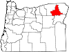
Union County is one of the 36 counties in the U.S. state of Oregon. As of the 2020 census, the population was 26,196. Its county seat is La Grande.
Shelton is a village in Buffalo and Hall counties, Nebraska, United States. It is part of the Kearney, Nebraska Micropolitan Statistical Area. The population was 1,059 at the 2010 census. It is located west of Grand Island along both the Union Pacific Railroad and U.S. Route 30. Nebraska Link 10-D connects Shelton with Interstate 80.
Ord is a city in Valley County, Nebraska, United States. The population was 2,112 at the 2010 census. It is the county seat of Valley County.
Haines is a city in Baker County, Oregon, United States. The population was 416 at the 2010 census.
Madras is a city in and the county seat of Jefferson County, Oregon, United States. Originally called "The Basin" after the circular valley the city is in, it is unclear whether Madras was named in 1903 for the cotton fabric called "Madras" that originated in the city of Madras in Tamil Nadu, India or from the name of the city itself. The population was 6,046 at the 2010 census.
Irrigon is a city in Morrow County, Oregon, United States, on the Columbia River and U.S. Route 730. The city is part of the Pendleton–Hermiston Micropolitan Statistical Area. The population was 1,826 at the 2010 census.
Troutdale is a city in Multnomah County, Oregon, United States, immediately north of Gresham and east of Wood Village. As of the 2020 census, the city population was 16,300. The city serves as the western gateway to the Historic Columbia River Highway, the Mount Hood Scenic Byway, and the Columbia River Gorge. It is approximately 12 miles (19 km) east of Portland.
Grand Ronde is a census-designated place (CDP) and unincorporated community in Polk and Yamhill counties, Oregon, United States. Historically noted as a village in Polk County, the sphere of influence and community is in both Polk and Yamhill counties. The name of the community is a variation of the French Grande Ronde or "Grand Round" which could be about the large round-up of Native American peoples in the area who were settled on what was known as the Grand Ronde Indian Reservation, or possibly referencing the shape of the valley in which the community is located. As of the census of 2010, there were 1,661 people in 658 households residing in Grand Ronde. It is part of the Salem Metropolitan Statistical Area.
Wheeler is a city in Tillamook County, Oregon, United States. The population was 414 at the 2010 census. It is named after Coleman Wheeler, who opened a sawmill in the town and had a lumber business; Coleman is a great-grandfather of Ted Wheeler, who as of 2023 is mayor of Portland, Oregon.
Stanfield is a city in Umatilla County, Oregon, United States. The population was 2,043 at the 2010 census. It is part of the Pendleton–Hermiston Micropolitan Statistical Area.
Cove is a city in Union County, Oregon, United States. The population was 620 at the 2020 census.
Elgin is a city in Union County, Oregon, United States. The population was 1,711 at the 2010 census. The community is named after the Lady Elgin, a ship lost on Lake Michigan.
Imbler is a city in Union County, Oregon, United States. The population was 306 at the 2010 census.
Island City is a city in Union County, Oregon, United States. Its name originated from the city's location on an island between the Grande Ronde River and a nearby slough. However, the slough was later diverted, removing the city's island status. The population was 989 at the 2010 census.
La Grande is a city in Union County, Oregon, United States. La Grande is Union County's largest city, with a population of 13,082 at the time of the 2010 U.S. Census. The La Grande metro population is 25,076. It is the 16th largest metropolitan area in Oregon.
North Powder is a city in Union County, Oregon, United States. The population was 439 at the 2010 census.
Summerville is a city in Union County, Oregon, United States. The population was 135 at the 2010 census.
North Plains is a city in Washington County, Oregon, United States, off U.S. 26 on the northwest outskirts of the Portland metropolitan area. The population was 3,441 at the 2020 census.
Shelton is a city in and the county seat of Mason County, Washington, United States. Shelton is the westernmost city on Puget Sound. The population was 10,371 at the 2020 census. Shelton has a council–manager form of government and was the last city in Washington to use a mayor–commission form of government.
Willamina is a city in Polk and Yamhill Counties in the U.S. state of Oregon. The population was 2,239 at the 2020 census.
This page is based on this Wikipedia article Text is available under the CC BY-SA 4.0 license; additional terms may apply. Images, videos and audio are available under their respective licenses.