Seaside, Oregon

Last updated

Seaside, Oregon
Seaside, OR Town - panoramio.jpg
Aerial view of Seaside, 2011
Clatsop County Oregon Incorporated and Unincorporated areas Seaside Highlighted.svg
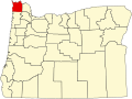
Location in Oregon and Clatsop County
Coordinates: 45°59′44″N123°54′50″W / 45.99556°N 123.91389°W / 45.99556; -123.91389
CountryUnited States
State Oregon
County Clatsop
Incorporated 1899
Government
  TypeCouncil-Manager
   Mayor Jay Barber [1]
Area
[2]
  Total4.05 sq mi (10.49 km2)
  Land3.89 sq mi (10.09 km2)
  Water0.16 sq mi (0.41 km2)
Elevation
[3]
23 ft (7 m)
Population
 (2020) [4]
  Total7,115
  Density1,827.17/sq mi (705.40/km2)
Time zone UTC−08:00 (Pacific)
  Summer (DST) UTC−07:00 (Pacific)
ZIP Code
97138
Area code(s) 503 and 971
FIPS code 41-65950 [5]
GNIS feature ID2411854 [3]
Website www.cityofseaside.us

Seaside is a city in Clatsop County, Oregon, United States, on the coast of the Pacific Ocean. The name Seaside is derived from Seaside House, a historic summer resort built in the 1870s by railroad magnate Ben Holladay. The city's population was 6,457 at the 2010 census. [6]

Contents

History

Ocean Shore Limited railroad at Seaside, Oregon ca. 1910 Ocean Shore Limited railroad at Seaside, Oregon (3229235015).jpg
Ocean Shore Limited railroad at Seaside, Oregon ca. 1910
The Gilbert House in Seaside GilbertHouse.JPG
The Gilbert House in Seaside

The Clatsop were a historic Native American tribe that had a village named Ne-co-tat (in their Chinook language) in this area. Indigenous peoples had long inhabited the coastal area.

About January 1, 1806, a group of men from the Lewis and Clark Expedition built a salt-making cairn at the site later developed as Seaside. The city was not incorporated until February 17, 1899, when coastal resort areas were being settled. [7] It is about 79 miles (127 km) by car northwest of Portland, Oregon, a major population center. [8]

In 1912, Alexandre Gilbert (1843–1932) was elected Mayor of Seaside. Gilbert was a French immigrant, a veteran of the Franco Prussian War (1870-1871). After living in San Francisco, California and Astoria, Oregon, Gilbert moved to Seaside where he had a beach cottage (built in 1885). Gilbert was a real estate developer who donated land to the City of Seaside for its one-and-a-half-mile-long Promenade, or "Prom," along the Pacific beach.

In 1892, he added to his beach cottage. Nearly 100 years later, what was known as the Gilbert House was operated commercially as the Gilbert Inn since the mid-1980s. Both it and Gilbert's eponymous "Gilbert Block" office building on Broadway still survive.

Gilbert died at home in Seaside and is interred in Ocean View Abbey Mausoleum in Warrenton.

Geography

According to the United States Census Bureau, the city has a total area of 4.14 square miles (10.72 km2), of which 3.94 square miles (10.20 km2) is land and 0.20 square miles (0.52 km2) is water. [9]

Seaside, OR - pano 01 (360 degree pano) (19326200874).jpg
360° (scrollable) panoramic view from the beach at Seaside. Tillamook Head at left.

Seaside lies on the edge of the Pacific Ocean, at the southern end of the Clatsop Plains, about 29 km (18 mi) south of where the Columbia River empties into the Pacific. The city is developed on both sides of the Necanicum River, which flows to the ocean at the city's northern edge. Tillamook Head towers over the southern edge of the city.

Harvesting razor clams QUINAULT INDIANS ON THE BEACH OF THEIR RESERVATION ON THE PACIFIC COAST. THEY ARE HARVESTING RAZOR CLAMS FOR THE... - NARA - 545204.jpg
Harvesting razor clams

The geography associated with the gradual slope of the broad sandy beaches of Clatsop Spit provide excellent conditions for the formation of beds of millions of Pacific razor clams annually. The razor clams attract thousands of visitors to Seaside Beach each year. [10] Waves attract surfers all year round from the challenging point break off the tip of Tillamook Head to the sandy shores at "the cove" parking lot at Ocean Vista Drive. [11] [12] [13]

Climate

Seaside has an oceanic climate (Köppen Cfb), typical Pacific Northwest climate, bordering very closely on a warm-summer Mediterranean climate (Köppen Csb). It receives rainy winters and mild-to-cool summers. Mean high temperature in the warmest month, August, is roughly 68 °F (20 °C). The warmest heatwaves, however, occur in September. The hottest day on record was 95 °F (35 °C), which occurred on both September 23, 1943 and September 24, 1974. The coldest temperature ever recorded was 5 °F (−15 °C) which occurred on December 8, 1972.

Climate data for Seaside, Oregon (1991–2020 normals, extremes 1930present)
MonthJanFebMarAprMayJunJulAugSepOctNovDecYear
Record high °F (°C)73
(23)
77
(25)
78
(26)
86
(30)
86
(30)
85
(29)
87
(31)
89
(32)
95
(35)
92
(33)
79
(26)
71
(22)
95
(35)
Mean maximum °F (°C)61.6
(16.4)
63.0
(17.2)
66.5
(19.2)
70.4
(21.3)
73.9
(23.3)
69.8
(21.0)
73.6
(23.1)
76.1
(24.5)
82.1
(27.8)
75.2
(24.0)
63.4
(17.4)
60.3
(15.7)
86.0
(30.0)
Mean daily maximum °F (°C)51.8
(11.0)
52.6
(11.4)
54.1
(12.3)
56.2
(13.4)
59.7
(15.4)
62.1
(16.7)
65.0
(18.3)
66.4
(19.1)
66.6
(19.2)
61.6
(16.4)
55.1
(12.8)
51.2
(10.7)
58.5
(14.7)
Daily mean °F (°C)45.6
(7.6)
45.5
(7.5)
46.8
(8.2)
49.0
(9.4)
53.0
(11.7)
56.2
(13.4)
59.0
(15.0)
60.0
(15.6)
58.3
(14.6)
53.6
(12.0)
48.4
(9.1)
44.8
(7.1)
51.7
(10.9)
Mean daily minimum °F (°C)39.3
(4.1)
38.4
(3.6)
39.5
(4.2)
41.8
(5.4)
46.3
(7.9)
50.4
(10.2)
53.0
(11.7)
53.5
(11.9)
50.1
(10.1)
45.6
(7.6)
41.7
(5.4)
38.5
(3.6)
44.8
(7.1)
Mean minimum °F (°C)27.6
(−2.4)
26.5
(−3.1)
28.9
(−1.7)
32.2
(0.1)
36.3
(2.4)
41.9
(5.5)
45.6
(7.6)
45.9
(7.7)
40.3
(4.6)
33.5
(0.8)
28.9
(−1.7)
27.0
(−2.8)
23.0
(−5.0)
Record low °F (°C)11
(−12)
9
(−13)
21
(−6)
24
(−4)
26
(−3)
36
(2)
35
(2)
32
(0)
30
(−1)
24
(−4)
14
(−10)
5
(−15)
5
(−15)
Average precipitation inches (mm)11.03
(280)
8.05
(204)
9.42
(239)
6.56
(167)
3.87
(98)
2.66
(68)
0.95
(24)
1.20
(30)
2.91
(74)
6.63
(168)
12.01
(305)
11.42
(290)
76.71
(1,947)
Average precipitation days (≥ 0.01 in)21.318.120.717.213.611.16.77.28.614.520.321.8181.1
Average relative humidity (%)81828181818283848281828182
Mean daily sunshine hours 3.93.95.67.48.38.99.810.08.85.24.44.26.7
Mean daily daylight hours 9.110.412.013.615.015.715.314.112.510.99.58.712.2
Average ultraviolet index 3233444443223
Source 1: NOAA [14] [15]
Source 2: Weather Atlas (UV and humidity) [16]

Tsunami inundation zone

A tsunami evacuation sign in Seaside. Tsunami evac sign Seaside Oregon.JPG
A tsunami evacuation sign in Seaside.

Part of Seaside is located in a tsunami inundation zone. Among other preparation, the City of Seaside has embarked on a program in which residents above the zone are asked to volunteer to store within their homes barrels of medical supplies, water purification systems, emergency rations, tarps, and radios, with each barrel having enough supplies to last 20 individuals for at least 3 days. As of January 2017, there are 119 barrels within volunteer households and a waiting list of interested households. [17]

Seismologists estimate that there is a one in three chance that Seaside will be hit by an earthquake and tsunami within the next fifty years. [18] On Tues. Nov. 8, 2016, Seaside citizens voted 65% to 35% to issue $99.7 million in bonds to move the remaining three schools out of the tsunami inundation zone. [19]

Demographics

Seaside after sunset Seaside after sunset.jpg
Seaside after sunset
Historical population
CensusPop.Note
1880 75
1890 8716.0%
1900 191119.5%
1910 1,121486.9%
1920 1,80260.7%
1930 1,565−13.2%
1940 2,90285.4%
1950 3,88633.9%
1960 3,877−0.2%
1970 4,40213.5%
1980 5,19318.0%
1990 5,3593.2%
2000 5,90010.1%
2010 6,4579.4%
2020 7,11510.2%
Sources: [6] [20] [21] [4]

As of the census [22] of 2010, there were 6,457 people, 2,969 households, and 1,565 families residing in the city. The population density was 1,638.8 inhabitants per square mile (632.7/km2). There were 4,638 housing units at an average density of 1,177.2 per square mile (454.5/km2). The racial makeup of the city was 88.1% White, 0.6% African American, 0.8% Native American, 1.4% Asian, 0.1% Pacific Islander, 5.8% from other races, and 3.1% from two or more races. Hispanic or Latino of any race were 12.4% of the population.

There were 2,969 households, of which 24.2% had children under the age of 18 living with them, 35.4% were married couples living together, 11.5% had a female householder with no husband present, 5.8% had a male householder with no wife present, and 47.3% were non-families. 38.6% of all households were made up of individuals, and 15.4% had someone living alone who was 65 years of age or older. The average household size was 2.16 and the average family size was 2.83.

The median age in the city was 41.5 years. 20% of residents were under the age of 18; 9.3% were between the ages of 18 and 24; 24.7% were from 25 to 44; 28.6% were from 45 to 64; and 17.4% were 65 years of age or older. The gender makeup of the city was 48.3% male and 51.7% female.

Arts and culture

Seaside holds an art walk the first Saturday of each month from March through December. [23] Several galleries are located along Broadway street in the historic Gilbert District.

The Seaside Jazz Festival (formerly the Oregon Dixieland Jubilee) was a long-running annual festival that featured some of the most popular Trad Jazz and Swing bands in the US and Canada.

Annual cultural events

Seaside hosts an annual 4th of July celebration which includes a parade, outdoor concerts, and one of the largest fireworks displays on the west coast. [24] [25]

Seaside City Hall Seaside, Oregon city hall.jpg
Seaside City Hall

Every spring until 2016 (in 2017 and 2018, the conference was moved to Salem, and the Dorchester Conference was moved to Welches, Oregon in 2019), Seaside hosted the Dorchester Conference, a convention of Oregon political activists, typically conservative, independent, or center-right. This convention was founded in 1964 by then-state representative Bob Packwood as a forum for all Republicans statewide.

In the 1990s, it became dominated by members of the conservative branch of the party. Over the years the conference has attracted visits from presidential candidates, debates between Republican primary candidates, and discussions of wider political and social issues. [26] It is run by an independent board and is not formally affiliated with the Oregon Republican Party. [27]

The Miss Oregon Pageant, the official state finals to the Miss America Pageant, takes place annually at the Seaside Civic and Convention Center. [28]

Seaside Beach Volleyball, the 2nd largest Beach Volleyball Tournament in the world takes place annually on the 2nd weekend of August. Started in 1982 the tournament has grown each year. In 2022 Seaside Beach Volleyball had over 1,800 teams and 192 courts for the four days of tournament play.

The annual Salt Maker's Return is held in September. The themed event celebrates Seaside history. Five men of the Lewis and Clark expedition needed nearly two months to make the equivalent of 28 US gallons (110  L ) of salt; it was critical for them to be able to preserve meat for the winter and their several thousand-mile journey home to the East. [29]

Seaside in 1972 Seaside, Oregon 1972.jpg
Seaside in 1972
Seaside beach. Seaside, Oregon beach.jpg
Seaside beach.

The beach and promenade at Seaside serve as the finish line for the Hood to Coast and Portland to Coast relays, held annually on the weekend before Labor Day.

Museums and other points of interest

Seaside is home to the Seaside Aquarium, featuring living regional marine life, a hands-on discovery center, and a 35-foot (11 m) gray whale skeleton, all within a short walk from the Lewis & Clark monument. [30]

The Seaside Museum & Historical Society features exhibits on local and regional history, and offers tours of the Butterfield Cottage, which has been restored to its 1912 state. [31]

Murals adorn several buildings throughout Seaside, depicting history, marine life, and life in Seaside. [32]

The Seaside Visitors Bureau and Travel Oregon Welcome Center offers one-on-one information for travelers to Seaside, as well as maps, magazines, public restrooms, and an oversized Adirondack chair popular for selfies with those traveling along the 101. [33] [34]

Media

Newspaper

Radio

Transportation

Notable people

Related Research Articles

<span class="mw-page-title-main">Astoria, Oregon</span> City in Oregon, United States

Astoria is a port city and the seat of Clatsop County, Oregon, United States. Founded in 1811, Astoria is the oldest city in the state and was the first permanent American settlement west of the Rocky Mountains. The county is the northwest corner of Oregon, and Astoria is located on the south shore of the Columbia River, where the river flows into the Pacific Ocean. The city is named for John Jacob Astor, an investor and entrepreneur from New York City, whose American Fur Company founded Fort Astoria at the site and established a monopoly in the fur trade in the early 19th century. Astoria was incorporated by the Oregon Legislative Assembly on October 20, 1856.

<span class="mw-page-title-main">Washington County, Oregon</span> County in Oregon, United States

Washington County is one of 36 counties in the U.S. state of Oregon and part of the Portland metropolitan area. The 2020 census recorded the population as 600,372, making it the second most populous county in the state and most populous "Washington County" in the United States. Hillsboro is the county seat and largest city, while other major cities include Beaverton, Tigard, Cornelius, Banks, Gaston, Sherwood, North Plains, and Forest Grove, the county's oldest city. Originally named Twality when created in 1843, the Oregon Territorial Legislature renamed it for the nation's first president in 1849 and included the entire northwest corner of Oregon before new counties were created in 1854. The Tualatin River and its drainage basin lie almost entirely within the county, which shares its boundaries with the Tualatin Valley. It is bordered on the west and north by the Northern Oregon Coast Range, on the south by the Chehalem Mountains, and on the north and east by the Tualatin Mountains, or West Hills.

<span class="mw-page-title-main">Pacific County, Washington</span> County in Washington, United States

Pacific County is a county in the U.S. state of Washington. As of the 2020 census, the population was 23,365. Its county seat is South Bend, and its largest city is Raymond. The county was formed by the government of Oregon Territory in February 1851 and is named for the Pacific Ocean.

<span class="mw-page-title-main">Tillamook County, Oregon</span> County in Oregon, United States

Tillamook County is one of the 36 counties in the U.S. state of Oregon. As of the 2020 census, the population was 27,390. The county seat is Tillamook. The county is named for the Tillamook or Killamook people, a Native American tribe who were living in the area in the early 19th century at the time of European American settlement. The county is located within Northwest Oregon.

<span class="mw-page-title-main">Columbia County, Oregon</span> County in Oregon, United States

Columbia County is one of the 36 counties in the U.S. state of Oregon. As of the 2020 census, the population was 52,589. The county seat is St. Helens.

<span class="mw-page-title-main">Clatsop County, Oregon</span> County in Oregon, United States

Clatsop County is one of the 36 counties in the U.S. state of Oregon. As of the 2020 census, the population was 41,072. The county seat is Astoria. The county is named for the Clatsop tribe of Native Americans, who lived along the coast of the Pacific Ocean prior to European settlement. Clatsop County comprises the Astoria, OR Micropolitan Statistical Area, or Sunset Empire, and is located in Northwest Oregon.

<span class="mw-page-title-main">Cannon Beach, Oregon</span> City in Oregon, United States

Cannon Beach is a city in Clatsop County, Oregon, United States. Its population was 1,690 at the 2010 census. It is a popular coastal Oregon tourist destination, famous for Haystack Rock, a 235 ft (72 m) sea stack that juts out along the coast. In 2013, National Geographic listed it as "one of the world's 100 most beautiful places."

<span class="mw-page-title-main">Gearhart, Oregon</span> City in Oregon, United States

Gearhart is a city in Clatsop County, Oregon, United States. The population was 1,462 at the 2010 census.

<span class="mw-page-title-main">Warrenton, Oregon</span> City in Oregon, United States

Warrenton is a small, coastal city in Clatsop County, Oregon, United States. Named for D.K. Warren, an early settler, the town is primarily a fishing and logging community. The population was 6,277 according to the 2020 US Census. Warrenton is a less urbanized area close to the Clatsop County seat, Astoria.

<span class="mw-page-title-main">Brookings, Oregon</span> City in Oregon, United States

Brookings is a city in Curry County, Oregon, United States. It was named after John E. Brookings, president of the Brookings Lumber and Box Company, which founded the city in 1908. As of the 2020 census, the population was 6,744.

<span class="mw-page-title-main">Port Orford, Oregon</span> City in Oregon, United States

Port Orford is a city in Curry County on the southern coast of Oregon, United States. The population was 1,133 at the 2010 census.

<span class="mw-page-title-main">Lincoln City, Oregon</span> City in Oregon, United States

Lincoln City is a city in Lincoln County on the Oregon Coast of the United States, between Tillamook to the north and Newport to the south. It is named after the county, which was named in honor of former U.S. President Abraham Lincoln. The population was 9,815 at the 2020 Census.

<span class="mw-page-title-main">Newport, Oregon</span> City in Lincoln County, Oregon

Newport is a city in Lincoln County, Oregon, United States. It was incorporated in 1882, though the name dates back to the establishment of a post office in 1868. Newport was named for Newport, Rhode Island. As of the 2010 census, the city had a total population of 9,989, an increase of nearly 5% over its 2000 population; as of 2019, it had an estimated population of 10,853.

<span class="mw-page-title-main">Manzanita, Oregon</span> City in Oregon, United States

Manzanita is a coastal city in Tillamook County, Oregon, United States. It is located on U.S. Route 101 about 25 miles (40 km) equidistant from Seaside to the north and Tillamook to the south. The population was 603 at the 2020 census.

<span class="mw-page-title-main">Rockaway Beach, Oregon</span> City in Oregon, United States

Rockaway Beach is a city in Tillamook County, Oregon, United States. The population was 1,312 at the 2010 census.

<span class="mw-page-title-main">Oregon Coast</span> Coastal region of the U.S. state of Oregon

The Oregon Coast is a coastal region of the U.S. state of Oregon. It is bordered by the Pacific Ocean to its west and the Oregon Coast Range to the east, and stretches approximately 362 miles (583 km) from the California state border in the south to the Columbia River in the north. The region is not a specific geological, environmental, or political entity, and includes the Columbia River Estuary.

<span class="mw-page-title-main">Clatsop</span>

The Clatsop are a small tribe of Chinookan-speaking Native Americans in the Pacific Northwest of the United States. In the early 19th century they inhabited an area of the northwestern coast of present-day Oregon from the mouth of the Columbia River south to Tillamook Head, Oregon.

<span class="mw-page-title-main">Necanicum River</span> River in Oregon, United States

The Necanicum River is a river on the Pacific coast of northwest Oregon in the United States, approximately 21 miles (34 km) long. It drains a timber-producing area of the Northern Oregon Coast Range northwest of Portland. It forms the first estuary south of the mouth of the Columbia River along the Oregon Coast, reaching the Pacific Ocean at Seaside in Clatsop County.

<span class="mw-page-title-main">U.S. Route 101 in Oregon</span> Section of U.S. Highway in Oregon, United States

U.S. Route 101 (US 101), is a major north–south U.S. Highway in Oregon that runs through the state along the western Oregon coastline near the Pacific Ocean. It runs from the California border, south of Brookings, to the Washington state line on the Columbia River, between Astoria, Oregon, and Megler, Washington.

<span class="mw-page-title-main">Arch Cape, Oregon</span> Unincorporated community in the state of Oregon, United States

Arch Cape is an unincorporated community in Clatsop County, Oregon, United States. Named for the natural arch in the coastal rocks and the headland (cape) that extends into the Pacific Ocean, it is located along the Pacific coast, approximately four miles south of Cannon Beach, between Hug Point State Recreation Site to the north and Oswald West State Park to the south.

References

  1. Marx, R. J. (December 13, 2016). "Barber is named Seaside mayor". The Daily Astorian . p. 1.
  2. "ArcGIS REST Services Directory". United States Census Bureau. Retrieved October 12, 2022.
  3. 1 2 U.S. Geological Survey Geographic Names Information System: Seaside, Oregon
  4. 1 2 "Census Population API". United States Census Bureau. Retrieved October 12, 2022.
  5. "U.S. Census website". United States Census Bureau . Retrieved January 31, 2008.
  6. 1 2 "2010 Census profiles: Oregon cities alphabetically R-S" (PDF). Portland State University Population Research Center. Retrieved September 29, 2011.
  7. Leeds, W. H. (1899). "Special Laws". The State of Oregon General and Special Laws and Joint Resolutions and Memorials Enacted and Adopted by the Twentieth Regular Session of the Legislative Assembly. Salem, Oregon: State Printer: 959.
  8. "Seaside, OR to Portland, OR", Distance between Cities website, 2016
  9. "US Gazetteer files 2010". United States Census Bureau. Archived from the original on July 2, 2012. Retrieved December 21, 2012.
  10. "Oregon's Clams". clamdigging.info. Retrieved April 22, 2016.
  11. Anderson, Don. "Point Break offers awesome, but dangerous surfing". The Astorian. Retrieved September 20, 2019.
  12. "Surfing in Oregon? It makes sense (really)". The Seattle Times. August 22, 2012. Retrieved September 20, 2019.
  13. Burningham, Lucy (August 16, 2013). "Surfing Oregon's North Coast". Wall Street Journal. ISSN   0099-9660 . Retrieved September 20, 2019.
  14. "NOAA NCEI U.S. Climate Normals Quick Access". National Oceanic and Atmospheric Administration . Retrieved October 7, 2021.
  15. "NOAA Online Weather Data – NWS Portland". National Weather Service. Retrieved December 30, 2022.
  16. "Climate and monthly weather forecast Seaside, OR" . Retrieved August 17, 2022.
  17. Tsunami Supply Barrel Program, City of Seaside.
  18. The Really Small Ones, New Yorker, Kathryn Schulz, Nov. 4, 2016.
  19. R.J. Marx (November 9, 2016). "Seaside Voters Back Bond To Move Schools From Tsunami Zone". Oregon Public Broadcasting. Seaside, Oregon. Daily Astorian. Archived from the original on November 10, 2016. This article includes a photo from another school district entirely of a student taking cover under a desk during a tsunami drill.
  20. Moffatt, Riley. Population History of Western U.S. Cities & Towns, 1850-1990. Lanham: Scarecrow, 1996, 215.
  21. "Subcounty population estimates: Oregon 2000-2007". United States Census Bureau, Population Division. March 18, 2009. Archived from the original (CSV) on July 9, 2009. Retrieved May 9, 2009.
  22. "U.S. Census website". United States Census Bureau . Retrieved December 21, 2012.
  23. "Seaside First Saturday Art Walks - The Gilbert District".
  24. "Seaside Chamber of Commerce". Archived from the original on June 14, 2010. Retrieved May 2, 2010.
  25. "Seaside Oregon". Saturday, 21 November 2020
  26. Dorchester Conference
  27. "Republican Party: We're not Dorchester". The Oregonian.
  28. "Miss Oregon Pageant starts today in Seaside," The Oregonian , 8 July 2004.
  29. "The Salt Works – Lewis and Clark National Historical Park". National Park Service. Retrieved August 3, 2016.
  30. "Seaside Activities and Attractions – Seaside Aquarium". Coast Explorer Magazine. Retrieved August 3, 2016.
  31. "Seaside Historical Society Museum".
  32. "Art & History Al Fresco: Historical Murals in Seaside Oregon". Coast Explorer Magazine. December 25, 2010. Retrieved August 3, 2016.
  33. "Travel Oregon - Oregon Welcome Centers".
  34. "City of Seaside Visitors Bureau - Contact us".
  35. "Seaside Transportation System Plan". seasidetsp.org. Retrieved August 3, 2016.
  36. "Obituary: Pierre Julian Radelet". The Oregonian . April 2021. Archived from the original on August 20, 2021.
  37. Grube, Janice. "Johnny Jewel & Ruth Radelet Interview". Revel In. New York City. Archived from the original on July 20, 2018. I was born and raised here, and aside from a few years on the Oregon coast, I lived in Portland my entire life until I moved to New York in 2011.