Sunset Beach, Oregon

Last updated
Sunset Beach, Oregon
USA Oregon location map.svg
Red pog.svg
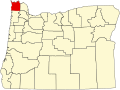
Sunset Beach
Location within the state of Oregon
Usa edcp location map.svg
Red pog.svg
Sunset Beach
Sunset Beach (the United States)
Coordinates: 46°6′4″N123°55′50″W / 46.10111°N 123.93056°W / 46.10111; -123.93056 Coordinates: 46°6′4″N123°55′50″W / 46.10111°N 123.93056°W / 46.10111; -123.93056
Country United States
State Oregon
County Clatsop
Elevation
36 ft (11 m)
Time zone UTC-8 (Pacific (PST))
  Summer (DST) UTC-7 (PDT)
ZIP codes
97148
GNIS feature ID1127744 [1]

Sunset Beach is a small unincorporated community located between the cities of Seaside and Warrenton in Clatsop County, Oregon, United States. Sunset Beach is located between U.S. Route 101, Neacoxie Lake and the Pacific Ocean. It serves as the northernmost access to the resort community of Surf Pines, and provides motor vehicle beach access. The "Fort to Sea Trail", which follows the route used by the Lewis and Clark Expedition when hiking from Fort Clatsop to the Pacific Ocean, ends at the beach access. A beach of the same name is west of the community.

Contents

See also

Related Research Articles

<span class="mw-page-title-main">Clatsop County, Oregon</span> County in Oregon, United States

Clatsop County is one of the 36 counties in the U.S. state of Oregon. As of the 2010 census, the population was 37,039. The county seat is Astoria. The county is named for the Clatsop tribe of Native Americans, who lived along the coast of the Pacific Ocean prior to European settlement.

<span class="mw-page-title-main">Cannon Beach, Oregon</span> City in Oregon, United States

Cannon Beach is a city in Clatsop County, Oregon, United States. Its population was 1,690 at the 2010 census. It is a popular coastal Oregon tourist destination, famous for Haystack Rock, a 235 ft (72 m) sea stack that juts out along the coast. In 2013, National Geographic listed it as "one of the world’s 100 most beautiful places."

<span class="mw-page-title-main">Seaside, Oregon</span> City in Oregon, United States

Seaside is a city in Clatsop County, Oregon, United States, on the coast of the Pacific Ocean. The name Seaside is derived from Seaside House, a historic summer resort built in the 1870s by railroad magnate Ben Holladay. The city's population was 6,457 at the 2010 census.

<span class="mw-page-title-main">Warrenton, Oregon</span> Unincorporated community in the state of Oregon, United States

Warrenton is a small, coastal city in Clatsop County, Oregon, United States. Named for D.K. Warren, an early settler, the town is primarily a fishing and logging community. The population was 6,277 according to the 2020 US Census. Warrenton is a less urbanized area close to the Clatsop County seat, Astoria.

<span class="mw-page-title-main">Oregon Coast</span> Coastal region of the U.S. state of Oregon

The Oregon Coast is a coastal region of the U.S. state of Oregon. It is bordered by the Pacific Ocean to its west and the Oregon Coast Range to the east, and stretches approximately 362 miles (583 km) from the California state border in the south to the Columbia River in the north. The region is not a specific geological, environmental, or political entity, and includes the Columbia River Estuary.

The Skipanon River is a tributary of the Columbia River, approximately 7 miles (11 km) long, on the Pacific coast of northwest Oregon in the United States. It is the last tributary of the Columbia on the Oregon side, draining an area of coastal bottom land bordered by sand dunes and entering the river from the south at its mouth west of Astoria.

<span class="mw-page-title-main">Lewis and Clark River</span> River in Oregon, United States

The Lewis and Clark River is a tributary of Youngs River, approximately 20 miles (32 km) long, in northwest Oregon in the United States. It drains 62 square miles (160 km2) of the Northern Oregon Coast Range in the extreme northwest corner of the state, entering Youngs River just above its mouth on the Columbia River at Youngs Bay. Near the river's mouth is the site of former Fort Clatsop of the Lewis and Clark Expedition. The river is named for Meriwether Lewis and William Clark.

<span class="mw-page-title-main">Fort Clatsop</span> United States historic place

Fort Clatsop was the encampment of the Lewis and Clark Expedition in the Oregon Country near the mouth of the Columbia River during the winter of 1805–1806. Located along the Lewis and Clark River at the north end of the Clatsop Plains approximately 5 miles (8.0 km) southwest of Astoria, the fort was the last encampment of the Corps of Discovery, before embarking on their return trip east to St. Louis.

<span class="mw-page-title-main">Necanicum River</span> River in Oregon, United States

The Necanicum River is a river on the Pacific coast of northwest Oregon in the United States, approximately 21 miles (34 km) long. It drains a timber-producing area of the Northern Oregon Coast Range northwest of Portland. It forms the first estuary south of the mouth of the Columbia River along the Oregon Coast, reaching the Pacific Ocean at Seaside in Clatsop County.

<span class="mw-page-title-main">Clatsop Plains</span>

The Clatsop Plains are an area of wetlands and sand dunes between the Northern Oregon Coast Range and Pacific Ocean in northwestern Oregon in the United States. They stretch from near the mouth of the Columbia River south to the vicinity of Tillamook Head near Seaside. The plains are drained by several coastal rivers include the Skipanon River and the Necanicum River, which flow parallel to the coast and empty into the Columbia at Youngs Bay near Astoria and into the Pacific Ocean near Seaside respectively. At the time, the Lewis and Clark Expedition recorded a different river draining the plains which entered the Pacific near the current day Camp Rilea Armed Forces Training Center. Research, 200 years later in 2005, seems to have confirmed this by locating an old river channel.

<span class="mw-page-title-main">John Day River (northwestern Oregon)</span> River in Oregon, United States

The John Day River is a tributary of the Columbia River, approximately 6 miles (10 km) long, in northwestern Oregon in the United States. The river rises in the Northern Oregon Coast Range in Clatsop County at 46.138889°N 123.704722°W.

<span class="mw-page-title-main">Lewis and Clark National Historical Park</span> Historic site in Oregon and Washington, United States

The Lewis and Clark National Historical Park, located in the vicinity of the mouth of the Columbia River, commemorates the Lewis and Clark Expedition. Administration of the park, which includes both federal and state lands, is a cooperative effort of the National Park Service and the states of Oregon and Washington. The National Historical Park was dedicated on November 12, 2004.

<span class="mw-page-title-main">Cape Kiwanda State Natural Area</span>

Cape Kiwanda State Natural Area is a state park in Pacific City, Oregon, United States. Cape Kiwanda is on the Three Capes Scenic Route, which includes Cape Meares and Cape Lookout. Hiking to the top of Cape Kiwanda allows views of Nestucca Bay to the south and Cape Lookout to the north.

<span class="mw-page-title-main">Svensen, Oregon</span> Unincorporated community in the state of Oregon, United States

Svensen is an unincorporated community and census-designated place (CDP) on the Columbia River in Clatsop County, Oregon, United States, named after early settler Peter Svensen. There was a post office in Svensen from 1895 to 1944. Since the closure of the Svensen Post Office, mail service has been provided by rural carriers of the Astoria, Oregon post office. Svensen is within the Knappa School District.

<span class="mw-page-title-main">Saddle Mountain (Clatsop County, Oregon)</span>

Saddle Mountain is the tallest mountain in Clatsop County in the U.S. state of Oregon. Part of the Oregon Coast Range, Saddle Mountain is in Saddle Mountain State Natural Area in the northwest corner of Oregon. The peak is listed on Oregon's Register of Natural Heritage Resources.

<span class="mw-page-title-main">Manhattan Beach State Recreation Site</span>

Manhattan Beach State Recreation Site is a state park in the U.S. state of Oregon. Administered by the Oregon Parks and Recreation Department, the park is open to the public and is fee-free. Amenities at the park, which is 2 miles (3 km) north of Rockaway Beach along U.S. Route 101, include picnicking, fishing, and a Pacific Ocean beach.

<span class="mw-page-title-main">Elsie, Oregon</span> Unincorporated community in the state of Oregon, United States

Elsie is an unincorporated community in Clatsop County, Oregon, United States. It is located in the Northern Oregon Coast Range, west of the junction of Oregon Route 103 and U.S. Route 26 where the roads cross the Nehalem River.

<span class="mw-page-title-main">Arch Cape, Oregon</span> Unincorporated community in the state of Oregon, United States

Arch Cape is an unincorporated community in Clatsop County, Oregon, United States. Named for the natural arch in the coastal rocks and the headland (cape) that extends into the Pacific Ocean, it is located along the Pacific coast, approximately four miles south of Cannon Beach, between Hug Point State Recreation Site to the north and Oswald West State Park to the south.

<span class="mw-page-title-main">Cape Falcon Marine Reserve</span>

Cape Falcon Marine Reserve in Oregon, USA, is a protected area located between Manzanita and the unincorporated community of Falcon Cove Beach in Tillamook and Clatsop Counties on the northern coast of Oregon. It is off the shore of Oswald West State Park. The marine reserve is part of Oregon's network of five marine reserves spread down the coastline. Its restrictions went into effect on January 1, 2016.

<span class="mw-page-title-main">Northwest Oregon</span> Geographic and cultural region of the U.S. state of Oregon

Northwest Oregon is a geographic and cultural region of the U.S. state of Oregon, composed of Clatsop, Columbia, and Tillamook counties. The region encompasses the northernmost parts of the state along the lower Columbia River.

References

  1. "Sunset Beach, Oregon". Geographic Names Information System . United States Geological Survey, United States Department of the Interior.