Vesper, Oregon

Last updated

Vesper, Oregon
USA Oregon location map.svg
Red pog.svg
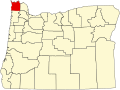
Vesper
Location within the state of Oregon
Coordinates: 45°58′49″N123°22′06″W / 45.98028°N 123.36833°W / 45.98028; -123.36833
Country United States
State Oregon
County Clatsop
Vesper1876
Founded by Clatsop people (before establishment); William Johnston
Named for Hesperus
Elevation
486 ft (148 m)
Time zone UTC-8 (Pacific (PST))
  Summer (DST) UTC-7 (PDT)
ZIP code
97138
Area code(s) 503 and 971

Vesper is an unincorporated community in Clatsop County, Oregon, United States. The Nehalem River flows through the town. Settled in 1876 by William Johnston, a man who would be responsible for the town's first post office and church, Vesper borders Jewell and the Columbia County line. Johnston also served as the town's first postmaster. Before 1901, Vesper was completely isolated from the rest of the county on land; for one to reach the community, it would have been necessary to travel via ferry on the Nehalem River. The county expanded wagon roads to the community, eventually leading to automobile roads being built in 1908. Nowadays, Oregon Route 202 passes through Vesper.

Contents

History

Oregon Trees Up View.jpg
Trees near the Clatsop State Forest in Vesper.
Oregon Farm House Pan.JPG
A Vesper farm house in 2009.
Vesper, Oregon road 1919.png
An early automobile road in Vesper.

Founding and name

Vesper was settled by William Johnston in 1876 with his family, who were from Ireland. [1] [2] The name Vesper is commonly applied to Hesperus, Greek mythology's personification for the planet Venus. [1] The reason Johnston selected the name is unknown. [1] Johnston established the first post office in Vesper during the Winter of 1879. [3] He also served as the town's first postmaster. [3] By 1895, E. A. Carl had taken over the reins as postmaster. [4] Another contribution to the Vesper community by Johnston was the town's first church, which he built with his family. [5] Lumber for the church was supplied by the local Douglas-fir trees. [5] The congregation at Emmanuel Episcopal Church was still meeting at the church until the late-1980s. [5] The church stands to this day.

Roads

The first wagon road connecting Astoria, Oregon with the Nehalem Valley, ending at Vesper was built in 1901. [6] The road was 42 miles long. [6] Those roads were restored often after that, including 1908, 1911, and 1914. [7] [8] [9] The 1914 reconstruction was the most expensive highway project in the history of Clatsop County at the time with an estimated cost of $542,875. [9] Vesper was host to an early automobile run from Portland, Oregon on July 15, 1915. [10] The 129 mile tour took the duo on the run, Frank L. Parker and C. S. Brown, 13 hours. [10]

The first bridge in Vesper, which spanned the Nehalem River, was built in 1914. [11] Clatsop County approved the building of two additional bridges connecting Vesper and Jewell, Oregon three years later. [12] The two steel bridges consisted of a single truss. [12] Presently, Oregon Route 202 goes through the town of Vesper. [13] Another notable road in the town is Old 77 Vesper Lane, which is a gravel road built alongside the Nehalem River. [13]

Natural history and agriculture

Much of Vesper is forested timberland and agriculture. During the 1920s, a Vesper resident by the name of H. A. Scullen operated an apiary. [14]

Related Research Articles

<span class="mw-page-title-main">Astoria, Oregon</span> City in Oregon, United States

Astoria is a port city and the seat of Clatsop County, Oregon, United States. Founded in 1811, Astoria is the oldest city in the state and was the first permanent American settlement west of the Rocky Mountains. The county is the northwest corner of Oregon, and Astoria is located on the south shore of the Columbia River, where the river flows into the Pacific Ocean. The city is named for John Jacob Astor, an investor and entrepreneur from New York City, whose American Fur Company founded Fort Astoria at the site and established a monopoly in the fur trade in the early 19th century. Astoria was incorporated by the Oregon Legislative Assembly on October 20, 1856.

<span class="mw-page-title-main">Nehalem River</span> River in Oregon, United States

The Nehalem River is a river on the Pacific coast of northwest Oregon in the United States, approximately 119 miles (192 km) long. It drains part of the Northern Oregon Coast Range northwest of Portland, originating on the east side of the mountains and flowing in a loop around the north end of the range near the mouth of the Columbia River. Its watershed of 855 square miles (2,210 km2) includes an important timber-producing region of Oregon that was the site of the Tillamook Burn. In its upper reaches it flows through a long narrow valley of small mountain communities but is unpopulated along most of its lower reaches inland from the coast.

The Nehalem Highway No. 102 is a state highway in the U.S. state of Oregon that passes through the Nehalem River valley. It runs from U.S. Route 101 (US 101) in Astoria southeast to Oregon Route 8 (OR 8) in Forest Grove. Between Astoria and the Mist–Clatskanie Highway No. 110 in Mist, it is signed as Oregon Route 202 while the rest is signed as OR 47. A piece of the highway in Astoria, north of the Warrenton–Astoria Highway No. 105, is also US 101 Business.

<span class="mw-page-title-main">U.S. Route 101 in Oregon</span> Section of U.S. Highway in Oregon, United States

U.S. Route 101 (US 101), is a major north–south U.S. Highway in Oregon that runs through the state along the coastline near the Pacific Ocean. It runs from the California border, south of Brookings, to the Washington state line on the Columbia River, between Astoria, Oregon, and Megler, Washington.

<span class="mw-page-title-main">U.S. Route 30 in Oregon</span> Highway in Oregon

In the U.S. state of Oregon, U.S. Route 30, a major east–west U.S. Highway, runs from its western terminus in Astoria to the Idaho border east of Ontario. West of Portland, US 30 generally follows the southern shore of the Columbia River; east of Portland the highway has largely been replaced with Interstate 84, though it is signed all the way across the state, and diverges from the I-84 mainline in several towns, as a de facto business route. Out of all the states U.S. Route 30 traverses, it spends the most time in Oregon. At 477 miles, it is also the longest road in the state.

<span class="mw-page-title-main">Lewis and Clark River Bridge</span> Bridge in near Astoria, Oregon

The Lewis and Clark River Bridge is a bascule bridge that spans the Lewis and Clark River on U.S. Route 101 Business in Clatsop County, Oregon. It was designed by Conde McCullough and opened in 1925. It was built to replace an earlier bridge at the same location, a swing-span bridge constructed around 1910.

<span class="mw-page-title-main">Jewell, Oregon</span> Unincorporated community in the state of Oregon, United States

Jewell is an unincorporated community in Clatsop County, Oregon, United States. The logging community is located at the junction of Oregon Route 103 and Oregon Route 202, near the Nehalem River.

<i>Bailey Gatzert</i> (sternwheeler)

The Bailey Gatzert was a famous sternwheel steamboat that ran on the Columbia River and Puget Sound from the 1890s to the 1920s. This vessel was considered one of the finest of its time. It was named after Bailey Gatzert, an early businessman and mayor of Seattle, who was one of the closest friends and business associates of John Leary – the person who financed the ship.

<span class="mw-page-title-main">Elsie, Oregon</span> Unincorporated community in the state of Oregon, United States

Elsie is an unincorporated community in Clatsop County, Oregon, United States. It is located in the Northern Oregon Coast Range, west of the junction of Oregon Route 103 and U.S. Route 26 where the roads cross the Nehalem River.

<span class="mw-page-title-main">Emil Schacht</span> Architect in Portland, Oregon (1854–1926)

Emil Schacht was a prominent architect in Portland, Oregon. Schacht's work was prolific from the 1890s until World War I and he produced commercial buildings including factories and warehouses as well as residential projects, hotels and theatres. He is known for his craftsman architecture style homes and was a founding member of the 1902 Portland Association of architects.

Hamlet is an unincorporated community in Clatsop County, Oregon, United States. It is located approximately six miles southeast of Necanicum, in the Northern Oregon Coast Range near the confluence of the North Fork Nehalem River and the Little North Fork Nehalem River. It is surrounded by units of the Clatsop State Forest.

<span class="mw-page-title-main">Astoria City Hall (old)</span> United States historic place

The Old Astoria City Hall, now known as the Clatsop County Historical Society Heritage Museum, is a historic building located in Astoria, Oregon, United States, that is listed on the National Register of Historic Places. The building served as the city hall of Astoria from 1905 until 1939. It was the first location of the Columbia River Maritime Museum, from 1963 to 1982, and has been the Heritage Museum since 1985.

Clifton is an unincorporated community in Clatsop County, Oregon, United States. It is located north of U.S. Route 30, about nine miles northwest of Westport on the south bank of the Columbia River. It is on Clifton Channel across from Tenasillahe Island.

<span class="mw-page-title-main">George Flavel</span> American maritime pilot

Captain George Edward Flavel was an Irish American maritime pilot and entrepreneur. Born in 1823 to Irish parents, Flavel relocated to the West coast of the United States in 1849, working as a tugboat operator between Sacramento and San Francisco, California. In 1851, he settled in the northern coastal port city of Astoria, Oregon, where he became one of the first licensed bar pilots in the state.

<i>Juneta</i> Passenger ferry

Juneta was a passenger ferry that operated on the Nehalem River on the north coast of Oregon from 1910 to the mid-1920s. Thereafter this vessel was transferred to the Columbia River where it was operated out of Astoria as a cannery tender until the 1960s. Juneta was then converted to a tugboat, and operated commercially on the Columbia and Willamette rivers until 1976. Juneta is still in existence and afloat as a private yacht in the vicinity of Portland, Oregon.

<i>C.H. Wheeler</i>

C.H. Wheeler was a schooner-rigged unpowered lumber barge that operated during the year 1901, making only a few voyages before it was wrecked near Yaquina Bay with the loss of one life. C.H. Wheeler was the largest vessel up to that time to reach Tillamook City and the first vessel to transport a load of lumber from Tillamook to San Francisco. The circumstances of the loss of the C.H. Wheeler were controversial and resulted in the arrest of the captain of the tug that had been towing the barge before it was wrecked.

<i>George R. Vosburg</i>

George R. Vosburg was a steam tug that operated from 1900 to 1912 on the Columbia River and the north coast of Oregon south from Astoria to the Nehalem River and Tillamook City. Generally called the Vosburg in practice, and referred to as Geo. R. Vosburg in official records, this vessel performed many tasks, from carrying cargo and passengers, and towing barges of rock for jetty construction. After 1925, this vessel was renamed George M. Brown, and was converted to diesel power. Under the name George M. Brown, this vessel remained in service until 1968 or later.

The Clatsop Mission was an outpost of the Methodist Mission near modern Astoria, Oregon, United States. Joseph H. Frost and his family was sent to the Clatsop Plains at the mouth of the Columbia River in 1841. Frustrated at his inability to convert the local Clatsop and Nehalem people, Frost took his family and left the area in August 1843. Josiah Parrish was appointed as his replacement, working at the station until its closure the following year in 1844.

<span class="mw-page-title-main">Hosea T. Botts</span> American attorney and politician

Hosea Thompson Botts (1873–1963) was an American attorney and politician who served as Mayor of Tillamook, Oregon from 1905 to 1907, spanning two terms.

<span class="mw-page-title-main">Clara C. Munson</span> American politician

Clara Cynthia Munson was an American politician who served as mayor of Warrenton, Oregon, and was the first woman elected mayor in Oregon during the 20th century. Her term lasted one year (1913–14) before she was succeeded by George Schmitz.

References

  1. 1 2 3 "Answers to yesterdays questions". The Oregonian. Portland, Oregon. March 2, 1928. p. 6.
  2. "Single family is entire church congregation". The Oregonian. Vesper, Oregon. August 5, 1917. p. 74.
  3. 1 2 "Postal changes". The Oregonian. February 3, 1879. p. 1.
  4. "New Oregon postmasters". The Oregonian. Portland, Oregon. November 30, 1895. p. 3.
  5. 1 2 3 Rubenstein, Sura (April 19, 1987). "Small Episcopal congregation keeps faith, family tradition alive". The Oregonian. Vesper, Oregon. p. 88.
  6. 1 2 "To build forty-two mile road". The Oregonian. Astoria, Oregon. March 10, 1901. p. 4.
  7. "Makes good roads; Clatsop County opens isolated districts". The Oregonian. Astoria, Oregon. January 6, 1908. p. 13.
  8. "Astoria to be motor mecca". The Oregonian. Astoria, Oregon. June 4, 1911. p. 5.
  9. 1 2 "Clatsop to spend $542,875 on roads". The Oregonian. Astoria, Oregon. January 11, 1914. p. 5.
  10. 1 2 "Auto finishes hard run". The Oregonian. Astoria, Oregon. July 16, 1910. p. 7.
  11. "Bridges to be built". The Oregonian. Astoria, Oregon. June 23, 1914. p. 5.
  12. 1 2 "Clatsop Bridge Planned". The Oregonian. Astoria, Oregon. April 28, 1917. p. 8.
  13. 1 2 "Clatsop County Road Map" (PDF). Oregon Department of Transportation. State of Oregon. Retrieved April 15, 2012.
  14. "Beemen to get lesson". The Oregonian. Astoria, Oregon. July 22, 1921. p. 2.