Clifton, Clatsop County, Oregon

Last updated

Clifton, Oregon
USA Oregon location map.svg
Red pog.svg
Clifton
Location within the state of Oregon
Usa edcp location map.svg
Red pog.svg
Clifton
Clifton (the United States)
Coordinates: 46°12′39″N123°27′44″W / 46.21083°N 123.46222°W / 46.21083; -123.46222
Country United States
State Oregon
County Clatsop
Elevation
[1]
10 ft (3 m)
Time zone UTC-8 (Pacific (PST))
  Summer (DST) UTC-7 (PDT)
GNIS feature ID1119023 [1]

Clifton is an unincorporated community in Clatsop County, Oregon, United States. [1] It is located north of U.S. Route 30, about nine miles northwest of Westport on the south bank of the Columbia River. [2] It is on Clifton Channel across from Tenasillahe Island. [2]

Contents

History

Henry Harrison Hunt, an Oregon Trail pioneer of 1843, established a sawmill in the Clifton area in 1845. [3] [4] By 1851 Hunt had moved on. [4] Later the site was an outpost for gillnetters. [5] In 1873 brothers James W. and Vincent Cook, pioneers of the Pacific Northwest salmon packing industry, established the second salmon cannery in Clatsop County there. [6] [7] [8] It is likely that settler Stephen G. Spear named his farm Clifton after the cliffs above the river before the land was owned by the Cook brothers. [6] Clifton post office was established in 1874, with Vincent Cook as the first postmaster. [6] The Astoria and South Coast Railway (later sold to the Spokane, Portland and Seattle Railway) was built through the area in 1898. [5] [9]

The cannery employed Chinese workers, who canned the fish caught by Greek, Yugoslav, and Italian fishermen. [5] When the cannery closed in 1906, the Chinese left the town, leaving behind their bunkhouses (which no longer exist). [5] The other immigrants settled in different parts of town. [5] In its heyday, Clifton had two saloons, one with a combination skating rink and dance hall upstairs, two stores, a church, and a one-room schoolhouse. [5] The railroad tracks served as the main street. [5] In 1915 Clifton had a population of 200. [10] The dance hall burned down in 1921. [5] Clifton was not connected to U.S. 30 by road until 1937. [5] Instead, to leave town people either boated across the Columbia to Cathlamet, Washington, or took the train to Astoria or Portland. [5] In the early 20th century, there were five logging camps within three miles of Clifton and when the camps closed the loggers would move into town. [5] By 1930 all logging activity in the area had ceased. [5] Today Clifton is on the edge of the Clatsop State Forest. [2] Electricity did not reach Clifton until 1958. [5]

Decline

Author Ralph Friedman considers Clifton a "picturesque ghost town". [5] The town went into decline as the salmon runs were depleted. [5] One store closed in 1950, the other closed in 1960 and was turned into an office for the caretaker of the town, which was then owned by Bumble Bee. [5] As people moved out, the houses were dismantled for their lumber. [5] Other buildings, such as the first store and the church, fell to splinters, while some structures fell into the river. [5] The post office closed in 1966. [6] As of 1990, very few structures were left in Clifton. [5] The rail line that passes through the area is now operated by the Portland and Western Railroad (PNWR), who acquired it from the BNSF Railway. [2] [9] Clifton is still a PNWR station. [11] There was renewed interest in the area in the early 2000s because of the proposed Bradwood Landing project.

Related Research Articles

<span class="mw-page-title-main">Biggs Junction, Oregon</span> Unincorporated community in the state of Oregon, United States

Biggs Junction is an unincorporated community in Sherman County, Oregon, United States. For statistical purposes, the United States Census Bureau has defined Biggs Junction as a census-designated place (CDP). The census definition of the area may not precisely correspond to local understanding of the area with the same name.

<span class="mw-page-title-main">Wilkesboro, Oregon</span> Unincorporated community in the state of Oregon, United States

Wilkesboro is an unincorporated community in Washington County, Oregon, United States. It is located on Oregon Route 6, one mile east of Banks.

<span class="mw-page-title-main">Blooming, Oregon</span> Unincorporated community in the state of Oregon, United States

Blooming is an unincorporated community in Washington County, Oregon, United States near the Tualatin River, about two miles south of Cornelius. Its elevation is 190 feet. There are several plant nurseries in the area.

<span class="mw-page-title-main">Lime, Oregon</span> Unincorporated community in the state of Oregon, United States

Lime is an unincorporated community and ghost town in Baker County, Oregon, United States, 5 miles (8 km) north of Huntington on U.S. Route 30/Interstate 84. It is near the confluence of Marble Creek and the Burnt River on the Union Pacific Railroad. The Oregon Trail passes through Lime.

<span class="mw-page-title-main">Cushman, Oregon</span> Unincorporated community in the state of Oregon, United States

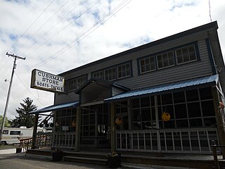
Cushman is an unincorporated community in Lane County, Oregon, United States. It is located on the north bank of the Siuslaw River on Oregon Route 126, between Tiernan and Florence.

Shaw is an unincorporated community in Marion County, Oregon, United States, on Oregon Route 214.

Denmark is an unincorporated community in Curry County, Oregon, United States, between Bandon and Port Orford where U.S. Route 101 crosses Willow Creek.

<span class="mw-page-title-main">Olney, Oregon</span> Unincorporated community in the state of Oregon, United States

Olney is an unincorporated community and former company town in Clatsop County, Oregon, United States, on Oregon Route 202 approximately eight miles south of Astoria. Its post office is assigned ZIP code 97325.

<span class="mw-page-title-main">Quincy, Oregon</span> Unincorporated community in the state of Oregon, United States

Quincy is an unincorporated community in Columbia County, Oregon, United States. It is located about 4.5 miles northeast of Clatskanie and 3.5 miles southwest of Mayger in a drained and diked area of the Columbia River lowlands.

Necanicum is an unincorporated community in Clatsop County, Oregon, United States. It is located approximately 13 miles southeast of Seaside on U.S. Route 26 in the Northern Oregon Coast Range, next to the Necanicum River. Necanicum Junction is about a mile east of the site of the former post office, at the intersection of U.S. 26 and Oregon Route 53. It is served by the Seaside post office.

Nonpareil is an unincorporated historic community in Douglas County, Oregon, United States. It is about 8 miles (13 km) east of Sutherlin, near Calapooya Creek. The population of the area was about 202 in 2000. Nonpareil was the birthplace of novelist H. L. Davis.

Prosper is an unincorporated community in Coos County, Oregon, United States. It is about 3 miles (5 km) northwest of Bandon next to the Coquille River. There is no longer a town at the site.

Cherryville is an unincorporated community and former town in Clackamas County, Oregon, United States, founded in 1884. It is located approximately 6 miles (9.7 km) east of Sandy on U.S. Route 26, near the route of the Barlow Road.

Gaylord is an unincorporated community in Coos County, Oregon, United States. It is about 12 miles (19 km) south of Myrtle Point on Oregon Route 542, near the South Fork Coquille River.

Hamlet is an unincorporated community in Clatsop County, Oregon, United States. It is located approximately six miles southeast of Necanicum, in the Northern Oregon Coast Range near the confluence of the North Fork Nehalem River and the Little North Fork Nehalem River. It is surrounded by units of the Clatsop State Forest.

Holland is an unincorporated community in Josephine County, Oregon, United States. It is about eight miles southeast of Cave Junction, in the Illinois Valley south of Oregon Route 46.

Dodson is an unincorporated community in Multnomah County, Oregon, United States. It is located about 4½ miles (7.2 km) east of Multnomah Falls and one mile west of Warrendale, in the Columbia River Gorge on Interstate 84/U.S. Route 30. It is across the Columbia River from Skamania, Washington. Dodson is within the Cascade Locks ZIP code.

<span class="mw-page-title-main">Warrendale, Oregon</span> Unincorporated community in the state of Oregon, United States

Warrendale is an unincorporated community in Multnomah County, Oregon, United States. It is located about a mile east of Dodson and about 3 miles (4.8 km) west of Bonneville in the Columbia River Gorge on Interstate 84/U.S. Route 30. It is across the Columbia River from Beacon Rock. The community was the site of an important salmon cannery founded in the 1870s.

Oretown is an unincorporated community in Tillamook County, Oregon, United States. It is along U.S. Route 101 about 4 miles (6 km) north of Neskowin and south of Nestucca Bay.

Hobsonville is an unincorporated community in Tillamook County, Oregon, United States. Although it is considered a ghost town, it is still classified as a populated place by the United States Geological Survey (USGS). Hobsonville is on the east shore of Tillamook Bay, about 2 miles south of Garibaldi via U.S. Route 101 or about a mile from Garibaldi across Miami Cove.

References

  1. 1 2 3 U.S. Geological Survey Geographic Names Information System: Clifton, Clatsop County, Oregon
  2. 1 2 3 4 Oregon Atlas & Gazetteer (7th ed.). Yarmouth, Maine: DeLorme. 2008. p. 18. ISBN   978-0-89933-347-2.
  3. Flora, Stephenie. "Emigrants to Oregon in 1843". oregonpioneers.com. Retrieved March 19, 2012.
  4. 1 2 Friedman, Ralph (2002) [1993]. "Some Who Didn't Stay". The Other Side of Oregon (2nd ed.). Caldwell, Idaho: The Caxton Printers, Ltd. p. 79. ISBN   0-87004-352-8.
  5. 1 2 3 4 5 6 7 8 9 10 11 12 13 14 15 16 17 18 19 Friedman, Ralph (1990). In Search of Western Oregon (2nd ed.). Caldwell, Idaho: The Caxton Printers, Ltd. pp.  123–124. ISBN   0-87004-332-3.
  6. 1 2 3 4 McArthur, Lewis A.; McArthur, Lewis L. (2003) [1928]. Oregon Geographic Names (7th ed.). Portland, Oregon: Oregon Historical Society Press. p. 210. ISBN   978-0875952772.
  7. "James W. Cook House". Archived from the original on March 30, 2014. Retrieved March 29, 2014.
  8. "Clatsop County Historical Society: Chronology of Clatsop County History". Cumtux.org. Retrieved March 19, 2012.
  9. 1 2 "Lewis & Clark Explorer & the P&W Astoria Line". Abandoned Railroads of the Pacific Northwest. Retrieved March 19, 2012.
  10. Friedman, Ralph (1978). "Ghost Towns of the Lower Columbia". Tracking Down Oregon. Caldwell, Idaho: The Caxton Printers, Ltd. pp. 30–34. ISBN   0-87004-257-2.
  11. "Freight Tariff PNWR 9500" (PDF). Portland & Western Railroad, Inc. Retrieved March 19, 2012.