Melville, Oregon | |
|---|---|
 Melville  Melville | |
| Coordinates: 46°03′36″N123°50′37″W / 46.06000°N 123.84361°W | |
| Country | United States |
| State | Oregon |
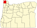
| County | Clatsop |
| Elevation | 26 ft (7.9 m) |
| Time zone | UTC-8 (Pacific (PST)) |
| • Summer (DST) | UTC-7 (PDT) |
| ZIP code | 97103 |
| Area codes | 503 and 971 |
| GNIS feature ID | 1136532 [1] |
Melville is an unincorporated community in Clatsop County, Oregon, United States, [2] on the Lewis and Clark River. Its post office was established in February 1891, with Wilthea S. Ingalls postmaster. The post office closed in November 1922. [3]