McDonald, Oregon | |
|---|---|
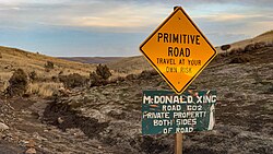 McDonald crossing | |
 McDonald, Oregon  McDonald, Oregon | |
| Coordinates: 45°35′20″N120°24′36″W / 45.589°N 120.41°W | |
| Country | United States |
| State | Oregon |
| County | Sherman |
| Elevation | 404 ft (123 m) |
| Time zone | UTC-8 (Pacific (PST)) |
| • Summer (DST) | UTC-7 (PDT) |
| ZIP code | 97065 |
| Area codes | 458 and 541 |
McDonald is an unincorporated community in Sherman County, Oregon, United States. [1] Its post office was established on the John Day River on March 15, 1902, and closed on October 14, 1922. The first postmaster was William G. McDonald. [2]