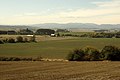
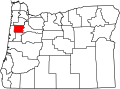
Bethel, Polk County, Oregon

Last updated
Bethel Church, formerly Bethel School, with auditorium in background Bethel Church 1.jpg
Bethel Church, formerly Bethel School, with auditorium in background

Bethel is an unincorporated community in Polk County, Oregon, United States. [1] It sits at the base of the Eola Hills in Plum Valley. Bethel is considered a ghost town as the only remaining structure is a school, [2] now serving as a church. The locale was named by the Rev. Glen O. Burnett for a Church of Christ in Missouri where he had served as pastor. [2] Bethel is a common name for churches as it is a Hebrew word that means "house of god". [2] After traveling with his family on the Oregon Trail, Burnett settled on a Donation Land Claim in 1846. [3] [4] Burnett later rode circuit to the surrounding area, preaching in nearby communities, including Rickreall. [4]

Contents

History

Another settler, Dr. Nathaniel Hudson, came to the area in 1851 and founded a school, Bethel Academy, in 1852. [2] Dr. Hudson moved to a new land claim in the Dallas area in 1854 and the academy closed. [2] In 1855 a new school named Bethel Institute was organized, and in 1856, the Oregon Territorial Legislature officially chartered the institute as one of the earliest colleges in the state, which was later renamed Bethel College. [2] Pioneer Jesse Applegate, who was a friend of Burnett's from Missouri and who traveled in the same wagon train, was on the college's board of trustees. [5] Bethel College had financial problems and in 1861 it merged with another Disciples of Christ institution: Monmouth College. Following a series of further mergers and name changes, Monmouth College became known as Western Oregon University. [2] The college building in Bethel was eventually dismantled. [4]

The first store in Bethel was built in 1855, and the post office followed in 1865. [3] At one time the town had a blacksmith shop, carpentry shop, and a wagon shop. [3] Bethel post office ran from 1865 to 1880. [2] The town was located on the wagon road that went between Amity and Monmouth, but when a new narrow-gauge railway line was built in the area, through Amity, Dallas and Independence, it bypassed Bethel and instead was routed through McCoy, a decision which contributed to Bethel's decline. [3]

In October 2013, the school's former auditorium, renovated two months earlier to become the Eola Hills Charter School within the Amity School District, burned down. [6] [7] The church building was not damaged. [7]

Agriculture and viticulture

Today, the area is part of the Eola-Amity Hills AVA with many wineries and vineyards, including Bethel Heights Vineyard which was named after the area. [8]

The Plum Valley area around Bethel.

Related Research Articles

<span class="mw-page-title-main">Yamhill County, Oregon</span> County in Oregon, United States

Yamhill County is one of the 36 counties in the U.S. state of Oregon. As of the 2020 census, the population was 107,722. The county seat is McMinnville. Yamhill County was named after the Yamhelas, members of the Kalapuya Tribe.

<span class="mw-page-title-main">Polk County, Oregon</span> County in Oregon, United States

Polk County is one of the 36 counties in the U.S. state of Oregon. As of the 2020 census, the population was 87,433. The county seat is Dallas. The county is named for James Knox Polk, the 11th president of the United States.

<span class="mw-page-title-main">Independence, Oregon</span> City in Oregon, United States

Independence is a city in Polk County, Oregon, United States, on the west bank of the Willamette River along Oregon Route 51, and east of nearby Monmouth. It is part of the Salem Metropolitan Statistical Area. Thirty square blocks of the oldest part of Independence form the National Register of Historic Places-listed Independence Historic District.

<span class="mw-page-title-main">Monmouth, Oregon</span> City in Oregon, United States

Monmouth is a city in Polk County in the U.S. state of Oregon. It was named for Monmouth, Illinois, the origin of its earliest settlers. The population is 11,110 at the 2020 Census and it is part of the Salem Metropolitan Statistical Area.

<span class="mw-page-title-main">Rickreall, Oregon</span> Unincorporated community in the state of Oregon, United States

Rickreall is an unincorporated community in Polk County, Oregon, United States. For statistical purposes, the United States Census Bureau has defined Rickreall as a census-designated place (CDP). The census definition of the area may not precisely correspond to local understanding of the area with the same name. The population of the CDP was 76 at the 2020 census. Rickreall is part of the Salem Metropolitan Statistical Area. Rickreall Creek runs along the community's southern edge.

<span class="mw-page-title-main">Western Oregon University</span> Public university in Monmouth, Oregon, USA

Western Oregon University (WOU) is a public university in Monmouth, Oregon. It was originally established in 1856 by Disciples of Christ pioneers as Monmouth University. Subsequent names included Oregon State Normal School, Oregon College of Education, and Western Oregon State College. Western Oregon University incorporates both the College of Education and the College of Liberal Arts and Sciences. Enrollment is approximately 3,750 students.

<span class="mw-page-title-main">Willamette Valley AVA</span> Wine region in Oregon, United States

The Willamette Valley AVA is an American Viticultural Area which lies in the Willamette Valley of Oregon. The AVA is the wine growing region which encompasses the drainage basin of the Willamette River. It stretches from the Columbia River in the north to just south of Eugene in the south, where the Willamette Valley ends; and from the Oregon Coast Range in the west to the Cascade Mountains in the east. At 5,360 square miles (13,900 km2), it is the largest AVA in the state, and contains most of the state's wineries; approximately 908 as of 2021.

Nathaniel Ford was an American politician and Oregon pioneer during the time of the Oregon Territory. A native of Missouri, he worked as a sheriff in that state before moving to the Oregon Country where he was selected as judge in the Provisional Government of Oregon and served in the Oregon Territorial Legislature. Ford also lost a civil case that freed his slaves who he had brought across the Oregon Trail from Missouri.

Buena Vista is an unincorporated community in Polk County, Oregon, United States. It is located on the Willamette River, and is the western landing for the Buena Vista Ferry. It is approximately 7 miles (11 km) south-southeast of Independence.

<span class="mw-page-title-main">Eola-Amity Hills AVA</span>

The Eola-Amity Hills AVA is an American Viticultural Area located in Polk County and Yamhill County, Oregon. It is entirely contained within the Willamette Valley AVA, and stretches from the city of Amity in the north to Salem in the south. The Eola and Amity hills cover an area west of the Willamette River approximately 15 miles (24 km) long by 6 miles (10 km) wide. The Eola-Amity Hills area benefits from steady winds off the Pacific Ocean that reach the Willamette Valley through the Van Duzer Corridor, a gap in the Oregon Coast Range, moderating the summer temperatures. The Eola Hills were named after the community of Eola, whose name was derived from Aeolus, the Greek god of the winds.

<span class="mw-page-title-main">Irving, Eugene, Oregon</span> Unincorporated Community in Lane County, Oregon

Irving was an unincorporated community in Lane County, Oregon, United States, and now partly within the Eugene city limits. Irving was a station on the Southern Pacific Railroad's Valley Line between Eugene and Junction City, first named "Halletts" when the line was built in 1872. J. L. Hallett had built the first 100 miles (160 km) of the line and supervised the construction of the rest of the line to Roseburg. In 1876, the name of the station was changed to Irving, probably for William Irving, who was a settler in the area. "Irvine" post office was established in January of the same year, and the name corrected to Irving in October; the post office ran until 1919.

<span class="mw-page-title-main">Benjamin Hayden</span> American politician

Benjamin F. Hayden was an American attorney and politician in the state of Oregon. A native of Kentucky, he moved to the West Coast with the California Gold Rush in 1849 and to Oregon in 1852. A Democrat, he served in the Oregon House of Representatives, including the 1870 session as speaker of the body.

<span class="mw-page-title-main">Spring Valley (Oregon)</span>

Spring Valley is a valley in Polk County, Oregon, United States, situated north and east of the Eola Hills and west of the Willamette River. It corresponds roughly to the drainage of Spring Valley Creek. Populated places in Spring Valley include Zena and Lincoln. Oregon Route 221 passes along the east side of the valley, next to the Willamette River.

<span class="mw-page-title-main">Levi L. Rowland</span>

Levi Lindsey Rowland FRSE was an American educator and physician in the state of Oregon. A native of Tennessee, he served as the Oregon Superintendent of Public Instruction, president of what became Western Oregon University, and as the superintendent of Oregon's insane asylum, now the Oregon State Hospital. The Republican was also a pastor and farmer.

<span class="mw-page-title-main">Cristom Vineyards</span> Wine producer and vineyard in Oregon, US

Cristom Vineyards is an Oregon wine producer and vineyard based near Salem, U.S. It is in the Eola-Amity Hills wine region within the Willamette Valley AVA, about 6 miles (9.7 km) northwest of Keizer.

<span class="mw-page-title-main">Bethel Heights Vineyard</span>

Bethel Heights Vineyard is an Oregon winery in the Eola-Amity Hills AVA of the Willamette Valley. Founded in 1977 by twin brothers Ted and Terry Casteel, their wives Pat Dudley and Marilyn Webb, and Pat's sister Barbara Dudley, the vineyard was one of the earliest plantings in the Eola-Amity Hills region. A winery soon followed, with the first estate wines produced in 1984. Bethel Heights specializes in Pinot noir, offering several individual block and vineyard designated bottlings, but also produces wines made from Chardonnay, Pinot gris, Pinot blanc, Riesling, Grüner Veltliner, and Gewürztraminer.

<span class="mw-page-title-main">James A. Bushnell</span>

James Addison Bushnell was a prominent American businessman and banker from Junction City, Oregon. He also served as president of the Board of Regents of Eugene Divinity School (EDS) from 1895, when it was founded by Eugene Claremont Sanderson, until his death on April 8, 1912. It is now named Bushnell University in his honor. He was buried in Luper Pioneer Cemetery northwest of Eugene, Oregon.

<span class="mw-page-title-main">Van Duzer Corridor AVA</span> American Viticultural Area of Oregon

The Van Duzer Corridor AVA, a sub-appellation of the Willamette Valley AVA located within Polk County, Oregon, in the United States, is an American Viticultural Area approved by the Alcohol and Tobacco Tax and Trade Bureau on December 13, 2018 and effective January 14, 2019.

<span class="mw-page-title-main">Amity School District</span> School district in Oregon, USA

Amity School District 4J is a rural public school district located in Yamhill County, Oregon. The district contains 3 schools and serves the residents of Amity and the surrounding areas.

<span class="mw-page-title-main">Ira F. M. Butler</span> American pioneer and politician

Ira Francis Marion Butler was an American politician who served in the Oregon Territorial House of Representatives and the Oregon House of Representatives as a member of the Democratic Party. He served as Speaker of the Oregon House of Representatives from 1857 to 1858, which was the last session before Oregon's statehood. Before immigrating to Oregon, Butler served as sheriff of Warren County, Illinois, and was circuit court clerk for Stephen A. Douglas when he was an Illinois judge. After moving to Oregon in 1853, he operated a farm in Polk County and was later the county’s judge.

References

  1. U.S. Geological Survey Geographic Names Information System: Bethel, Polk County, Oregon
  2. 1 2 3 4 5 6 7 8 McArthur, Lewis A.; Lewis L. McArthur (2003) [1928]. Oregon Geographic Names (Seventh ed.). Portland, Oregon: Oregon Historical Society Press. p. 77. ISBN   0-87595-277-1.
  3. 1 2 3 4 "Polk County: 1846-1855". Pioneer History to about 1900: Churches of Christ & Christian Churches in the Pacific Northwest. Northwest College of the Bible. Retrieved 2008-03-14.
  4. 1 2 3 "Glen Owen Burnett". Pioneer History to about 1900: Churches of Christ & Christian Churches in the Pacific Northwest. Northwest College of the Bible. Archived from the original on 2008-02-25. Retrieved 2008-03-14.
  5. "The Colleges Founded Before 1898". Pioneer History to about 1900: Churches of Christ & Christian Churches in the Pacific Northwest. Northwest College of the Bible. Archived from the original on 2008-04-15. Retrieved 2008-03-14.
  6. Lynn, Capi (September 12, 2013). "Eola Hills Charter School gets facelift". Statesman Journal. Archived from the original on October 4, 2013. Retrieved October 4, 2013.
  7. 1 2 Dewitt, Joce (October 3, 2013). "Fire consumes recently-renovated Eola Hills Charter School". Statesman Journal. Archived from the original on October 4, 2013. Retrieved October 4, 2013.
  8. John Winthrop Haeger Pacific Pinot Noir pg 51-53 University of California Press, Berkeley, CA 2008 ISBN   978-0-520-25317-9

45°02′25″N123°11′05″W / 45.04028°N 123.18472°W / 45.04028; -123.18472