
Perrydale is an unincorporated community in Polk County, Oregon, United States. [1] It is approximately 10 miles from Dallas. It is part of the Salem Metropolitan Statistical Area.
Perrydale is an unincorporated community in Polk County, Oregon, United States. [1] It is approximately 10 miles from Dallas. It is part of the Salem Metropolitan Statistical Area.
Perrydale was formed from the Townsend, Kinsey, and Butler donation land claims; the Townsend claim was deeded to Narcis Provo, who then deeded it to William Perry, after whom the community was named by John McGrew, who had bought Perry's claim and platted the town of Perrydale. [2] Beginning in 1881, the town was the site of a station on the Airlie branch of the Oregonian Railway Company. [2] [3] Rail service to Perrydale ended in 1985. [4]
The Perrydale post office ran from 1870 until 1971. [2] Today, locations in Perrydale have Amity, Oregon, mailing addresses.[ citation needed ]
Near Perrydale are the Perrydale Hills, a wine-growing location that was expected to become an American Viticultural Area (AVA). [5] [6] The new AVA was instead named the Van Duzer Corridor AVA, because there was a requirement that the name must appear in print, and although the locals know the area as Perrydale Hills, no print references could be found. [7]
Perrydale School District is a single-school district that serves Perrydale School. [8]
Perrydale is built on three land donations. They are the Townsend, Kinsey, and Butler land claims. The Townsend land claim was deeded to Narcis Provo in 1859 and then to William Perry in 1866; then he deeded it to John McGrew. Three years later Mr. McGrew plotted the town of Perrydale, embracing seven blocks and named the town after William Perry, from whom he had bought the property.
The area west and southwest of Salem, Ore., where Maple Grove Vineyard sits, may be an under-the-radar region poised to gain prominence. A group of 12 wineries is currently preparing to propose a new sub-appellation, tentatively titled Perrydale Hills, in the area.
Now known as the Perrydale Hills wine growing area (we hope for an official AVA designation as well), Huntington Hill Vineyards was one of the first pioneers committed to growing wine grapes in an area that is now experiencing a series of vineyard developments.
45°02′33″N123°15′20″W / 45.0426172°N 123.2556588°W
Municipalities and communities of Polk County, Oregon, United States | ||
|---|---|---|
| Cities | 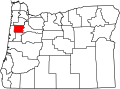 | |
| CDPs | ||
| Unincorporated communities | ||
| Indian reservation | ||
| Ghost towns | ||
| Footnotes | ‡This populated place also has portions in an adjacent county or counties | |
| | This Polk County, Oregon state location article is a stub. You can help Wikipedia by expanding it. |