Cottage Grove is a city in Lane County, Oregon, United States. Its population was 10,643 at the 2020 census.[7] It is the third largest city in Lane County. It is on Interstate 5, Oregon Route 99, and the main Willamette Valley line of the CORP railroad.[8]
Cottage Grove post office was established in 1855 east of present-day Creswell.[9] It was named by its first postmaster, G. C. Pearce, whose home was in an oak grove.[9] In 1861, the office was moved to the present site of Saginaw;[9] then in the late 1860s, to the southwesternmost part of present-day Cottage Grove, on the west bank of the Coast Fork Willamette River.[9] When the Southern Pacific railroad was built through the area in the 1870s, Cottage Grove station was placed more than half a mile northeast of the post office, on the river's east side.[9][10] This was the start of a neighborhood dispute that lasted for nearly 20 years.[9] The people living near the post office did not want it moved to the railroad station, so a new office was established at the station with the name Lemati, a Chinook Jargon word that means "mountain".[9] Lemati office ran from November 1893 to September 1894, but in March 1898 the Cottage Grove office was renamed Lemati, and ran that way until it was permanently renamed Cottage Grove in May 1898.[9]
Cottage Grove received the All-America City Award by the National Civic League in 1968 and 2004.[12] It has been recognized as a Tree City USA by the Arbor Day Foundation for over a decade.[13] In October 2008, it was the 17th city in the United States to be recognized as a Green Power Community.[14]
Lemati
Cottage Grove was incorporated in 1887, but the people on the city's east side rebelled in 1893 and founded East Cottage Grove.[9] The Oregon State Legislature changed its name to Lemati in 1895; the train station's signboard said "Cottage Grove", with "Lemati" appearing in smaller letters.[9] In 1899 an act was passed that consolidated the two towns as Cottage Grove.[9]
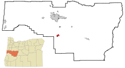
Geography
According to the United States Census Bureau, the city has a total area of 3.77 square miles (9.76km2), of which 3.76 square miles (9.74km2) is land and 0.01 square miles (0.03km2) is water.[15]
This region experiences warm (but not hot) and dry summers, with no average monthly temperatures above 71.6°F (22.0°C). According to the Köppen Climate Classification system, Cottage Grove has a warm-summer Mediterranean climate, abbreviated Csb on climate maps.[17]
Climate data for Cottage Grove (1991–2020 normals, extremes 1916–present)
As of the 2020 census, Cottage Grove had a population of 10,574. The median age was 39.7 years. 23.3% of residents were under the age of 18 and 19.4% of residents were 65 years of age or older. For every 100 females there were 95.4 males, and for every 100 females age 18 and over there were 92.0 males age 18 and over.[21][22]
100.0% of residents lived in urban areas, while <0.1% lived in rural areas.[23]
There were 4,078 households in Cottage Grove, of which 32.3% had children under the age of 18 living in them. Of all households, 41.8% were married-couple households, 18.7% were households with a male householder and no spouse or partner present, and 29.5% were households with a female householder and no spouse or partner present. About 27.3% of all households were made up of individuals and 13.9% had someone living alone who was 65 years of age or older.[21]
There were 4,251 housing units, of which 4.1% were vacant. Among occupied housing units, 60.1% were owner-occupied and 39.9% were renter-occupied. The homeowner vacancy rate was 1.0% and the rental vacancy rate was 3.9%.[21]
As of the census[24] of 2010, there were 9,686 people, 3,895 households, and 2,469 families living in the city. The population density was 2,576.1 inhabitants per square mile (994.6/km2). There were 4,154 housing units at an average density of 1,104.8 per square mile (426.6/km2). The racial makeup of the city was 90.4% White, 0.3% African American, 1.3% Native American, 1.1% Asian, 0.1% Pacific Islander, 3.1% from other races, and 3.8% from two or more races. Hispanic or Latino of any race were 8.0% of the population.
There were 3,895 households, of which 32.2% had children under the age of 18 living with them, 43.8% were married couples living together, 14.8% had a female householder with no husband present, 4.9% had a male householder with no wife present, and 36.6% were non-families. 29.9% of all households were made up of individuals, and 14.1% had someone living alone who was 65 years of age or older. The average household size was 2.47 and the average family size was 3.02.
The median age in the city was 38.3 years. 24.4% of residents were under the age of 18; 8.5% were between the ages of 18 and 24; 25.1% were from 25 to 44; 25.3% were from 45 to 64; and 16.5% were 65 years of age or older. The gender makeup of the city was 48.0% male and 52.0% female.
2000 census
As of the census[6] of 2000, there were 8,445 people, 3,264 households, and 2,183 families living in the city. The population density was 2,561.6 inhabitants per square mile (989.0/km2). There were 3,430 housing units at an average density of 1,040.4 per square mile (401.7/km2). The racial makeup of the city was 92.84% White, 0.15% African American, 1.21% Native American, 0.92% Asian, 0.09% Pacific Islander, 1.55% from other races, and 3.23% from two or more races. Hispanic or Latino of any race were 4.94% of the population. There were 3,264 households, out of which 33.0% had children under the age of 18 living with them, 49.4% were married couples living together, 13.2% had a female householder with no husband present, and 33.1% were non-families. 28.1% of all households were made up of individuals, and 14.3% had someone living alone who was 65 years of age or older. The average household size was 2.54 and the average family size was 3.05.
In the city, the population dispersal was 27.4% under the age of 18, 8.5% from 18 to 24, 26.4% from 25 to 44, 21.7% from 45 to 64, and 16.0% who were 65 years of age or older. The median age was 37 years. For every 100 females, there were 92.1 males. For every 100 females age 18 and over, there were 86.5 males. The median income for a household in the city was $30,442, and the median income for a family was $37,457. Males had a median income of $30,775 versus $23,485 for females. The per capita income for the city was $14,550. About 15.6% of families and 19.8% of the population were below the poverty line, including 29.0% of those under age 18 and 13.0% of those age 65 or over.
Arts and culture
Centennial Bridge and Veterans Memorial
Annual cultural events
The largest festivals in Cottage Grove are Bohemia Mining Days (third weekend in July) and the Western Oregon Exposition Heritage Fair (third weekend in August).[25]
It is home to 21 murals throughout downtown reflecting the community's history.[28]
The Cottage Theatre and the Opal Center for Arts and Education offer excellent live theatre productions year-round.
Cottage Grove has four museums:
The Cottage Grove Historical Museum, filled with vintage photographs and artifacts, including a coat worn by a survivor of the 1912 shipwreck of the RMS Titanic
The Oregon Aviation History Center, preserving Oregon's rich aviation history, including some vintage aircraft restoration projects.
The Dr. Snapp House, with artifacts of early medical practices; built in 1886 by one of the community's first doctors, the Queen Anne–style home is owned and maintained by the Prospectors' and Gold Diggers' Club.
Filming location
The Generalsignage in Cottage Grove where the cast and crew stayed
Several films have been filmed in Cottage Grove:
Buster Keaton's The General (1926) in town and the surrounding countryside;[30] the film included a spectacular locomotive crash, and the wrecked train was a minor tourist attraction until it was dismantled for scrap during World War II[31]
Parts of Animal House[32] (1978); citizens celebrated the film's 25th-anniversary release with a toga party on August 30, 2003, on Main Street, where the movie's climactic parade sequence was filmed
Cottage Grove has two golf courses. Middlefield is owned and operated by the City of Cottage Grove. It is a challenging 18-hole executive course surrounded by mature landscaping and next to Interstate 5. Middlefield also has a disc golf course. Hidden Valley is a privately owned 10-hole course nestled along the northern slope of Mount David, featuring numerous gigantic oak trees and bounded by Bennett Creek and the Coast Fork of the Willamette River. Coiner Park offers tennis, pickleball and basketball courts. South Lane School District has a newly renovated aquatic center and its high school athletic facilities are often used for regional and state athletic events.
Parks and recreation
Dorena Lake and Cottage Grove Lake are near the city and offer picnicking, camping and boating facilities. The Row River National Recreation Trail is a 14-mile, paved, multi-use trail that begins in Cottage Grove's Historic Downtown District and follows the route of the now-abandoned Oregon Pacific & Eastern Railroad line, along the scenic shores of the Row (rhymes with 'cow') River and Dorena Reservoir. Rental bicycles are available near Trailhead Park.[citation needed]
Education
The South Lane School District serves Cottage Grove and the surrounding area. Cottage Grove High School, Al Kennedy High School, Lincoln Middle School, Bohemia and Harrison elementary schools and the Academy for Character Education are in the city. Dorena School (K–8) and the Child's Way Charter School (5–12) are rural schools located in the Row River Valley east of Cottage Grove. London School (K–8) is a rural school located south of Cottage Grove Lake. Lane Community College has a Cottage Grove satellite campus offering credit and enrichment courses.[citation needed]
Media
Founded in 1909, the Cottage Grove Sentinel (circulation: 3,331) is the city's weekly newspaper.[34]KNND is the local radio station.
Infrastructure
Transportation
Air
Jim Wright Field is a public airport serving small general aviation aircraft, located one mile (1.6km) east of Cottage Grove.
Bus
Lane Transit District runs bus service to nearby Eugene and Springfield. South Lane Wheels offers a shuttle and door-to-door service in Cottage Grove.
This page is based on this Wikipedia article Text is available under the CC BY-SA 4.0 license; additional terms may apply. Images, videos and audio are available under their respective licenses.