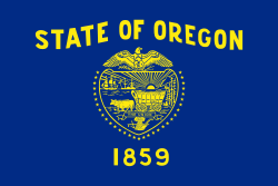
Outline of Oregon

Last updated
The location of the state of Oregon in the United States Map of USA OR.svg
The location of the state of Oregon in the United States

The following outline is provided as an overview of and topical guide to the U.S. state of Oregon:

Contents

General reference

An enlargeable map of the state of Oregon Map of Oregon NA.png
An enlargeable map of the state of Oregon

Geography of Oregon

Geography of Oregon

Places in Oregon

Places in Oregon

Environment of Oregon

Natural geographic features of Oregon

Regions of Oregon

Regions of Oregon

Administrative divisions of Oregon

An enlargeable map of the 36 counties of the state of Oregon Oregon counties.png
An enlargeable map of the 36 counties of the state of Oregon

Demography of Oregon

Demographics of Oregon

Government and politics of Oregon

Politics of Oregon

Branches of the government of Oregon

Government of Oregon

Executive branch of the government of Oregon

Legislative branch of the government of Oregon

Judicial branch of the government of Oregon

Courts of Oregon

Law and order in Oregon

Law of Oregon

Military in Oregon

History of Oregon

History of Oregon, by period

History of Oregon, by region

History of Oregon, by subject

Culture of Oregon

Culture of Oregon

The arts in Oregon

Sports in Oregon

Sports in Oregon

Economy and infrastructure of Oregon

Economy of Oregon

Education in Oregon

Education in Oregon

See also

Related Research Articles

<span class="mw-page-title-main">Oregon City, Oregon</span> City in Oregon, United States

Oregon City is the county seat of Clackamas County, Oregon, United States, located on the Willamette River near the southern limits of the Portland metropolitan area. As of the 2020 census, the city population was 37,572. Established in 1829 by the Hudson's Bay Company, in 1844 it became the first U.S. city west of the Rocky Mountains to be incorporated.

<span class="mw-page-title-main">Wasco County, Oregon</span> County in Oregon, United States

Wasco County is one of the 36 counties in the U.S. state of Oregon. As of the 2020 census, the population was 25,213. Its county seat is The Dalles. The county is named for a local tribe of Native Americans, the Wasco, a Chinook tribe who live on the south side of the Columbia River. It is near the Washington state line. Wasco County comprises The Dalles Micropolitan Statistical Area.

<span class="mw-page-title-main">Clackamas County, Oregon</span> County in Oregon, United States

Clackamas County is one of the 36 counties in the U.S. state of Oregon. As of the 2020 census, the population was 421,401, making it Oregon's third-most populous county. Its county seat is Oregon City. The county was named after the American Indians living in the area, the Clackamas people, who are part of the Chinookan peoples.

<span class="mw-page-title-main">Shaniko, Oregon</span> City in Oregon, United States

Shaniko is a city located in Wasco County, Oregon, United States, on U.S. Route 97 and about 8 miles (13 km) north of Antelope. The population was 30 at the 2020 census.

<span class="mw-page-title-main">Barlow Road</span> Historic road in Oregon

The Barlow Road is a historic road in what is now the U.S. state of Oregon. It was built in 1846 by Sam Barlow and Philip Foster, with authorization of the Provisional Legislature of Oregon, and served as the last overland segment of the Oregon Trail. Its construction allowed covered wagons to cross the Cascade Range and reach the Willamette Valley, which had previously been nearly impossible. Even so, it was by far the most harrowing 100 miles (160 km) of the nearly 2,000-mile (3,200 km) Oregon Trail.

<span class="mw-page-title-main">National Register of Historic Places listings in Oregon</span>

This is a list of properties and historic districts in Oregon that are listed on the National Register of Historic Places. There are listings in all of Oregon's 36 counties.

<span class="mw-page-title-main">Willamette National Cemetery</span> Veterans cemetery in Multnomah County, Oregon

Willamette National Cemetery is a United States National Cemetery located about 10 miles (16 km) southeast of the city of Portland, Oregon. Administered by the United States Department of Veterans Affairs, it encompasses 269.4 acres (109.0 ha) straddling the county line between Multnomah and Clackamas Counties. As of 2021, there had been 188,000 interments. It is one of three national cemeteries in Oregon. On July 5, 2016, the cemetery was listed on the National Register of Historic Places.

<span class="mw-page-title-main">Oregon's 3rd congressional district</span> U.S. House district for Oregon

Oregon's 3rd congressional district covers most of Multnomah County, including Gresham, Troutdale, and most of Portland east of the Willamette River. It also includes the northeastern part of Clackamas County and all of Hood River County. Generally, most of Portland east of the Willamette River is in the 3rd District.

<span class="mw-page-title-main">National Register of Historic Places listings in Multnomah County, Oregon</span>

The following list presents the full set of National Register of Historic Places listings in Multnomah County, Oregon. However, please see separate articles for listings in each of Portland's six quadrants.

<span class="mw-page-title-main">Index of Oregon-related articles</span>

The following is an alphabetical list of articles related to the U.S. state of Oregon.

<span class="mw-page-title-main">Index of Washington (state)-related articles</span>

The following is an alphabetical list of articles related to the U.S. state of Washington.

<span class="mw-page-title-main">Outline of Idaho</span> Overview of and topical guide to Idaho

The following outline is provided as an overview of and topical guide to the U.S. state of Idaho:

<span class="mw-page-title-main">Outline of Montana</span> Overview of and topical guide to Montana

The following outline is provided as an overview of and topical guide to the U.S. state of Montana:

<span class="mw-page-title-main">Outline of Washington (state)</span> Overview of and topical guide to Washington (state)

The following outline is provided as an overview of and topical guide to the U.S. state of Washington:

<span class="mw-page-title-main">Outline of Wyoming</span> Overview of and topical guide to Wyoming

The following outline is provided as an overview of and topical guide to the U.S. state of Wyoming:

References

  1. "Oregon's license plate from 1960 to circa 1966". Plate Shack. Retrieved 2007-07-12.
  2. "U.S. Census Bureau State & County QuickFacts Oregon". Archived from the original on 2016-02-24.
  3. "States Ranked by Size & Population". Internet Public Library. Archived from the original on 2018-08-18. Retrieved 2009-07-14.; 2000 Census.gov data
  4. "JULY 1, 2006 Population estimates for Metropolitan Combined Statistical Areas". U.S. Census Bureau. Archived from the original (csv) on 2007-09-20. Retrieved 2007-10-19.

Gnome-globe.svg Wikimedia Atlas of Oregon