Grosvenor Arch is a unique sandstone double arch located within Grand Staircase-Escalante National Monument in southern Kane County, Utah, United States. It is named to honor Gilbert Hovey Grosvenor (1875–1966), a president of the National Geographic Society, publishers of the National Geographic Magazine.

Kanab Creek is one of the many tributaries of the Grand Canyon. It begins in Kane County, Utah, just south of the watershed to the Great Basin and flows 125 miles (201 km) south to the Colorado River. It passes Kanab, Utah, crossing the border to Arizona near Fredonia. It flows through the Kaibab Indian Reservation of the Paiute people and the 1984-designated Kanab Creek Wilderness, a wilderness area, before its mouth in the Grand Canyon National Park.

Death Hollow is a slot canyon in the Grand Staircase-Escalante National Monument in central Garfield County, Utah, United States.

Horse Canyon is a small canyon near the towns of Boulder and Escalante in the Grand Staircase-Escalante National Monument in central Garfield County, Utah, United States

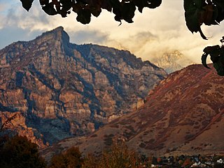
Rock Canyon is located in the Wasatch Mountains, in east Provo, Utah, United States. It is popular with rock climbers and hikers due to its unique and rugged geology as well as its proximity to Brigham Young University. The mouth of the canyon is located just behind the Provo Utah Temple.

Vivian Park is an unincorporated community in northeastern Utah County, Utah, United States.

Provo Canyon is a canyon in unincorporated Utah County, Utah, USA and Wasatch County, Utah. Provo Canyon splits between Mount Timpanogos on the north and Mount Cascade on the south. The canyon extends from Orem on the west end to Heber City on the east. The canyon's main thoroughfare is U.S. Route 189. Attractions in Provo Canyon include Vivian Park and Bridal Veil Falls. The Heber Valley Historic Railroad operates passenger trains through the canyon. The Provo River has carved out the canyon over time along with the forces of erosion.
Box Elder Canyon is a canyon located within the western slopes of the Wellsville Mountains, a branch of the Wasatch Range of the Rocky Mountains in Utah, United States.
Mollie's Nipple or Molly's Nipple is the name given to as many as seven peaks, at least one butte, at least one well, and some other geological features in Utah. Some sources claim there are eleven geological features in Utah that bear this name. At least some of those names are attributed to John Kitchen – a pioneer of an early exploration of Utah, who named them to commemorate a nipple of his wife Molly.
Salina Creek is a tributary of the Sevier River, in Utah.
Diamond Valley is a valley in northern Washington County, Utah, United States, that is located about 3 miles (4.8 km) north of the northern limits of St. George on Utah State Route 18, just past the entrance to Snow Canyon State Park. The unincorporated community of Diamond Valley is located within the valley, as is the Santa Clara Volcano.

Laguña Creek also formerly also known as Tyende Creek, is a stream in the Navajo and Apache Counties of Arizona. Laguña Creek has its source at 36°41′15″N110°30′36″W, at the conflence of Long Canyon and Dowozhiebito Canyon at an elevation of 6325 feet / 1928 meters at the head of Tsegi Canyon. Its mouth is in the Chinle Valley at its confluence with Chinle Wash which together forms Chinle Creek, at an elevation of 4774 feet / 1455 meters. Chinle Creek is a tributary of San Juan River which is in turn a tributary of the Colorado River.
Willow Creek is a tributary stream of the Jordan River, in Salt Lake County, Utah.
Daves Hollow is a canyon in southeastern Garfield County, Utah, United States.
Dead Mare Wash is a valley in the Dixie National Forest in south-central Garfield County, Utah, United States.
Denmark Wash is a stream and a canyon in eastern Millard County and north-central Sevier County, Utah, United States.
Holt Canyon, originally called Meadow Canyon or Meadow Valley, is a valley in Washington County, Utah. Its mouth lies at an elevation of 5,387 feet / 1,642 meaters where it enters the Escalante Valley. Its head lies at an elevation of 5,600 feet at 37°32′32″N113°36′46″W west of the site of the ghost town of Hamblin, Utah.
Fremont Wash sometimes called Fremont Canyon in its upper reach, is a stream and a valley in the north end of Parowan Valley, in Iron County, Utah. Its mouth lies at its confluence with Little Salt Lake at an elevation of 5,686 feet / 1,733 meters. Its head is found at 38°07′46″N112°34′36″W, the mouth of Fremont Canyon, an elevation of 6,476 feet / 1,974 meters.
Fremont Canyon is a stream and a deep valley or canyon that runs from its mouth at its confluence with Coyote Creek at the head of Fremont Wash in Iron County, Utah, eastward across the Tushar Mountains to its head at 38°05′05″N112°27′35″W on the west side of Fremont Pass in Garfield County, Utah.

Currant Creek is a stream in eastern Juab County and southern Utah County in northern Utah, United States.


