
Highgate is a suburban area of north west London at the northeastern corner of Hampstead Heath in the London Boroughs of Camden, Islington and Haringey, 4+1⁄2 miles north-northwest of Charing Cross.

Hornsey is a district of north London, England, in the London Borough of Haringey. It is an inner-suburban, for the most part residential, area centred 10 km (6.2 mi) north of Charing Cross. It adjoins green spaces Queen's Wood to the west and Alexandra Park to the north, and lies in the valley of the now-culverted River Moselle. The central core of the area is known as Hornsey Village.

Muswell Hill is a suburban district of the London Borough of Haringey, north London. The hill, which reaches over 100 m (330 ft) above sea level, is situated 5+1⁄2 miles north of Charing Cross.
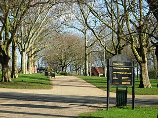
Finsbury Park is a public park in Harringay, north London, England. The park lies on the southern-most edge of the London Borough of Haringey. It is in the area formerly covered by the historic parish of Hornsey, succeeded by the Municipal Borough of Hornsey. It was one of the first of the great London parks laid out in the Victorian era. The park borders the neighbourhoods of Finsbury Park, Stroud Green, and Manor House.

Crouch End is an area of North London, approximately five miles (8 km) from the City of London in the western half of the borough of Haringey. It is within the Hornsey postal district (N8). It has been described by the BBC as one of "a new breed of urban villages" in London. In 2023, it was voted the best place to live in London by the Sunday Times, saying "A creative edge and friendly neighbours give this lofty northern enclave social capital in the capital".

Archway is an area of north London, England, in the London Borough of Islington 3.8 miles (6 km) north of Charing Cross. It straddles the A1 and is named after a local landmark, the high, single-arched Highgate Archway Bridge which crossed the road in a cutting to the north. It has a modern commercial hub around Vantage Point and Archway tube station.
Harringay is a district of north London, England, within the London Borough of Haringey. It is centred on the section of Green Lanes running between the New River, where it crosses Green Lanes by Finsbury Park, and Duckett's Common, near Turnpike Lane.
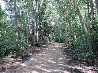
The Parkland Walk is a 3.1-mile (5.0 km) linear green pedestrian and cycle route in London, which follows the course of the railway line that used to run between Finsbury Park and Alexandra Palace, through Stroud Green, Crouch End, Highgate and Muswell Hill. It is often mistakenly described as 4.5 miles long, but even taking in the gap between the two sections it still only totals 3.1 miles (5.0 km). The route follows the bridges and cuttings of the line, but avoids the closed surface section of Highgate station and its adjoining tunnels, which are closed to walkers for safety reasons. The walk is almost all in Haringey, but a short stretch between Crouch Hill and Crouch End Hill is in Islington and this section incorporates Crouch Hill Park.

Stroud Green is a suburb and electoral ward in north London, England, split between the London boroughs of Haringey and Islington. On its south-western side, Stroud Green Road forms part of the boundary between the two boroughs.

Crouch Hill is a street in north London, England, running between Crouch End and Stroud Green in the boroughs of Haringey and Islington. It is not to be confused with Crouch End Hill which runs between Crouch End and Hornsey Rise..
Green Lanes is a main road in North London which forms part of the A105 road. Covering a distance of 6.3 miles (10.1 km) between Newington Green and Winchmore Hill, it is one of the longest streets in the capital, passing through the N16, N4, N8, N13 and N21 postcode areas. Green Lanes is recognised as one of the longest roads in the world, and can be seen from space.

The London Borough of Islington is short of large parks and open spaces, given its status in recent decades as a desirable place of residence. In fact, Islington has the lowest ratio of open space to built-up areas of any London borough. The largest continuous open space in the borough, at 11.75 hectares, is Highbury Fields.

Stroud Green railway station is a former station in the Stroud Green area of north London. It was located between Finsbury Park station and Crouch End station on a bridge over Stapleton Hall Road. The station had platforms cantilevered from the bridge structure and a wooden station building at ground level under and on either side of the bridge, with a station master's house to the north of it. The bridge still exists and now carries the Parkland Walk cycle and pedestrian path, whilst the station master's house serves as a community centre.
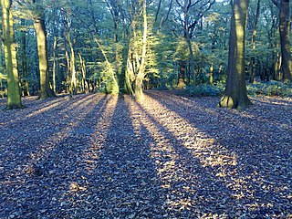
Coldfall Wood is an ancient woodland in Muswell Hill, North London. It covers an area of approximately 14 hectares and is surrounded by St Pancras and Islington Cemetery, the East Finchley public allotments, and the residential streets Creighton Avenue and Barrenger Road. It is the site of the discoveries which first led to the recognition that glaciation had once reached southern England. It was declared a local nature reserve in 2013, and is also a Site of Borough Importance for Nature Conservation, Grade 1.
Hornsey was an ancient parish in the county of Middlesex. It was both a civil parish, used for administrative purposes, and an ecclesiastical parish of the Church of England.

Queen's Wood is a 52-acre area of ancient woodland in the London Borough of Haringey, abutting Highgate Wood and lying between East Finchley, Highgate, Muswell Hill and Crouch End. It was originally part of the ancient Forest of Middlesex which covered much of London, Hertfordshire and Essex and was mentioned in the Domesday Book. It is now one of three Local Nature Reserves in the London Borough of Haringey. It is situated a few minutes' walk from Highgate tube station.
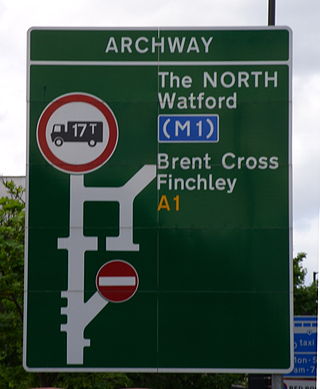
The A1 in London is the southern part of the A1 road. It starts at Aldersgate in the City of London, passing through the capital to Borehamwood on the northern fringe of Greater London, before continuing to Edinburgh. The road travels through the City and three London boroughs: Islington, Haringey and Barnet, which include the districts of Islington, Holloway, Highgate, Hendon and Mill Hill, and travels along Upper Street and Holloway Road, crossing the North Circular Road in Hendon, a district in the London Borough of Barnet.
The history of Harringay tells the story of the development of the district of London five miles from its centre, affected by, but not always part of, the great city's history.

Stroud Green in London, England, is a suburb adjacent to Finsbury Park in the northern part of Greater London. While most of the area is in the London Borough of Haringey, a very small part is in the London Borough of Islington. The Stroud Green Road not only forms the boundary between the two boroughs but is also the area's principal thoroughfare and a busy local shopping street, with many popular restaurants and bars.

Hornsey Lane is a road in the London Borough of Haringey, forming part of its border with the London Borough of Islington, and classified as the B540 between Highgate Hill leading to Highgate Village and Crouch End Hill leading to Crouch End.

