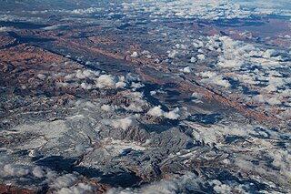
Crouse Creek is a stream in the Uinta Mountains near the eastern edge of Daggett County, Utah, United States. [1]
The creek is a distributary of the Pot Creek and branches off from that creek about 1.15 miles (1.85 km) due east of the Crouse Creek Dam and immediately east of the Uintah‑Daggett county line. From its source, the Crouse Creek flows north‑northeasterly through the Crouse Creek Canyon to empty into the Green River in Browns Park at the mouth of Swallow Canyon. [2] (From the source of the Crouse Creek, the Pot Creek continues southeasterly to empty into the Green River in the Canyon of Lodore within the Dinosaur National Monument in northwest Colorado.) [3]
Crouse Creek bears the name of Charles Crouse, an early rancher who settled at the stream's banks in 1880. However, the creek was previously known as Jimmie Reed Creek, named after a settler who built a cabin at the mouth of the stream in 1876. [4]
The Pink Cliffs are a series of highly dissected cliffs on the Colorado Plateau in Garfield, Iron, and Kane counties in southwestern Utah, United States. Contrary to the implication of the name, the cliffs are not a single set of rock formations, but actually a geological formation that manifests itself in multiple sets of rock formations.
Keetley is a ghost town located in northeastern Wasatch County, Utah, United States.

The Roan Cliffs are a series of desert mountains and cliffs in eastern Utah and western Colorado, in the western United States that are distinct from the Book Cliffs.
Chester is an unincorporated community in central Sanpete County, Utah, United States.

Vivian Park is an unincorporated community in northeastern Utah County, Utah, United States.

Maple Canyon is a canyon in the northeastern San Pitch Mountains in northern Sanpete County, Utah, United States Nearly all of the canyon, except the western end, is located within the Uinta National Forest. The mouth of the canyon is in the northwestern Sanpete Valley, south of Fountain Green and just northwest of the unincorporated community of Freedom, at an elevation of 6,017 feet (1,834 m).
Little Salt Lake, is a dry lake in east‑central Iron County, Utah, United States.
Crescent Lake is a lake in northeastern Cache County, Utah, United States.
Crystal Canyon is a canyon on the northeastern edge of Juab County, Utah, United States.
Crystal Spring is a spring in northern Beaver County, Utah, United States.
Cunningham Wash is a wash in eastern Beaver County, Utah, United States.
Curry Canyon is a canyon on the eastern edge of Emery County, Utah, United States.
Davis Lakes is a group of lakes near the northern edge of Duchesne County, Utah, United States.
Days Canyon is a canyon in the Wasatch Range in eastern Utah County, Utah, United States.
Dead Ox Canyon is a canyon in southern Morgan County, Utah, United States.
Deadman Lake is a lake near the northern edge of Uintah County, Utah, United States.

Spanish Valley is a flat in Grand and San Juan counties in Utah, United States, south of Moab.
Jordanelle was a community in northern Wasatch County, Utah, United States.
Diamond Gulch is a gulch in eastern Juab County, Utah, United States.
Currant Creek is a stream in eastern Juab County and southern Utah County in northern Utah, United States.
40°50′55″N109°03′53″W / 40.8485714°N 109.0648447°W