Cruagh

Last updated

Cruagh
An Chraobhach
Ireland adm location map.svg
Red pog.svg
Location in Ireland
Coordinates: 53°14′05″N6°18′01″W / 53.234822°N 6.300256°W / 53.234822; -6.300256
Country Ireland
Province Leinster
Area
[1]
  Total29.61 km2 (11.43 sq mi)
Population
 (2011)
  Total3,967 [2]
Website www.cruagh.ie
Historical population
YearPop.±%
18211,036    
18311,216+17.4%
1841979−19.5%
1851770−21.3%
1861695−9.7%
1871512−26.3%
1881459−10.4%
1891474+3.3%
1901488+3.0%
1911489+0.2%
1966542+10.8%
1971554+2.2%
1981664+19.9%
20113,967+497.4%

Cruagh (Irish: An Chraobhach) [3] is a civil parish in the barony of Uppercross in South Dublin, Ireland. It contains the townlands of Cruagh, Killakee, Tibradden, Glendoo, Newtown, Jamestown, Woodtown and Orlagh. It is situated south of Ballyboden on the R116 regional road.

Contents

Toponymy

The name of the parish derives from Craobhach, meaning "branches". This ultimately comes from Old Irish Croibech, or cráebach. The name in its current form was first recorded in 1641. [4]

The area was commonly known as 'Creevagh' or 'Crevagh' until the 19th and, on occasion, the early 20th century.

Early history

The area has been inhabited since the Neolithic period, evident by the chambered cairn situated atop nearby Tibradden Mountain. It is likely that this settlement in the area continued through the Bronze Age, due to the 2nd century BC cemetery uncovered during the 1950s in Edmondstown. [5]

Around 460 AD a small church was built in what is now the old section of Cruagh Cemetery. It was likely built by Dalua, a 5th-century saint and disciple of Saint Patrick. [6] In 1184 the church was granted by Prince John to the Archbishop of Dublin. The church was served by the Vicar of Tallaght until c.1700, when turbulent times in Ireland and the eventual union of parishes led to its falling into lay hands and finally disuse. The ruins were noted by John Canon O'Hanlon in the 1870s and today little remains of the church.

Townlands

There are 8 townlands contained in Cruagh, the largest by population being Newtown

Townland NameAcresPopulation
Cruagh948.50204
Glendoo929.44---
Tibradden849.12123
Killakee659.4581
Woodtown495.821287
Newtown452.422272
Jamestown94.25---
Orlagh41.63---
Total4470.633967

Tibradden

The cairn at Tibradden Tibradden in winter.jpg
The cairn at Tibradden

Tibradden is home to several points of interest, one of which is a rock where Daniel O’Connell gave an address to the locals as they celebrated Garland Sunday in 1843. Also situated here is Tibradden House, which was constructed in 1859 as a wedding present for Mary Davis, whose descendants occupy the house today. Close to the summit of Tibradden Mountain is a 4000-year-old chambered cairn. It was excavated in 1849 by the Royal Irish Academy who found a stone-lined cist containing a pottery vessel and cremated remains. [7]

Woodtown

With a history dating back to the 16th century, the area has two historic buildings; Woodtown Park and Woodtown Manor. Woodtown Park was built around 1700 as a farm house. In 1896 the Reverend Walter A Hill started a school here that was the first boarding school in Ireland which kept boys only up to the age of thirteen. [8] It was once a residence of the MacNeill family and it is believed that final plans for the 1916 rising were drawn up here. Opposite is Woodtown Manor, built around 1720. The estate consisted of 132 acres, including a deer park. In 2014 it was listed for sale at €2.25 million. In 2003, the DSPCA relocated to their center at Mount Venus, a state-of-the-art facility offering shelter and care to a wide variety of animals.

Cruagh

Cruagh itself is a small townland. As mentioned earlier the area was previously served by the church in Cruagh Cemetery, and in the early 19th century a watchtower was constructed partly on the site of the church. A sentry was employed there to prevent body snatching to occur. This was common at the time due to the lack of cadavers available. The old section of the cemetery was in use from the early 1700s to the mid 20th century. An 1839 issue of the Dublin Weekly Register says that “The mortal remains of the Archbishop of Tuam were this day deposited in the family vault at the ancient church-yard of Cruagh”, although no family vault there can be found. A new section was opened around 1945, although today it is currently full. Next to the entrance to the cemetery is a former subscription school which served the area in the 19th century, and was built sometime before 1833. It was converted into a home in the 1970s. The area also contains Cruagh Wood, which at 522m boasts a great view of Dublin City and its surroundings. In 1659, Cruagh had a population of 22 (only 3 being Irish), and by 1851 180 lived there. By 1911, the population was 64 although a century later it is 204. [9]

Orlagh

Just below the ruins of the Hell Fire Club in Killakee, lies the house now known as Orlagh. It was constructed in 1790 and was sold to the Augustinian Order in 1872. Eoin MacNeill was given refuge and slept in the college for the first few days of the Easter Rising. Famous visitors to the house include Patrick Pearse and Daniel O’Connell. Today, it is a retreat and conference centre run by the friars. In a field opposite is a famous well of the area that was unveiled in 1920. Crowds of people came to the opening, which included a drum band and banners. [10]

Killakee

Glendoo

Glendoo is an area near Tibradden that is relatively devoid of houses, as it was in 1837 when it is described as having "a great quantity of turf with only one house in which Mr. White's gamekeeper lives. [11] " At 586 metres, Glendoo Mountain is typically featureless and the summit partially crosses the Wicklow-Dublin border.

Newtown

Newtown, bordering Killakee to the south and Woodtown to the west, begins at Mount Venus Cemetery and ends at Boden Park estate. In the 19th century it was home to a number of mills. Edmondstown National School is built on the site of Newtown Great Paper Mill, founded early in 19th century and at one time employed over 600. Next are the ruins of Newtown Little Paper Mill which was built in 1757. This was converted into a cloth mill later and it ceased operation around 1836.

Jamestown

Jamestown contains only several houses, and is mostly farmland. The townland border follows Masseys Wood for its whole length. Little is known of its history although during the Irish Rebellion of 1641 it suffered heavy losses of goods and cattle.

Related Research Articles

<span class="mw-page-title-main">Rathfarnham</span> Suburb of Dublin, Ireland

Rathfarnham is a southside suburb of Dublin, Ireland in County Dublin. It is south of Terenure, east of Templeogue, and is in the postal districts of Dublin 14 and 16. It is between the local government areas of Dún Laoghaire–Rathdown and South Dublin.

<span class="mw-page-title-main">Julianstown</span> Village in Leinster, Ireland

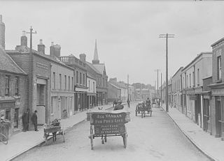
Julianstown is a village in County Meath, Ireland. It is located near Drogheda on the R132 regional road. In 1641, the Battle of Julianstown was fought here during the Irish Rebellion of 1641.

<span class="mw-page-title-main">Whitechurch, Dublin</span> Remote semi-suburban area near Dublin, Ireland

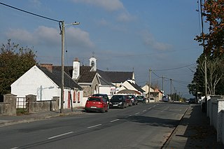
Whitechurch is a small suburban area on the south side of County Dublin, in the administrative county of South Dublin, situated south of Ballyboden, east of Edmondstown and west of Marlay Park. The greater part of the area lies north of the M50 semi-orbital motorway, with some remote parts merging into the mountainous districts of Tibradden and Kilmashogue south of the road, all at the foot of the Dublin mountains. Whitechurch is usually considered to lie within the greater Rathfarnham area.

<span class="mw-page-title-main">Kilmashogue</span> Mountain in Ireland

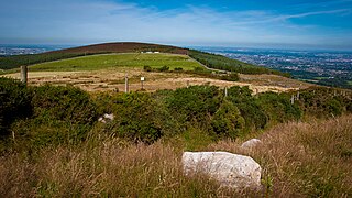
Kilmashogue or Kilmashoge is a mountain in Dún Laoghaire–Rathdown county in Ireland. It is 408 metres high and forms part of the group of hills in the Dublin Mountains which comprises Two Rock, Three Rock, Kilmashogue and Tibradden Mountains. The forest plantation on its northern slope, which is composed mainly of Sitka spruce, Scots pine and beech, is a habitat for Sika deer, hares, rabbits and foxes. A number of prehistoric monuments can be found on the slopes of the mountain.

<span class="mw-page-title-main">Naul, Dublin</span> Village in County Dublin, Ireland

Naul, is a village, townland, and civil parish at the northern edge of the traditional County Dublin in Ireland. The Delvin River to the north of the village marks the county boundary with County Meath. Naul civil parish is in the historic barony of Balrothery West.

<span class="mw-page-title-main">Rockbrook</span> Area in County Dublin, Ireland

Rockbrook is a small area, once site of a small settlement, now semi-suburban, in County Dublin, Ireland. It is in the local government area of South Dublin.

<span class="mw-page-title-main">Tibradden Mountain</span> Mountain in Ireland

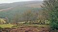
Tibradden Mountain is a mountain in County Dublin in the Republic of Ireland. Other former names for the mountain include "Garrycastle" and "Kilmainham Begg". It is 467 metres high and is the 561st-highest mountain in Ireland. It forms part of the group of hills in the Dublin Mountains which comprises Two Rock, Three Rock, Kilmashogue and Tibradden Mountains. The views from the summit encompass Dublin to the north, Two Rock to the east and the Wicklow Mountains to the south and west.

<span class="mw-page-title-main">Montpelier Hill</span> Mountain in County Dublin, Ireland

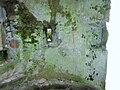
Montpelier Hill is a 383-metre hill in County Dublin, Ireland. It is topped by the Hell Fire Club, the popular name given to the ruined building. This building – an occasional summer residence built in around 1725 by William Conolly – was originally called Mount Pelier and since its construction the hill has also gone by the same name. The building and hill were respectively known locally as 'The Brass Castle' and 'Bevan's Hill', but the original Irish name of the hill is no longer known although the historian and archaeologist Patrick Healy has suggested that the hill is the place known as Suide Uí Ceallaig or Suidi Celi in the Crede Mihi, the twelfth-century diocesan register book of the Archbishops of Dublin.

<span class="mw-page-title-main">Gortnahoe</span> Village in Munster, Ireland

Gortnahoe, also known as Gortnahoo, is a village in County Tipperary, Ireland. It is located on the R689 regional road 6 km (3.7 mi) south of Urlingford, County Kilkenny. It is 3 km (1.9 mi) southeast of the N8 Dublin - Cork road. Gortnahoe, pronounced "Gurt/na/hoo" by the locals, is part of the parish of Gortnahoe–Glengoole.

<span class="mw-page-title-main">Ashbourne, County Meath</span> Commuter town in County Meath, Ireland

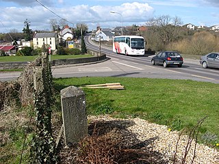
Ashbourne is a town in County Meath, Ireland. Located about 20 km north of Dublin and close to the M2 motorway, Ashbourne is a commuter town within Greater Dublin. In the 26 years between the 1996 and 2022 census, the town tripled in population from approximately 4,900 to 15,680 inhabitants. The town is passed by the Broad Meadow Water, which comes from Ratoath and Dunshaughlin.

<span class="mw-page-title-main">Dublin Mountains Way</span> Hiking trail in the Dublin Mountains in Ireland

The Dublin Mountains Way is a waymarked long-distance trail in the Dublin Mountains, Counties South Dublin and Dún Laoghaire–Rathdown, Ireland. The route is approximately 42 kilometres long and runs from Shankill in the east to Tallaght in the west. It has been developed by the Dublin Mountains Partnership, an umbrella group of relevant state agencies and recreational users working to improve recreational facilities in the Dublin Mountains.

<span class="mw-page-title-main">Owendoher River</span> River, largest tributary of the Dodder, Dublin, Ireland

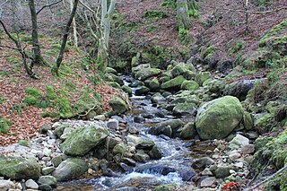
The Owendoher River is a small river in southern County Dublin, Ireland, the largest tributary of the River Dodder, and a part of the River Liffey system.

Coolkerry is a civil parish in the barony of Clarmallagh in County Laois. It is separated into two disjoint areas by an arm of Aghaboe civil parish.

<span class="mw-page-title-main">Newtown Castle</span> Tower house, County Clare, Ireland

Newtown Castle is a 16th-century tower house, located close to the village of Ballyvaughan within the Burren area of County Clare, Ireland. Uniquely for a tower house of its type in Ireland, Newtown Castle is mostly cylindrical in shape but rises from a square pyramidical base. It is today part of the Burren College of Art.

<span class="mw-page-title-main">Oughtmama</span> Civil parish in County Clare, Ireland

Oughtmama is a civil parish in County Clare. It lies in the Burren, a region in the northwest of the county. It contains many antiquities, including three early-medieval Christian churches, ruined castles, prehistoric cairns and ring forts and two Martello Towers built in the early 19th century.

<span class="mw-page-title-main">Killilagh</span> Civil parish in County Clare, Ireland

Killilagh or Killeilagh is a civil parish in County Clare, Ireland. It contains the village of Doolin.

<span class="mw-page-title-main">Drumcreehy</span> Parish in Munster, Ireland

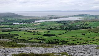
Drumcreehy or Dromcreehy is a civil parish in County Clare, Ireland. It contains the village of Ballyvaughan.

<span class="mw-page-title-main">Lickbla</span> Civil parish in Leinster, Ireland

Lickbla, is a historic monument, civil parish, religious parish, and townland, in County Westmeath, Ireland. It is located about 23.05 kilometres (14 mi) north of Mullingar. St. Bladma is listed in the Martyrology of Oengus as a saint: "Bladma, i.e. from Blad son of Conmac Cas Clothach, grandson of Tachall son of Cermait, son of the Dagda, a quo nominatur. Or Blad son of Breogan, a quo Sliab Bladma" whose feastday is 7 April and 20 November.

Dalua of Tibradden, also called Dalua of Craoibheach, was an early Irish saint who is said to have been a disciple of St. Patrick. He founded a church that became known as Dun Tighe Bretan (Tibradden) which is located today in the townland of Cruagh, County Dublin.

References

  1. "Map of Cruagh, Ireland".
  2. CD175 , Central Statistics Office
  3. "An Chraobhach/Cruagh". Logainm.ie.
  4. Kco Ltd. "1641 Depositions". www.1641.tcd.ie.
  5. Mount, Charles. "Early Bronze Age cemetery at Edmondstown, County Dublin". Proceedings of the Royal Irish Academy, Section C. JSTOR   25516111.
  6. The History of the Parish of Cruagh, John McManus; Page 2
  7. Proceedings of the Royal Irish Academy. Vol. VII. 1863. p. 160.
  8. "Woodtown Park House". www.askaboutireland.ie.
  9. "Central Statistics Office".[ permanent dead link ]
  10. Knockylon Past and Present; pg.28
  11. Behind The Scenes by Ernie Shepard; pg.2