Csörög | ||
|---|---|---|
| ||
| Coordinates: 47°43′53″N19°12′10″E / 47.73141°N 19.20290°E | ||
| Country | Hungary | |
| Region | Central Hungary | |
| County | Pest | |
| Subregion | Váci | |
| Rank | Village | |
| Area | ||
| • Total | 6.46 km2 (2.49 sq mi) | |
| Population (1 January 2008) [2] | ||
| • Total | 2,116 | |
| • Density | 330/km2 (850/sq mi) | |
| Time zone | UTC+1 (CET) | |
| • Summer (DST) | UTC+2 (CEST) | |
| Postal code | 2135 | |
| Area code | +36 27 | |
| KSH code | 34333 [3] | |
| Website | www.csorog.hu | |
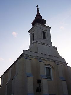
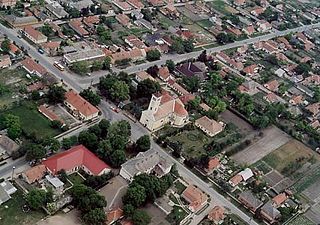
Csörög is a village in Pest county, Budapest metropolitan area, Hungary. It has a population of 2,056 (2007).

The Budapest metropolitan area is a statistical area that describes the reach of commuter movement to and from Budapest and its surrounding suburbs. Created by Hungary's national statistical office HCSO to describe suburban development around centres of urban growth, the surrounding a more densely built and densely populated urban area. As of 2014 the Budapest metropolitan area, with its 7,626 km², extends significantly beyond Budapest's administrative region, a region also commonly referred to as Central Hungary. It had a population of 3,303,786 inhabitants at the January 2013 census, making it the tenth largest urban region in Europe. 33% of Hungary's population resides in the region.

Hungary is a country in Central Europe. Spanning 93,030 square kilometres (35,920 sq mi) in the Carpathian Basin, it borders Slovakia to the north, Ukraine to the northeast, Austria to the northwest, Romania to the east, Serbia to the south, Croatia to the southwest, and Slovenia to the west. With about 10 million inhabitants, Hungary is a medium-sized member state of the European Union. The official language is Hungarian, which is the most widely spoken Uralic language in the world. Hungary's capital and its largest city and metropolis is Budapest. Other major urban areas include Debrecen, Szeged, Miskolc, Pécs and Győr.


