
Futaleufú is a department in the north west of Chubut Province, Argentina. Its main town and capital is Esquel to the north, with Trevelin and El Corcovado as the only other towns of significant size. Other settlements are Cerro Centinela, Aldea Escolar, Los Cipreses and Lago Rosario. The population of the department is 37,500 inhabitants as per the 2001 census [INDEC], which represents a population density of fewer than 4 inhabitants/km2.
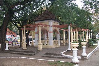
Santos Lugares is a town in the southeast of the partido of Tres de Febrero. It is part of the urban agglomeration of Greater Buenos Aires in Buenos Aires Province, northeast of the Buenos Aires city proper. According to the 2001 census [INDEC], Santos Lugares had 17,023 inhabitants.
Tinogasta is a city in the west of the province of Catamarca, Argentina, on the right-hand shore of the Abaucán River, about 280 km from the provincial capital San Fernando del Valle de Catamarca. It had about 11,500 inhabitants at the 2010 census [INDEC]. It is the head town of the department of the same name. The name of the city comes from the Kakana words tino ("meeting") and gasta ("town").

Belén is a small town in the province of Catamarca, Argentina. It has about 12,000 inhabitants according to the 2001 census [INDEC], and it is the head town of the department of the same name. Belén is the birthplace of Luis Franco.

Santa María is a city in the province of Catamarca, Argentina. It has about 17,030 inhabitants per the 2010 census [INDEC], and is the head town of the department of the same name.
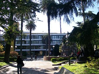
Berazategui is a city in Buenos Aires Province, Argentina, located to the south-east of Quilmes. It is the head town of the Berazategui Partido. It is part of the Gran Buenos Aires metropolitan area.

Dock Sud is a town of Avellaneda Partido in Buenos Aires Province, Argentina. It forms part of the urban agglomeration of Greater Buenos Aires.
Ciudad del Libertador General Don José de San Martín, more commonly known as San Martín, is the administrative seat of General San Martín Partido in the urban agglomeration of Greater Buenos Aires.
Isidro Casanova is a city in La Matanza Partido, Greater Buenos Aires, Argentina. It borders the towns of Villa Luzuriaga, San Justo, Ciudad Evita, Rafael Castillo, Laferrere, and Ezeiza.
San José de Fray Mamerto Esquiú or simply San José is a town in Catamarca Province, Argentina. It is the head town of the Fray Mamerto Esquiú Department. It is part of the Gran San Fernando del Valle de Catamarca urban agglomeration.
Bañado de Ovanta is a town in Catamarca Province, Argentina. It is the head town of the Santa Rosa Department. The town was established in 1981 by Provincial decree.
San Isidro is a town in Catamarca Province, Argentina. It is the head town of the Valle Viejo Department. It forms part of the Gran San Fernando del Valle de Catamarca urban agglomeration.
Remedios de Escalada is a town in Buenos Aires Province, Argentina. It is the head town of the Tres de Febrero Partido.
El Maitén is a town in Argentina in Cushamen Department on the margins of the Chubut River, on the northwest of Chubut Province, in Patagonia. In older times it was the intermediate point in the railroad tracks of the Old Patagonian Express between the towns of Ingeniero Jacobacci and Esquel.
Monte Chingolo is a town in Buenos Aires Province, Argentina. Located in Lanús Partido in the south of the Greater Buenos Aires metropolitan area.

Villa de Mayo is a town in the Malvinas Argentinas Partido of Buenos Aires Province, Argentina. It is located in the north west of Greater Buenos Aires urban conurbation around 39 km from Buenos Aires.
José Ingenieros is a town in Tres de Febrero Partido of Buenos Aires Province, Argentina. It is located in the Greater Buenos Aires urban agglomeration.

Loma Hermosa is a town in Tres de Febrero Partido of Buenos Aires Province, Argentina. It is located in the Greater Buenos Aires urban agglomeration. Part of the town falls in the General San Martín Partido.
Once de Septiembre is a town in Tres de Febrero Partido of Buenos Aires Province, Argentina. It is located in the Greater Buenos Aires urban agglomeration. The name is often spelt "Once de Setiembre" or "11 de Setiembre/Septiembre".
Pablo Podestá is a town in Tres de Febrero Partido of Buenos Aires Province, Argentina. It is located in the Greater Buenos Aires urban agglomeration.
