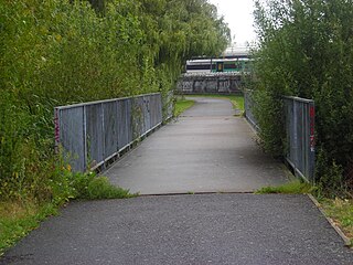
Clifton Down is an area of public open space in Bristol, England, north of the village of Clifton. With its neighbour Durdham Down to the northeast, it constitutes the large area known as The Downs, much used for leisure including walking and team sports. Clifton Down is the part of the Downs south of Stoke Road.

Durdham Down is an area of public open space in Bristol, England. With its neighbour Clifton Down to the southwest, it constitutes a 400-acre (1.6 km2) area known as The Downs, much used for leisure including walking, jogging and team sports. Its exposed position makes it particularly suitable for kite flying. Durdham Down is the part of the Downs north of Stoke Road.

Chestnut Hill is a wealthy New England village located six miles (10 km) west of downtown Boston, Massachusetts, United States. It is best known for being home to Boston College and a section of the Boston Marathon route. Like all Massachusetts villages, Chestnut Hill is not an incorporated municipal entity. It is located partially in Brookline in Norfolk County; partially in the city of Boston in Suffolk County, and partially in the city of Newton in Middlesex County. Chestnut Hill's borders are defined by the 02467 ZIP Code. The name refers to several small hills that overlook the 135-acre Chestnut Hill Reservoir rather than one particular hill.

Oxford West and Abingdon is a constituency represented in the House of Commons of the UK Parliament since 2017 by Layla Moran, a Liberal Democrat.

New Hall Valley Country Park is a country park located in New Hall Valley between Walmley, Wylde Green and Pype Hayes in the Sutton Coldfield area of north Birmingham. It is the first new country park in the UK for over a decade. The park is split into "phases".
The London Borough of Bexley owns and maintains over 100 parks and open spaces within its boundaries, with a total of 638 hectares. They include small gardens, river and woodland areas, and large parks with many sporting and other facilities.

North Oxford is a suburban part of the city of Oxford in England. It was owned for many centuries largely by St John's College, Oxford and many of the area's Victorian houses were initially sold on leasehold by the college.
Cutteslowe is a suburb in the north of Oxford, in Oxfordshire, England, between Sunnymead and Water Eaton.

Bedfords Park is public open space of 215 acres or approximately 87½ hectares near Havering-atte-Bower in the London Borough of Havering in England. It is one of three large parklands around Havering-atte-Bower; the others are Havering Country Park and Pyrgo Park.
Colmworth is a village and civil parish in the Borough of Bedford in the county of Bedfordshire, England about 6.5 miles (10 km) north-east of Bedford.

Wanstead Park is a municipal park covering an area of about 140 acres, in Wanstead, in the London Borough of Redbridge. It is also a district of the London Borough of Redbridge, which was in Essex until 1965.

Normandy is a village and civil parish of 16.37 square kilometres in the borough of Guildford in Surrey, England. Almost surrounded by its hill ranges, Normandy is in the plain west of Guildford, straddles the A323 'Aldershot Road' and is north of the narrowest part the North Downs known as the Hog's Back which carries a dual carriageway. The parish in 2011 had a population of 2,981 living in 1,310 households, has woods, a public common and four government-operated commons to the north that are an SSSI heath. Normandy has been home to a number of notable residents, including William Cobbett.
Beaulieu Heights 16 acres (6.5 ha) is an area of ancient woodland between South Norwood and Upper Norwood in the London Borough of Croydon, London. It is located between South Norwood Hill and Auckland Road with Auckland Rise to the north and Tummonds Gardens to the south. There are pedestrian entrances from South Norwood Hill and Auckland Rise, and a pond. The name is pronounced as if spelled "Beulah" like the nearby Beulah Hill, and not like the French word or the town of Beaulieu, Hampshire.
Heavers Meadow is a meadow located in South Norwood and Selhurst in the London Borough of Croydon. South Norwood Recreation Ground is on the other side of the road. The meadow covers an area of 83⁄4 acres. With meadows there are not usually many facilities. Heavers is no exception; the only facility stated on the council's website is a footpath through a flood meadow.

Tilgate Park is a large recreational park situated south of Tilgate, South-East Crawley.

The waymarked path Darent Valley Path is 19 miles (31 km) long, following the River Darent from the banks of the River Thames at Dartford through the Kent Downs Area of Outstanding Natural Beauty to the Greensand Hills above Sevenoaks. It runs through the villages of Shoreham and Otford.
Wandle Meadow Nature Park is a 4.15 hectare local nature reserve and Site of Borough Importance for Nature Conservation, Grade 1, in Colliers Wood in the London Borough of Merton. It is owned and managed by Merton Council.
The Tarn is a 9 acres (3.6 ha) site on Court Road between Mottingham and Eltham, in the Royal Borough of Greenwich, southeast London, United Kingdom, consisting of a public garden, a bird sanctuary nature reserve and a lake amongst woodland. The woodland and lake, which was historically known as Starbuck's Pond, were previously the southern part of the Great Park, one of three parks belonging to the estate of Eltham Palace and used as a royal deer hunting park for several centuries up until the English Civil War. As a garden The Tarn opened in 1935, after the Metropolitan Borough of Woolwich acquired the site from the adjacent Royal Blackheath Golf Course. The Tarn remains largely unchanged since the 1930s and contains several shelters, benches, a public toilets building and a circular path which crosses a wooden footbridge spanning the lake. There is also an 18th-century ice house in the garden, which is a listed structure.

Horn Park is a 16 acres (6.5 ha) public park within Horn Park in the Eltham area of the Royal Borough of Greenwich, southeast London, United Kingdom. It has a mixture of grassland and woodland, children's playground, football pitch, outdoor gym and the first skate park in the Royal Borough of Greenwich. Historically Horn Park was one of three deer hunting parks belonging to Eltham Palace, over the centuries it was also used as grazing farmland and a fruit orchard. The park today is some of the last remaining open space of the original park, a public park next to the Horn Park housing estate which was completed just after the Second World War.

Christchurch Meadows is a park in Reading, Berkshire, England, located next to the River Thames. It stretches along the north (Caversham) side of the river, between Caversham Bridge and Reading Bridge, and is linked to the south (Reading) bank by the Christchurch Bridge, a pedestrian and cycle bridge built in 2015. The name of the meadow derives from Christ Church in Oxford, whose dean owned 25 acres (10 ha) of farmland in Reading.